Showing posts with label wildflower. Show all posts

Monday, July 1, 2019


--- Terminus: Wheat Ridge ---

I'm not going to recommend the Wheat Ridge/Ward Road Station for tourism. The G Line that services the station is rather unspectacular with the exception of the Arvada Olde Town Station that looks like a nice place for shoppers that like quaint little villages. It has that feel. But my target was the terminus in northwestern Wheat Ridge, the only RTD light rail station in Wheat Ridge.

The G Line runs through a corridor of industrial zones and the Wheat Ridge/Ward Station is no different. It is surrounded by industry, but it does have some interesting points.

The station itself has parking for 290 cars and is a clean, attractive site. It isn't far from the foothills of the Rockies and especially offers some nice views of North Table Mountain. I was tempted to hike on over to the mountain but I'm not as familiar with that area as I am some parts of the Denver Metro area and I might have been disappointed by the real distance (as contrasted with the apparent distance) and lack of access to the mountain. Anyway, I am planning to visit the mountain in a couple of years when I look at the geology of the area.


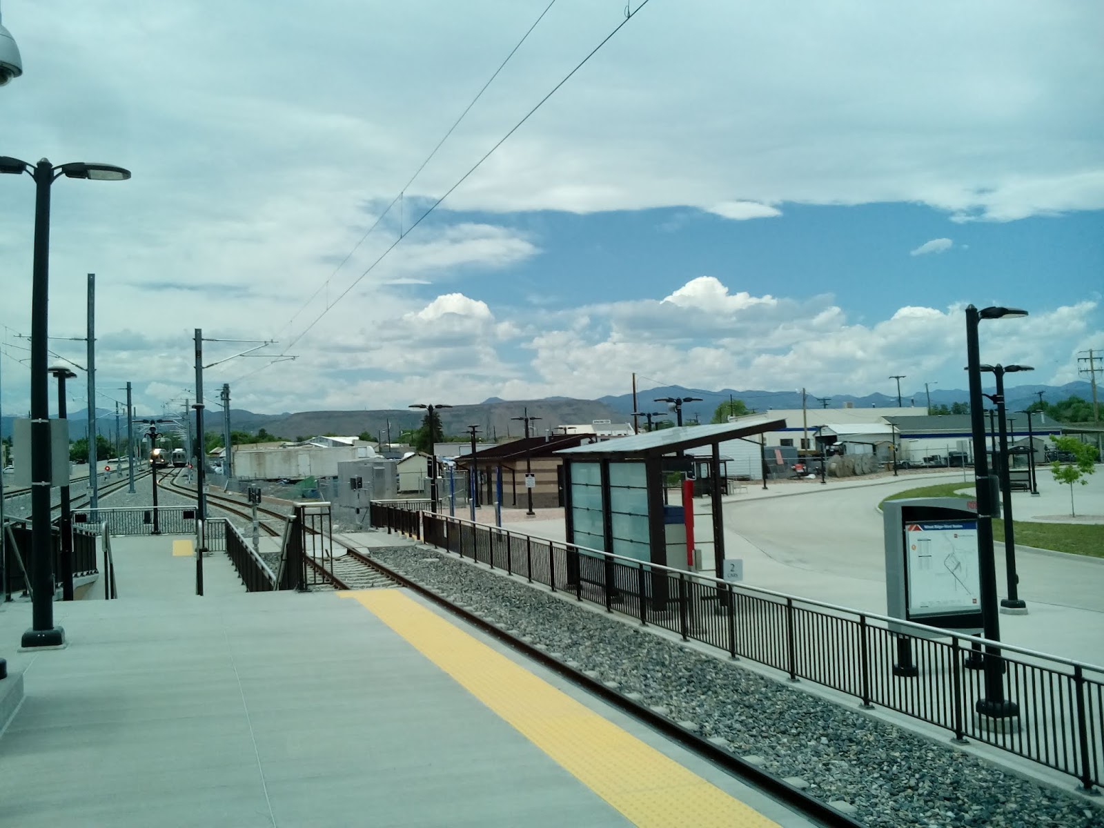
                          [Photos of Wheat Ridge/Ward Station and the Rocky Mountains beyond]

One thing that I like about Colorado is the variety of showy wildflowers here. In the Southeast, most of the nice indigenous plants were woodland flowers and one had to do some hiking to see them. Here, any vacant lot may be a home to some pretty plants. One common plant with showy flowers is the thistle. Colorado has 15 native species and 5 non-native species, loved by bees and butterflies, browsing wildlife and wildflower enthusiasts. The one I found in the grassy burm of the light rail station is (I think) a nodding thistle (or musk thistle), considered a non-native, noxious weed.


                                                                     [Thistle]

As much as Denver is associated with the mountains, it's still a plains city and the great variety of grassland grasses are represented here. This foxtail barley is pretty common in the area. We have lots of it in our back yard.

                                                                  [Foxtail barley]

The stations of the RTD are micro-museums. Many of them display narratives of their neighborhoods. At Wheat Ridge/Ward Road you can read about the relationship between Denver and the mountains....and gold. G, in the G Line stands for "gold". The windscreens at the stations on the G Line tells the story of gold.

The artwork at Wheat Ridge/Ward Station is a modernist sculpture called "Anchored by Place". It was created by artist and art educator Michael Clapper.

                                                                [Anchored by Place]

You can read a lot about the stations of the RTD light rail, their art, including the windscreens, and stories connected to the stations and their neighborhoods at the FastTrack website, http://www.rtd-fastracks.com/main_1 .

If you follow me in my adventures and want to check out any of these places, you can prepare by going to the FasTrack site.

After wandering around the station, I walked down to Ward Road and a convenience store where I picked up a snack and then returned to wait for a train for my trip back home.

Along the way, I noticed this clump of a favorite wildflower, milk weed. Despite it's name, it's a gorgeous flower. Monarch butterflies will only lay their eggs on this plant. Check out the Fish and Wildlife website (https://medium.com/usfws/spreading-milkweed-not-myths-5df8c480912d ) to clear up misconceptions about this valuable plant.
                                                                        [Milkweed]

Ward Road has some nice views of North Table Mountain. The two Table Mountains are the exposed innards of an ancient but dead volcano. Their volcanic origin is made quite clear by the basalt deposits around the crown. Basalt is a dark, fine grain rock that is formed close to the earth's surface. It hardens too quickly for the melted magma to form large crystals like granite. These unearthed bones of dead volcanoes are sometimes called "fossil volcanoes". Luckily, they're as volcanic as the Denver area gets.


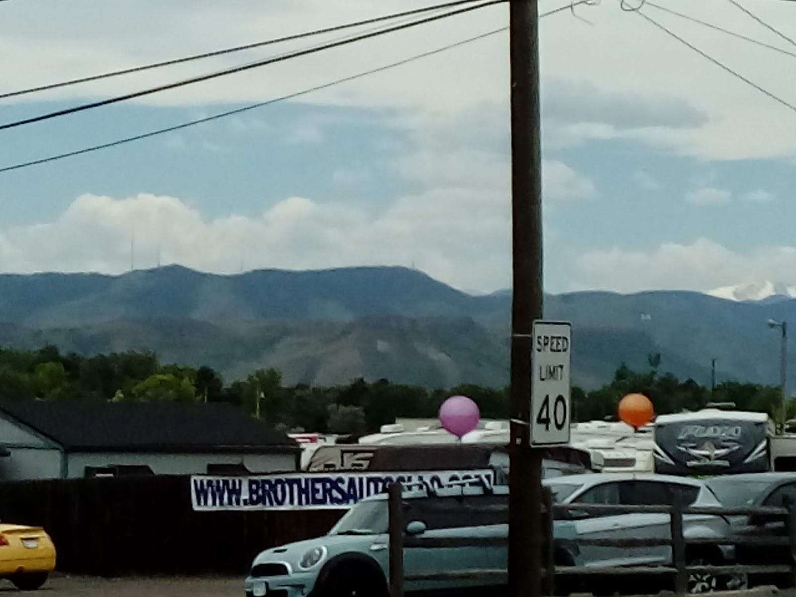
                                                            [North Table Mountain]

Regardless of how boring any area looks, if you look a little closer, you can usually find fascinating facts right in front of you.


Monday, June 10, 2019


--- Highline Canal: Spring ---

The Highline Canal Trail is like a highway for pedestrians.

That sounds too much like a metaphor. Let me drop the "like". The Highline Canal Trail is a highway for pedestrians. If you're hiking or biking and you want to get from A to B, then the Highline might be your friend, along with the many other urban trails that intersect it.

Pedestrianism has it's advantages and disadvantages. It's not for the lazy. It's usually slow (barring heavy traffic on the roads)) and takes considerably more effort than driving. It's not going to take you any great distance unless you're going to get into backpacking in a big way.

On the other hand, it's cheap and doesn't rely on fossil fuels. And you get a bonus. All that exercise your doctor prescribes? It's built in.

Exercise. This 17 mile stretch of the Highline pretty much convinced me that I'm getting too old for the 30 mile day hikes I used to do. 20 seems to be my new limit....at least when temperatures rise above 70 degrees.

I joined the Highline Canal Trail near Dry Creek Road in Littleton. There are several access points in the area.


                                                     [Approach to the Highline Canal]

In following the "highline" contour of the area, the canal has to navigate many roads and natural streams by passing over or under. Here is one of the aqueducts over Dry Creek. It's definitely not a Roman aqueduct but it has it's charm in a Currier and Ives way.

                                                                  [Aqueduct]

As an early 20th century work of engineering, it's certainly interesting.

The canal and it's accompanying trail meanders through a wide variety of scenery, including urban shopping areas.

                                                                         [Littleton]

And just to show that I actually did begin near milepost 20, here's milepost 21.

                                                                      [Milepost 21]

Although I was hoping spring wildflowers would be out for the hike (and there was some as I will show), the predominant color was green.

                                                                   [Along the trail]

One of the many walkers I met early on the trail described the trail as "bone dry". As this photo shows, that isn't exactly right. Denver Water allows water to flow along the canal occasionally, but even when it's not flowing, snow melt and rain will produce ponds along the way.

                                                             [Pond on the canal]

There are quite a few vistas of the Rockies along the canal, such as this view of snow capped Mount Evans.

                                                                    [Mount Evans]

One wildflower I encountered was this small white ground cover. I couldn't quite narrow it down but the five petalled flowers and lacy leaves reminded me of an anemone. A good site for wildflower identification in Colorado is Wildflowers of Colorado (http://www.wildflowersofcolorado.com/index.html), which let's you search by flower color and provides lots of photos.

                                                                  [Anemone?]

At one point, the canal crosses Lee Gulch and it's a little difficult to figure out which trail is the Highline Canal and which is the Lee Gulch Trail. Actually, it's not that difficult since the Highline Canal Trail follows the canal....always.

                                                               [Cascade on Lee Gulch]

There are places where the canal really is "bone dry" and you can see the stream bed and how the canal is constructed. Through most of it's length, the Highline flows across natural earth.

                                                                      [Dry bed]

Where there is water, the many foot bridges across the canal provide picturesque scenery.

                                                                        [Footbridge]

I left the trail where it crossed University (the first time) and walked up to Cherry Hills Marketplace for lunch at the Original Pancake House. The food was good and reconnection with the trail was easy. I just followed Orchard Road back down to where it intersected the Highline Canal.

In places honeysuckle splashed that banks of the canal with white, pink, and rose.

                                                                   [Honeysuckle]

These are different honeysuckle than the ones I'm familiar with down South. Those are vines....these are bushes.

I'm especially fond of succulents and cactuses. Their blossoms tend to be extremely varied, intricate, and colorful. Euphorbia is one of the common varieties in this area. It's also called "spurge" There are many species but this green flowered kind is the only kind I've seen locally.

                                                                     [Euphorbia]

These little guys are called Cowboy's Delight or Copper Mallow. They're tiny but the orange blossoms sorta grab you.

                                                           [Copper Mallow plant]

The orange color on this tree trunk is pretty but it is probably a disease called Cytospora Canker.

                                                               [Orange tree trunk]

And this is only the third snake I've seen since I moved to Colorado, all garter snakes (I miss snakes).

                                                                     [Garter snake]

I've hiked the last 7 miles of this stretch of the Highline before. You can see the backyards of some very large homes here. The structures in Cherry Hills Village tend toward the impressive, ornate and large.

By the time I got to Hampden, my feet were blistered, I was tired, and  it was verging on heat-prostration-weather for me, so, after walking down to University, I was ready to hop a bus for the last half mile.

Poetically, spring is the time that nature revives from it's long winter sleep. Actually, nature never sleeps, it's just harder to see what's going on in the winter. But spring is a great time for people who are interested in birds, other wildlife, or flowers. What's happening outside in your area?