Wednesday, August 29, 2018


--- Pride of Place: Denver c. 1860 ---

If you look at a current map of Denver, you can see the original town. Check it out.


Denver, current. Google Maps. https://www.google.com/maps/place/Denver,+CO/@39.7524295,-104.9982855,14z/data=!4m5!3m4!1s0x876b80aa231f17cf:0x118ef4f8278a36d6!8m2!3d39.7392358!4d-104.990251 accessed 8/25/18

Do you see how the pattern of streets change? Between interstate highways 25 and 70, the streets run diagonally to the map but in other areas they run north-south and east-west.

Towns are established where they are for different reasons. For instance, Tombstone, Arizona was a silver mining town. Look at a map of Tombstone and see if you can see the peculiarity.

No water! There are no streams running through it. Towns tend to develop where there are resources. Many Native American villages were mobile and followed game, or weather. Food is important but by far, water is the most important. Most large cities were founded on oceans or rivers. Denver is no exception.

Gold drew people to the Denver area and the original settlers set up around the South Platte River and Bear Creek, but it turned out that Denver's gold was only a rumor. Montana City, on the South Platte near Big Dry Creek was a bust, but the settlers didn't give up. They moved their cabins up river to where Cherry Creek ran into the river and set up a permanent settlement. They called it Auraria - they evidently still had gold on their minds. You can see the Auraria Parkway on the above map where the two interstates come together.

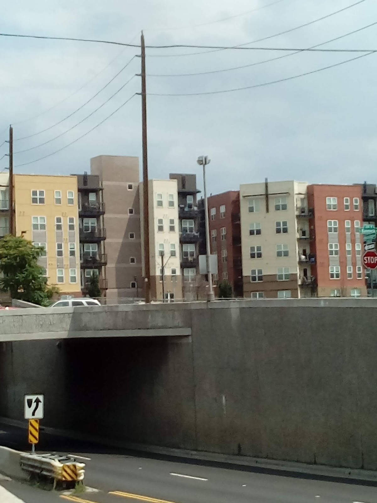
I'll be hiking from Auraria station to Osage station in November.

Notice, on the map, how the streets run along the river. The river was the important thing in early Denver around 1860. The railroad was yet to come.

You can find Cheesman Park, a green spot on the mouth a little southeast of downtown Denver. That was the city's "boot hill" - the cemetery. It was outside the city proper. Now it's a major park well inside the heart of Denver. Notice how the streets in this part of town run vertically and horizontally. Many modern cities follow this kind of grid pattern and Denver quickly became a modern city.

The state capitol building was raised in 1886. The green blip on Interstate 70 - that's Civic Center Park. The capitol building is just east of that - just outside of the old town.

Here are a couple of old maps from the 1860s of the area around Denver, and Denver City (that's what it was called before it became the territorial capitol. Can you see where old Denver fits into new Denver?

Early maps

Denver 1862 from https://www.loc.gov/resource/g4310.ct001032/?r=0.491,0.305,0.145,0.055,0 accessed 8/25/18 "Map of Colorado Territory embracing the Central Gold Region" Jacob Monk, Philadelphia

Denver City Map (1860) Ellis Gene. http://cdm16079.contentdm.oclc.org/cdm/ref/collection/p16079coll39/id/409 accessed 8/25/18.

Denver's oldest standing structure is, well, four miles southeast from where old Denver was. Four Mile House, on Cherry Creek, is a white clapboard and brick home built in 1859 as a way house for travelers on the Cherokee Trail, a major overland trail to the gold fields in Oregon and California that was established in 1849. Here is a picture and some links to information about the Four Mile Historic Park.

Four Mile House. (Kevin J. Beaty/Denverite) https://denverite.com/2017/06/21/oldest-buildings-denver-matter accessed 8/25/18

https://coloradoencyclopedia.org/article/four-mile-house

Use Google to look at some maps of major cities of the world. Do they seem to have been established on streams? Do you think the streams were navigable to the ocean? What about your town? Why is it where it is?

Are there any surviving buildings from your towns founding? What material was used in their construction? What "style" are they?

You can often learn a lot about the early history of towns from local cemeteries. Are there any old cemeteries in your town? Where was it built in relation to the town? What are the earliest dates on tombstones there? Were any of the first settlers buried there?


--- How Denver has grown ---

Damascus was established in the third millennium BC. Rome, in 753 BC. Paris was established by the Romans as a military camp in 52 BC. Alfred the Great founded London in 886. It had been settled off and on earlier, but this is the London that grew into the modern city in the United Kingdom.

Cholula is the oldest continuously inhabited city in North America, settled in the second century BC. Mexico City was founded in 1325. The Pueblo village of Oraibi, Arizona has been inhabited since around 1100, despite St. Augustine, Florida's contention that it is the oldest city in America. It was settled in 1565, and is the oldest city in America settled by Europeans. Hopewell, Virginia was settled in 1613 and Albany, New York in 1614, over five years before the Pilgrims landed in the New World at Plymouth, Massachusetts in 1620.

Denver, Colorado was founded in 1858. That was three years before the beginning of the American Civil War. Actually, Montana City was settled in 1858 where Grant Pioneer Park now stands on the Platte River. It was soon abandoned in favor of Auraria, a little further north. As the name suggests, the draw was gold. Gold wasn't found there. The McBroom brothers, John and Isaac, settled the area around Bear Creek near the confluence with the South Platte around 1859. A Swedish immigrant, Peter Magnes, also founded a small settlement, Petersburg, near the confluence of Bear Creek and the South Platte in 1865. Petersburg later became Sheridan, Colorado. There are plaques along Bear Creek and the South Platte commemorating the McBrooms and Petersburg.

By the way, the McBrooms bare no relation to Broomfield, Colorado, which was probably named for broomcorn grown in the area, an early source of revenue.

All this to demonstrate that, in terms of American cities, Denver is an adolescent. In terms of world cities, it is an infant. Still, in its short time, it has grown from three rows of cabins in 1858 to 4,749 in 1860 to over 700,000 people. It is currently the 19th largest city in the United States. By decade the growth chart looks like this:

                                                                       [Denver Growth]

Denver really took off in the 1870s when the population jumped from 4,759 to 35,629 and 1890s when it reached 106,713 people. Denver City became the territorial capital of the Colorado Territory on February 28, 1861 and, with a railroad to the first transcontinental railroad, which passed through Cheyenne, Wyoming, a major supply hub.

For more about early Denver, check out Pride of Place: Denver c. 1860.

Why is your home town where it is? When was it founded and how quickly did it grow? Is it still growing?


Saturday, August 25, 2018


--- Pride of place: Mapping the Neighborhood ---

Pride of Place: New Haven Material and Visual Culture is a lesson module created by teachers in the Yale-New Haven Teacher's Institute. These modules are great sources of ideas for personal adventures in learning. This one explores neighborhoods, maps, local history, fences, artifacts, cultural art, public art, tools and art, ethnicities, memorials, and local narrative.

I will be telling stories of past and current adventures for each of these lessons and I will make suggestions how you can explore your local culture through the material structure of your neighborhoods.

Maps are primary tools of social studies  and they are more accessible today through the Internet than they have ever been. The first lesson in Pride of Place is Mapping the Neighborhood by Carol Boynton. You might want to read it before you begin your own exploration.

http://teachersinstitute.yale.edu/curriculum/units/2008/3

A good way to get a feeling for geography is to create your own (maps, that is) of your microgeography - the geography of your home, and then broaden out to look at your neighborhood, your town and on out to the world.

I have a home layout utility called Sweet Home. It's an opensource package available from SourceForge or from the Sweet Home 3D website:

http://www.sweethome3d.com

You might want to play with it.

Here's a quick, approximate floor plan I made of my room. The only measurements I made were the room dimensions.


                                                                     [Floor plan]

I live on a main north-south thoroughfare in south Denver. I walk the streets a lot. My preferred grocery is about a mile to the south and the library I use is 1.3 miles to the east. I walk to each of those at least once a week. The only trails near to me are the Highline Canal Trail to the south and the Harvard Gulch Trail to the north. The Denver University campus is less than a mile to the north.

Directly across the street is an interesting two story house and just to the south of that is the church I attend. To the north is a gated community. I am surrounded by affluent neighborhoods. It feels strange.

Selma played havoc with my sense of direction. People talked about East Selma and I had to figure out what they meant every time. The roads and river conspired to throw me off. Starting in Valley, Alabama, where I grew up, the road to Selma is Interstate 85 which runs from Georgia south southwest to Montgomery, then the Selma Highway turns off to head due west following the Alabama River, which also turns west from a generally southern flow in Montgomery. Just outside Selma, the main route through Selma - Broadway - begins a gradual turn to the north and by the time Broadway turns into Citizens Parkway, it has made a straight shot due north toward Birmingham. The River, on the other hand has taken a southerly direction toward Mobile.

It was very disconcerting.

Denver is easy. If you can see the Rocky Mountains, that's west. That's all you need to know.

Of course, where ever you are on Earth, the sun always rises in the east and sets in the west.

There was a time that, if you wanted a map of the region, you had to go somewhere and get it. When I was a child, maps were provided free as a courtesy by gas stations. Now, you can get them as state rest stations...or you can buy them at a local department or grocery store.

But, then, everyone with a smart phone or computer has a map. The Internet offers several mapping utilities but the most popular is Google maps. Most Internet browsers will give you an excerpt and a link to Google Maps when you type in a place name. It offers not only street and road maps but topographic maps and satellite images. You can zoom in or out for details or search for nearby locations by topic - restaurants, churches, schools, whatever. I use Google Maps quite a lot when planning my adventures.

[Google Maps (2018) Denver, Colorado. retrieved from https://www.google.com/maps/place/Denver,+CO/@39.7136308,-105.0346792,12z/data=!4m5!3m4!1s0x876b80aa231f17cf:0x118ef4f8278a36d6!8m2!3d39.7392358!4d-104.990251 8/25/2018]

And if you want more, there is Google Earth which provides....well, I don't have the space here to list all that it offers. You'll just have to download it (it's free) and play around with it if you want to know. And you're not just stuck with our planet. You can explore space. The universe is at your fingertips.

                                                             [Moon from Google Earth]

Many people think that exploration involves travel. Your neighborhood is interesting. You may be surprised by what you find there - the cultures, architecture, history, geology, etc. Take a walk near home and keep your eyes and mind open to new things.

A "bird's eye" view of your area can often show you details that you would otherwise miss. Check out your area on Google Maps or Google Earth. See what you've been missing.

Sketch details in your area - interesting houses and other buildings in your neighborhood, nearby parks, geographic details. Sketching focuses your senses and guides them to things that you would otherwise miss. It's a great way to train your senses.

                                                                   [Sketch of bindweed]


--- That underbelly (the scary side of cities) ---


                                                             [Colorado State Capital]


                                  [Voorthies Memorial with Chinese Zodiac Head Sculptures]

                                                      [The Capital from the memorial]

                                                            [Denver City Council]

                                               [The McNichols Civic Center Building]

                                     [The McNichols Building and Downtown Denver]

                                  [Godzilla - AKA construction crane - Denver is growing]


                                                                   [Some animal heads]

August 14, I took a couple of buses downtown to the Civic Center Park and the McNichols Building to attend a town meeting on "Group Living". Denver city government is looking for ways to update the current zoning laws to allow for innovative living arrangements that might reduce homelessness and provide for special needs groups.

The trip was great. Civic Center Park is beautiful. The day was great.I made one serious miscalculation. I left the bus intending to return to the other side of the street to go back home. It was a one way street and I had not checked to see where the bus stop for the return home was. So, when the town meeting was over, I had to track down a train to carry me back, at night.

Actually, it was fun. I know enough about the transportation system to be able to guess where all the buses and trains go. I got to talk to some people - so many homeless! so many street people!

I got to see more of the "dark underbelly" of Denver. Every city has one. It's inherent in cities - that dangerous layer lying just under the peaceful, beautiful exterior that most people see.

I hear contemporaries bemoan the time they remember when "everyone could just leave their doors unlocked," and I think "Yeah. Everyone except for Black people in the South, Native Americans in the West, people of Asian extraction during World War II and after, poor people everywhere." I remember those times.

You have to live in a city awhile and pay attention before you start catching hints of the violence and misery. It's easy to ignore if it's not happening to you.

I grew up in LaGrange, Georgia and Valley, Alabama. I was 10 years old when we moved to Valley and I moved away to go to college. It was a nice little mill village. It was a shock when a mayor was killed by a secret lover. I knew about moonshiners from my childhood but I later learned of the connections between Valley and Phenix City (Sin City in the 40s and 50s, a place of organized crime). There were stories of unsolved murders, street rowdies (Street gangs were not known back then), and "freelance" Satanic covens (the organized movements don't sacrifice neighbors pets - these were local kid, embittered by poverty, watched by the local police, and aiming to be bad.) There was plenty to titillate the seeker that wanted to sample the "dark underbelly."

I lived in Selma for 20 years and was a founding member of the Citizens Against Violence. The core of the group were several mothers who had lost sons to violent crime. We had a dual street lamp installed in front of the city office building. It had a white light that was lit when there had not been a murder for a  month, When there was a murder, the purple light went on. The purple light was off once for a whole year, then it never went off the rest of the time I was there. I read that they only turn it on for the day a murder is committed now. I guess that looks better. Selma is a town of only about 19,000 people.

Denver is a beautiful city on the Great Plains at the foot of the Rocky Mountains. It is a town that draws much tourism.

Cities were established to increase the security of their inhabitants and to organize human activities more effectively. What nobody seemed to foresee is that, as people relegated their security more and more to new technologies rather than their neighbors, their neighbors lost value. It was a progressive illness but, where once people were more important than things , and relationships were more important than possessions; more and more other people are now only important for how they can help get things, and relationships are often thrown aside completely at the most trivial occasions.

In 2016, I attended a conference in Denver called "Talking About the Affordable Housing Crisis: Tools for Delivering the Bad News." Ideally, a person should not be paying more than a third of their income for housing. An affordable housing unit, then, costs less than a third of the resident's income. At the time of the conference, there was an 80,000 affordable housing unit deficit in Colorado. Last year, 2017, was the worst year to date for Denver, with a 32,000 affordable housing unit deficit.

In 2014, a survey by the Metro Denver Homeless Initiative uncovered that a third (actually 31.9%) of Denver's homeless population was homeless because housing costs were too high. Last year (2017) Denver had over 5116 homeless according to the Denver Post (1/30/2018 edition). Last year, Denver had over 232 deaths in the homeless population (12/21/2017 edition, Denver Post).

This year my avowed brother and I did some volunteer work for a political campaign in the Cap Hill residential area of Denver. One thing that struck us was the large number of vacant dwellings in the area, dwellings that did not look like they had been lived in for some time. In contrast were the number of homeless that were wondering the streets of that area and nearby. Why were there so many empty residences and so many homeless residents?

There has currently been a petition circulating here to call for the addition of a "Denver Right to Survive" item on the next ballot. Currently, under the Unauthorized Camping Ban, it is illegal to "use any form of protection from the elements other than your clothing."

In 2016, Denver police were caught on video taking blankets from homeless people in sub-freezing weather. The reply by the police department was that the action was to encourage the homeless to use the provided homeless shelters. Having visited homeless shelters in the area, I could well understand why the homeless people, and especially the homeless families would prefer not to spend the night in one.

To give Denver city government it's due, there are services for homeless people. The problem is that the social services landscape in the area is complex and very difficult to navigate. When you are on the street, it is very hard to connect with needed services. It's hard to obtain needed employment. It's hard to do anything more than survive.

And Denver is trying to find solutions to the housing crisis, thus the town meeting at the McNichols building. It was exploring possibilities with local residents - possibilities like tiny home communities, single occupancy dwellings, artist communities, dwelling options for elderly members of the community, halfway houses and other community correction options. I was happy to see the city government actively working on the problem, but through it all ran the plea, "Don't do anything to lower property values."

I have come to the conclusion that property values are inimical to human life.

Is there a homeless population in your area? What are the causes of homelessness - they differ from place to place? One problem that homeless people face is that others avoid them, making it even harder to connect to services. Most homeless people don't want to be outcasts. I have never run into a problem talking to the homeless people in my area. I learn things. You might want to try talking to the homeless in your area. You might enjoy volunteer work to help the homeless people in your area. That is often managed through local Human Services or churches.

There is a "dark underbelly" of your community. Don't poke around there too much - it's dangerous, but I would bet that older people in your community have stories they could tell. Many older people like to tell stories and many of them are in possession of some very obscure knowledge.


Wednesday, August 15, 2018


--- School away from school ---

Libraries, museums, parks, zoos, gardens...I think that most people thing of them as entertainment, and I guess they are, but they think of themselves as having educational missions. The difference is that they are not compulsory education. Children are subjected to grades K through 12 whether they want to be or not because society has deemed it important that citizens be prepared with the basic skills needed for personal and vocational success. After high school, people have some freedom of choice. They decide what they want to do with their lives and they "give themselves" for 3 to 12 years to some institution that is paid to train them in some field - vocational program, apprenticeship, technical school, college, university.

Personal education is different. If you want to know how to fix your broken plumbing, you can go to your local library and check out a book or a DVD that explains what you need to know. If you want to see animals, you can go to the zoo or aquarium. But many of these places also have classes - like in school, but you can pick and choose.

Many of the parks in the Denver area even give guided tours that teach about plants, animals, and the environment in this area. Some have informative plaques that offer self-guided tours.

The library in my neighborhood offered a "Space Party" that presented information about space science and tips for watching the upcoming Persied meteor shower. I thought it was an adult program - it was a childrens' program - but that was okay. I'm not doing astronomy right now; I'm doing social science, and education is a social science.

Actually, education is somewhat of a hybrid. How we learn is definitely in the domain of psychology, but much of education is what happens between teachers, the student, and the other students - not to mention the organization that is the school.

So I settled down to watch the show, and a show it was. The presenter had his act down well. Meteors, the solar system, rockets, and mars exploration - the children were fascinated as much by the information (which was surprisingly substantial) as by his theatrics - acting, choreography, sleight of hand, special effects (demostrations). And the kids asked great questions. They showed themselves surprisingly knowledgable about space science ($11 and million dollar space dollars were handed out for correct answers).

So, it was a fun time for all. The program (SpaceTimeKids - if you're curious, they're on the Internet at https://www.spacetimekids.com) is particularly appropriate for this area. Denver has long been a center for the space program with Lockheed Martin nearby in Littleton, and a new focus in the Colorado School of Mines is space science and space  mining.

Does libraries, museums, zoos, gardens, and parks in your area offer educational programs or tours? Often they will have websites that provide schedules or calendars of events.


--- Evans to Broadway ---

The hike from Evans station to Broadway station is short but there are some interesting highlights along the way. Pasquinel's Landing and Overland Park takes up the length of the Mary Carter Greenway between Evans and Mississippi Avenues along the South Platte River. On the other side of Platte River Drive is Ruby Hill park.

The light rail station at Evans is a short walk along an overpass over Sante Fe Boulevard. As an example of how Denver has ornamented its public places, here is some of the art on the overpass.  Denver has encouraged the public expression of art in murals and sculptures.

                                                                    [Evans overpass]

Pasquinel's Landing is directly across Evans Boulevard from Grant Frontier Park and begins with a fitness park with a set of exercise equipment. I investigated them but didn't use them. I still had Ruby Hill to deal with. Still, with the trail itself, they looked like a pretty complete workout.

Fitness parks seem to be a feature of our landscape now. The Rails-to-Trails trail in Valley had one as did the park near the stadium in Selma and I knew of several other city parks in Alabama with exercise stations.


                                                            [Pasquinel's Landing]

This is also a boat landing for people who want to canoe or kayak on the river, and the water birds seem to like this area. I saw these herons and also a snowy egret (I couldn't get a good picture of the egret because it kept its back to me.)


                                                                           [Herons]

Along the river, the area has been planted to provide examples of ecosystems in the Denver area from the southern hills to the alpine regions above 900 feet in the Rockies. Plaques along the trail offer a self guided tour.

The land to the west of the river is hilly and a couple of the hills really stand out. The panorama for this blog was taken from Loretto Heights and is one of the best views of the area around. Ruby Hill is also a popular prominence, especially in the winter when it provides gentle, clear slopes for snow sledding. The lawn is kept well maintained but the slopes at the bottom near the river are allowed to grow in a more natural state.  The several varieties of trees provide nesting for raptors like eagles and hawks.

A trail circles the hill to the top and back to the base where Florida Avenue crosses Platte River Drive. Denver has themes. Further South, the streets are named for colleges. Here, they are names for states. To the north, in Denver proper, they start getting numbers.


                                                                        [Ruby Hill]

The crown of Ruby Hill offers good views east across the plains, and the tall buildings in downtown Denver.


                                                                        [Vistas]

There is also a large pavilion on top with picnic tables and a modernistic Stonehenge type sundial. This day was not sunny, so I didn't get a picture of it working, but you can get an idea of how it works from these pictures. When I start writing blogs about astronomy in a couple of years, I'll have to revisit the many sundials in the area.


                                                             [Pavillion and sundial]

Sanderson Gulch is the northernmost point that I've hiked on the South Platte River to date. Like Harvard Gulch, it is a man made canal created to drain storm waters off the slopes of the river valley. It runs about five miles from Lakewood, through North Harvey Park, to the Platte River at Ruby Hill. This is where it empties into the river.

                                                                [Sanderson Gulch]

This time, I continued a little further to Mississippi Boulevard. Here is a view of downtown Denver from the bridge over the river. I'm getting close.

                                                  [Denver from Mississippi Boulevard]

I grabbed a bite at the Breakfast King on Mississippi before continuing to Broadway Station. Until recently, I've associated the colors of the apartments in this picture as "Denver colors", but I've learned that they are the colors of a major construction company in Denver that builds apartments around light rail stations. It seems a lot of people don't like the colors. I don't mind them - they sorta look autumnal.


                                                  [Apartments near Broadway station]

Broadway station is a hub for several of the lines on the RTD system. The train overhead lines and the rails create interesting patterns where the different lines come together.

Power is delivered to the RTD trains through structures that sweep these overhead power lines. Other systems use third rails to deliver power. The motors on these trains are 620 horsepower electric engines that run on 25,000 volts of alternating current. They can reach speeds up to 79 miles per hour.


                                                               [Broadway station]

From Broadway, I take the train to University station, and the bus from there back home. The summer is still on us but the overcast skies kept the temperature somewhat less than brutal.

Denver is all about art. Most of the railway stations are decorative and many areas sport murals, sculptures, outdoor art exhibits and art museums. What kind of art is on display in your area? Does your town support local artists?

Denver is on several migration routes for birds. Also, raptors seem to like the area. It's a popular place for bird watchers. Most areas in the US have interesting features for bird watchers. Even New York city and many other large towns have their falcons. What kind of bird populations are in your area?

Do you have a light rail system in your area? In addition to being a fun means of transportation, they are interesting engineering achievements in their own right.


Wednesday, August 8, 2018


--- Schools along the trail ---

In a way, I've been blogging about education on the Bear Creek Trail the whole time. I started by looking at museums, libraries, and computers (at least my smart phone, which is a pocket computer.) Then I looked at psychology and philosophy using the trail as a "natural laboratory". This year, I have been looking at the sociology and religions of the trail. Along the way, I have taken side-trips into science (for instance, wildflowers and weather), industries, food on the trail, art, and history.

But other people use the trail for educational purposes. I have seen three school field trips on Bear Creek Trail and a group from one of the local colleges at the nearby Morrison Museum of Natural History studying paleontology.

There are several schools along Bear Creek Trail. Most of them are along the eastern part of  the trail, so I hiked from Wadsworth Boulevard to Oxford Station and visited a couple of them: John F. Kennedy High School and Mullen Catholic High School. These are within view of the trail.

It's summer, so I was hoping I could catch staff on campus when students were not around so I would not interrupt their studies. In both cases, that worked.

This is a large town, so the schools tend to be large. Enrollment  in Kennedy High School runs about 1500 students and that for Mullen is about 800-900 students.

The people I talked to did not know of any use of the creek as a resource but said that they thought that the science classes did have field trips to look at things like life in the creek. Kennedy students use the creek as a hangout. I have seen families of graduating students in the park celebrating.

One of the classes I saw at the creek were, indeed, looking at life forms in the creek. One of the others was testing the creek waters for impurities.


                                                     [John F. Kennedy High School]


                                                             [Mullen High School]

Does your local schools use parks and other outdoor sites for educational purposes?

If you see a group on a field trip, you might ask them what their doing and let them teach you something.