Monday, October 30, 2023

Colorado Station to University Station


First snow hike of the autumn!

This was a pleasant hike. There was about six inches of snow on the ground. The air was chilly but not freezing and the cloud cover kept the sun from blazing down. The above photo is Little Dry Creek Trail. I was on my way out. I had to detour down to the pharmacy to pick up a prescription before I hit the trail.

The hike began at Colorado Station and retraced a stretch of my last hike down to the Schlessman YMCA.
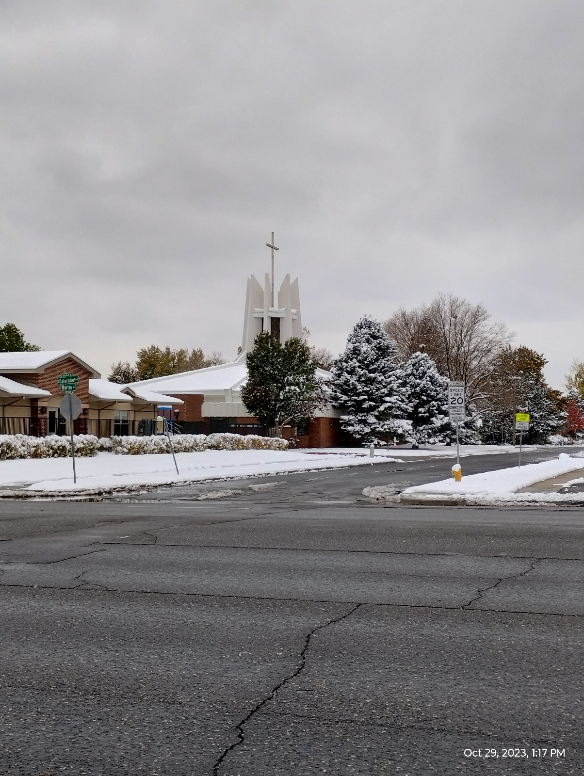
There is a variety of churches and church architecture along the way. This is the Most Precious Blood Catholic Church of Colorado Boulevard.
Most of Colorado Boulevard looks like this, gas stations, shopping centers, and office buildings, typical urban fair.
Here's what the weather was doing.

29.86 inches mercury (1.011 bar, pretty much normal sea level barometric pressure.) 41.4 ° Fahrenheit is a comfortable chill. The reason the snow is sticking around is that it's such a good insulator that the snow on top keeps the snow underneath from melting and the snow underneath keeps the snow on top cold. 43% humidity is pretty wet for Colorado. The consistent cloud cover helped to keep things stable. I didn't expect any storms and only got a few occasional flakes of snow.
If you look back in the blog, you can find other pictures of the University Hills Library (I demonstrated the difference between weight and mass in their elevator!). This photo is just for nostalgia.
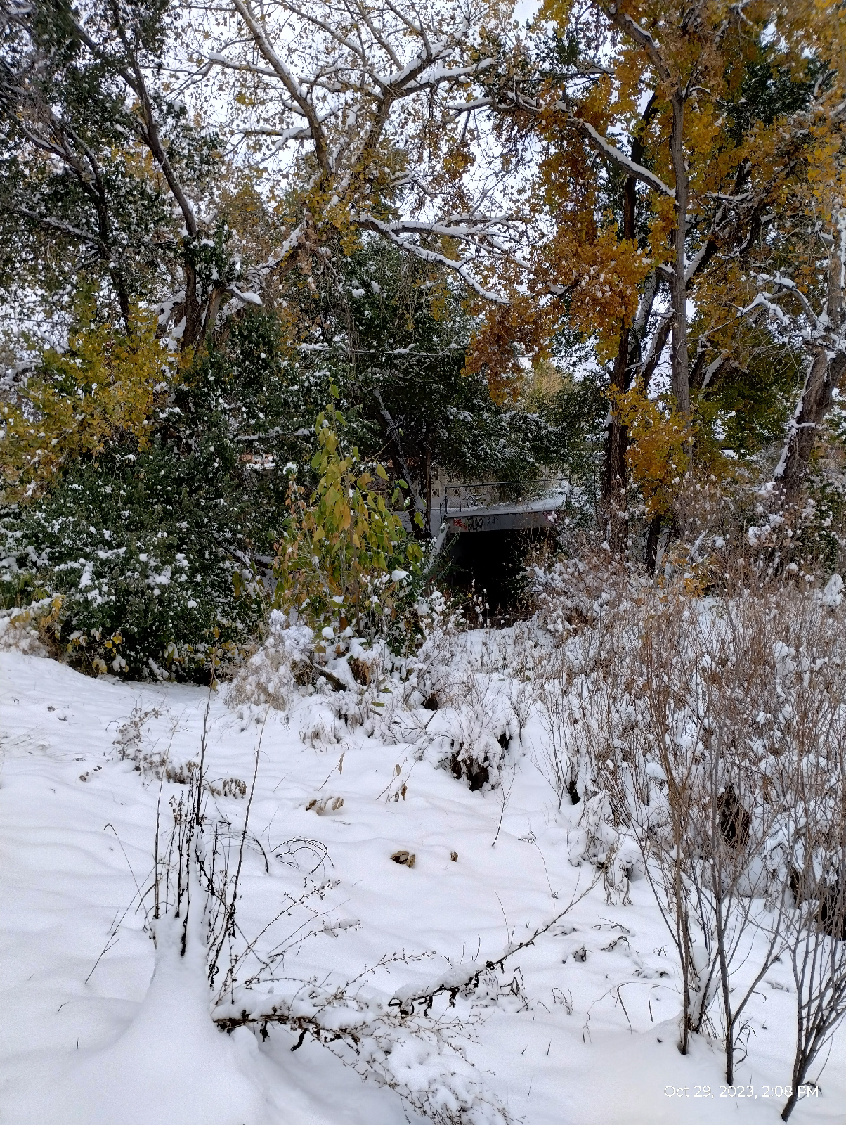
And this is the real start of my hike. Here, Harvard Gulch emerges from underground as a storm sewer. It's pretty high right now with snow runoff. The water looks clean but I wouldn't drink it. It's not like there's stuff from toilets and washing machines but melted snow carries a lot of surface materials like street debris and leakage from cars. Still, a surprising amount of tiny plants and animals live there.
The gulch provides storm drainage and recreation (Harvard Gulch Trail runs from the emergence of the gulch to where it disappears underground near Broadway. I saw kids sledding on the broader banks). Less obviously, the stone reinforced banks and many water features inhibit erosion and the natural bed helps to cleanse the water before is pours into the South Platte River.
Harvard Gulch borders the University of Denver Campus. I've spent a lot of time there as there's a lot to see. Here's a picture of the sundial on the southern side of the Newman Arts Building. I hadn't seen some of the new buildings on campus so I decided to cut through on the way to University Station.

Much of the space between the buildings are gardens and malls.
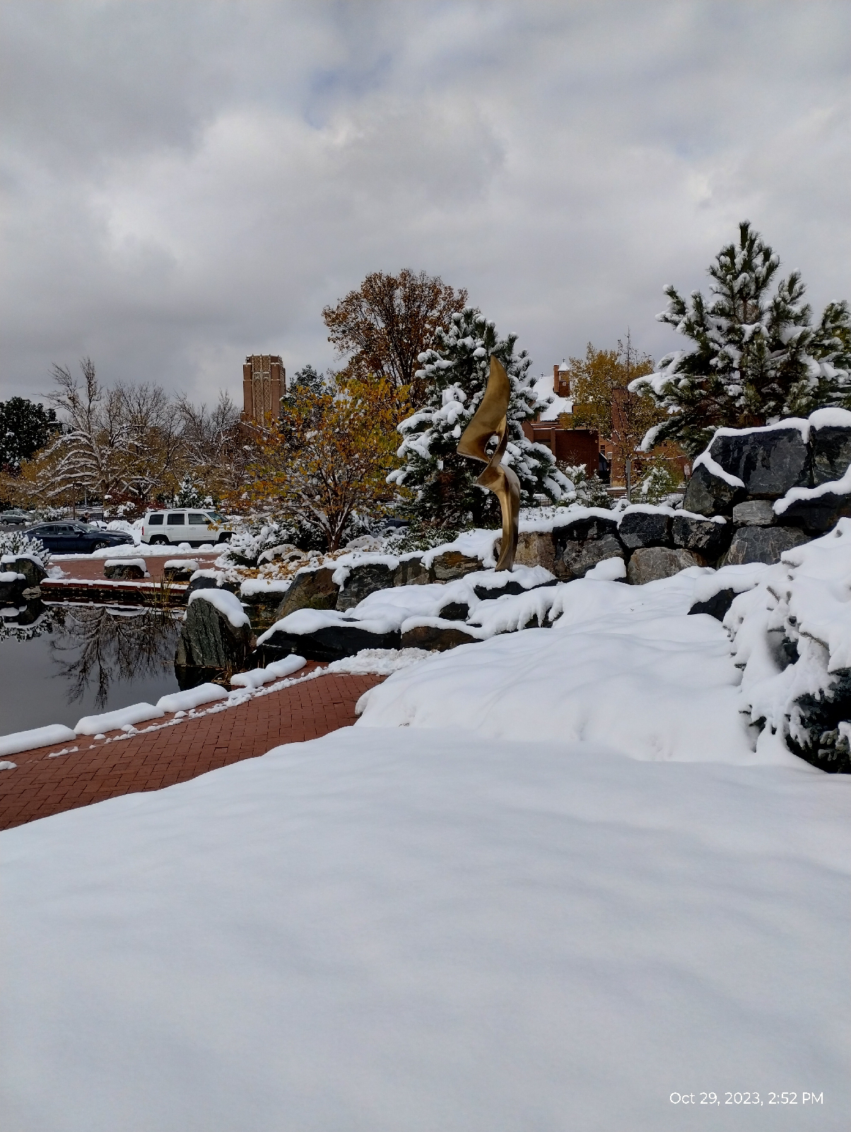
Dan's Garden is a visual highlight of the Daniel Felix  Ritchie School of Engineering and Computer Science. In the winter, it transforms into a wonderland of snow and cascading waters.

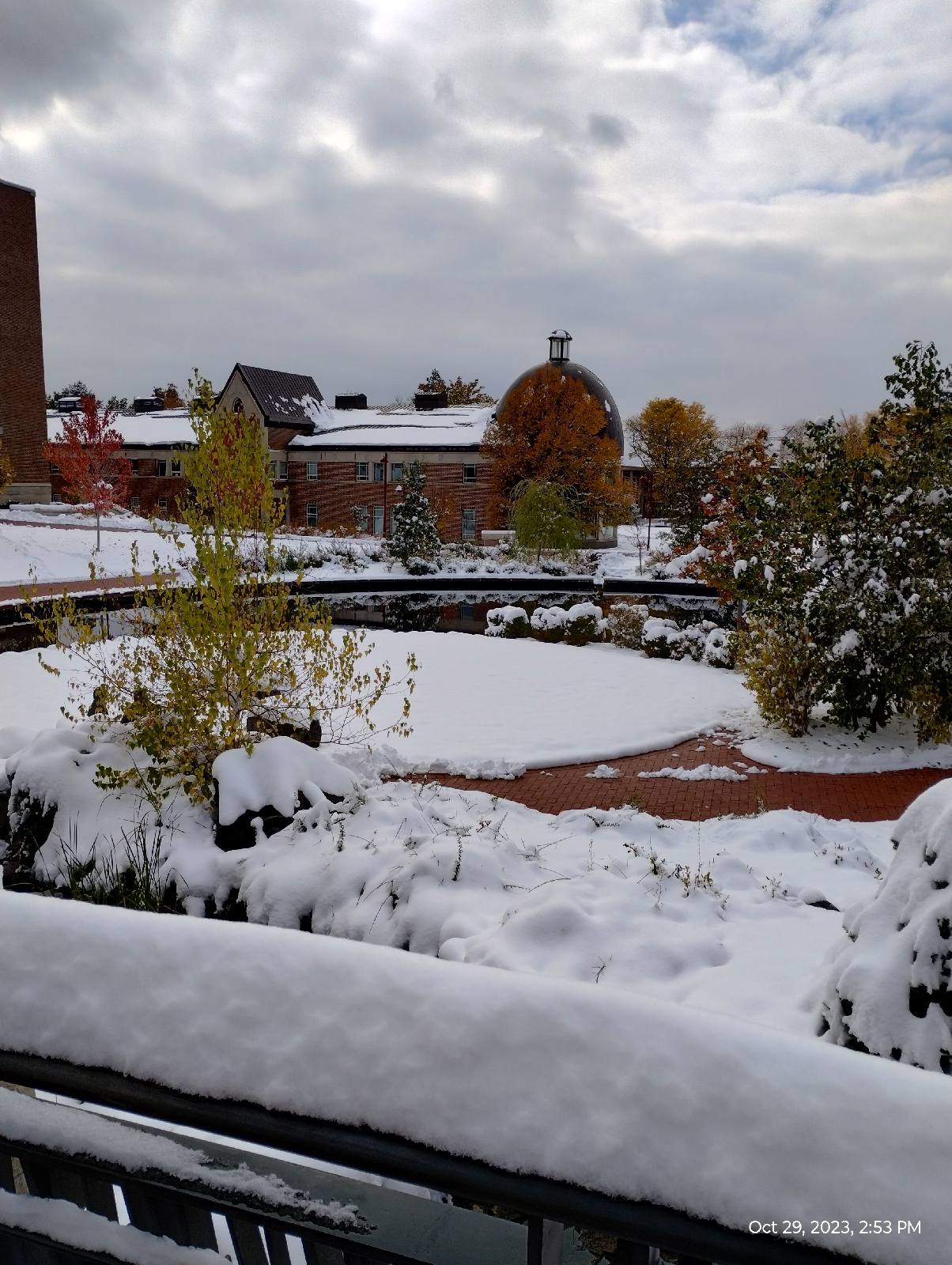
The campus is quiet now on this snowy Sunday. There are certainly students and faculty strolling around, but the traffic is reduced and the snow muffles a lot of the usual noise.

The Chester M. Alter Arboretum with its water gardens is similarly subdued. 
The new student union building actually looks new. I didn't go in....I should some day. I like that glossy dark red exterior.

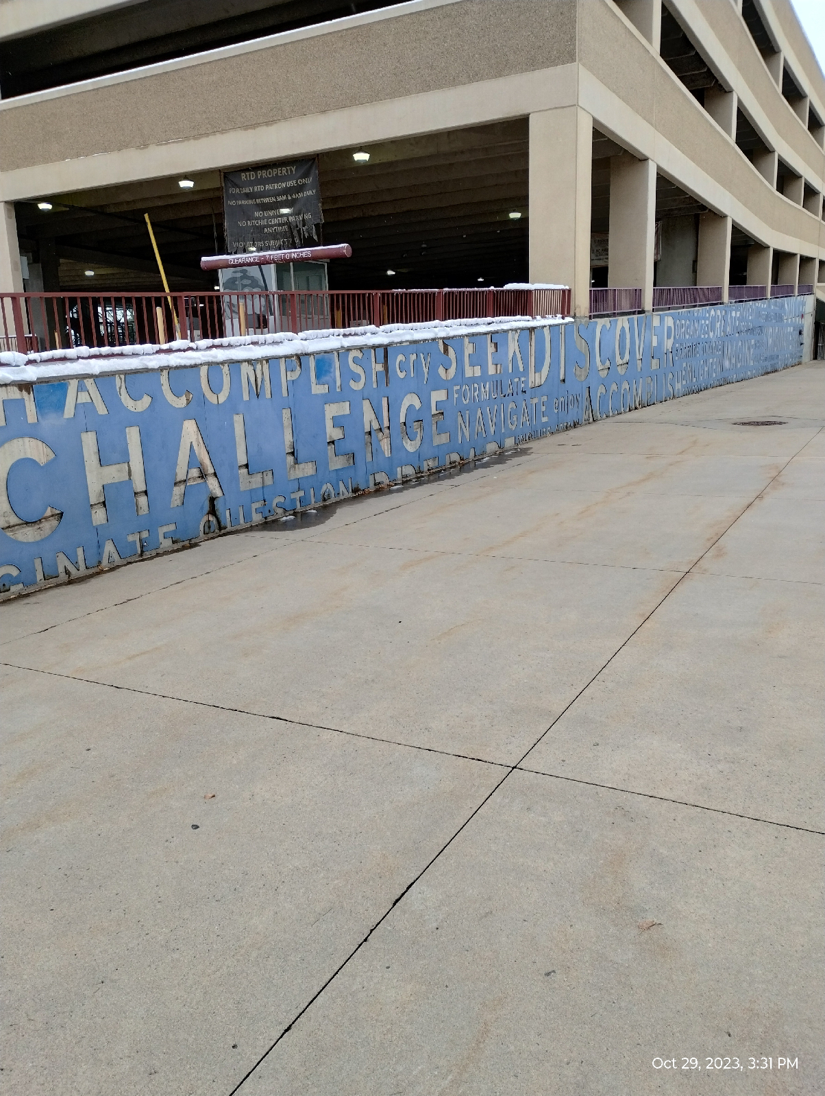
The art at the University of Denver Station is a blue metal plate cut out to show the off white concrete underneath. It's called "Reflective Discourse" and it was constructed by John Goe and Larry Argent. Argent is also the creator of the Big Blue Bear at the Colorado Convention Center.
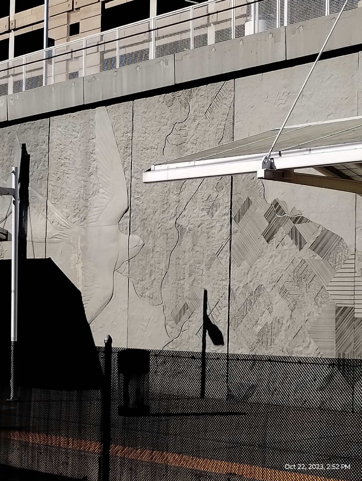
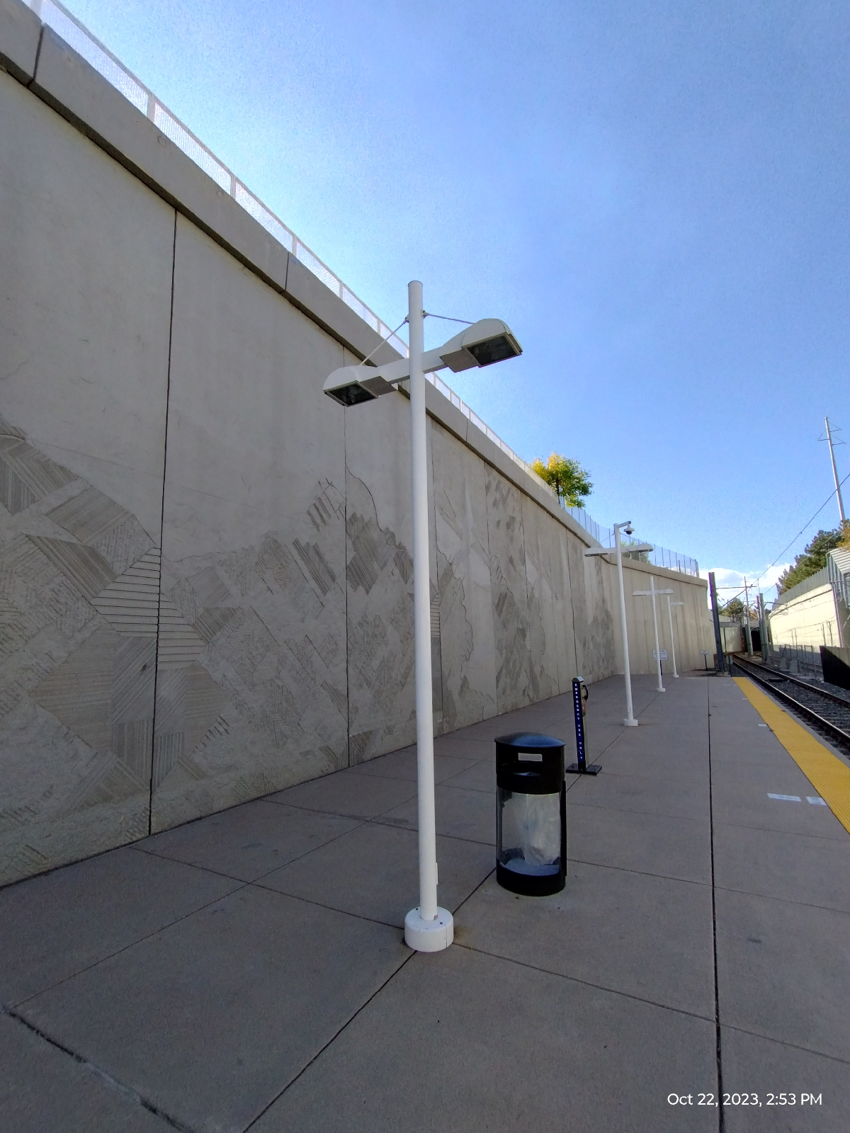
Many of the shelters at the RTD light rail stations have the cable support design shown above. It's the same principle as the cable support bridges except what's being supported is a roof instead of a footpath.

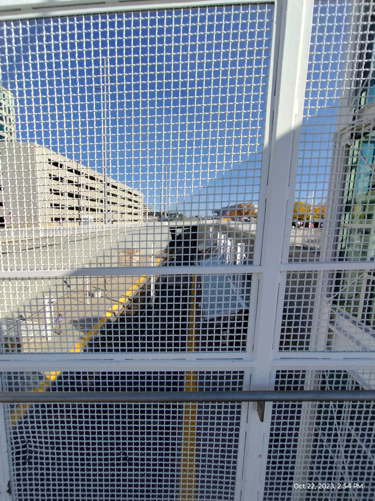
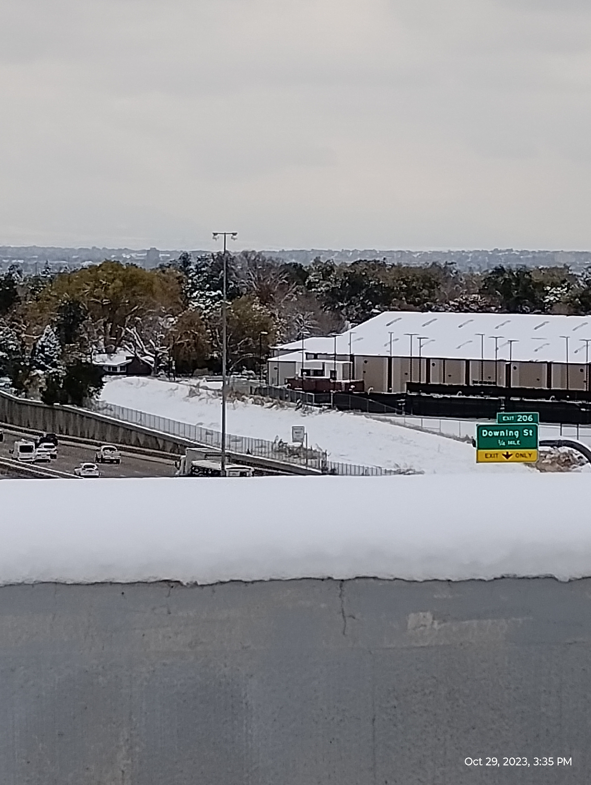
There are not a lot of accessible observation platforms in the Denver skyline but there are plenty of parking garages and some of the best views in the area are on the top decks. So here's the requisite shot of the Rockies.
Oops.... where'd they go?

Well, it's not all bad. This area relies a lot on the snow packs on the mountains for it's year round water and those clouds are packing the snow in. Here's a picture I took near home a couple of days later on a grocery run.
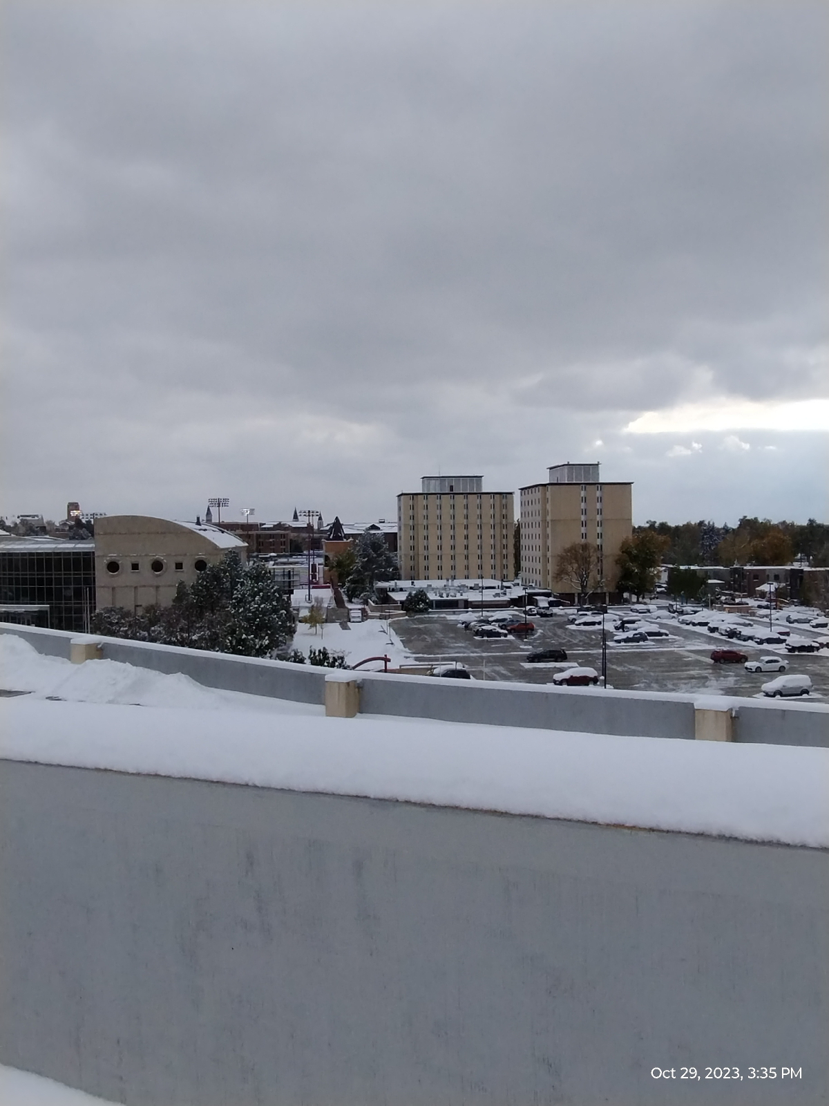
Here are some more shots from the top deck.
The Denver skyline

The plains

Colorado Center

The University of Denver carillon Tower

The University of Denver

and more University of Denver

The next station-to-station "hike" will be more of a homecoming. This area used to be one of my past neighborhoods and I have good memories of the church I used to attend. I'll be getting up really early so I can make a morning service, and then I'll make a first-or-the-month supply run.

There are just two more station-to-station hikes on the E/H lines before I turn my attention to Cherry Creek 

Saturday, October 28, 2023

Seismology on the Patio

I carried my phone out to the patio, placed it on the concrete slab, and stomped. Big deal. So what.

Let me fill in a few details. This was my setup.
The phone was two feet from me and it was oriented as the arrow.

I opened the Arduino Science Journal app and opened the accelerometer sensor cards (all three dimensions) before laying the phone down on the concrete slab, then I started recording. I stomped twice. Here's the recordings 
Of course, I was recording the vibrations in the concrete. I was also simulating a seismograph, the instrument used to record vibrations in the Earth.

When looking at the tracings, keep in mind that the z direction is straight up perpendicular to the face of the phone. The x direction is left and right, and the y direction is along the long dimension of the screen.

Vibrations along the z dimension and those along the x and y dimensions are actually two different kinds of vibrations and they mean different things to a seismologist.

The vibrations I recorded are sorta complicated. There are more than a handful of different kinds of waves that can arise in concrete...or the Earth due to earthquakes, landslides, mining operations, charges set off by researchers, bomb tests, etc. But the two kinds of most interest to seismologists are body waves, waves that travel through the Earth. Secondary and primary waves are usually abbreviated as S and P waves.

P waves are "primary" because they're faster than S waves and usually appear first on the seismograph. The X and Y tracings above record mostly P waves and you can tell that they start a fraction of a second before the waves on the Z tracing. They're like sound waves, compressional waves that move the particles in the material back and forth. They can travel through any kind of material, perhaps slowing down at boundaries or being bent. 

S waves, the ones showing up on the Z tracing, are like ocean waves, ripples through the materials and, even though they can appear on the surface of lakes and oceans, they're shear distortions and can't travel deeply through fluids. For instance, they're blocked by fluid layers in the Earth.

We haven't been able to go very deeply into our planet. The deepest anyone has been is the Kola Superdeep borehole in Russia at 12,262 meters (40,229 feet or 7.6 miles). The Earth is 6,371 kilometers thick. We have a long way to go.

But we do know a lot about the internal structure of the Earth and are still learning a lot of details, and most of what we know comes from understanding the nature of these waves and studying the tracings of vibrations sent through the Earth by earthquakes and other disturbances.

Seismic waves have many other purposes. Do you want to know how far it is to solid bedrock? It's easier to set off a small charge and record the echoes sent back up to the surface than to dig a deep hole.

The way seismologists can know where an earthquake occurs, where the epicenter is, is by triangulating between three sets of seismograph readings.

If you want to explore actual seismic waves with your cellphone, you need some way of fixing it to solid bedrock. The colluvium that covers this area is too springy and would dampen most seismic waves. A pole down to bedrock could be useful if you don't have any convenient outcroppings. Of course, it might be interesting to study how sound travels through soft earth. An "earthquake" in south Florida is a tractor trailer traveling on the Tammiammi Trail.

Also, keep in mind that what the accelerometers in you phone measure are not displacement, but acceleration...not meters, but meters per second squared.

There's a vast body of knowledge of seismology but it's easy to understand and can make fascinating reading, and it's within reach of anyone with a cellphone.

Monday, October 23, 2023

From Colorado Station to Yale Station: Shops and restaurants, oh my!


I took this hike backwards, starting at Colorado Station and going south to Yale Station. I was hoping to find a particular cut of meat at a grocery store on Yale (I didn't.) and I didn't want to pack it any further than necessary.

Colorado Station is interesting in that, where most of the other platforms are built above the surrounding land, Colorado is below the ground level. The train enters the station from both ends through tunnels. This stop provides access to a cluster of high rise buildings called "Colorado Center" which includes a theater, office space, and a few shops and restaurants.
The walls of the station feature a bird. I'm not sure what kind of bird it's supposed to be. It doesn't look like the Colorado state bird, the lark bunting.
Colorado Station has its art piece.
Ries Niemi designed these seven foot high, stainless steel "Big Boots" that include both Native American and traditional cowboy imagery.

They wouldn't fit me so I left them where they were.
This hike is urban at its most...well, urban. If you're into shopping, this area is for you. If you're looking for international cuisine, this might be what you're looking for.

There wasn't much for me but I used to live on the next main street to the east so there wasn't much to surprise me.
Harvard Gulch arises directly behind this YMCA and that will be where my next hike begins.
Autumn is in full color here. 

I wonder whose Mercedes has lost an emblem.
This is about as well as I could do on this hike for my requisite shot of the Rockies. It is from the platform at Yale Station and captured more fall color 

People here talk about driving into the mountains to look at the trees.

I don't get it. The Aspen trees go bright yellow but everything else is green evergreens. All the color is down here in the city.
The train ride back to Arapahoe Station was uneventful. A neighbor's garden had a milkweed going to seed. There were tuffs of milkweed floss all over their lawn. The method of spreading seed is pretty effective.
Next time: Harvard Gulch and the University of Denver campus.

Anatomy of a Mountain Range 4: The final stretch.


South Rooney Road runs from the intersection of West Street and Colfax in Golden to the east entrance of Dinosaur Ridge on Alameda Parkway. It passes between the Dakota hogback and Green Mountain and has trailheads that go both ways. On my hike, I was ready to get home so I was ignoring the trailheads. I wasn't ignoring Rooney Road, though. The traffic was continuous if not outright heavy with people going to and from Dinosaur Ridge and Red Rocks Park, and the narrow shoulder was knee deep in places with grasses, thistles, and nettles.

So, if you visit, be careful. 

Green Mountain, shown above, is popular with bird watchers and mountain bikers. It's not particularly spectacular in its own right (frankly, I think it's sorta barren and ugly) but the views from the summit of the Front Range, the Denver skyline, and the plains are stunning. And it has interesting wildlife and wildflowers. The summit is at 6854 feet and a hike from the base gives you an elevation gain of 677 feet.

It's a foothill, a three layer mud pie composed of Denver, Dawson, and Arapahoe conglomerates washed out of the Rockies as they rose from the plains. There are some patches of Shoshonite, like the volcanic stuff that caps the Table Mountains. All this stuff....well, from the mountains to the Mississippi River, the Great Plains, in fact, was once buried in sediments from the Rockies as erosion excavated them. Green Mountain is a patch of real estate that withstood erosion a little better than the land around it.

It's now a park, by name the William F. Hayden Green Mountain Park and there is a network of trails that run from one end to the other. Who was William F. Hayden? Well, he was rich. He and his family owned coal mines, cattle, and land in the Colorado. After he died in 1937, his family left the mountain to Lakewood, Colorado.

Interstate 70 crosses Rooney Road at the outskirts of Golden. The road cut through the Dakota hogback appears in a surprising number of books including geology texts. It includes a very clear unconformity between the Dakota and Morrison formations. 

Thunder Valley is a large all-terrain vehicle park. It looks like it would be fun to explore the hogback there.

This was a sight I earnestly desired. Coming over a bridge I saw the Jeffco (Jefferson County) Government Center right there in front of me with its backdrop of the Rocky Mountains and the two Table Mountains. If you've been following my blog, you've seen a lot of Golden, Colorado.

This hike was somewhere between twelve and fifteen miles, which would not have been so tiring except I began in Morrison at an elevation of about 5723 feet. At the top of the Geological Overlook Trail I made it to 6680 feet. That was an elevation gain of around 957 feet.

I was tired.

Rooney Road turned into West Street which leads to a convenience store where I could recover some electrolytes. A foot trail to the government center rather conveniently started there and I was very soon at the train station. Tired and sore, I enjoyed sitting throughout the return trip to Centennial. It was night when I arrived. The trip was one to remember.

This was a hike that effectively encapsulated the history of the Front Range of the Rocky Mountains. Is there a place like that that provides insights into the big history of your area?

Friday, October 20, 2023

Anatomy of a Mountain Range 3: Where There Be Dragons (or what's left of them)


Just across the road from the north entrance to Red Rocks Park, Alameda Parkway climbs the Dakota hogback. It's blocked off to vehicles except for the tour buses and maintenance vehicles of Dinosaur Ridge. The Friends of Dinosaur Ridge museum especially designed for younger visitors is there, also.

Dinosaur Ridge, a very prolific source of dinosaur fossils, has been designated a National Natural Landmark. There are dinosaur fossils from there and the sister site, Triceratops Trace, in museums all over the U.S. Although the park charges for guided tours, it's free to hike over the hogback and read the interpretive markers. It's a fascinating hike.

Apropos to this blog, Dinosaur Ridge dissects the Dakota hogback. That means I won't be showing you all the sights. You'll have to visit in person for that, but it's well worth the visit. The dinosaurs are waiting.

The dinosaur fossils in the sandstone consists of both bones and footprints. The skeleton above is surprisingly intact. The bones underneath are more typical. At this site, the dinosaurs died upstream and the bones were washed downstream in a humble.

The footprints can be crowded and tell paleontologists a lot about dinosaur behavior. Evidently, they were very social creatures.


Dinosaur Ridge is a veritable bone quarry. It was a major site in the infamous bone wars waged by the paleontologists Othniel Charles Marsh and Edward Drinker Cope. You should look it up. It's a prime example of how scientists should not behave.
Remember the Law of Lateral Continuity? Remember the layer of volcanic ash back in Morrison? Here it is again on Dinosaur Ridge. 
The beast that left the claw marks in this rock (it was sand back then) ate dinosaurs. It was a crocodile and it's modern relatives haven't changed a lot! Not all the fossils in Dinosaur Ridge are of huge animals. It was a marine environment so it's not surprising to find shells and worm burrows.
and wave ripples.
The lower layers of the hogback are stone made from compacted mud: mudstone and shale. The size of particles that make up rock is an important hint to deciphering it's geologic history.
Big chunky sediments are deposited by powerful streams close to their source, or, as in the case of the Castle Rock capstone, very powerful torrents far from their source. We know that the Castle Rock conglomerate material originated near what is today Boulder because that's the only place we can find the blue quartzite in it's "mother lode". What a flood that must have been!

The finer the sediment, the more languid the streams or the further away from the sources. They don't call the Mississippi River "the Big Muddy" for nothing. It starts off in the mountains tearing them to shreds as powerful rivers like the Missouri and the Tennessee but by the time it has grown into the huge river that flows into the southern states, it carries a lot of weight in water and has lost most of its boulders and gravel. It's weighed down with mud and silt.

This Benton Shale is made from silt from far away mountains and was deposited in the shallow inland sea. We know that because we find the fossils of marine animals in it. This rock has been dated at around 92 million years.

The Benton shale is near the bottom of the pile and so is the east entrance to Dinosaur Ridge. There is a little paleontology museum there but I was in a hurry to get to Golden before nightfall more from outright fatigue than any worry about hiking at night. Just as Alameda Parkway comes off the hogback, it intersects Roony Road and the last stretch of my hike