Showing posts with label fossils. Show all posts

Friday, October 20, 2023

Anatomy of a Mountain Range 3: Where There Be Dragons (or what's left of them)


Just across the road from the north entrance to Red Rocks Park, Alameda Parkway climbs the Dakota hogback. It's blocked off to vehicles except for the tour buses and maintenance vehicles of Dinosaur Ridge. The Friends of Dinosaur Ridge museum especially designed for younger visitors is there, also.

Dinosaur Ridge, a very prolific source of dinosaur fossils, has been designated a National Natural Landmark. There are dinosaur fossils from there and the sister site, Triceratops Trace, in museums all over the U.S. Although the park charges for guided tours, it's free to hike over the hogback and read the interpretive markers. It's a fascinating hike.

Apropos to this blog, Dinosaur Ridge dissects the Dakota hogback. That means I won't be showing you all the sights. You'll have to visit in person for that, but it's well worth the visit. The dinosaurs are waiting.
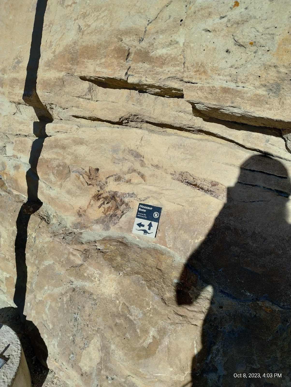
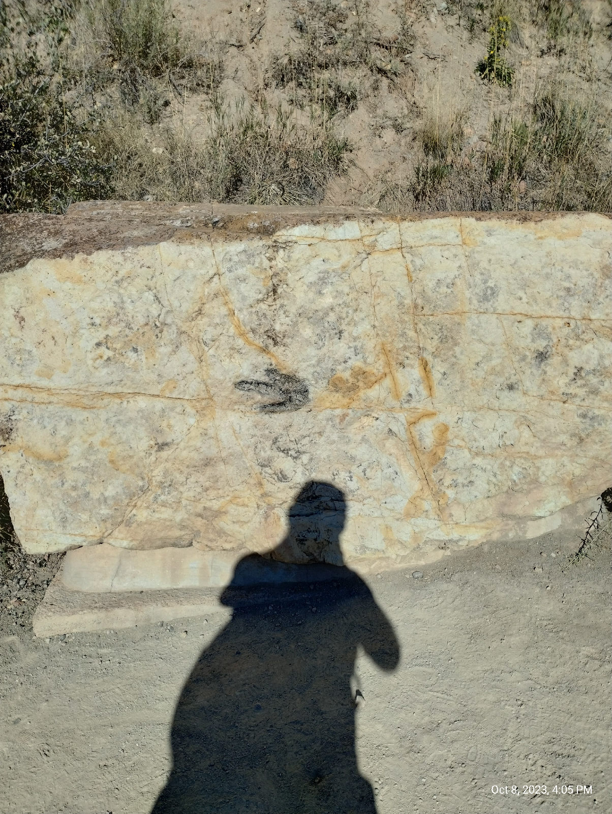
The dinosaur fossils in the sandstone consists of both bones and footprints. The skeleton above is surprisingly intact. The bones underneath are more typical. At this site, the dinosaurs died upstream and the bones were washed downstream in a humble.

The footprints can be crowded and tell paleontologists a lot about dinosaur behavior. Evidently, they were very social creatures.


Dinosaur Ridge is a veritable bone quarry. It was a major site in the infamous bone wars waged by the paleontologists Othniel Charles Marsh and Edward Drinker Cope. You should look it up. It's a prime example of how scientists should not behave.
Remember the Law of Lateral Continuity? Remember the layer of volcanic ash back in Morrison? Here it is again on Dinosaur Ridge. 
The beast that left the claw marks in this rock (it was sand back then) ate dinosaurs. It was a crocodile and it's modern relatives haven't changed a lot! Not all the fossils in Dinosaur Ridge are of huge animals. It was a marine environment so it's not surprising to find shells and worm burrows.
and wave ripples.
The lower layers of the hogback are stone made from compacted mud: mudstone and shale. The size of particles that make up rock is an important hint to deciphering it's geologic history.
Big chunky sediments are deposited by powerful streams close to their source, or, as in the case of the Castle Rock capstone, very powerful torrents far from their source. We know that the Castle Rock conglomerate material originated near what is today Boulder because that's the only place we can find the blue quartzite in it's "mother lode". What a flood that must have been!

The finer the sediment, the more languid the streams or the further away from the sources. They don't call the Mississippi River "the Big Muddy" for nothing. It starts off in the mountains tearing them to shreds as powerful rivers like the Missouri and the Tennessee but by the time it has grown into the huge river that flows into the southern states, it carries a lot of weight in water and has lost most of its boulders and gravel. It's weighed down with mud and silt.

This Benton Shale is made from silt from far away mountains and was deposited in the shallow inland sea. We know that because we find the fossils of marine animals in it. This rock has been dated at around 92 million years.

The Benton shale is near the bottom of the pile and so is the east entrance to Dinosaur Ridge. There is a little paleontology museum there but I was in a hurry to get to Golden before nightfall more from outright fatigue than any worry about hiking at night. Just as Alameda Parkway comes off the hogback, it intersects Roony Road and the last stretch of my hike 

Sunday, August 6, 2023

And, finally, Colorado

The series of paintings at the Denver Convention Center by Kirk Johnson and Jan Vriesen entitled Ancient Colorado shows artist renderings of Colorado over the last 500 million years. Why just 500 million years? Why not beginning at the formation of the Earth? Well, you probably know the answer by now.

The land that eventually became Colorado didn't exist before 500 million years ago. We'll start here at 395 million years ago, but first, let's talk about geological time. Geologist work with time scales in which human history is the blink of an eye, so they have to have a completely different framework.

We've looked at the four broadest divisions of geologic time: Hadean, Archean, Proterozoic, and Phanerozoic. These are called "eons".

Eons are divided into eras. These geological units aren't directly related to time but are associated with particular identifiable strata of rock, but those strata have been dated by many means, including radiometric dating (using known decay rates of radioactive elements.) and so the system of geologic time is known as chronostratigraphy. Dates are implied by rock strata. There are ten defined eras.

Eras are further divided into periods. There are 22 accepted periods of geologic time.

The next division is into epochs. There are 37 defined epochs and one informal one. Then there are 11 subepochs in the most recent two epochs.

Finally, epochs are divided into ages.

The Emsian age is dated from 407.6 Ma (million years ago) to 393.3 Ma. Like many of the age units, this one is named after a place, the Ems River in Germany, where the typical rock strata was discovered. It is in the early part of the Phanerozoic eon, the Paleozoic era. This was the most recent part of the Devonian period. It's start is defined as the first appearance of the conodont Polygnathus kitabicus and it's end is defined by the first appearance of the conodont Polygnathus costatus partitus. A conodont is an extinct jawless fish resembling an eel.

Okay, you won't be tested on all that. I just wanted to give you a little flavor of how geologists approach geologic time. What is important to our discussion is where Walnut Hills was during the Emsian age. It, in fact, barely was at all. The land which is today at coordinates -104.8949, 39.5876 (Denver) was then at -48.7203, -32.7033. Today that's way out in the South Atlantic Ocean a good distance north of the South Georgia and South Sandwich Islands. AKA....there's nothing but a lot of water there.  If you want to see it on a map, type the coordinates into the Google Search bar. The plot of land we're interested in was on the beach of an island north of Gondwana, which was breaking apart (the last supercontinent, Pangaea would be formed from the fragments.) If you have the Rocks app, you can use the Paleo feature to look at maps of the world at that time.

The North American craton was north of the larger body of Gondwana. That land, then a large island, is called the "Wyoming Provence" by geologists. Colorado was way offshore. Note: we were very far south of the equator at that time and north of the largest landmass. A lot has happened between then and now.

Eh, let's go back further for a minute. In Boulder Canyon, (http://adventuringbcc.blogspot.com/2023/04/boulder-canyon.html) I saw rock much older than Emsian. The North American continent grew by accretion. Between 1.8 and 1.4 billion years ago, at least three arcs of volcanic islands collided with the Wyoming Province and stuck. Much of that material forms core rocks of the Rocky Mountains. During the Emsian age, most of that had been submerged for a long time (about 400 million years). The North American craton was a large island north of Gondwana and what would become Colorado was offshore from a peninsula extending to the west.

How do we know the shapes and orientation of landmasses in these distant times. One way is to measure the arrangements of atoms in the rocks. Many rocks are magnetic and when they solidified from their molten state, the arrangements of their atoms were frozen. Today, their magnetic fields are not aligned to the present orientation of Earth's magnetic field. Working backwards through layers that can be dated more confidently, for instance, by the fossils of life that we know existed at certain times, geologist can painstakingly work out what things were like.

North America drifted to the west and rotated counterclockwise. About where the Front Range is today, Colorado was a long island and sediments were building up offshore that would become limestones of the Chaffee and Ouray formations in the central parts of the state.

A major event leading up to Walnut Hills geology occured during the late Pennsylvanian age about 323 to 299 million years ago. Geologists aren't sure of what caused it. Perhaps North America crashing into Africa during the creation of Pangaea, caused the North American continent to buckle, creating the Appalachian Mountains. But many geologists believe that Colorado was too far away to uplift the Ancestral Rocky Mountains. They were composed of two ranges called "Frontrangea" and "Uncompahgria" about where the current Rockies are. Colorado was finally and uncompromisingly (see what I did there?) on the scene.

The Pennsylvanian age was also the end of the Carboniferous period which produced many of the widespread coal bearing deposits around the world. It hosted a major extinction event called the Carboniferous Rainforest Collapse.

Why are the Ancestral Rocky Mountains important to Walnut Hills? Well, they eroded down to nothing and all that stuff had to go somewhere. When you visit Red Rocks, you're looking at it. The Fountain formation is part of the residue left by the Ancestral Rockies.


The end of Permian times, and the Paleozoic era, was punctuated by...something...that almost wiped out life on Earth. It might have been meteor bombardment or a catastrophic volcanic eruption that threw the world into a prolonged period of winter, but enough life survived to inaugurate the Mesozoic era and from that came dinosaurs.