Showing posts with label Fountain Formation. Show all posts

Monday, October 16, 2023

Anatomy of a Mountain Range 2: The geological spectacle of Red Rocks


I made these recordings at the Phillips 66 in Morrison at the start of my hike. The weather is holding steady but it's warming up. My sweater has long ago gone into my backpack. The altitude is actually below that of the light rail station at Broadway. That's not surprising since the train station is up above the South Platte River. Morrison is nestled down in the Bear Creek Canyon. I'll be hiking up a lot for awhile.

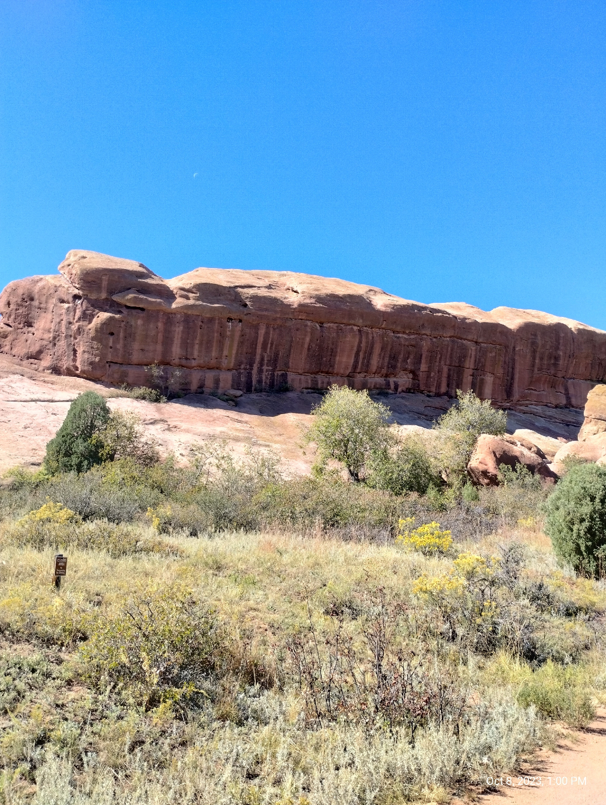
To the right is the valley cut out by Bear and Mount Vernon Creeks. They flood occasionally so it's a fairly broad area. To the left is the rise to the Rocky Mountains. Here, that would be Mount Morrison and Mount Falcon.
These huge chunks of Fountain formation rock are arkose sandstone. What makes them "arkose" is the large amount of feldspar still in them. What gets eroded out of mountains is usually the constituents of granite - quartz, feldspar, mica, amphiboles, pyroxenes. And small amounts of other stuff. The stuff washed out of the Ancestral Rockies obviously had a lot of dark, iron-bearing minerals such as biotite mica and amphiboles. That's where the red rust comes from when they fall apart chemically. But the feldspar usually goes to clay and quickly gets washed downstream. For there to be feldspar left, the sediments must have been washed out very quickly, deposited close to their source, and buried so that the process of consolidation can begin sooner than later.

There's something else you can see here. Those pockmarks in the rock are called "tafoni" or "honey comb weathering". They're fairly common in desert environments. In really wet places, water just grinds away at rock faces willy-nilly and wears them down large scale. Here, water seeps into the permeable rock and finds weak spots. That's where it starts chemically weathering the stone...in spots.

The sandstone particles are tough because they're cemented together with calcite, but calcite is soluble in acids, and dew and occasional rain is weakly acid from the carbon dioxide it has dissolved. That's how caves form in limestone, which is primarily calcite. In sandstone, the quartz particles (sand) just fall out to form these little holes and horizontal and vertical joints.

The wind and moisture isn't in any hurry to do widespread damage so they can be artistic, carving out these spectacular rock sculptures.
There are a couple of streams in the neighborhood. Bear Creek is a picturesque mountain stream draining the area around Mount Blue Sky. It comes in crashing in from the west having cut out it's canyon. Mount Vernon Creek is a smaller, lazier stream that pours in from the north skirting the edge of the hogback. Most of the streams in Red Rocks Park are like the one shown above...dry until it rains. They're called "draws". This landscape would fit right in with any John Ford western.

Typically, the Fountain formation show up as "standing stones". They look like they were arranged by some giant child marching off into the horizon. Now you know why. They're the shell of the Rocky Mountains, cracked open as the present Rockies were born. Most of the red sandstone on top have long ago been weathered to nothing but there are still some places in the mountains where there are remnants such as Red Rocks Campground, near Woodland Park, west of Pike's Peak.

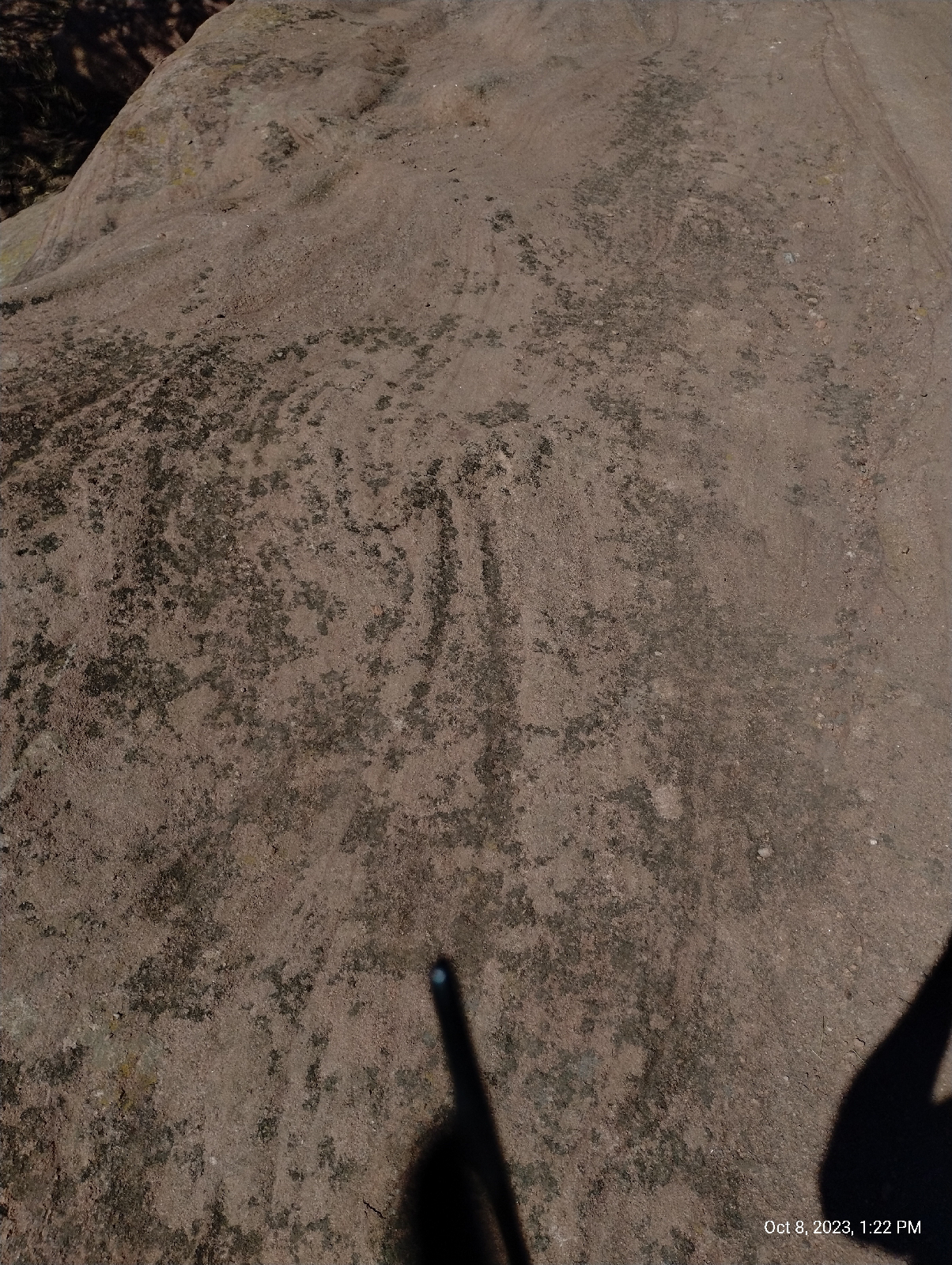
This is a view south on the Trading Post Trail that runs from a parking lot near the South Entrance to the park to the Trading Post/Rock and Roll Hall of Fame Museum at the base of the amphitheatre.

The lower part of the trail is loose rock and sand deposited by present streams, mostly flooding by Bear Creek, but near the amphitheatre, the flat rock is Fountain formation, giving the hiker an opportunity to see Red Rocks closeup. These ripples are cause by the same weathering that creaked the tefoni in the standing stones.

That's part of the amphitheatre peeking out from behind the little tree. I followed the Trading Post Trail up and around to the grueling stairs up the side of Red Rocks Amphitheatre called the Funicular Trail, which leads to the upper parking lot.

When Red Rocks Park was first built, there was a funicular railroad that carried visitors to the summit of Mount Morrison for a grand view of ...well, everything....mountains, canyon, plains, Red Rocks. To get up there now, you have to hike, but the stairs will get you part way if your knees and lungs hold out.

At the upper parking lot is this...
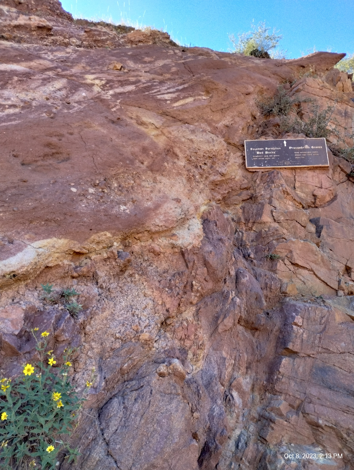
This is the mystery I promised you at the end of the last blog. At the breadth of a finger is a gap of over a billion years!

It's called the Great Unconformity. The red Rocks on top are the 300 million year old Fountain formation. They sit directly on top of 1.7 billion years old rock of the Idaho Springs formation. What happened in between?

The grayish rock at the bottom is metamorphic gneiss and it's older than the land that would become Colorado. Over a billion years ago a chain of volcanic island crashed into the North American plate and stuck. Rocks like this were lifted with the rest of the Rockies during the Laramie orogeny to become the core of the mountains. 

But what happened to the geologic history of over a billion years? Nobody knows for sure but the most popular answer I find reading about the Great Unconformity is erosion. Something scraped all that accumulated debris off the core rock 400 million years ago. 

Of course, the erosion that formed the Fountain formation razed the Ancestral Rockies to level plains. The sediments above the metamorphic and igneous core of those ancient hills simply washed to the sea. As the hills came down and their slopes leveled out, the sediments were deposited closer and closer (gentler slopes meant slower water currents) until the erosion met granite and gneiss and the sand was laid down right there in what would become Red Rocks Park.

But some geologists find even that to be a weak explanation for the elimination of a billion years of strata.

A tantalizing theory is that the great eraser, glaciers, did it. About that time is when some geologists speculate that Ice covered the Earth, a time they call "the snowball Earth."
West Alameda Parkway begins in Aurora (East Denver Metro) at the Buckley Space Force Base, runs through Denver (one of my favorite shopping areas is around Alameda and Broadway) and ends at the top parking lot of Red Rocks Amphitheatre. In fact, Dinosaur Ridge is a closed off section of Alameda. It passes through a tunnel in a big chunk of the Fountain formation and, not long after, the Plains View Road splits off to the left and leads to the Geological Overlook Trailhead. That looked inviting so I took the bait. It wasn't long before I realized that, if I wanted to make it to Golden before night, I needed to turn back, but before I did, I took a few shorts from a high point (the trail climbs up about a third the distance to the summit of Mount Morrison.) The photo above is one of them.

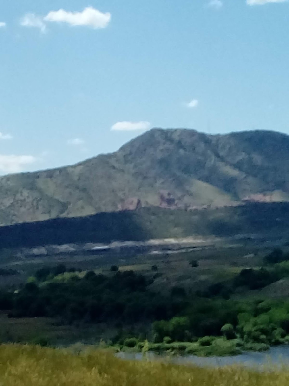
The two hills in the distance is the mouth of Bear Creek Canyon and just beyond is Bear Creek Lake and Mount Carbon.
This is a view back down to the amphitheatre and Mount Falcon beyond.
Here's some more of that chemical weathering. It gets pretty extensive in some of the areas in Red Rock Park.


A little further north on Alameda Parkway I find the other end of the Geological Overlook Trail and realize that the overlook itself is just off the road, so I take another picture. There's a big sign there that tells you what you're looking at but it was crowded and I try not to get recognizable pictures of people without their permission, so I just got a panorama from the side.

A little more roadwork brought me to Dinosaur Ridge, and that will be the main subject of the next section of Anatomy of a Mountain Range.

Sunday, August 6, 2023

And, finally, Colorado

The series of paintings at the Denver Convention Center by Kirk Johnson and Jan Vriesen entitled Ancient Colorado shows artist renderings of Colorado over the last 500 million years. Why just 500 million years? Why not beginning at the formation of the Earth? Well, you probably know the answer by now.

The land that eventually became Colorado didn't exist before 500 million years ago. We'll start here at 395 million years ago, but first, let's talk about geological time. Geologist work with time scales in which human history is the blink of an eye, so they have to have a completely different framework.

We've looked at the four broadest divisions of geologic time: Hadean, Archean, Proterozoic, and Phanerozoic. These are called "eons".

Eons are divided into eras. These geological units aren't directly related to time but are associated with particular identifiable strata of rock, but those strata have been dated by many means, including radiometric dating (using known decay rates of radioactive elements.) and so the system of geologic time is known as chronostratigraphy. Dates are implied by rock strata. There are ten defined eras.

Eras are further divided into periods. There are 22 accepted periods of geologic time.

The next division is into epochs. There are 37 defined epochs and one informal one. Then there are 11 subepochs in the most recent two epochs.

Finally, epochs are divided into ages.

The Emsian age is dated from 407.6 Ma (million years ago) to 393.3 Ma. Like many of the age units, this one is named after a place, the Ems River in Germany, where the typical rock strata was discovered. It is in the early part of the Phanerozoic eon, the Paleozoic era. This was the most recent part of the Devonian period. It's start is defined as the first appearance of the conodont Polygnathus kitabicus and it's end is defined by the first appearance of the conodont Polygnathus costatus partitus. A conodont is an extinct jawless fish resembling an eel.

Okay, you won't be tested on all that. I just wanted to give you a little flavor of how geologists approach geologic time. What is important to our discussion is where Walnut Hills was during the Emsian age. It, in fact, barely was at all. The land which is today at coordinates -104.8949, 39.5876 (Denver) was then at -48.7203, -32.7033. Today that's way out in the South Atlantic Ocean a good distance north of the South Georgia and South Sandwich Islands. AKA....there's nothing but a lot of water there.  If you want to see it on a map, type the coordinates into the Google Search bar. The plot of land we're interested in was on the beach of an island north of Gondwana, which was breaking apart (the last supercontinent, Pangaea would be formed from the fragments.) If you have the Rocks app, you can use the Paleo feature to look at maps of the world at that time.

The North American craton was north of the larger body of Gondwana. That land, then a large island, is called the "Wyoming Provence" by geologists. Colorado was way offshore. Note: we were very far south of the equator at that time and north of the largest landmass. A lot has happened between then and now.

Eh, let's go back further for a minute. In Boulder Canyon, (http://adventuringbcc.blogspot.com/2023/04/boulder-canyon.html) I saw rock much older than Emsian. The North American continent grew by accretion. Between 1.8 and 1.4 billion years ago, at least three arcs of volcanic islands collided with the Wyoming Province and stuck. Much of that material forms core rocks of the Rocky Mountains. During the Emsian age, most of that had been submerged for a long time (about 400 million years). The North American craton was a large island north of Gondwana and what would become Colorado was offshore from a peninsula extending to the west.

How do we know the shapes and orientation of landmasses in these distant times. One way is to measure the arrangements of atoms in the rocks. Many rocks are magnetic and when they solidified from their molten state, the arrangements of their atoms were frozen. Today, their magnetic fields are not aligned to the present orientation of Earth's magnetic field. Working backwards through layers that can be dated more confidently, for instance, by the fossils of life that we know existed at certain times, geologist can painstakingly work out what things were like.

North America drifted to the west and rotated counterclockwise. About where the Front Range is today, Colorado was a long island and sediments were building up offshore that would become limestones of the Chaffee and Ouray formations in the central parts of the state.

A major event leading up to Walnut Hills geology occured during the late Pennsylvanian age about 323 to 299 million years ago. Geologists aren't sure of what caused it. Perhaps North America crashing into Africa during the creation of Pangaea, caused the North American continent to buckle, creating the Appalachian Mountains. But many geologists believe that Colorado was too far away to uplift the Ancestral Rocky Mountains. They were composed of two ranges called "Frontrangea" and "Uncompahgria" about where the current Rockies are. Colorado was finally and uncompromisingly (see what I did there?) on the scene.

The Pennsylvanian age was also the end of the Carboniferous period which produced many of the widespread coal bearing deposits around the world. It hosted a major extinction event called the Carboniferous Rainforest Collapse.

Why are the Ancestral Rocky Mountains important to Walnut Hills? Well, they eroded down to nothing and all that stuff had to go somewhere. When you visit Red Rocks, you're looking at it. The Fountain formation is part of the residue left by the Ancestral Rockies.


The end of Permian times, and the Paleozoic era, was punctuated by...something...that almost wiped out life on Earth. It might have been meteor bombardment or a catastrophic volcanic eruption that threw the world into a prolonged period of winter, but enough life survived to inaugurate the Mesozoic era and from that came dinosaurs.


Monday, February 3, 2020

Terminus: Boulder

It was a nice day to take a walk.

This terminus hike was different in that it wasn't a train terminal. There is a fleet of buses that run regularly from Union Station in Denver to Downtown Boulder Station in Boulder. Designated FF1 through FF7, they make different stops on the way. FF2 is the express, so I took it out. "FF" stands for "Flatirons Flier" named after the huge outcrop of iron laden sandstone that looms over Boulder.
[Flatirons from downtown Boulder]

Unlike the commuter buses that run in Denver, the Flatiron Fliers are comfy cross country buses. I almost expect a steward to come out on the way and offer little cups of soda and peanuts. It's a long ride, but a nice one through the mesa country north of Denver.

The Fliers run through the first area I lived in when I moved to Colorado, Broomfield. Looking back through the blogs, you can find past hikes I took near Superior, Colorado and Flatiron Junction.
Downtown Boulder looks a little "small town" but the city is home to a very big school, the University of Colorado, and it's a major Colorado tourist destination. Situated at the mouth of Boulder Canyon, it's a gateway to the Rockies known for its shopping and nightlife.

Watch the traffic - it's also known for reckless drivers.

From the bus station, I walked down to the little bandshell amphitheater located on Boulder Creek. Boulder Creek Trail parallels the creek through town and into the canyon. It's well traveled by students, tourists, and resident joggers, but not such that it's not a corridor for wildlife. The town loves its animals. It's the first place in the US to give pets the status of personhood.
Boulder Creek Trail is a nice walk, ending at the west end in Eben G. Fine Park. Eben Givens Fine was a community builder who moved to Boulder from Missouri in 1886 and took a job as a pharmacist in a local drug store.

[Boulder Public Library from Boulder Creek]

[Boulder Creek]

[Boulder Creek at Eben Fine Park]

A tunnel under Canyon Road connects Eben Fine Park with Settlers and Red Rocks Park. "Red Rocks" may sound like plagiarism. After all, Red Rocks Park is near Morrison, but, in fact, it's the same Red Rocks, known also as the Fountain Formation, that pops up in places along the Front Range from Wyoming to New Mexico. The red rock is arkose conglomerate and the "red" is mostly iron rich feldspar that was recrystallized under pressure from stuff washed out of the mountains after the uplift that formed the Rockies. [Correction. It was debris from the Ancestral Rockies. ]

(By the way, if you're curious, the word "plagiarism" is from the Latin word "plagiarius" which means "kidnapping".)


[Red Rocks at Red Rocks Park in Boulder]

I returned to the bus station along Pearl Street, especially known for its shops, restaurants and nightlife.

[Pearl Street]

Since I was in no hurry to get back home (I needed a rest and the hike was short - it was just a little after noon when I left Boulder.) I took the first Flatirons Flier to leave, the FF1, which stops at pretty much every stop along the route. 

Wednesday, July 17, 2019


--- How big is Creation Rock 2 ---

Frankly, I have no idea.

I've seen two websites that have the same statement, that both Shiprock and Creation Rock are 300 feet tall...but they're different heights. I've also seen that they're both taller than Niagara Falls.

Actually, it's hard to figure out which rock is Shiprock and which is Creation Rock, as this article at the Red Rocks Park website explains.

http://www.redrockspark.com/history/history-of-red-rocks-park

And obviously my survey wasn't correct, though I'm not as bothered about that as some might expect.

Success is an American ideal. Researchers rarely publish reports on failed experiments despite most books on research design encourages researchers to do so.

You often learn more from a well designed failure than you do from a success. A success gives you an answer. A failure gives you a bunch of interesting questions, such as, "What went wrong? Was my study design flawed?" "I was expecting this to work, it should have worked, why didn't it?"

In 1887, Albert Michelson and Edward Morley wanted to study the "stuff" that light waves flowed through. They set up and experiment that shot a stream of light in two different directions, one at a right angle to the other. They wanted to measure the difference in the speed of light through the paths. They were sorely disappointed when there was no difference.

The problem was that light doesn't propagate through "stuff" like sound or water waves, and this failure started a line of study that lead quickly to Einstein and special relativity.

So, I learned some things from my "failure" and I'll let you in on those things. And, one of the great things about adventures vs. studies is that adventures have a focus surrounded by lots of other "stuff".

I knew that Red Rocks had a concert planned that night (summer's like that at Red Rocks) and that I needed to do what I was going to do before 2:00 afternoon, so I hired a Lyft and headed straight there. The driver let me out at the Trading Post Trail trailhead.

I was delighted by the diversity of plant life on the trail.


                                                   [White Anemones and Golden Asters]

I was rather concerned by the many signs that urged visitors to stay on the trail. I certainly understood the reason - there are delicate plants and animals that live at Red Rocks Park and they don't respond well to crowds tromping all over them, but that was going to interfere with me finding a site for my survey.

As for the plants in the above photo, the anemones are easy to identify by their simple (but often brightly colored), five petaled flowers and deeply lobed leaves. The asters are a little more difficult but many similar flowers have more irregular petals and/or broader central disks.

In contrasts to the tiny flowers are the gargantuan rocks in the park. Red Rocks is justifiably famous for the huge natural amphitheater, home to internationally attended and broadcast performances, but the park itself is a geological wonder.

                                                                        [Big rock]

As the Pacific Plate crashed up against the North American continent, pushing the Colorado Plateau up to form what would become the Rocky Mountains, land around the edges were severely twisted and buckled. These layers of sediments are often tilted to right angles to the rock to the east and are sometimes turned over completely. There's evidently some debate as to whether the rock is sedimentary sandstone or gneiss. In support of the frustrated geologist that snorted and corrected me when I called the Red Rocks "sandstone", rocks this twisted are usually considered metamorphic and, therefore, gneiss. Regardless, the red is prominent and is caused by the same thing that makes old iron red.....rust.


                                                                 [Slanted rocks]

In the photos above, the big rock center stage is my target, Creation Rock. It's the largest of the three massive rocks that make up the amphitheater.

Although Red Rocks Park is the most famous display of these tilted Goliaths (and, in my estimation, the best), there are certainly others. Technically, they are called the Fountain Formation. They stretch through Wyoming and Colorado. These photos bear a strong resemblance to the Flatirons just outside Boulder, and for good reason since the Flatirons are another example of the Fountain formation. Other famous outcroppings are the Garden of the Gods in Colorado Springs. Other instances are the Red Rocks of  Eben G. Fine Park in Boulder, Roxborough State Park, and Red Rocks Canyon in Colorado Springs.

Here are some tiny blue larkspurs.

                                                                 [Blue Larkspurs]

Just behind Red Rocks is Mount Morrison and to the south is Mount Falcon.

                                                      [Mount Falcon from Red Rocks]

I was considering hiking up Falcon when I finished at Red Rocks but the brutal heat of the Colorado summer convinced me that I would be miserable and decided to hold off until cooler weather.

The Fountain Formation marches off to the south between the Front Range and the Hogback ridge to the east, From there to the Mississippi River is grassland plains.

                                                  [Slanted rocks to the south of Red Rocks]

                                               [Wavy rocks on the Trading Post Trail]

I overheard a lady telling a group of children that these waves frozen in stone were the result of erosion from the action of water. My understanding is that the rock carvings of Red Rocks Park and other parts of the Fountain Formation are mostly due to wind erosion. A little further to the north, on Dinosaur Ridge, I over heard a tour guide tell a completely different story.

As incredible as it may be, Colorado was, at one time, covered by a shallow sea. All the dinosaur activity in the area were huge beasts sunbathing at the beach (or maybe a marsh). This was before the Colorado Plateau was uplifted. So, these waves, frozen in rock were not due to erosion, but deposition - sand deposited by the gentle wave action of the inland sea, then covered by more sediment, packed down, and turned into stone under great pressure until they were uncovered millions of years later by the wind. And if you've been in any of the downslope winds in this area, that won't be a great stretch of your credibility.


                                                                 [Jumping cholla]

This is another good reason to stay on the paths at Red Rocks. The Jumping Cholla is notorious for reaching out and touching people. Still, these (cactuses) are still my favorite wildflowers and Denver area, being desert, is a natural habitat for them.

At the end of the Trading Post Trail is, of course, the Trading Post, which is also a museum of pop music. It is located to showcase some of the big rock formations, such as this huge column.

                                                                 [Big rock column]

Many of the formations are named, but there are so many....I can't find a name for this one.

I looked around the Trading Post and asked a couple of staff some questions verifying that I was going to have problems finding a place to stretch my 100 foot cord. I finally settled on a line of sight near the Trading Post for my two locations. The first is at a fire plug across from the building. Here is Creation Rock from that site. The road branching off to the left is Shiprock Road.

                                                       [Creation Rock from Site H]

The other site was a little ways up Shiprock Road to the south. I could just sight the summit of Creation Rock above the boulders to the west of the road.

                                                          [Creation Rock from Site G]

Since I knew that I would have problems with this data, I started looking for ways to double check my work, multiple ways of estimating bearings and distances. I measured the distance between my two sites using an app on my phone called Altitude (created by PyGDroid and available on the Google Play Store). The app calculates distance traveled using GPS. I found the distance between the two sites to be 0.05 miles. That converted to 264 feet and, later checking Google maps for a distance, I found it to be about 257 feet, which is the distance I ended up using.

Here is a shot from the Trading Post back down through Bear Creek Canyon where Morrison is situated. The lakes in the distance  are the Soda Lakes at Bear Creek Lakes State Park. I'll get to that later.

                                                    [Bear Creek Canyon from Red Rocks]

My altimeter reading told me that Site G was about 40 feet above Site H and I could look down on top of the tall Trading Post building from Site G, so I felt pretty confident with the phone app.

I went to work getting bearing readings from my surveyor's compass and I checked them to the nice north to south bearing of the Front Range. My bearing from Site G to Creation Rock was 313 degrees and, since I was east of the summit, that made sense. The north to south line is 360 degrees and everything to the west would be less than that. Sighting back to Site H, I found a bearing of 72 degrees. Since it was east of the north - south line, it should have been between 0 degrees and 90 degrees, and it was. I could add the difference between the bearing to Creation Rock and the north - south line (47 degrees) to the 72 degrees west to find the angle G, which was 119 degrees.

The bearing from the fire plug to Creation Rock was 257 degrees and the bearing back to Site G was 290 degrees - both were west of the north - south line, so those made sense and I could subtract them to find angle H, which was 33 degrees. That felt right. The angle of inclination from G to the summit of Creation Rock is 16 degrees and that from H to the top is 15 degrees, so I had the distance of the base of my triangle (side e) and the angles G and H, and the angles of inclination. That was what I needed. Here's my trigonometric plan diagram again.


The problem was that I had no idea what the elevation difference was between me and the base of Creation Rock. I was going to calculate the height of Creation Rock above me, not above its base. I didn't expect to be close. Well, I went with it and started back down Trading Post Trail to Morrison.

                                                     (From Red Rocks to the south]

On the way, I saw this patch of prickly poppies. That was the first western wildflower to confuse me after moving from Alabama. It looks like a thistle until it blooms and, then, that's certainly not a thistle bloom.


                                                                 [Prickly poppies]

And there was this paintbrush flower.

                                                                [Paintbrush plant]

And this rose.

                                                                             [Rose]

I didn't know that roses grew wild in Colorado.

Back on the road, I saw these huge sweet pea plants and milkweeds


                                                                    [Sweet peas]

                                                                    [Milkweeds]

I've mentioned that milkweed is one of my favorite wildflowers. I think that it grows over most of North America. I would occasionally see it in the South but it seems to like cooler climates. The further north I would travel, the more milkweed I would see.

We had a few stalks trying to grow in our back yard but one of the recent storms took them out. I was a little disappointed, there was a big flower head developing on one of them, and they are the only plant that Monarch butterflies will lay their eggs on, but then I saw all these plants in Morrison and felt better about it. I can enjoy other people's milkweed.

After a milkshake at the Mill Street Eats, I headed down Bear Creek Trail. It's been awhile and, after all, this is the Bear Creek Commentaries. I felt the need to reconnect. I also wanted to get a shot of Red Rocks Amphitheater from Mount Carbon to put it in perspective.

                                                                [Mount Carbon]

I found Bear Creek Lakes Park just as I left it, a blazing expanse of open space. By the time I reached the top, I was ready for a snack, water, and a long rest.

                                                       [Denver from Mount Carbon]

Here's Red Rocks with a magnification of X2. It may not seem so big but compare it with the prominence of Mount Morrison behind it (741 feet) and consider that this photo was taken from 3.9 miles away.

                                                       [Red Rocks from Mount Carbon]

My preferred route up or down the eastern flank of Mount Carbon is the Mount Carbon Loop Trail, which has great views of Denver and Bear Creek Valley. It also has a diversity of wildflowers such as this prickly pear cactus, certainly not a rare plant, but, like all cactuses, has an intricate, silky, showy blossom.


                                                               [Prickly Pear Cactus]
By the time I walked around the Fox Hollow Golf Course and reconnected with Bear Creek, I was whipped and spent some time on the shoulder of the trail. I would have used the bench across from me but Colorado, evidently, does not believe in shade and most park benches are situated to catch full sun. (what is that?)

Still, it allowed me to catch this bug's eye view of the grasses that line the trail.

                                                                       [Grasses]

I made it to Wadsworth Boulevard and chugged down two cans of Arizona Green Tea before calling a Lyft taxi to return home.

Now....the calculations.

Here's the geometry again.

 I know that angle G is 119 degrees, angle H is 33 degrees, and the length of side e is 257 feet. Angle E is easy because the sum of the angles in any triangle add to 180 degrees, so 180-(119+33)=28 degrees. That makes sense. Angle E is the angle between the two sites as seen from the top of Creation Rock. They are only separated by 257 feet so the angle of separation should be sorta small.

Since I have all three angles in the triangle EGH and the length of the base side, I can now use the law of sines to figure out the other two sides.

                                                                      [Law of Sines]

The length of side g, the distance from site H up to the top of Creation Rock, works out to be about 479 feet. The length of side h is about 298 feet.

Now, the diagram is a little misleading here. The point F looks like it's on the line GH, but it's not - it's way back behind the line. It is the point directly beneath the summit of Creation Rock. I calculate the length of line EF by either looking at the right triangle EGF or the right triangle EHF, and I will do both because the difference I come up with is important.

Right triangles are easy. In this case, I have the long side, the hypotenuse of the triangles (sides g and h) and the angles of inclination at G and H, and I want the length of the opposite sides. That's actually the measures that I want because it's the height of Creation Rock from the summit down to the level of my surveying sites. In other words, if I find the sine of one of the angles of inclination from the site up to the top of Creation Rock and multiply that by the distance from the site to the top, I'll have the height. I use my spreadsheet to calculate the sines and I come up with 82 feet (from site G) and 124 feet (from site H).

These results are certainly far short of the actual height of Creation Rock, but do they make sense?

Well, the difference between the two calculated heights is 42 feet. That's the difference in altitude between Site G and Site H. To walk from the Trading Post to the fire plug at site H, I had to walk slightly down the hill, then to walk to site G I had to walk around and above the tall Trading Post building. I could look down onto the roof. 42 feet works.

Also, I pulled a topographical map from the Internet site:

https://www.topozone.com/colorado/jefferson-co/locale/red-rocks-amphitheater

The contours are 40 feet elevation apart.The contour on level with the Trading Post seems to be about 3 contours above the base of Creation Rock, so that would explain the discrepancy between my measurements and the reported 300 foot height of Creation Rock. It looks like site G was about 3 contours, or 120 feet above the base. Even with that, I was off, so, no cigar.

Most likely, distance e was my most inaccurate measurement. The compass bearings seemed to agree well with the line described by the mountains.

But it was a fun and scenic adventure, so I'm happy.

The methods I used have served me well in the past. This trip was plagued by several unexpected problems - difficulty in finding two good sites being a major one. You may be able to use trigonometry in your own projects. One suggestion is to avoid angles that are too steep (within between 70 and 110 degrees) or too flat (between 340 and 20 degrees.) At these angles, a tiny difference in slant can make a huge difference in the value of a trigonometric function, or vice versa, so that can throw your precision off considerably.

There are a lot (!) of resources on the Internet about trigonometric functions and surveying methods. I can recommend CK12's Trigonometry textbook, 2nd edition by Lori Jordan, Larry Ottman, Brenda Meery, Art Fortgang, Andrea Hayes, and Mara Landers  and you may want to look at their other offerings at:

https://www.ck12.org/student

By the way, according to the topographic map, Creation Rock is either 280 feet or 400 feet tall according to where you consider the base to be.