Wednesday, August 30, 2023

Where did all these people come from? Walnut Hills in the Anthropocene

Hominids, human-like apes, appeared on the Earth about 15 to 20 million years ago in what was, by this time, Africa pretty much as the continent appears today. This model has them evolving, along with other great apes, from gibbons. By 300,000 years ago, they had formed into anatomically modern humans, relatively hairless, typically upright walking bipeds. The switch from hunter-gatherer societies to sedentary lifestyles, what we call "civilization", happened around 30,000 years ago in southwest Asia. About 6000 years ago, city-states developed, primarily in the river valleys of Asia and Africa, and with cities came writing, recorded history, and various technical disciplines like mathematics.

Did homo sapiens (scientific name for humans) appear in different places on Earth. Hints reappear from time to time that they might have but, fossils being what they are-rare and elusive- evidence is not conclusive.

From all that we know, humans are a very new addition to the Americas. Humans were established in North and South America by 12,000 to 14,000 years ago and may have crossed the Bering land bridge from Asia to the area now occupied by Alaska as early as 26,000 to 19,000 years ago during the last glacial maximum. Again, fossils are rare and hard to interpret because they have to be preserved by very special processes. Hunter gatherer societies did not leave abundant traces like later, more sedentary colonies. When humanity began constructing permanent dwellings and tools, human history shifted from paleontology to archaeology. Instead of looking for bones, we began reading the artifacts left behind.

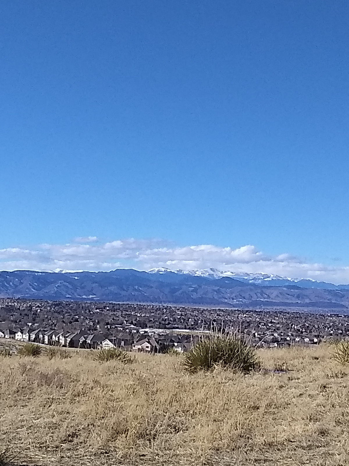
Lamb Springs, south of Lake Chatfield, has produced the remains of mammoths killed by humans dated at 14,140 to 12,140 years ago, so they were in the area before that time. The earliest natives seemed to stick to the plains but later humans were established in both the plains and the mountains. 

By 1700 AD, both the Ute and Apache tribes were settled in this area. The Ute were primarily in the mountains while the Apache were mainly a plains tribe. The. Comanche entered the area in the early 1700s and banded with the Ute to drive the Apache south of the Arkansas River, then, in the 1820s, the Arapahoe and Cheyenne moved in and pushed the Comanche south.

The first settlers of European ancestry in the area were gold prospectors from Georgia. In fact, the early settlement that became Denver was named Auraria after the Georgia town of the same name. Gold prospectors entered the area on the way to California after the Sutter's Mill strike and found some gold in the South Platte River and it's tributaries. Towns like Montana City and Petersburg sprang up but the gold wasn't as forthcoming as the prospectors expected. Still, people settled in to farm the land in places like Arvada and what is now West Denver.

If you spend much time in Denver, you'll eventually encounter the name "Little Raven". That was the name of a Southern Arapahoe chief who established peaceful relations with the first European settlers to enter the area.

The Pike's Peak gold rush commenced in 1859 bringing thousands of settlers into the Colorado territory. In 1862, engineer Richard Sullivan Little brought his wife Angeline and built the Rough and Ready flour mill, establishing the town of Littleton in 1867, which was incorporated in 1890. Both Littleton and Little Dry Creek are named after the Little family.

Centennial is a recent addition of Arapahoe County. It was established February 7, 2001.  Walnut Hills was incorporated much earlier in 1965.

Big history is the history of everything. We are the outcome of everything that has gone before us. Carl Sagan said that, "we're made of star stuff," and he meant that literally. Everything is.

Everything has a big history... your town, yourself. I had a genetic trace done several years ago. My ancestors originated in Africa (like every other hominids on Earth) and left with a handful of others, probably during a time of drought). It's rather miraculous that they survived to exit the continent. Their descendants traversed the passes of the Caucasian mountains and entered Europe about 45,000 years ago, likely following migrations of large game animals like bison. My ancestors obviously included Neanderthal...most hominids today are sapiens hybrids. 


During the last of the last ice age, about 20,000 years ago, my people were in the Balkans, as soon as they could, migrating north. We were in southern France about 15,000 years ago, following the retreat of glaciers, finally settling in the region around the Rhine River.

We were dispersed when the Burgundians took over the region during the One Hundred Year war(s) and returned to our homeland after Germanic regions were returned to earlier inhabitants. We were originally Sahns, but took the name VanZandt from the Burgundians who left the Xanten area.

We were present in upstate New York during the Revolutionary War and later migrated to the Midwest, Oklahoma and Texas, and from there to North Carolina and Georgia, where my mother and father was born.

I came (briefly) from southern Florida before my family returned to our homeland in south Georgia, but my father followed jobs to central Georgia and Alabama. Leaving our home in the mill village of Valley, Alabama, I entered the university at Auburn, Alabama and, after twenty years of college and working through college, I began my career in Selma, Alabama as a vocational rehabilitation specialist. Now I have retired to the Denver, Colorado area, and that is my big history.

What's yours?

Friday, August 25, 2023

Walnut Hills in the Cenozoic

If you visit the Denver area, almost everything you see is a product of the Cenozoic era, the most recent of geologic times. Older sediments from the Ancestral Rockies were packed down into hard stone. Many were buried so deeply that they were changed into completely different rocks - metamorphic rocks.

It also becomes harder to get all this stuff down. It's not like more things are happening. Things have been going on since the beginning. Until geologically recently, there wasn't macroscopic living things to watch but, then, we don't have the bombardment from outer space that the early Earth had.

Primarily, the more recently we look, the more detail we can see.

The Eocene world looked much as it does today. At the beginning, the Indian subcontinent had not joined Asia but, by the end of the Eocene period, it had. The Arabian peninsula had not separated from Africa.

The Rocky Mountains were completing their first phase of uplift. They were not huge mountains...since erosion kept pace with the uplift, they were more like hills. The debris was washing into the Denver Basin forming the Denver and Dawson formations. Walnut Hills topology was gentle slopes. The sea was far away and would not return.

Mountain building forces were pushing from the west, so the older Front Range hills were (and are) oriented north to south. The forces will rotate southward so that younger mountains to the south will be more northwest to southeast. Volcanic islands will be adding on to the coast around what is now Texas.

Then there was peace for about 20 million years.

The Oligocene was...dramatic. I've talked about the Ignimbrite Flare-up...here it is. Some of the most explosive volcanic eruptions that have ever occurred on Earth took place in Colorado. For instance, Mt. St. Helens blew out about a cubic kilometer of volcanic ash. The eruption that ejected the Fish Canyon tuff in southern Colorado was the largest known and blew out 5,000 cubic kilometers of pyroclastic materials. Eventually, as much as a third of Colorado was covered with ash flows.

Mountain building events ramped up again during Miocene times lifting the Rockies to 5,000 feet. A couple of Flare-up eruption were important to Walnut Hills. 

The Golden volcano that created the Table Mountain lava flows was an early volcano, perhaps even late Mesozoic. Radioactive dating places it at 64 to 62 million years ago.

Mount Guffey, west of Colorado Springs today blew it's top around 34 million years ago and belched a pyroclastic flow that extended almost to where Interstate 25 is today. The debris piled up around it by wind and flood formed the core of Palmer's Divide, which separates the watersheds of the South Platte and Arkansas Rivers. It can be seen to the south of Walnut Hills as The Bluffs. Cherry Creek, the second most important tributary in the Denver area, originates there.

The bentonite clays in the unconsolidated materials that cover the bedrocks of the Denver Basin are also of volcanic origin but were brought in by the wind from much further west, volcanoes in the areas that would become Utah and Nevada.

The last phase of uplift raised the Rockies to their present height. It also increased the gradient of the streams draining the mountains. More slope meant greater flow rate and faster erosion. Add in runoff from the Pleistocene glaciers 1.2 million years ago and there was plenty of energy for sculpting the ragged portrait of today's Rockies.
The material on the surface of Walnut Hills is Holocene, the most recent period of geologic time. It has been laid down over the last ten thousand years by runoff and Little Dry and Willow Creeks. 

The aquifers that feed the creeks are only fifty to one hundred million years old, so the creeks are, at least, younger than that. As weathering has broken down older rocks, gravity and the creeks moved the powdered material (dirt, really) downstream, water was wearing down a path through the unconsolidated materials.  

Little Dry Creek has all the characteristics of a young stream. Its course is relatively straight and the banks are deep. As a valley ages, the walls start to slump with the pull of gravity. The material that falls into the stream is washed down, ultimately, to the ocean. This stuff will end up in the Gulf of Mexico. As the valley widens, the stream will have more room to move from side to side and meanders will form. More middle aged streams like the South Platte River show these meanders. Old rivers, for example, the Mississippi, twists all over a wide, flat topography that it's cleared out and often branch into networks of streamlets that recombine with the main flow.

As the South Platte River and Cherry Creek wallowed out wide valleys bringing the ridge between into sharp relief, the slopes steepened for their tributaries near their headwaters on the ridge. They had more energy to cut deeper valleys of their own. Little Dry Creek and Willow Creek, of course, are two of those tributaries. They helped to widen the river valley.

Rapids, and maybe even waterfalls, pouring down the steep sides of the canyon cut into the soft material of the valley wall, cutting back to form that big hill that Arapahoe Road climbs today. The rapids have receded to the stream beds a little west of Holly Reservoir and up to the Valley Highway (I-25) and The Bluffs. They're still moving eastwards but have been slowed considerably by the weir dams and other fixtures placed by stream authorities in the Arapahoe and Douglas Counties.

There is some heated debate about what to call the last ten thousand or so years of geologic time. It has be proposed that it should be called the Anthropocene since the primary force shaping the surface of the Earth seems to be humanity. We have terra-formed our own planet.

Wednesday, August 23, 2023

Arapahoe at Village Center Station to Orchard Station


Okay, this one will be a big blog. There's a lot to see in the Greenwood Village area. I walked up the hill to the station three times to get these photos. 
The requisite Rockies from Arapahoe Plaza

The first trip was a supply run. Arapahoe Station is my point of departure to just about everywhere...at least everywhere I have to take a train to.  Then I walked up to photograph some of the art on Fiddler's Green Circle. Finally, for the actual station-to-station hike, I walked from Arapahoe Station to Orchard Station. That was the end of a supply run, so I also looped through Englewood and Littleton. It was a long day.
Village Center Tower One, with 22 floors, is the tallest building around making it a good landmark for home. It stands directly over Arapahoe Station and I've been able to see it in the distance on all of the E/F line hikes and will be able to see it for many more.
There's the typical Denver Tech Center traffic light. This train station and the next two serve the DTC area on both sides of Interstate 25.

The Denver Tech Center was designed in the early 1970s by architect Carl Worthington and was the place of origin of several major cable companies, including United Artists Cable and AT&T Broadband. The new skyline was developed along a new optical fiber line 12 miles south of Denver. The E and F Lines were primarily built in response to the DTC.
I still have absolutely no idea why there's a fake burial mound beside Arapahoe Station, but it's attractive so there it is again.
The train station is nestled between several tall buildings. The main parking area and bus gates are across Interstate 25 from the light rail. The station is accompanied by a plaza with a fountain and stairs leading up to Village Center.

Not all of these southeastern light rail stations have art work right in the stations except maybe windscreens but there is usually some significant piece of art commissioned by RTD close by. At Arapahoe Station, that would be Nucleus, by Michael Clapper.
It's on the second level of the stairs leading up from the station to Village Center. Constructed of sandstone and marble, the three interlocking forms symbolize interdependence and connectivity in the relatively new town of Greenwood Village.

The bottom tier of the plaza includes this fountain
and benches, and the top level is street level with bus gates, Village Center, the Denver Open Air Art Museum, and Fiddler's Green.
This is the site of the Denver Museum of Outdoor Arts headquarters and Greenwood Village Collection. This museum is free and if you visit, here's the website. You can take your own guided tour!


There is just way too much for me to do justice in a blog.
This fellow is in the Englewood Collection between Englewood Station and the Englewood shopping area. His companion is in the Greenwood Village Collection.
One of my favorite pieces is the elephant fountain. He's rearing up because of the mouse.
Bronzes, murals, fountains, architecture, and and landscaping, here are some other sites near Fiddler's Green. Check out the website for details 

It's very strange to find Fiddler's Green so far inland. After all, in English folklore, Fiddler's Green is sailor's heaven, a place of eternal mirth. Maybe sailors just want to get away from the ocean.

Village Center is also the site of Marjorie Park, another part of the Museum of Outdoor Arts and memorial to one of it's founders, Marjorie Madden. It's a private park that is normally closed except during special events or tours. I was lucky to pass by while the gates were open. Most of the sculptures are scenes from Lewis Carroll's Alice adventures.

Across from Marjorie Park is Tuscany Plaza.

It's purpose is office space, but it is also a beautiful example of modern architecture and a site for more pieces of the Greenwood Village Collection.
Also on Fiddler's Green Circle is this dancing waters fountain.


Most of the walk from Fiddler's Green Circle to Orchard Road was through a vast city of office buildings. Once at Interstate 25, I could see the typical pedestrian bridge in the distance but, how to get there?

I found a narrow dirt foot trail at the base of the light rail retaining wall and followed that.
The art at Orchard Station is a set of little silvery birds on the fence posts.
This area used to be the site of apple orchards, hence the name of the road. The first time I saw one of these birds from the window of a train, I thought someone had left it there by mistake, but they are parts of an installation by Wopo Holop called "Orchard Memory." There were also supposed to be apple leaves stamped into the concrete below each bird but I couldn't find them so I guess they didn't make it or were removed later.

This was my last stop before returning to Arapahoe Station and home. It's squarely within the Denver Tech Center and I'll be looking at that next time.

Wednesday, August 16, 2023

Mesozoic Colorado

At the beginning of the Triassic period, the land that would become Walnut Hills (oh, that's too many words. Let's just call it "Walnut Hills") was at longitude -31.6506, latitude 8.2783. Today, that's about halfway between Venezuela and Northwest Africa, and it's definitely tropical. The global landmass was Pangaea and dinosaurs were well established as the dominant life form.

 Colorado was beachfront property with the ocean to the north and west. It was situated on the western side of a large peninsula on northern Pangaea. 

This was 250 million years ago and the coastal areas and inland deserts were covered with fine, red, windblown sand that would later pack down into a fine shale. Pangaea was about to break apart.

The North America drifted northward during Jurassic times. Early on, the sea was to the west but land rose there and inland seas flowed in to cover most of what would become Colorado. Sands were washed in that would become the Morrison formation.

At the end of the Jurassic period, the North American craton had drifted north and Walnut Hills was 35 degrees above the equator. There were mountains to the west but sea flowed in from the northwest.

225 million years passed as the Ancestral Rockies wore down and the sea covered the lands to the east and receded repeatedly laying down sediments that would become the Dakota sandstone to the west and the Pierre Shale, underlying most of the Denver region. Then during Cretaceous times, the land was buckled again, probably by the Pacific plate crashing into the western edge of the continent, beginning the Colorado uplift and the Laramie orogeny ("orogeny" means "mountain building event"), the creation of today's Rocky Mountains. As soon as the uplift began, erosion started tearing it down. 

As counterpoint to the upward motion of the land to the west, the Denver area sank to form the Denver Basin and sediments began pouring in. The Rocky Mountains literally buried themselves. The Great Plains formed a gradual ramp from the east all the way to the summit of the mountains. The mountains were not near their full heights but Walnut Hills was on the ramp at a considerably higher elevation.

At the end of the Cretaceous, the outlines of North America would have been recognizable to any modern inhabitant and Denver was around -80 degrees longitude, and 47 degrees latitude, east of where it is today but a little further north.

And suddenly, something happened that wiped out half of all life on Earth, including all the dinosaurs (well, chickens and crocodilians are still around). Big animals were doomed, clearing the way for smaller creatures, including mammals, to establish dominance. One would evolve into humans.

Most geologists today think that an asteroid slammed into the area that is today the Yucatan peninsula, about 66 million years ago, throwing enough material into the atmosphere to block the sun for years, casting the Earth into what seemed like eternal winter.

The first phase of uplift that began to create the Rockies in the Cretaceous period continued for 32 million years, well into the Eocene period. Walnut Hills was on a gently sloping plain that rose gradually to the west.

Sunday, August 6, 2023

And, finally, Colorado

The series of paintings at the Denver Convention Center by Kirk Johnson and Jan Vriesen entitled Ancient Colorado shows artist renderings of Colorado over the last 500 million years. Why just 500 million years? Why not beginning at the formation of the Earth? Well, you probably know the answer by now.

The land that eventually became Colorado didn't exist before 500 million years ago. We'll start here at 395 million years ago, but first, let's talk about geological time. Geologist work with time scales in which human history is the blink of an eye, so they have to have a completely different framework.

We've looked at the four broadest divisions of geologic time: Hadean, Archean, Proterozoic, and Phanerozoic. These are called "eons".

Eons are divided into eras. These geological units aren't directly related to time but are associated with particular identifiable strata of rock, but those strata have been dated by many means, including radiometric dating (using known decay rates of radioactive elements.) and so the system of geologic time is known as chronostratigraphy. Dates are implied by rock strata. There are ten defined eras.

Eras are further divided into periods. There are 22 accepted periods of geologic time.

The next division is into epochs. There are 37 defined epochs and one informal one. Then there are 11 subepochs in the most recent two epochs.

Finally, epochs are divided into ages.

The Emsian age is dated from 407.6 Ma (million years ago) to 393.3 Ma. Like many of the age units, this one is named after a place, the Ems River in Germany, where the typical rock strata was discovered. It is in the early part of the Phanerozoic eon, the Paleozoic era. This was the most recent part of the Devonian period. It's start is defined as the first appearance of the conodont Polygnathus kitabicus and it's end is defined by the first appearance of the conodont Polygnathus costatus partitus. A conodont is an extinct jawless fish resembling an eel.

Okay, you won't be tested on all that. I just wanted to give you a little flavor of how geologists approach geologic time. What is important to our discussion is where Walnut Hills was during the Emsian age. It, in fact, barely was at all. The land which is today at coordinates -104.8949, 39.5876 (Denver) was then at -48.7203, -32.7033. Today that's way out in the South Atlantic Ocean a good distance north of the South Georgia and South Sandwich Islands. AKA....there's nothing but a lot of water there.  If you want to see it on a map, type the coordinates into the Google Search bar. The plot of land we're interested in was on the beach of an island north of Gondwana, which was breaking apart (the last supercontinent, Pangaea would be formed from the fragments.) If you have the Rocks app, you can use the Paleo feature to look at maps of the world at that time.

The North American craton was north of the larger body of Gondwana. That land, then a large island, is called the "Wyoming Provence" by geologists. Colorado was way offshore. Note: we were very far south of the equator at that time and north of the largest landmass. A lot has happened between then and now.

Eh, let's go back further for a minute. In Boulder Canyon, (http://adventuringbcc.blogspot.com/2023/04/boulder-canyon.html) I saw rock much older than Emsian. The North American continent grew by accretion. Between 1.8 and 1.4 billion years ago, at least three arcs of volcanic islands collided with the Wyoming Province and stuck. Much of that material forms core rocks of the Rocky Mountains. During the Emsian age, most of that had been submerged for a long time (about 400 million years). The North American craton was a large island north of Gondwana and what would become Colorado was offshore from a peninsula extending to the west.

How do we know the shapes and orientation of landmasses in these distant times. One way is to measure the arrangements of atoms in the rocks. Many rocks are magnetic and when they solidified from their molten state, the arrangements of their atoms were frozen. Today, their magnetic fields are not aligned to the present orientation of Earth's magnetic field. Working backwards through layers that can be dated more confidently, for instance, by the fossils of life that we know existed at certain times, geologist can painstakingly work out what things were like.

North America drifted to the west and rotated counterclockwise. About where the Front Range is today, Colorado was a long island and sediments were building up offshore that would become limestones of the Chaffee and Ouray formations in the central parts of the state.

A major event leading up to Walnut Hills geology occured during the late Pennsylvanian age about 323 to 299 million years ago. Geologists aren't sure of what caused it. Perhaps North America crashing into Africa during the creation of Pangaea, caused the North American continent to buckle, creating the Appalachian Mountains. But many geologists believe that Colorado was too far away to uplift the Ancestral Rocky Mountains. They were composed of two ranges called "Frontrangea" and "Uncompahgria" about where the current Rockies are. Colorado was finally and uncompromisingly (see what I did there?) on the scene.

The Pennsylvanian age was also the end of the Carboniferous period which produced many of the widespread coal bearing deposits around the world. It hosted a major extinction event called the Carboniferous Rainforest Collapse.

Why are the Ancestral Rocky Mountains important to Walnut Hills? Well, they eroded down to nothing and all that stuff had to go somewhere. When you visit Red Rocks, you're looking at it. The Fountain formation is part of the residue left by the Ancestral Rockies.


The end of Permian times, and the Paleozoic era, was punctuated by...something...that almost wiped out life on Earth. It might have been meteor bombardment or a catastrophic volcanic eruption that threw the world into a prolonged period of winter, but enough life survived to inaugurate the Mesozoic era and from that came dinosaurs.


Friday, August 4, 2023

The origin of life

One billion years later...

Life. But where did life come from. It's pretty much accepted now that, like the Bible said, the waters and the land brought it forth. 

Back in 1953, Stanley Miller under the supervision of Harold Urey published the description of an experiment in which Miller mixed up what he figured Earth's early atmosphere was like and shot an electric discharge through it over several days. The result was a dark soup. From the mixture of inorganic gases came a solution that contained organic compounds necessary for life including amino acids (the building blocks of proteins) and nucleic acids (the units of which our genetic materials are made). Life could come from no life, but did it?

Organic materials have also been found in meteorites, reviving the fantastic sounding theory that life came from outer space, but if that's the case, where did that life come from?

Regardless, life was on Earth a billion years after it's birth. It wasn't life as we know it. The organisms were what we call "extremophiles". They resembled some of the kinds of life that live on the ocean bed around volcanic vents. They might have "eaten" sulfur. Although they created oxygen as part of their metabolism, oxygen was toxic to them, so how did they survive? Enter "Red Earth".

Early Earth resembled meteors and asteroids a lot more than the lush green and blue planet we see today. Without a lot of oxygen in the atmosphere, there was a lot more metallic elements, especially iron, in the crust. Iron rusts, taking oxygen out of the atmosphere. At one point our green and blue planet was black, and then it turned red as it rusted. Extremophiles could, then, survive.

The cells in our body are extremely organized with their own organs (we use the term "organelles") that do specific jobs like manufacture proteins, pump materials into and out of the cells, and provide structure. Our cells are called "eukaryotic", because "sometimes you feel like a nut". (The Greek word "karyos" means "nut" and it refers to the nucleus of the cell which is certainly a "good" - "eu" is Greek for "good" - nut). Bacteria and extremophiles are prokaryotes. They don't (and didn't) have a well defined nucleus. Their genetic material just floated around inside their cells (ours is stored in our cells' nuclei.) Early cells were just sacks of chemicals.

Fossils are the remains of past life that have typically been turned to stone by the precipitation of silica or calcite rich solution to replace their organic components. Most organisms just die and rot. Fossils are very rare and soft tissue very (very!) rarely becomes fossils. What we know of early extremophiles, we learn from the ones that exist today (for instance, in hot pools at Yellowstone National Park and at mid-oceanic rifts) and by a lot of painstaking deduction.

The oldest fossils of confirmed age are stromatolites, fossils of colonial organisms. The oldest seem to be cyanobacteria but most are eukaryotic organisms akin to our algae. The oldest confirmed fossil is 2.724 billion years old. The oldest fossils might be 3.5 to 4.1 billion years old.

By the time extant fossils formed, life had to exist long before. The earliest life forms never had the chance.

The geological record is divided into four eons. The Hadean eon began with the Earth's formation and ended 4 billion years ago. The standard unit of geologic time is abbreviated "Ma" and stands for a million years. Geologists also use Ga to represent a billion (giga-) years. We generally talk about "years ago".

The Archean eon started where the Hadean left off and ended 2,500 Ma ago. This is roughly before life on Earth, but there seems to have been some very primitive life forms.

Life really took off during the Proterozoic eon, which ended 538.8 million years ago. This was the time from the appearance of an oxygen rich atmosphere to the rise of complex life forms. "Proterozoic" literally means "early life".

We live in the Phanerozoic eon. The plot of land that will be Colorado has not existed up to this eon. The Greek "phaneros" means "visible" so this is the time of complex life forms, life that can be seen without the aid of a microscope.

The longest segment of time in the geologic time scale was the Proterozoic. Life was on Earth surprisingly quickly but it took a long time for it to really take off.

The transition from prokaryotes to eukaryotes was an odd event. Prokaryotic cells ingested other prokaryotes sorta like amoeba or The Blob, and the food lived! They became organelles. Cells differentiated and organized and then they started living together in colonies. Then different parts of the colonies became specialized for different life functions and complex life forms appeared.

And, eventually, there was Colorado. How did that happen?