Sunday, July 30, 2023

Dry Creek Station to Arapahoe Station


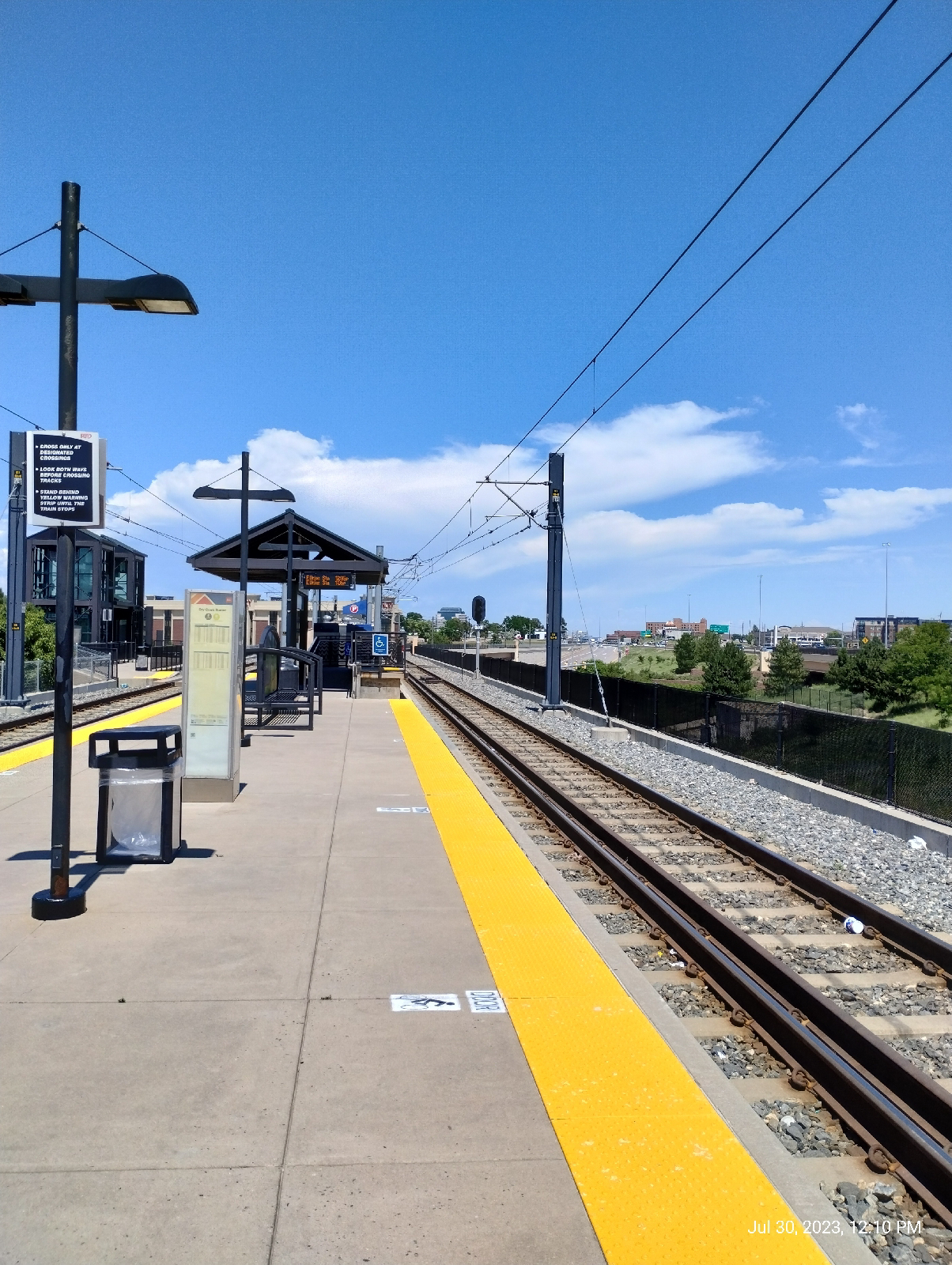
At Dry Creek Station, the day promised (and delivered) sun and heat.
There was a chance of thunder storms. Barometric pressure was dropping and humidity was in the upper 40 percent. But I wasn't holding my breath (I needed all I could conserve.)

The requisite shot of the Rockies, this time from Dry Creek Road. Dry Creek Road makes a straight shot toward South Platte Park and the Carson Nature Center so I was solidly on the divide between the South Platte River and Cherry Creek. This was home territory. The church with the sharp steeple is Good Samaritan Episcopal, a church I've attended several times since moving to Centennial. Willow Creek Covenant community is to the left and Willow Creek crosses the road a little further down. That was my destination.

These little guys are a feature in the Denver Metro area. I have a friend who distributes pellets of food laced with bubonic plague vaccine. The fleas prairie dogs host carry the plague. I'm sure that some would come up with the solution of just exterminating the creatures but they're an important step in the food chain.

They're pretty fascinating in their own right. As you near the prairie dog town, you hear them barking. It's been a focus of research because they have a complex language that includes identifiers for individual prairie dogs.

Also, they're cute.

At Willow Springs Green Space, Willow Creek has picked up a lot of water since drizzling out of the Bluffs, and is about to pick up more. This area isn't far from it's confluence with Little Dry Creek. There, the two will merge and become Little Dry Creek.

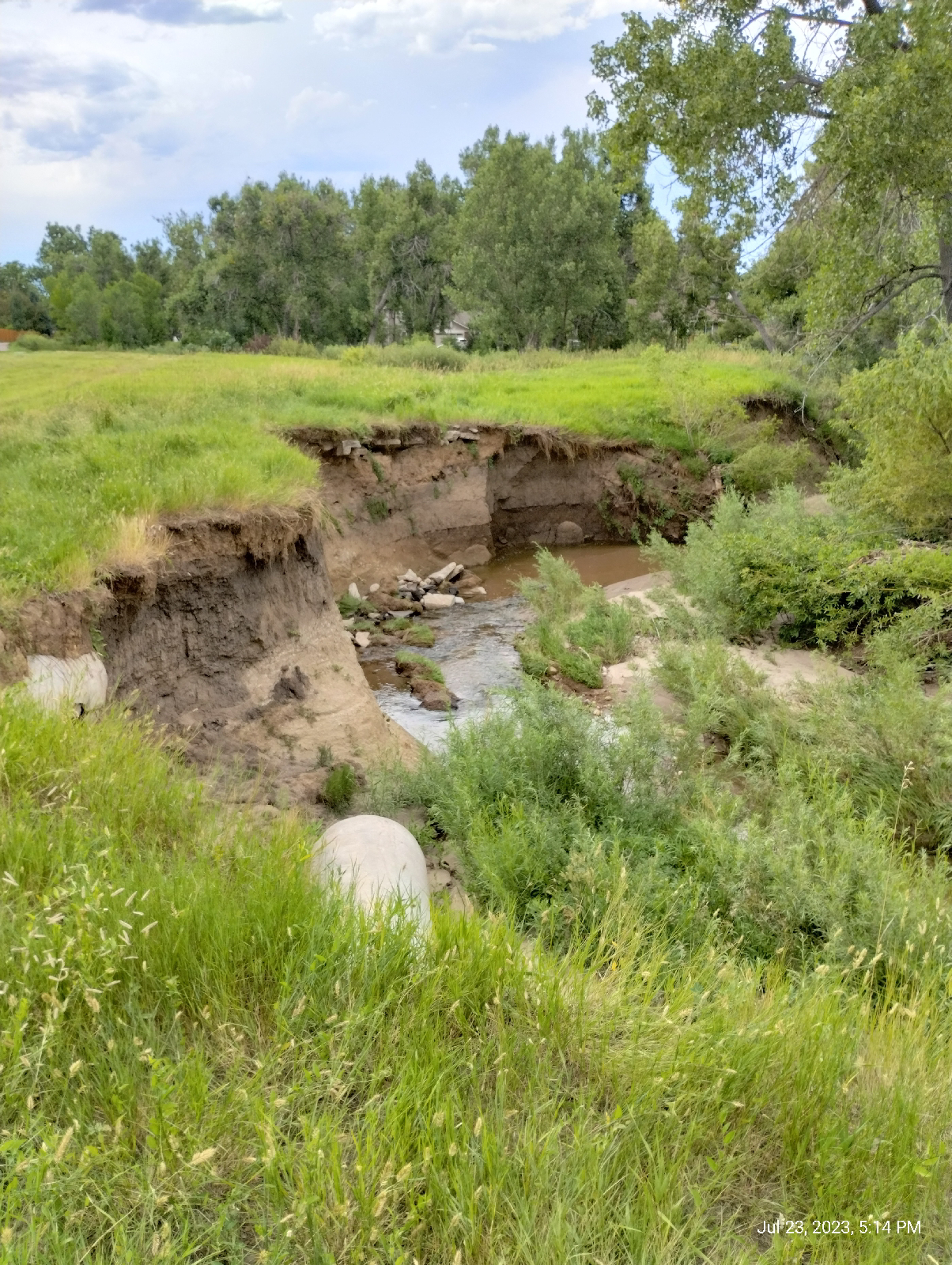
I'm not sure why that is, or if there is even a solid naming convention. By this point, Willow Creek has run a lot further than Little Dry Creek. There's not a lot of difference in size normally, but Willow Creek will flood occasionally and I can't find that Little Dry Creek ever has. About a month ago, the reservoir on Willow Creek was allowed to fill up due to our particularly wet monsoon season. There were boats out on the resulting lake. The United States Geological Survey has a hydrologic station on Little Dry Creek but (best I can tell) not on Willow Creek.

There is another blogger in the area that keeps an eye on Willow Creek and other local areas and maintains an interesting resource called "Naturalist Perspective". I check it occasionally for information in the area.

Sharon Pickens lives locally and explores the Denver Metro area, logging her explorations in Naturalist Perspective. She focuses on the nearby Willow Springs Open Space and is particularly interested in the wildlife and plants in the area, but she has somewhat to say about the geology of Willow Springs also. The website is well worth a look 


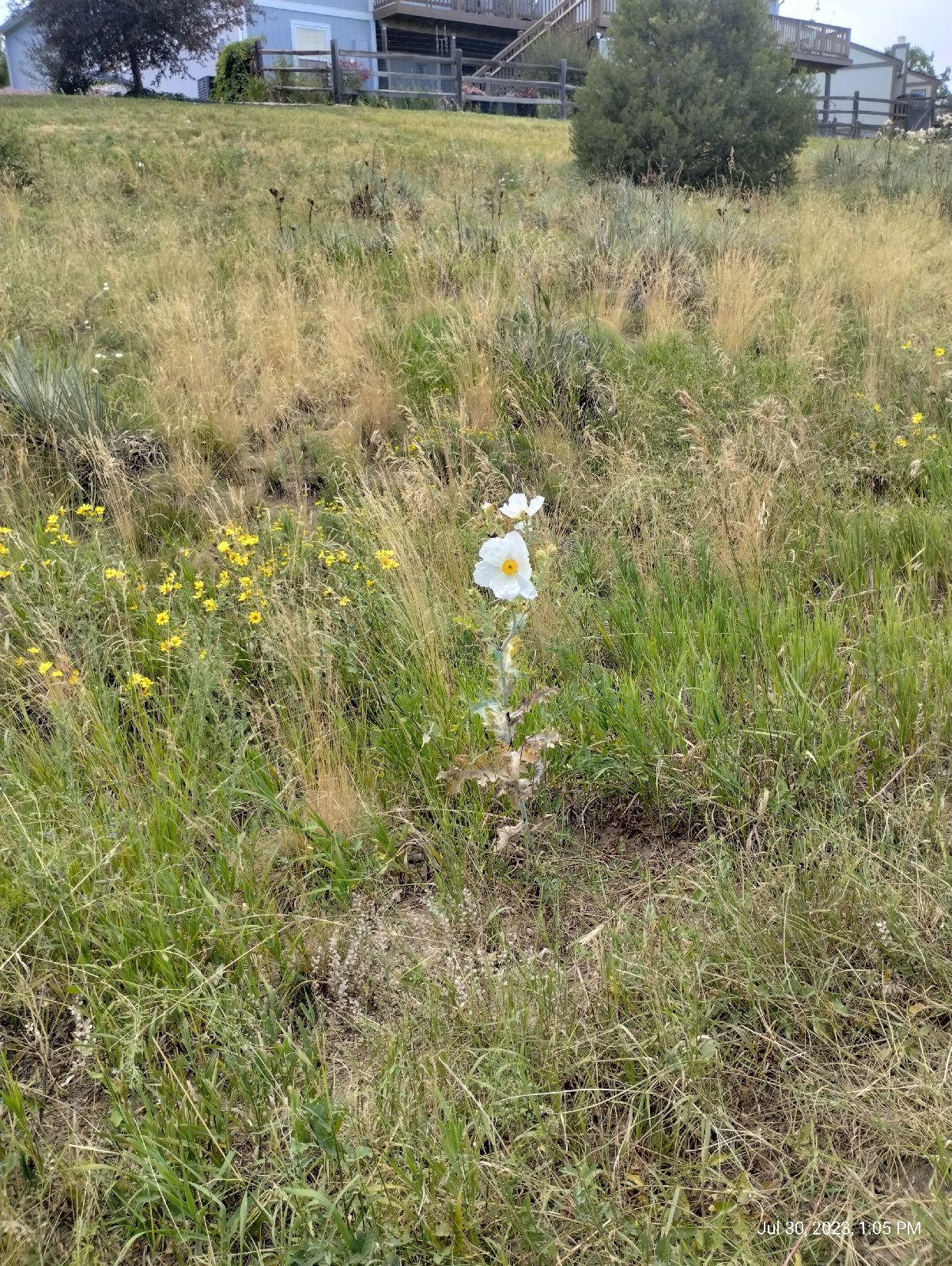
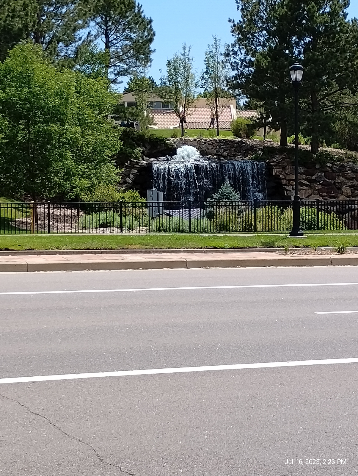
The "Springs" part of the park name gives an idea of where some of the water comes from. Willow Creek is never far from the aquifer that underlies Denver, but this open space brings it to the surface as several small branches that flow into the creek. At least three streams join Willow Creek in the open space.

The new South Suburban Parks and Recreation markers keep visitors up on where they are and what's available and they're not unsightly .

There's a good variety of plant life around the creek. This burdock is doing it's best to be photogenic. 

Willows with catkins

California (prickly) poppy
One of those springs

The park system has some off leash areas but most of the areas require dogs to be on leash. There are reasons and South Suburban tries to make those reasons explicit.

Willow Springs is located in and around Englewood Reservoir, a depression behind an earthen dam in Centennial. It infrequently becomes a lake. It's purpose is primarily flood control. But South Suburban is conscious of opportunities for education.

These plaques are scattered around the park explaining the purposes of the reservoir and conservation in the area. The dam, built in 1936, is 15 meters (50 feet) tall and 520 meters (1700 feet) long. It can impound 28 square kilometers (11 square miles) and 1,832,000 cubic meters of water. Usually, there's just a swampy area behind it.
That's the extent of the lake currently.

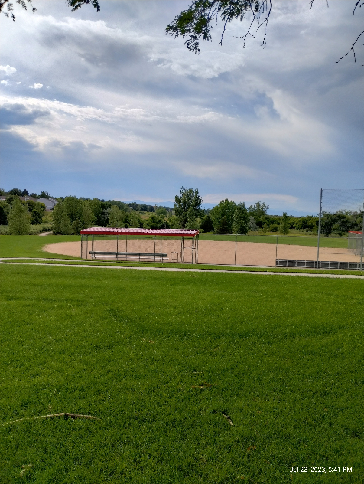
That's a bike park below the dam. There are nice views of the mountains from the top.
Arapahoe Road...I've walked up that grade way too many times. One of the grocery stores I use frequently is west of here. The photo doesn't come close to doing that hill justice. The tall building in the background is Village Center Tower One and it stands directly over Arapahoe light rail station. I'm going to cheat this time and not end up there. Home is at the top of that hill.

You're looking at the crest of the South Platte River valley. At the top is Interstate 25 and the light rail. The other side slopes down into Cherry Creek valley. Cherry Creek doesn't arise in the mountains. It's a plains stream that starts on Palmer's Divide near Castle Rock. One of the two major streams in the Denver Metro area, it joins the South Platte in downtown Denver.

Willow Creek joins Little Dry Creek a little northwest of this point. There's another of those flood control dams, Holly Reservoir, across the street.
And less than a mile east, Little Dry Creek passes under Arapahoe Road.
There's a stream gauge up there somewhere, but it's on private property in the middle of an HOA so this is as close as I'll go. It would just look like a metal box, anyway. I do get readings from it on my phone, though. 

The United States Geological Survey maintain hydrologic stations all over the country. Most of them transmit their data so the only human presence required is occasional maintenance.

The most primitive stage measure is just a ruler against a bridge support. There's one on Bear Creek at Knox Court.


The one in Sturbridge Community is a stillwell. The surface of streams tend to be turbulent, so it's hard to get precise measurements with a ruler. A Stillwell is a conduit from the stream to a vertical pipe. The surface of the water in the pipe is even with the surface of the water on the stream, except that it's still (thus, "still" well.). There are several setups that can convert water level to electronic data, for instance, a float connected to a pulley that drives a potentiometer. The electronic signal is then transmitted to the USGS site in Denver, or the water authorities in Centennial and Littleton, or to...my phone.

Little Dry Creek is at, eh, 

5.53 feet. I have two apps to track streams in my area: Flow Alert (by Shaina) and Rivercast (by Juggernaut Technologies Inc ). Both provide stage and flow data. The measurement shown above is a stage measurement. I can guarantee that Little Dry Creek isn't five feet deep there. Stage measurements are depths compared to some arbitrary vertical elevation. It might be sea level, or the surface of the stream at zero capacity (the problem with that is that the elevation of the stream bed changes with time and erosion), or a nearby survey marker. I don't know what they use here but it doesn't really matter since what you want is just a constant you can use for comparison over time. Here's what Little Dry Creek does over time.
We had a little spike on the twentieth, hardly flood stage at six feet  There was a little thunderstorm that day. I also get flow rate data.

Almost six cubic feet a second!

Streams have always fascinated me. I have an urge to follow them from beginning to end to see what they do. There may be meanders or waterfalls. My friends and I would dam up ponds to wade in. We'd camp on sand bars.

What do the streams in your area do? Do they ever flood? Is there a hydrologic station near you? How long does it take for the water level to rise after a rain? How long does it take to return to it's average stage?

Thursday, July 27, 2023

The origins of continents

Felsic crust may have begun forming on the surface of Earth as early as 140 million years after Earth's formation. Felsic rock is called that because it's primary components are iron (Fe) and silicon (Si) with oxygen. The other kind of crustal rocks are "mafic" (because of their high concentration of magnesium and iron.) Oceanic crust is primarily composed of mafic rocks like basalt, porphyry and gabbro. We looked at basalt on North Table Mountain in Golden, Colorado. Continental crust, on the other hand, is primarily felsic.
Basalt on North Table Mountain, Golden, Colorado


Felsic rock was rare on Young Earth. It formed in the process of differentiation. As the molten surface of the Earth solidified, it "froze" in stages because different components of the rock have a different "freezing point". Just as the dark, iron rich minerals of granite crystallize first from magma, then feldspar, and last quartz, silica rich minerals like those that make up granite tend to separate from basaltic minerals like olivine as they solidify and, because they are less dense, they float on top of the basalt.

So every time oceanic crust melts and rehardens (part of what geologists call the "rock cycle"), a little more continental crust precipitates out.

I hate seeing the foamy sludge that collects on urban streams but, conversely, the way it floats on the water is entrancing and educational. It seems to try to stay in place while the water moves under it. Eventually, the foam will be washed downstream but, until it does, it piles up behind obstacles, even if the water pours over them. It swirls around in whirlpools. It's so buoyant, and rides so high on the surface that the water doesn't have much to push against.

And that's the way continental crust rides on oceanic crust. Early chunks of continental crust tended to hang around forming the cores of landmasses. They persist even today. Geologists call them "cratons". 

Just like rafts of foam tend to collide to form larger masses of foam on streams, and then break apart to forms smaller islands, these cratons collide to form "supercontinents" and then break apart as smaller pieces float away on the oceanic crust to form smaller, individual continents. 

This "tectonic plate theory", the idea that the Earth's crust is broken up into rocky plates that move around, was a little hard for scientists to swallow when Alfred Wegener, a meteorologist, first proposed it in 1915. In fact, he was treated sorta badly by the geological community. After all, what would it take to break the crust apart and where was the evidence of such a stupendous force?

Of course, it turned out that Wegener was right. You can see the force if you cook. If you start heating a liquid, it will stay quiet for a while, but then you will notice that the surface becomes bumpy before the liquid begins to boil. The bumps are the tops of convection currents in the fluid. The bottom of the pot is hotter than the surface of the fluid and hot materials are less dense than cooler materials. The less dense liquid rises through the cooler fluid and, when it cools at the surface, sinks again to create currents up and down throughout the liquid.

The Earth has layers. The top part of the crust is relatively cool and solid, but the bottom part is, at least, plastic with pockets of molten magma. If you travel into the Earth's interior, you would find that the deeper you go, the hotter it gets. Materials under pressure get hot but there is another thing that fires Earth's inner furnaces. The heavier an element is (meaning, the larger an element's nucleus is and the more protons and neutrons are there) the more unstable it is and, when it breaks apart, it gets hot. You know where the heavier elements went when the Earth formed...straight to the center. The Earth is a nuclear furnace.

The top part of the mantle, the layer beneath the crust, is also plastic. The plastic layers of the Earth's crust and mantle are known as the asthenosphere. The crust floats on the asthenosphere. Deeper layers of the mantle and the outer part of the core are molten, liquid rock. Like a pot of hot broth, the inner part of the Earth has convection currents. If you can imagine crackers floating on boiling broth or a film on the surface of gravy, you should be able to imagine why Earth's crust is broken apart.

There have been at least five supercontinents on Earth. Columbia (aka Nuna) formed around 1.8 billion years ago and broke apart about 1.3 billion years ago. Rodinia lasted from 1,130 million years ago to 750 million years ago. Pannotia stayed together from 633  million years to 573 million years. Gondwana lasted from 550 to 175 million years ago. The last supercontinent, Pangaea formed about 336 million years ago and broke apart about 175 million years ago 

There were probably other landmasses before Colombia. The first continental crust is sometimes called "Vaalbara". Some geologist calls it a craton (continents come and go but the cratons we have now are from the original craton) and some just call it a continent. A lot of continental crust has been added on since then and Vaalbara may not have been big enough to justify the "super-" prefix 

What are continents without water to surround them? Where did the water come from?

A lot of it was already here. I've said that oxygen is very reactive and doesn't like hanging around in it's elemental state. Much of it is bound with hydrogen to form water, otherwise there would be no hydrogen on Earth because it's light enough to float away out into space. Early on, most of that water was trapped in rock and only came to the surface through volcanic venting. A lot of water has been added by bombardment by icy space junk.

Nature recycles. Everything is used and reprocessed to use again. Air, water, rock, plants, animals...all recycled. There's no waste.

What geologists call the rock cycle is driven by erosion and tectonic drift. The Rocky Mountains...
was preceded by flat plains and before that, the Ancestral Rocky Mountains and the current mountains are in the process of being worn down to flat plains again to be again uplifted to form another mountain chain.

The dust formed as the Rockies are ground down are carried by streams like the Colorado, South Platte, Arkansas, and Rio Grande Rivers to be packed into sand bars, dunes, and beaches where they become buried and harden to sedimentary and metamorphic rock.

There are 16 principal tectonic plates that have formed since Earth's crust fractured around 3.4 billion years ago. They're pretty much the same plates and, although most of what you see around you is continental crust, that's just what you see. It rides on a surface of oceanic crust. That's what the tectonic plates are made of. They're constantly being extruded from Earth's molten interior, typically on ocean floors, at mid-oceanic rifts, but there are places like Iceland and northeastern Africa where you can see it happening on dry land.

If land is being created at one place on the globe, it has to be un-created somewhere else. That happens at the other side of a tectonic plate at a place called the "subduction zone". There, one plate pushes under another and is melted to merge with the Earth's mantle. There, it's mixed and churned out at a rift zone to be reused as solid crust. The continents just float on top....crash together...tear apart...like a crust over a pot of boiling gravy.

Where was Colorado, and, thus, Walnut Hill back during Columbia's time?

It wasn't. The North American craton extended as far as Wyoming, but Colorado isn't on a craton. It's been added on since Columbia. There has been land at this latitude and longitude, but it wasn't Colorado. Also, there was still no oxygen to breathe. It was all in rust and water.


County Line Station to Dry Creek Station

The obligatory Rocky Mountains shot, this time from County Line Road.

A common city layout has straight roads in a grid with roads running east-west and north-south. In the Denver Metro area, the north-south roads are usually called "boulevards", and the east-west are avenues. The landscape tends to be hilly and obstruct long views on the boulevards but the avenues run down long slopes to the South Platte River and then back up the other side of the river valley. Going west, that affords some striking vistas of the Rocky Mountains.

The word "boulevard" looks French, and it is. It was originally the flat surface of a rampart but became the term for a promenade that ran along a city wall, then a road that circled a city, like circumferential bypasses in many modern cities.. It usually implies a broad thoroughfare planted with shade trees.

"Avenue" is also French and originally denoted a straight, tree lined street. Ironically, Denver has an Alameda Avenue. "Alameda" is the Spanish equivalent of the French "avenue". We have an Alameda Avenue in Denver.

County Line approximately follows the line between Douglas and Arapahoe counties. It also parallels Colorado 470, which is Denver's circumferential bypass.

 
Occasionally, I will lose a trail. Somehow I got off Willow Creek Trail and ended up in the middle of the Willow Creek Covenant community (aka HOA - Home Owners Association). These folks usually live in walled villages because they like the security of living around stable populations of homeowners and they tend to be suspicious of outsiders. Many of the popular trails in the Denver area run through HOAs. It always makes me edgy to find myself in an HOA. I've seen too many horror movies (The Stepford Wives, Black Cove, Fear Itself: Community, there was even an X-Files episode).

I did appreciate the appearance of this Little Free Library, a corner bookswap supported by the Little Free Library organization, and the facing title was Tenderness of Wolves by Stef Penney (it's, uh, not really about wolves, by the way).

Predictably, as I came to residents, they looked at me like "Who is this guy?" but, when I asked how to get back to the trail, they brightened up and became chatty.

When I rejoined Willow Creek, I found that it had grown considerably.

Most of these creeks have numerous tributaries, but they also run over active aquifers creating a dynamic give-and-take with the local ground water. The Dawson and Arapahoe formations are close to the surface around Willow Creek.
Willow Creek Open Space provides a wide park in the center of the Willow Creek community. It also provides a rare public restroom along the 8 mile trail.


The stream gouges out some tall banks into the soft sandstone and clay of Arapahoe county.
I left Willow Creek at Homestead Elementary School on Dry Creek Road overlooking Englewood Reservoir. That will be the main point on the next station-to-station hike. I took a snack and long rest before continuing up the slope to Dry Creek Station. From here, I will be hiking along the divide between the South Platte River and Cherry Creek.

The school has a memorial to family members lost in the 9/11 attacks.
As I walked up Dry Creek Road, my neighborhood, Walnut Hill, was to the left and the Willow Creek community was to the right. This is home territory.
Dry Creek Station has the longest pedestrian bridge I've seen at any of the RTD stations.
Trains have traffic lights, too.

When a train leaves a station, the light at the next station comes on. It's not really there for the riders. The three colors mean about the same thing for the conductors as they do on traffic lights for cars. Green means the track ahead is clear, amber means to proceed with caution, and red means that there's a problem down the track.

The E/F Lines and the R/H Lines out to Peoria and the airport are complex with branches and parallel tracks that can turn into a single track that carries traffic in both directions. And the overhead lines that feed the electric light rail trains have to keep up with the rails. During the time I've been using RTD, these lines seem to have most of the technical problems. I'm going to assume the complexity has something to do with it.
But the train always arrives, eventually, and carries me on up the line and to home, which is currently Arapahoe at Village Center Station - next destination.

Saturday, July 22, 2023

Young Earth


(Keep in mind that my story is woven together from the majority speculation among geologists. There are certainly counter theories floating around. For a good overview of Big History, check out The Teaching Company's lecture series, Big History, presented by David Christian.)

The formation of Earth, around 4.5 billion years ago, bore some resemblance to the formation of the sun. Gravity pulled a lot of stuff together and crushed it, somewhat like a child would form a hard snowball, but there wasn't enough mass to cause the kind of pressures required to start a fusion reaction.

Still, the early Earth was mostly molten, not because of pressure, but because space debris rained down on it and blasted the surface. In fact, soon after the formation of the planet (in geological terms) a huge asteroid hit it and knocked a considerable glob of molten crust out. That became our moon.

There was an atmosphere but, if it contained oxygen, it reacted with everything else until it was all quickly bound up. In that hellscape, there was no life (although life did form much earlier than scientists though a decade ago.) There was no liquid water. It would have quickly boiled off. There were no oceans or continents. Space would have been completely obscured from the surface by dense clouds of methane, ammonia, nitrogen, sulfur, and water vapor. If there was rain, it would have been acid 

The reason we have nowhere near the bombardment now that early Earth sustained, is that we've pretty much swept our orbit clear of major impact bodies.

It took about a billion years for the Earth to cool off enough and to gather the raw materials (water, oxygen, carbon dioxide...probably a little from volcanic venting and a lot from bombardment by icy space debris), to create life. 

Young Earth was not the same planet we have now. The crust has been thoroughly shuffled and reshuffled. The planet has been "terra-formed". It would be impossible to pinpoint a spot that would become Walnut Hill.

By 3.5 billion years, Earth had a magnetic field. Heavy metals, mostly iron and cobalt, but most elements heavier than silicon, sank to the core. The center most part of the core remained solid because of the pressure exerted on it by the surrounding material, but the outer core was (and is) molten. Currents in the molten core created a natural dynamo that produced a magnetic envelope around the planet. That helped to, among other things, hold onto a dense atmosphere. It was a "greenhouse atmosphere" that kept the planet hot and, as water collected on the surface, it didn't melt. There was no ice.

On Young Earth, if you were standing at latitude 39.7392 north and longitude 104.9859 west (the coordinates of present day Denver), you would probably be standing in lava. If you managed to find solid rock to stand on, it would be basalt. The crystalline, granitic rocks, sedimentary and metamorphic rocks you see all around you today didn't exist on Earth then. The air was from volcanic outgassing. There was very little oxygen and a lot of unbreathable stuff like carbon dioxide, methane, ammonia, sulfur dioxide...oxygen is very reactive and doesn't like to hang around in free state. To maintain an oxygen rich atmosphere, oxygen has to be continuously generated. That's why plants are so important to us. The streams I've talked about having been so large in the past didn't exist on Young Earth...there was no liquid water. The sky was colorful and dark.

The surface of Earth was made up of basalt. It's the kind of rock you find on the ocean floor and underlying the continents today.  It's what happens when molten rock is extruded onto the Earth's surface to cool quickly. Oceanic crust, basalt, is heavier than continental rock, and it has more heavy elements like iron, making it dark. In fact, a very important fact for understanding geology is that continental crust floats on denser basaltic crust.

Young Earth went through a period of differentiation. The laws of physics were well established by then... everything worked the same way that it works today. Heavy sinks down through light, so the heavy elements sank down through the lighter elements. Most of the iron and cobalt ended up in the core. Gold, for instance, so important historically to Denver, is one of the rarest elements in the Earth's crust. Here's a chart of the predominance of all the elements in the crust (from Wikipedia, "Abundance of the Chemical Elements"), . Gold is rarer than most of the "rare earth" elements like niobium, yttrium, and tantalum. It's down in the super-rare, yellow area.


(Abundance of the Chemical Elements in Earth's Crust by Gordon B. Hazel, Sara Boore, and Susan Mayfield, from USGS. https://pubs.usgs.gov/fs/2002/fs087-02)

Gold is so rare for two reasons. First, the most common elements are those that make up stars (it's called "stellar nucleogenesis.") Stars produce elements by fusion, starting with hydrogen and deuterium and sticking atoms together to form the lighter elements like carbon, silicon and iron. It stops at iron. Once fusion starts, it can continue as long as the reaction doesn't require the input of energy from the outside. As the atoms created get larger and larger, less energy is created by the reaction. After iron, energy must be fed into the system to continue fusion.

At the end of a large star's life (our sun is much too small), it explodes. The energies produced are spectacular and a supernova is created. That's where gold is produced. The space junk that our solar system was created from was contaminated by the remains of some supernova.

Another factor against the production of gold is that fusion starts by sticking together atoms with even numbers of neutrons and protons in their nuclei, deuterium and helium, so larger atoms with even numbers of particles are favored. The only stable isotope of gold has 79 particles in it's nucleus.

The other reason gold is so rare in the crust is that most of it sank to the core with iron and cobalt. What's in the crust mostly came with later space junk, dust, meteors, and asteroids, and a little made it's way from deep inside the Earth by convection currents and random diffusion.

About a billion years after Earth formed, life appeared...

Thursday, July 20, 2023

Back to the beginning...

This one is difficult. Just bear with me...

In the beginning, there was nothing. The picture that probably brings up is empty space and that isn't what I mean. I mean, nothing....

no vacuum, no empty space, no space, no time. There was absolutely nothing. If you can talk about it, there's something. When I say "nothing", that's a thing that wasn't.

In the beginning, there was absolutely nothing....

except...

a singularity.

Everything that exists now existed then compacted into a place with the volume of exactly zero. And the singularity was unstable so at a point in time....no, that's wrong ...there was no point and there was no time....

But the singularity exploded....um, there wasn't anything to exploded into. It expanded rapidly into....well, itself. All of the potential for time and space became actual.

This "Big Bang" happened around 13.8 billion years ago. (Before that, there was no time that would provide a "before"). In the first 10^-10 second (sorry, I don't know how to do exponents with Blogger) the four fundamental energies: gravity, electromagnetic energy, and the nuclear strong and weak forces, were unified and had to unravel themselves. There was no cap on the speed of light, so there was no limit on how quickly the universe expanded.

In the first second, the material component of the universe condensed into the fundamental particles and the universe began sorting itself out into atoms of stuff. It took a few minutes for hydrogen and deuterium to form but after that, things slowed down and it was, oh, a few hundred million years (get used to the big numbers. A hundred million years is a blink of the eye on the geological time scale.) before other elements began to appear. 

You see, hydrogen and deuterium make up stars. Other elements are formed in stars. You have to have stars to have larger atoms in any significant amount. If you don't do something in our universe, things fall apart...they don't stick together and stay stuck. The something that has to happen is stars.

Gravity pulls things together in the universe. It's a weak force but given enough time, it will pull enough hydrogen atoms together to form a huge mass of gas. The pressure at the center becomes so great that it ignites and a star is born.

Okay, there have been whole books written outlining (just outlining!) the process of cosmogenesis, and that's not the purpose of this blog. I'm attempting a "big history" of Walnut Hills.

So I'm going to jump ahead to about 4.6 billion years ago...the birth of our sun. We call it Sun or Sol but it's a fairly mediocre star about halfway through it's life cycle.

At the beginning of our solar system, space debris - gas, dust, and larger particles - had been drifting around for a long time. Under the influence of gravity, the universe had become...chunky. When stuff in a region of space starts attracting each other, they begin as a spherical cloud, but the particles tend to spiral in toward the center and they flatten into a disk (astronomers call it an accretion disk). You can see much of the effect if you spin around in an office chair and hold your arms and legs out in different positions. As you bring them in toward the center of your body, you spin faster. It also matters whether you hold them perpendicular to the axis of spin.

Most of the debris is drawn to the center, but smaller clumps forms along the disk. The central mass collapses until the intense pressure at the center begins crushing hydrogen atoms together to ignite a fusion chain reaction. The center of the dust cloud becomes a star. The clumps of matter spinning around the star become planets and other bodies.

Heavier matter fall further to the center of the disk to form Rocky planets and the outer clumps become icy or gaseous bodies, many of them huge like Jupiter and Saturn. The process is complicated and interesting features form like ring systems, moons, asteroids, and comets.

There is nothing that could be pinpointed as where-Walnut-Hills-will-be, but the third big clump from the sun has started to collapse in on itself, transitioning from a big ball of space debris to a solid ball. That will be our planet, Earth.


Monday, July 17, 2023

Lincoln Station to County Line Station


Blue skies. 91 degrees Fahrenheit on my weather meter. Those high, icy, citrus clouds mean that there's moist air moving in up there but down here, it's just hot and humid (33% humidity) and promises to get hotter. Atmospheric pressure is up and down and I don't expect any storms to break the pattern.

But, visually, the day is beautiful and I can focus on that.

These early E/H Line hikes explore Willow Creek. It is a nicely typical stream to explore.

 Notice that the Bluffs seem to curve around something...like a chunk has been gouged out in the middle. That's because a chunk has, indeed, been gouged out in the middle. Willow Creek did most of that.

Remember that most of these streams, in the past, were much larger. Willow Creek was, perhaps, not a huge stream. The pictures you'll see show a fairly narrow valley, much smaller than, for instance, Little Dry Creek Valley, despite the fact that it runs a longer course.

Typically, a stream begins it's journey at a steep gradient that gradually gets shallower the further it runs. The amount of water it carries also tends to increase and it's power to erode downward into the earth decreases, although it's sluggish meanders broaden it's valley as it continues it's course.

Willow Creek isn't long enough to get out of it's steep, wild section before it joins with Little Dry Creek. There, it takes the other streams name and becomes Little Dry Creek as it runs down to the South Platte River in Englewood.

Of the two creeks, Willow is more variable and more likely to flood, partially because the aquifers that feed it are more productive. Most of their volumes are contributed by runoff and Willow has a longer run to pick up storm water.

The area around Lincoln Station is affluent and much landscaped, but landscaping isn't just about artistry as this sign explains. This area collects storm water and provides a porous surface which also acts as a filter to trap contaminants.

As usual, Lone Tree, a suburb of Denver, being a desert town, likes it's water features. If you want to see a waterfall in the Metro area, water features are your only options. This one is at the Lone Tree Golf Club.
This is a golf course so the landscape has been modified, but it does give an idea of how narrow and shallow the valley excavated by Willow Creek is.

On one hand, golf courses require a lot of water to maintain, pamper invasive lawn grasses, and sink a lot of agricultural chemicals into the ground, but they do manage the water they use and water fowl such as these egrets and ducks, like it.
Here is another shot of the valley back toward the headwaters.

After Lone Tree Golf Club, the creek flows through Sweetwater Park and the Park Meadows shopping district. Here it finds less managed, and softer land to cut into. Also, it has picked up water from Cook's  Creek and other sources. There are some interesting banks cut into muddy sandstones and sandy mudstones of the Dawson and Arapahoe formations.
I was pleased to see the tunnel under C470, the main bypass around Denver. The air in it is about 20 degrees cooler than the air outside.
There are some interesting stalactites hanging from a crack in the ceiling (Remember. If it's from the Ceiling, it's a stalaCtite. If it's from the Ground, it's a stalaGmite.) 

I suspect that these "cave formations" are made from gypsum redeposited from water percolating through  the sheetrock of the walls.

I really have to watch my hydration in this weather and, as I neared County Line Station, I really needed to cool off and get something to drink so I stopped at Tropical Smoothie Cafe for a large Watermelon Mojo Smoothie and a rest in the shade. Here's a view of the Rockies (and the top of my drink cup).

I took my time and felt much better when I walked the last short stretch to the station.

County Line Station is at the edge of the huge Park Meadows shopping area. The light rail and I-25 is on the other side of that wall.
In addition to a packed, sprawling parking lot, the station has some nice views of the surrounding countryside.

This hike brings me to very familiar territory. Little Dry Creek is the only stream in my neighborhood large enough to have a name but the southern ridge of Little Dry Creek valley is the northern ridge of Willow Creek. The next neighborhood to the South is Willow Creek covenant community and I will explore that on the next hike.