Showing posts with label RTD. Show all posts

Monday, June 5, 2023

Fox to Union Station

The last leg of the G Line brought me back to Union Station. I started my hike at 41st and Fox light rail station and and walked straight down Fox Street into downtown Denver.


Actually, since I begin these G Line adventures at Union Station, it was both my starting and end points. Here's another photo of the train pavilion.

Union Station was first opened in 1881 but was rebuilt in 1914 after a fire. It was revitalized in 2014, conserving the image of the past with the high ceilinged hall and 112 room Crawford Hotel  and adding the very modernist additions of the RTD facilities. With ready access to 16th Street Mall and the free MallRide buses; the underground bus terminal serving RTD buses, Colorado's Bustang routes, and Grayhound; plus Amtrak, Union Station is central to just about everywhere.

The Colorado monsoons were in full swing so the day was nicely overcast and the rains were hours away. All in all, it was a nice day for an adventure.

Fox Station serves a neighborhood. I don't see much to drew tourists. Being north of and close to (and not in) downtown Denver places it in an area of industrial activity. 

This hike was short, under and over a couple of bridges, and became interesting as I neared downtown.

There is the Fox Station art piece.

Aggregation, by Brian Brush, looks like an industrial fabrication waiting to be delivered. That's not a criticism since it certainly fits it's surroundings.

Between the station and downtown, under Interstate 25, Fox Street is lined with a gallery of art works and quotes calling for peace.

Fox Street, terminating as it does at the doorsteps of Coors Field and Union Station is conceived as a gateway to downtown Denver. The Washington Street Bridge was designed with that in mind.

It passes over the South Platte River in a long arc.

Coors Field is Denver's baseball diamond and home to the Rockies professional baseball team. I'm not a fan of baseball (or much of anything, for that matter) but this building draws my attention. It looks very goth to me.

Union Station is right down the street and so, to home.

I go places that I would not normally choose to go because when I put feet to the ground I'm often surprised by things that I would otherwise not experience.

Saturday, May 27, 2023

Westminster Station to Pecos Junction Station: Goodbye to North Denver (for awhile)

The B Line is a commuter line to Westminster, Colorado. It shares three stations with the G Line and has only one to itself. I've decided to make this my last station-to-station hike in North Denver for awhile and check out the E and H lines from Ridgegate Station in Lonetree to Broadway Station... that's 16 stations in the southern part of the Denver Metro area. I'm not sure what I want to do with the remaining three sections of the RTD light rail system.

Many of the stops along the N, A, and R Lines are pretty far apart and most of them are industrial or residential and they're all on the plains. I can find points of interest anywhere, and I don't mind long hikes if they have a lot of interesting points, but I don't want to do both "long" and "boring".

After the southeastern lines, I might take a break from RTD and hike the 24.6 mile Cherry Creek Trail in sections and maybe extend it to Castle Rock. Then maybe I'll take selected stations along the rest of the light rail system.

The B Line is a short stretch between Westminster Station and Union Station. Between Westminster and Pecos Junction, where it joins the G Line, it follows Little Dry Creek to it's confluence with Clear Creek. I was there earlier this year (http://adventuringbcc.blogspot.com/2023/04/clear-creek-station-to-pecos-junction.html?m=0) and I visited the Westminster terminus back in 2019 (http://adventuringbcc.blogspot.com/2019/06/terminus-westminster-good-morning.html).

I started out from Union Station on the cushy G Line commuter train. From the window, I watched the familiar sights go by: Coors Field, apartment buildings, the South Platte River, Fox Station, industries, and Pecos Station. 

The Colorado monsoons (hmmm...that should be a sports team) were still in affect but this early there were just scattered clouds. The mountains were hazily visible, partially blurred by smoke drifting down from the Canadian wildfires.

I made a stop in Arvada Olde Town for a milkshake before backtracking to Pecos Junction to switch to the B Line.

Westminster Station's curved canopy and clean lines belie it's recent addition to the light rail system. It opened July 26, 2016 with the intention of extending the B Line to Broomfield and Boulder. That hasn't happened yet and it's still the terminus of the B Line. Still, the city of Westminster has developed the area around the terminal nicely.

Little Dry Creek runs through this intricately landscaped park.

This Little Dry Creek is "little" because it's smaller than nearby Big Dry Creek. It's mostly fed by runoff from the surrounding neighborhoods but, running through the concrete structures at Westminster Station, it looks clear and clean.

The area attracts a great variety of both water fowl and song birds.

The trail is popular with bikers, joggers, and local strollers and the area is dotted with small lakes. Since I have seen people fishing and lots of water fowl, I'll assume that the lakes are stocked, though I haven't seen any fish.

Very soon after leaving the park at Westminster Station, I saw the grain elevator near Pecos Junction that marks the end of my hike.

64th Avenue crosses Little Dry Creek Trail a short walk from Pecos Street. Clear Creek here can reasonably be called a river. I hiked this route on the Clear Creek Station to Pecos Junction Station hike, so it was familiar.

Back at Pecos Junction, I took the G Line back into Denver.

I miss the waterways of the East but the many trails in the Denver Metro area remind me that water is still a major part of life in Colorado. What part do the streams in your area play in your life and the life of your community?

Friday, March 24, 2023

The last leg: The W Line

The terminals tend to be the most interesting stations on a line.

The W Line began in the mountains at Golden and ends in downtown Denver at Union Station. Along the way, I've seen ancient lava flows, art, antique toys, and miniature houses, and heard people's stories. 

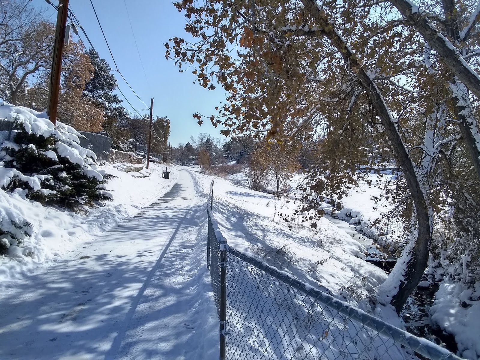
You won't see any snow in these photos. That's funny since snow is still on the ground a few miles down the track where I live. The Front Range urban corridor, the most populated areas in Colorado just east of the Rockies, varies drastically in weather as you move north or south. Warmer downslope winds called "chinooks" crash down off the higher mountains, often with hurricane force winds, while the mountain passes let colder air through as fronts move out onto the plains. So ten miles can make a huge difference in weather here.

My hike began where I left off the last time, at the modernist event center, the Ball Arena. Although it hosts cultural events like concerts and plays, the big theme here is sports and you can see art dedicated to sports and buy items celebrating many of the local teams.

Not much of a spectator, I look and pass by.

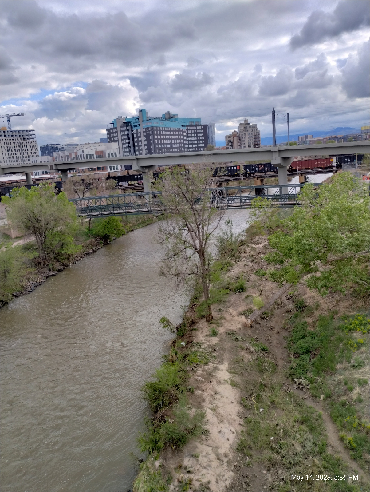
Denver should be a Mecca for people who like bridge architecture. There are bridges everywhere illustrating many styles. These truss bridges over Cherry Creek are foot bridges connecting the Auraria neighborhoods to Denver proper. They don't span much distance so the simple truss structure works well. It works like a board across a creek.

If you built bridges as a kid, you probably remember that your plank was, well...fun? As you walked across, it sagged in the middle and bobbed up and down.

All bridges are a road or trail bed supported by some kind of structure to carry the weight of the "plank" and lead the force of the weight down into the earth. Here, sturdy steel girders form a lattice work that lays across from one bank of Cherry Creek to the other. The road bed rests on a platform of girders like the slats under your mattress. The trapezoids on either side keep it from sagging and bobbing. The trapezoids are reinforced by diagonal girders that form triangles. In a triangle, any joint is braced by the opposite side. A triangle is the most stable plane shape.

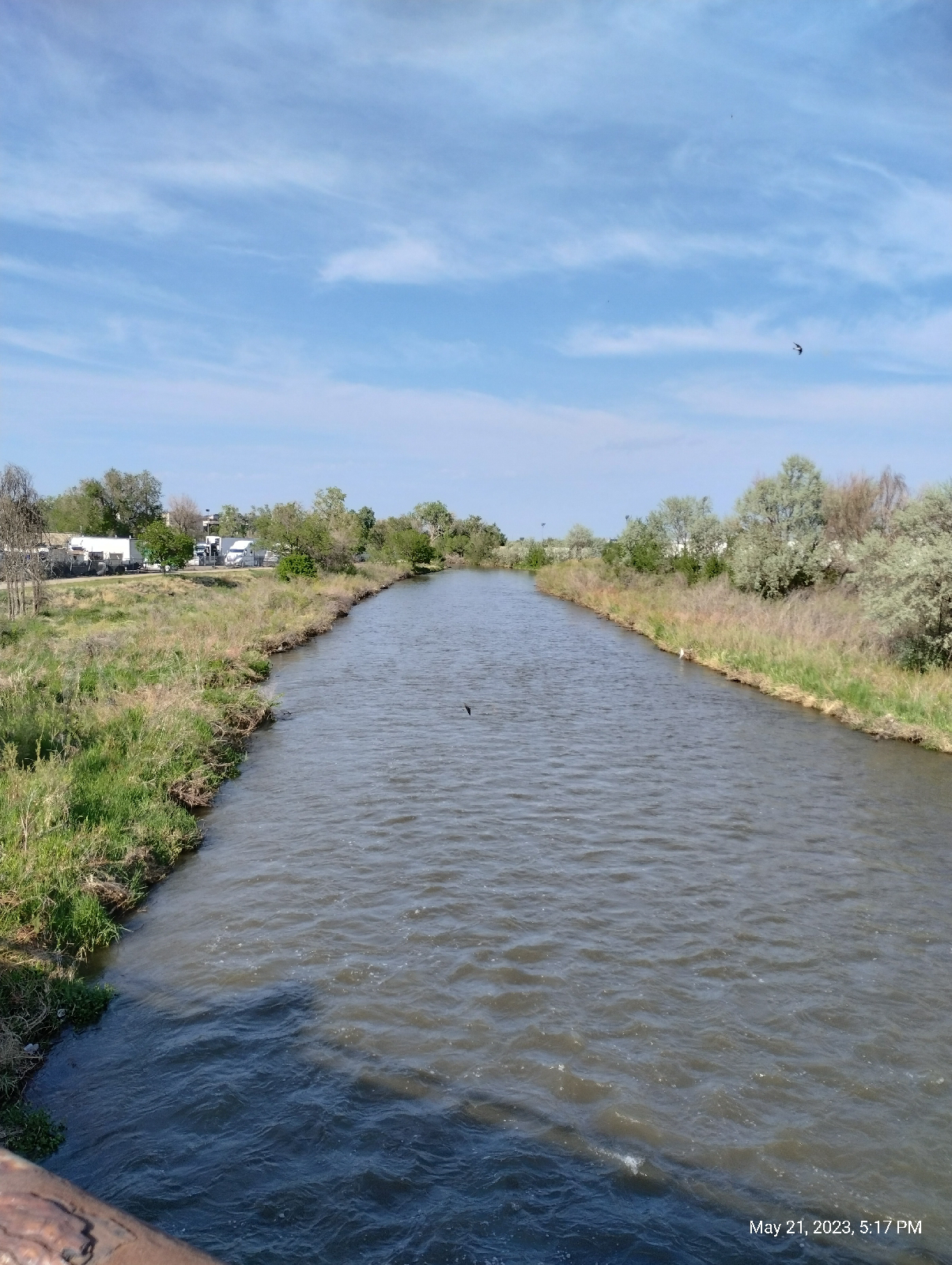
Cherry Creek and the South Platte River define major regions of Denver. West Denver is west of the river. The original settlement of Auraria where settlers of European heritage joined Chief Little Raven's tribe of Arapahoe was nestled between the two streams, and Denver proper developed across Cherry Creek. The streams have never been navigable to large river traffic but was the original draw to the area as gold was panned from them and their tributaries. Then they served as open sewers. Although they have been cleaned up considerably, they still carry an invisible load of diverse toxic metals from mining operations upstream and enteric bacteria like Escherichia coli from ongoing sewage contamination. Swim at your own risk.

Nevertheless, water fowl find the streams inviting, and I occasionally see fish there. Denver used to be on the migration routes for many birds but as the climate has warmed, more and more are staying put year round. Also, further south they get shot.

Confluence Park

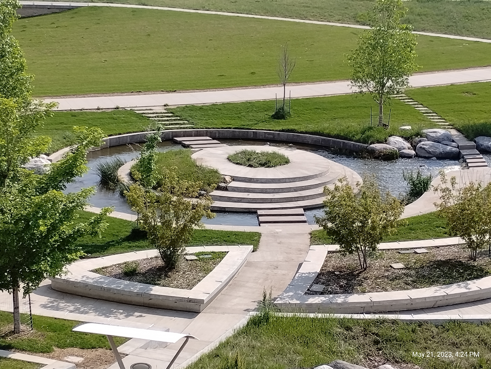
The South Platte River and Cherry Creek merge in downtown Denver at Confluence Park. This area has been extensively landscaped not only for aesthetic reasons but also to manage erosion. A lot of energy is expended here and the valley shape can change quickly (over geologic time) if allowed.

Confluences are often a good place to look for heavy metals like gold. Industrial placers are troughs fitted with slats or ridges in the beds. Water is sent down under pressure (often by gravity flow). Light particles of dirt, sand, or crushed rock wash on by while the heavier partials are caught behind the slats. In a confluence, the trough is the natural stream bed and the slats are rocks and boulders that slow the flow of the water. The Sand that collects there is enriched with heavy materials and can be panned to find heavy particles.

Confluence Park is a popular place for kayaking and tubing because the water gets a big boost there. There's actual white water around the boulders that have been washed down from upstream (but keep an eye on the pollution reports if you're interested!) It's no surprised that this was the first place prospectors decided to look for gold in the area. 

Why is Denver where it is?

That's why.

Geology not only changes geography. It changes us.

But they didn't find gold at the Confluence of the South Platte and Cherry Creek. Bragging rights for the first gold panned in the area goes to the confluence of Clear and Ralston Creeks further to the west. Then they found placer gold three miles south at the confluence of the South Platte and Little Dry Creek, and the rush was on.

The pedestrian bridge at Confluence Park

Many of the bridges in the Denver area are arch suspension bridges. The road bed is suspended by cables from an arch. Of course, arches were used extensively by the Romans for their strength and stability. In the case of the pedestrian bridge at Confluence Park, each cable holds only a section of the weight of the road bed. The downward pull of the cables threaten to push the ends of the arch outward but, if you look at them, they're braced so that the force of the weight is conducted up the cables into the arch and down into the Earth.

This is a typical confluence. Two streams rarely, if ever, join at right angles. There is a stagnation zone in a larger stream just before a smaller tributary joins it. That allows particles to precipitate out of the water to form a delta pushing the junction of the two stream further downstream.

The confluence of Cherry Creek with the South Platte River from the pedestrian bridge at Confluence Park.


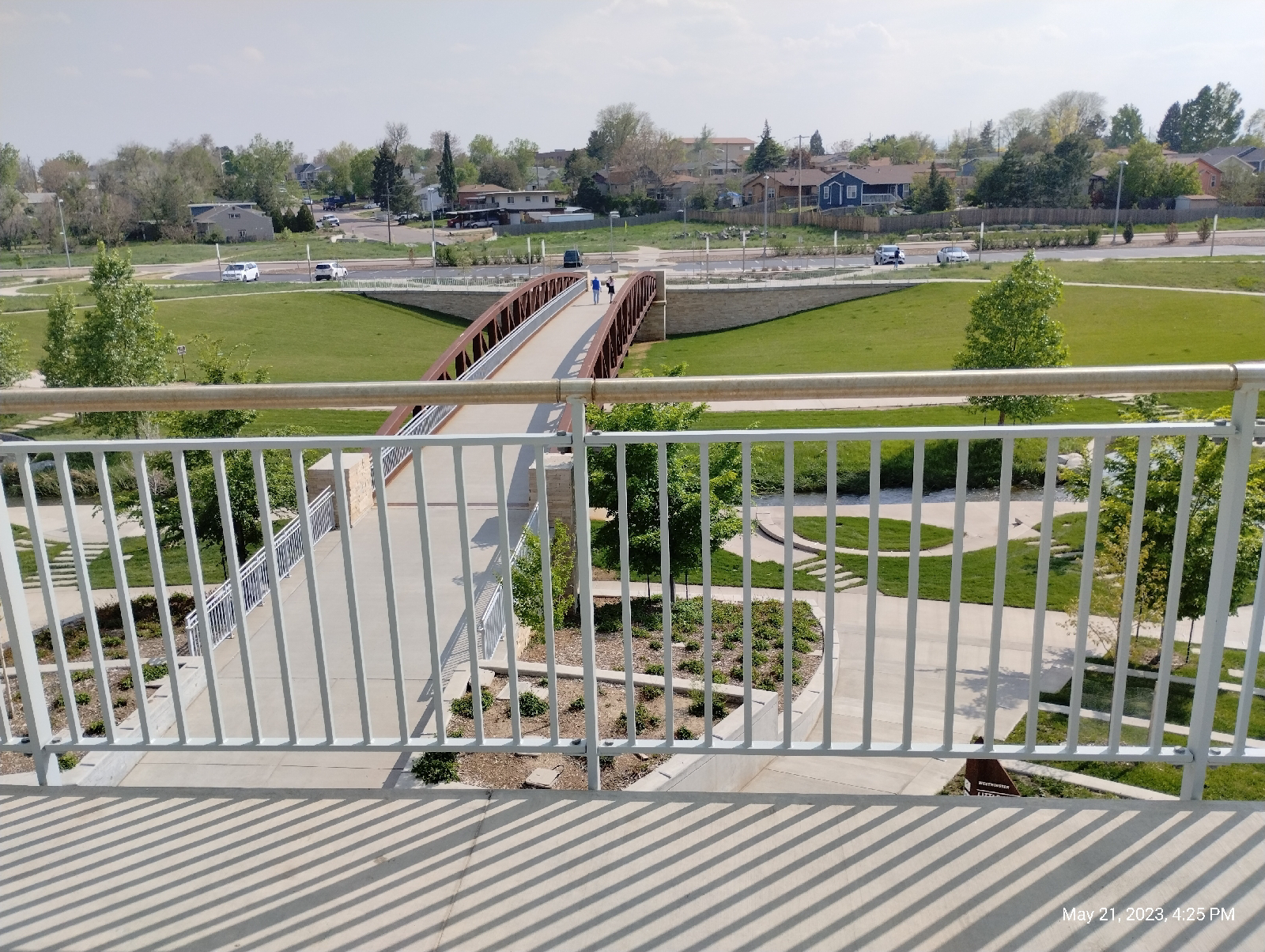
Near Confluence Park are three suspension bridges of innovative design. They're featured prominently in the January 13, 2019 blog, Terminus: Union Station (http://adventuringbcc.blogspot.com/2019/01/terminus-union-station-gold-drew-people.html). Here, the road bed is supported by cables attached to one or more masts. These two masts are curved outward to counteract the tendency of the weight they're carrying to pull them together. They're also springy (remember the old saying, a flexible tree doesn't break in the wind"), so you might have a little more bounce in your step as you cross the South Platte River pedestrian bridge.

Millennium Bridge from the South Platte River bridge.

Highlands pedestrian bridge from the South Platte River bridge.

All three bridges are in line and visible from each other.

This striking building, at the edge of downtown Denver, is a condominium called "the Riverfront Tower". It was built in 2002 and if you want to live there, be ready to shell out the $$$, because it's right in the middle of everything. At this writing, space goes for over $700 per square foot per month. You can sit in Commons Park and gaze at it for free. (I also like to watch humans and dogs play catch there.)

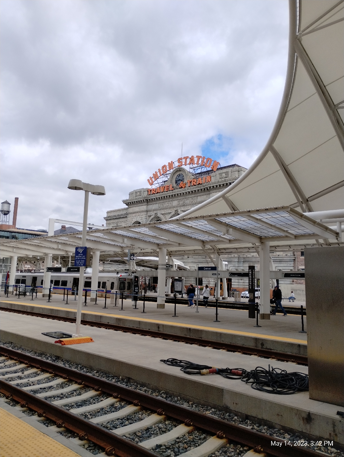
This hike (and the W Line) ended at Union Station light rail pavilion. The Millennium Bridge is just to the west (trains pass under it as they pull into the station). The big concrete barrels shown in the photograph above are works of art but, primarily, they are the ventilation shafts for Union Station's underground bus terminal. 

Union Station sits directly on the 105th meridian west. It is one of 24 meridians on which time zones are based. Running north and south, the meridians are imaginary lines of longitude used to describe positions and time zones on the globe. This one is seven hours west of the prime meridian. That means that, when it's noon at Union Station, it's 7:00 pm in Greenwich, England.


How does the topography of your area alter your weather. If it's hilly or mountainous, it might impede winds and air masses as they move across. If you live on the plains, they may crash through with impunity.

If you pay attention, the more you walk in an area, the more you become aware of migration patterns of animals. Have you noticed that habits of animals in your area have shifted? Are new species appearing or old ones disappearing?

Are there any places near you where two streams join? Is there a delta there? If so, what does it look like? Is the water in the streams different colors? Do they mix immediately or can you see the different colored waters further downstream as though there are two streams flowing down the same stream bed?

Bridges are cool! There's likely one near you. Visit it and see if you can tell how the road bed is supported. How does the force from that  weight flow from the road bed to the ground. Most energy, to be useful, has to flow from a source to a sink. For instance, in an electrical circuit, electrical force is produced by a battery or generator, some of the force is lost to heat in a load, and the rest travels into a ground. In a microscope, light is reflected from a small object, magnified by lenses, and collected by your eyes' retinas. If most of the force of a road's weight was not directed through a bridge's structure into the ground, it would strain the bridge's structural members and eventually break them.

Monday, February 3, 2020

Terminus: Boulder

It was a nice day to take a walk.

This terminus hike was different in that it wasn't a train terminal. There is a fleet of buses that run regularly from Union Station in Denver to Downtown Boulder Station in Boulder. Designated FF1 through FF7, they make different stops on the way. FF2 is the express, so I took it out. "FF" stands for "Flatirons Flier" named after the huge outcrop of iron laden sandstone that looms over Boulder.
[Flatirons from downtown Boulder]

Unlike the commuter buses that run in Denver, the Flatiron Fliers are comfy cross country buses. I almost expect a steward to come out on the way and offer little cups of soda and peanuts. It's a long ride, but a nice one through the mesa country north of Denver.

The Fliers run through the first area I lived in when I moved to Colorado, Broomfield. Looking back through the blogs, you can find past hikes I took near Superior, Colorado and Flatiron Junction.
Downtown Boulder looks a little "small town" but the city is home to a very big school, the University of Colorado, and it's a major Colorado tourist destination. Situated at the mouth of Boulder Canyon, it's a gateway to the Rockies known for its shopping and nightlife.

Watch the traffic - it's also known for reckless drivers.

From the bus station, I walked down to the little bandshell amphitheater located on Boulder Creek. Boulder Creek Trail parallels the creek through town and into the canyon. It's well traveled by students, tourists, and resident joggers, but not such that it's not a corridor for wildlife. The town loves its animals. It's the first place in the US to give pets the status of personhood.
Boulder Creek Trail is a nice walk, ending at the west end in Eben G. Fine Park. Eben Givens Fine was a community builder who moved to Boulder from Missouri in 1886 and took a job as a pharmacist in a local drug store.

[Boulder Public Library from Boulder Creek]

[Boulder Creek]

[Boulder Creek at Eben Fine Park]

A tunnel under Canyon Road connects Eben Fine Park with Settlers and Red Rocks Park. "Red Rocks" may sound like plagiarism. After all, Red Rocks Park is near Morrison, but, in fact, it's the same Red Rocks, known also as the Fountain Formation, that pops up in places along the Front Range from Wyoming to New Mexico. The red rock is arkose conglomerate and the "red" is mostly iron rich feldspar that was recrystallized under pressure from stuff washed out of the mountains after the uplift that formed the Rockies. [Correction. It was debris from the Ancestral Rockies. ]

(By the way, if you're curious, the word "plagiarism" is from the Latin word "plagiarius" which means "kidnapping".)


[Red Rocks at Red Rocks Park in Boulder]

I returned to the bus station along Pearl Street, especially known for its shops, restaurants and nightlife.

[Pearl Street]

Since I was in no hurry to get back home (I needed a rest and the hike was short - it was just a little after noon when I left Boulder.) I took the first Flatirons Flier to leave, the FF1, which stops at pretty much every stop along the route. 

Thursday, October 31, 2019

New location, first excursion

This one was about dental work...very interesting but probably not for everyone, but it did give me an opportunity to check out some of the neighborhood. 

The roads here are a spaghetti mess so they're taking some time for me to learn, but that does mean that there's little though traffic and not much opportunity to get up speed driving. It really is a quiet little neighborhood. Unlike an HOA, it looks like people live around here. It's not junky but people work on their cars in the yard and the lawns are not homogeneous and manicured. I think I'll like these people.

A short walk from our house, on the street we have been using to get home, is a park that has Little Dry Creek (which I have never seen dry, and is named after the Little that Littleton is named after, not because it is necessarily smaller than Dry Creek) flowing through it. It provides a convenient corridor to the major road that forms the eastern boundary of the neighborhood. 


[Walnut Hill Park]

Part of the South Suburban Parks and Recreation trail system, this trail links up with an extensive network of walking, biking, and connector trails. The trails in the Denver area are intended to be an alternative to vehicular traffic.

This is the second snow of Autumn 2019 and the combination of snow, traffic, and mountains is pretty much iconic for Denver.


[Shots around Centennial]

I caught the RTD light rail from the Dry Creek Station, about a mile and a half walk from my house, but on the return trip I checked out the Arapahoe Station which seems closer. I'm sure I'll have photos of that in later articles.

[Dry Creek Station]

I'll be recuperating from our move for the rest of the week but will start my morning doctor-prescribed walks next week with excursions around the corners of our neighborhood. Hopefully I'll find interesting things to post.

Relocations are irritating and exhausting but, for the adventurer, they mean new environments and opportunities for chance to take you into new territories. If you just have to relocate, take advantage of your new surroundings. New is good.