Wednesday, April 26, 2023

Waterfalls

Land isn't static. It moves. It boils from the sea bed at mid-oceanic rifts to add onto tectonic plates and billion years old cratons. Continents crash together causing them to buckle in places. The land rised and dips like a rug under furniture that never visibly moves...but moves anyway.

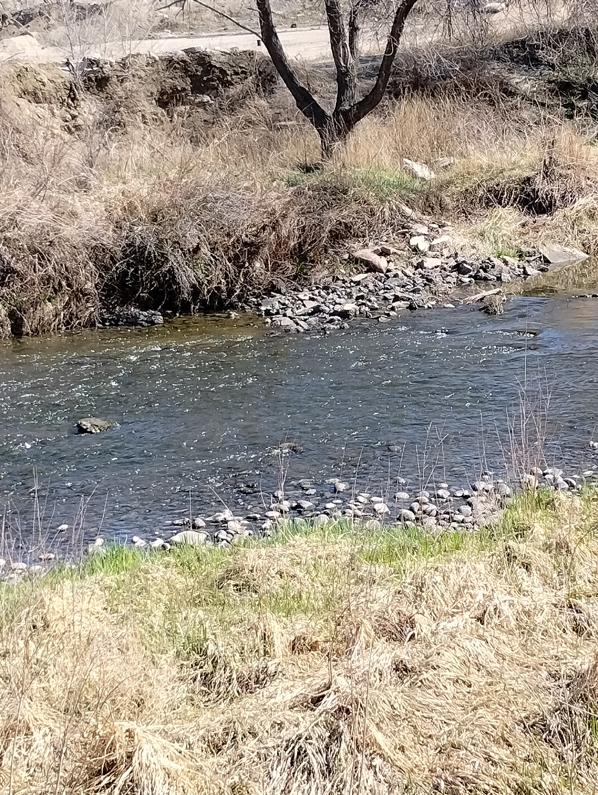
And as land rises, water runs off. It establishes a course and keeps to it, eating ever deeper into the land beneath it. The spinning Earth moves out from under it making it squirm. Water is ticklish. It wiggles and vibrates. It meanders.

And when it gets to the edge of a bulge, it falls. It is the visible embodiment of gravity. Rarely does it go against gravity. Old Faithful comes to mind, and the Upside Down Falls in Hawaii. But, inevitably, down it comes.

Boulder Falls, Boulder Canyon, Colorado

Waterfalls travel. They travel down through the rock they flow over to form valleys and canyons, and they travel upstream. For instance, 12,000 years ago, Niagra Falls was 7 miles closer to Lake Ontario than it is today and it continues to move upstream. Waterfalls travel upstream until they have carved out a path of low slope along the length of the stream 

Waterfalls have personalities. They're all different. Let me introduce you to some of the waterfalls I've known.I regret the number of photographs that I've lost over the years but images of all these falls are on the Internet. I'll share links but, remember, links aren't forever. If one goes away, just use your browser to find another.

I left the Southeastern United States only a handful of times, so I haven't seen the tallest waterfall in the world, Angel Falls in Venezuela (https://en.wikipedia.org/wiki/Angel_Falls?wprov=sfla1), or even the tallest in the coterminous U.S., Colonial Creek Falls in Washington State (https://alchetron.com/Colonial-Creek-Falls). There are world famous falls like Niagara falls (https://en.wikipedia.org/wiki/Niagara_Falls?wprov=sfla1) and Cumberland Falls (https://en.wikipedia.org/wiki/Cumberland_Falls?wprov=sfla1) that I haven't seen. There are things that are debatable that I, personally, distinguish from waterfalls. If they were included, the absolutely tallest waterfalls on Earth are underwater, where dense cold water currents drop from continental shelves to very deep ocean floors. I also don't consider something a fall if it doesn't drop vertically. Cascade Falls in Colorado (https://www.coloradoguy.com/cascade-falls/chaffeecounty-co.htm) is a cascade, not a fall. Those excepted, I can give you examples of all the kinds of waterfalls.

Usually, when people envision a waterfall, they think of the plunge type, where the falling water loses contact with the rock wall behind it.

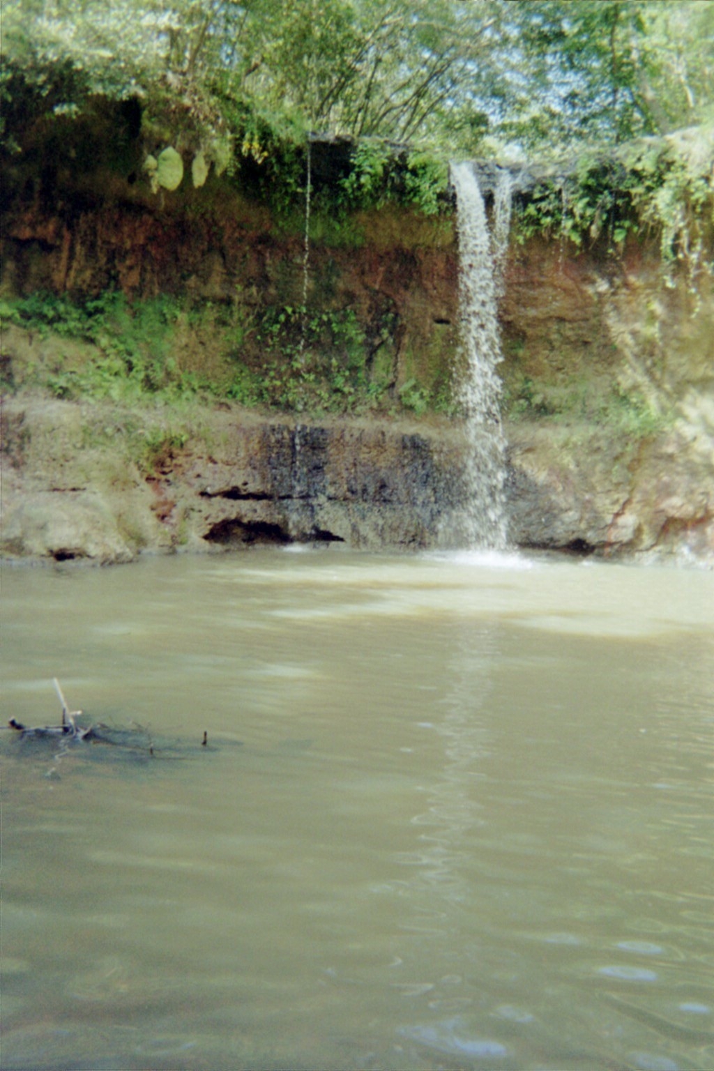
Waterfall in River Falls, Alabama. (see the blog for Wednesday, August 9, 2017, Your Adventure)

People don't usually talk about going to Alabama on vacation but there are many things to recommend it, especially for outdoor enthusiasts and geotourists. It packs a lot in from the mountains, caverns, and space history in the northeast and canyons in the northwest to surprising mineral finds in the hilly central lands to the southern plains, swamps, and beaches, the parks are well maintained and there's a brochure, "One Hundred Dishes to Eat in Alabama Before You Die" that you really should reference.

I've heard that there are more waterfalls in Alabama than any state in the contiguous United States. I'm suspicious. Officially, Washington State has that distinction. I've also seen a map from an study that said that Alabama has 112 waterfalls. The authors should actually go to Alabama.

At one time, I conceived of the project of surveying all the waterfalls in Alabama. I quickly realized my error. I couldn't live long enough to visit them all.

A very surprising thing about Alabama is the number of waterfalls on the seaboard side of the fall line.

A fall line is an geographic boundary that separates the hard igneous and metamorphic rocks of a highland area from the softer sedimentary materials of a coastal plane. When rivers cross that boundary, they will often dig in and gouge out a waterfall. Above the fall line, waterfalls are often common; below, they're usually rare. For instance, in Georgia, waterfalls are scattered throughout the mountains all the way down to the fall line that passes through Columbus and Macon but try to find one to the south.

Across the Chattahoochee River in Alabama, nature made a joke. The fall line runs through Montgomery and Selma and then turns north to Tuscaloosa, but there are several significant waterfalls to the south as far as Mount Vernon, just a little over 30 miles north of the Gulf of Mexico. The Alabama Piedmont stops 200 miles to the north in Selma.

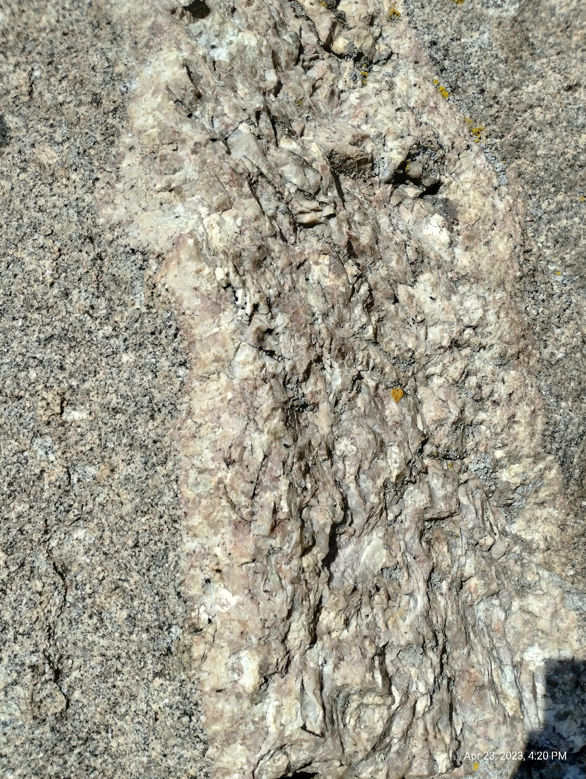
The waterfall shown above is in River Falls, Alabama near Enterprise. It's located on a tributary of the Conecuh River. A lot of the falls south of the Alabama fall line look like that. The ground is little more than mud so the stream has little difficulty cutting through it. Here, there's a thin, sandy, resistant layer capping the clayey stone of the coastal plain. The wall behind the fall is soft and easily undercut by flooding. The mists rising from the splash pool soften and oxidize it, speeding erosion. Flash floods are not rare here.

I suspect that this waterfall started out as a "pothole" in the bed of the creek and just widened out, drilling down into the landscape.

Little River Falls

In a horsetail waterfall, the water maintains contact with the bedrock. 

I haven't seen many river falls like Niagara or Cumberland Falls. Fact is, there are not a lot since dams often get built over them. Check out Great Falls in Montana (https://en.wikipedia.org/wiki/Big_Falls_%28Missouri_River_waterfall%29?wprov=sfla1). I've seen the bottom few cascades. The rest is no more. That monster almost ended Lewis and Clark's expedition to the Pacific Ocean. Also, many river falls have been around so long that they have worn themselves down to nothing.

Little River, in northeast Alabama has the distinction of being a river that runs it's entire course on a mountain. It, in fact, cuts down through Lookout Mountain which begins in Tennessee and then slants down through Georgia into Alabama. It is protected by the Little River Canyon National Preserve.

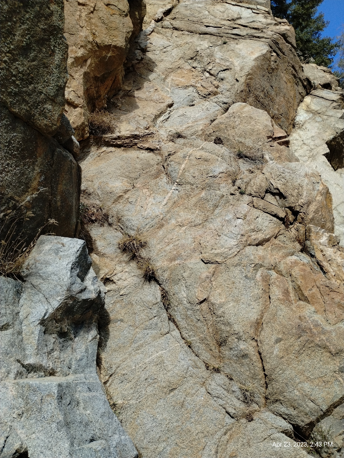
The river drops into the canyon here at Little River Falls. The rocks are hard sandstones of the Pottsville formation. When I say that they are Pennsylvanian, that might ring a bell. While the Fountain formation out west was being laid down as sand in a relatively quiet ocean, the Pottsville formation was being washed out of a much older Appalachian Mountains into a depression in the earth, a wrinkle caused when Europe and Africa crashed into North America's east coast. Lookout Mountain is a feature of the eastern Piedmont much as the foothills of the Rockies are features of the Colorado Piedmont. The Appalachian Mountains, now worn down to their roots, pretty much end where the Tennessee River cuts across northern Alabama. The Piedmont slopes far down to Selma in south Central Alabama. The last two named rises, Parker Mountain and Mount Baber, are just outside Selma. Hills to the south of Selma are the result of erosion by the many streams in southern Alabama.

The tallest waterfall in the state, Grace's High Falls, at 134 feet, is also in the Little River Canyon.

DeSoto Falls

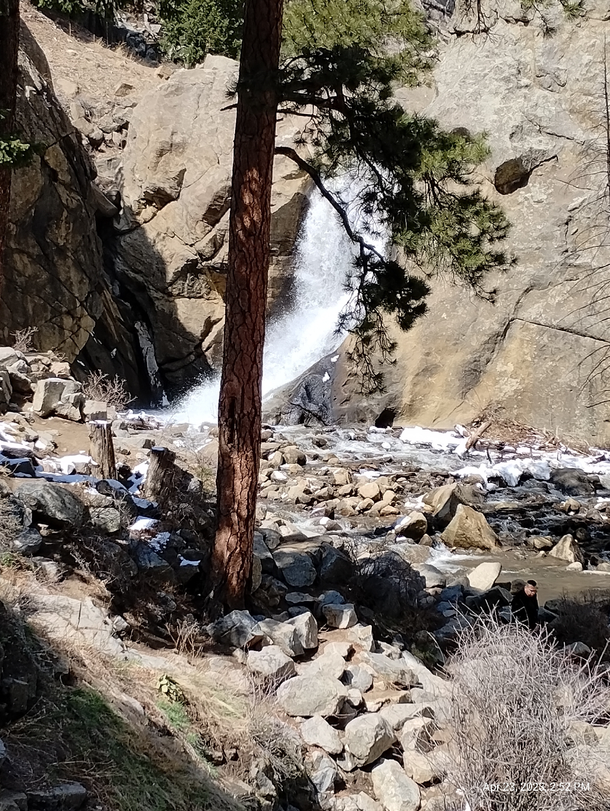
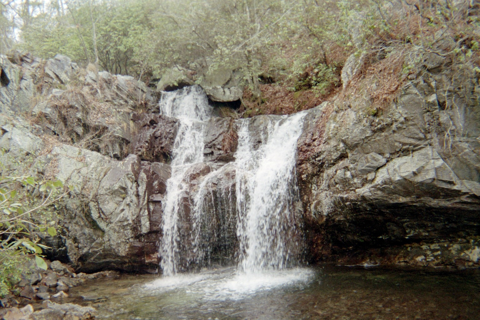
A cataract is a large waterfall. As an example, DeSoto Falls, shown above, is upstream from Little River Falls. It cuts through the same tough Pottsville formation that predominates on Lookout Mountain.

An overlook is breathtakingly (downright scarily) posed over the 107 foot fall, leading to a staple in the stone wall. A staple is just what it sounds like, only several thousand times bigger. It once attached part of a hydroelectric conduit from the dam (which is still upstream from the falls) to the wall of the canyon. There wasn't a guard rail there when I took this picture so be careful. It's a long way down.

Arthur Abernathy Miller built the dam in 1925 to generate electricity to nearby cities like Mentone and Fort Payne. He had already supplied electricity to cities in Virginia and West Virginia, and this was the first hydroelectric dam in Alabama. He eventually sold the project to Alabama Power and the generator is long gone.

This waterfall is also a multi-step falls. Below the 20 foot high dam, the river drops over a rock shelf about ten feet.

High Falls, Alabama

One of my favorite multi-step waterfalls is High Falls between Talladega and Ashland, Alabama. Here a stream cascades over the metamorphic rocks of the Talladega group in three drops. Each part has it's own splash pond. Also see the Tuesday, February 5, 2019 blog, "The long and short of it" for more pictures of this beautiful waterfall. The stream drains water off the slopes of Alabama's highest mountain, Mount Cheaha (2407 foot summit).

When a waterfall drops in stages without intervening splash pools, it's usually called a tiered waterfall.

Block falls are places where large streams or rivers drop over a rock shelf. Catoma Creek is a broad tributary of the Alabama River along the southern city limits of Montgomery, Alabama. Catoma Creek Falls (https://www.facebook.com/nomadicleprechaun/posts/catoma-creek-in-montgomery-al-actually-did-pretty-good-while-not-as-big-as-my-mi/681898702262173/) jumps a low (maybe ten foot high) self of sedimentary rock. Just looking at the rock, it's evident that it's loaded with fossils. The area was also the site of a Native American town.

In a segmented waterfall, the water goes over a ledge in several distinct streams.

Devil's Den, Cheaha State Park, Alabama

Cheaha Creek, in Cheaha State Park in Alabama, splits into several streams at Devil's Den.

A fan waterfall comes off its rock ledge as a relatively narrow dream but widens as it falls.

One of my favorite hikes is U.S. 64 between Highlands and Franklin, North Carolina. It parallels the Cullasaja River, which, for the first ten miles pours over one rock shelf after another. Highlands itself is surrounded by outcrops of igneous material, but the rest of the 20 mile route is over metamorphic material and the tortured rock is reflected by the path of the river. The last 10 miles is more serene, looking like a postcard of an alpine valley, chalets and all.

The Cullasaja River begins at Sequoyah Lake, just north of Highlands, and starts down through the mountains into the Little Tennessee River valley. The first waterfall is Bridal Veil ( https://www.romanticasheville.com/bridal_veil_falls_highlands.htm) on a tributary creek. It's distinctive because a loop of the main road curves around in back of the waterfall. The rock is loaded with rhodolite garnet, an unusual, rose colored intermediate between pyrope and almandine. We also used to find carnivorous sundew plants on the moist cliff beside the falls.

Close by, the main river channel takes the Cullasaja over Dry Falls (https://en.wikipedia.org/wiki/Dry_Falls_%28North_Carolina%29?wprov=sfla1), a thundering cataract with a trail that leads visitors behind the curtain of water. 

After a few more miles of almost constant cascades, the river enters a slot canyon, a place where the broad river squeezes through a narrow trough in the rock. It emerges at the edge of 200+ foot Cullasaja Falls (https://en.wikipedia.org/wiki/Cullasaja_Falls?wprov=sfla1). It takes about two tenths of a mile to fan out over cascades to finally plummet into the valley.

It's not easy seeing the falls from the road. You have to look quickly as I.S. 64 curls around a rock wall with a low rock curb dropping to the valley floor far below. This part of the hike is terrifying. There is a tiny pull off a little further north where you can park and get a good look.

I had seen photos of the falls from the bottom so I knew that there had to be a way down (unless they let bikini clad ladies down in there by helicopter). On a solo hike, I started looking around the overlook and, sure enough, there was a narrow trail, almost invisible, passing through some bushes to a precipitous rock face with a cable strung across that hikers could hold on to in transit. On the other side, the trail continued in switchbacks down to the base of the falls.

My first thought was "why here? Half way between Highlands and Franklin," but, of course, in a few thousand years, it will move a mile or so south and, eventually, it will build back into and annihilate Sequoyah Lake.

Look back at Boulder Falls above. It's also a slot waterfall.

Some waterfalls drop through slots in a rock wall. Raven Cliff Falls ( https://www.atlantatrails.com/hiking-trails/hiking-to-raven-cliff-falls) in northern Georgia and the waterfall in Roaring River State Park in Missouri ( https://www.tripadvisor.com/Attraction_Review-g44216-d2265033-Reviews-Roaring_River_State_Park-Cassville_Missouri.html) are good examples.

Hanging falls look similar for different reasons. Glaciers grind out broad U-shaped valleys and tributaries that once flowed down gradual slopes to a primary river suddenly have to jump off a high cliff. Often, the tributary itself froze for a time to form a tributary glacier and, when it receded, it left its own U-shaped valley.

Bridalveil Falls in Yosemite Park in California (https://en.wikipedia.org/wiki/Bridalveil_Fall?wprov=sfla1) is a good example of a hanging waterfall.

In addition to the regular types of waterfalls, there are some weird variations.

Many caves feature waterfalls, either falling from the surface via a sinkhole or totally underground, like Ruby Falls (https://www.rubyfalls.com) inside Lookout Mountain in Tennessee.

There is even an upsidedown waterfall in Hawaii, Waipuhia Falls (https://mauihacks.com/see-the-waipuhia-falls-the-upside-down-waterfall). It falls so far, and the wind is consistently so strong, that the water doesn't reach the bottom. It just turns into spray which is blown back up.

One thing that draws me to waterfalls is their fascinating variety. They're uncommon on plain areas of the Earth, but in most places, there will be waterfalls a days drive away. Are there any near you? What kind of landscape do they inhabit? How do the rocks and the water work together to produce their distinctive natures?

Thursday, April 20, 2023

Boulder Canyon

A million years is an inconceivably long time to a human. A billion years is a thousand of those. There are rocks in this area that are 1.7 billion years old (give or take a few.) There have been at least three "Rocky Mountains" in that time.

One Sunday, I took trains and buses up to Boulder, Colorado to look around. As usual, my trip started at Arapahoe at Village Center Station, but that was unremarkable (except very early for me. My body was protesting). The adventure really started here:

in the underground bus terminal at Union Station in Denver. When the original sewers were decommissioned, this part was repurposed for waiting bus patrons. Just about all subsets of humanity (and several subsets of canininity) come through here eventually, so it's a great place to people watch. But there are guards everywhere and they don't want you sitting on the floor. 

I waited about an hour for the Flatiron Flier to Boulder. This is a good route to view the high plains north of Denver. This is mesa country. Sometimes (like driving across Kansas) it's difficult to tell that the plains aren't really flat but it's pretty obvious here where hills like Lake Mesa and Davidson Mass provide plenty of contour. It's all fairly new (less than 2 million years old) sediments washed out of the mountains. Some of the older stuff, called the Laramie formation, around 100 million years old, has been mined for coal near Superior, Colorado. Keep in mind that the Laramie Orogeny, the mountain building event that created the current Rockies, happened between 80 and 35 million years ago. Coal forms from lowland plants in marshy areas. Colorado was low and wet back then. I've spent some time wandering around out there (Wednesday, June 21, 2017, Flatirons Crossing).

I disembarked the bus at Euclid and Broadway, right in front of the Henderson Museum. Just about anywhere in Boulder that trees or buildings don't block the view is a good place to see the Flatirons, named for their resemblance to the domestic contraption. 


They are, in fact, part of the same formation that includes Red Rocks Amphitheater near Denver and the Garden of the Gods in Colorado Springs.

The eastern facade of the Rocky Mountains is well ordered in Colorado. It springs abruptly from the plains and can be seen a hundred miles to the east. It was an imposing and dreadful site to the early pioneers trying for California.

The foothills: Green Mountain, the Table Mountains near Golden, mesas and Mount Carbon, are just stuff that washed out of the rising Rockies (with a few older layers surfacing). The actual wall begins with the (still sedimentary) Dakota hogback. Then the Fountain formation covers the first of the Rockies like a blanket. Then the actual mountains of the Front Range soar skyward.

The Fountain formation used to be horizontal, flat. It was sand laid down by an inland sea between 290 and 340 million years ago, what geologists call the Pennsylvanian age. It was at the edge of the new Rocky Mountains when they were uplifted so they were cracked open and tilted skyward and that is exactly how the slabs of sandstone called "the Flatirons" appear. I'm reminded of the scenes in the movie 2012 as California folded up and toppled into the sea.

But that doesn't seem to be how it was. Judging by studies of stream erosion and other means, the Rockies seemed to be uplifted in three steps, each very slow by human standards. The initial uplift happened between 80 and 50 million years ago. The land rose about a kilometer at the rate of about three hundredths of a millimeter per year...hardly breathtaking. The second stage began about 35 million years ago and continued for about 20 million years. That brought the Rockies up another kilometer and a half at a breakneck speed of six hundredths of a millimeter per year. The last phase of uplift began about five million years ago and is still going on. Come to Colorado and watch the mountains grow! (Heh) This data is from a study published by G. G. Roberts, N. J. White, G. L. Martin-Brandis, and A. G. Crosby entitled "An uplift history of the Colorado Plateau and its surroundings from inverse modeling of longitudinal river profiles" (August 16, 2012, https://doi.org/10.1029/2012TC003107)

Most of the rocks of the Fountain formation are red, gray, or black. The color is from iron that was in the sediments. It rusted, like iron does.

I checked my altitude by GPS at the bus stop in Boulder. It was 1611.44 meters (that's 5287 feet, roughly a mile.) I am gratified at how much better I feel at this height than when I first visited the Denver area.
The Henderson Museum, the University of Colorado's museum of natural history, is a small affair with four rooms of exhibits, some permanent, some changes over time since it is an educational museum with students learning to curate.

There is no admission fee (they do appreciate donations) and there is a lounge with vending machines and places to sit and rest and make notes. One of the permanent collections (shown above) shows mostly local fossils, a wide range of plant, invertebrate, dinosaur, and mammal species. There's also a lot of cultural and historical exhibits, as well as current and historical science.

The building, like many of the cyclopean structures on the University of Colorado campus, is constructed of Lyons sandstone quarried nearby. The material was deposited by an inland sea around 250 million years ago. It's a very tough, fine grained, pretty stone that occurs in horizontal layers that are easy to quarry. See?

After a bite and a milkshake, I caught the NB2 bus up Boulder Creek Canyon to Boulder Falls. I figure NB stands for "Nederland bus" since it runs between Boulder and Nederland, Colorado. (Eh. It might stand for Nederland Boulder. Who knows?)

The Stony heart of the mountains is disclosed here. Boulder Creek has cut right down through it. I took another altimeter reading and found that I was about 2200 meters (7218 feet or about 1.4 miles)  above sea level. That's 589 meters (1932 feet) above Boulder. 
The elevation up there is 7886 feet (according to the topographic map on the AllTrails app.) The creek has cut 668 feet through hard granite. (More actually since "up there" has been worn down considerably over the millennia and the creek was another 20 feet below me.)


The oldest rock in Colorado is a 2.5 billion years old mass of quartzite in the northwestern corner of the state. Colorado was beachfront property near the equator when an arc of volcanic islands crashed into it piling up debris like a pileup on a California turnpike. Later collisions added landmass to what geologists call the "Wyoming Province". This early formed piece of crust, called a craton (Greek for "shield") formed a permanent part of the North American tectonic plate.

About 1.7 billion years ago, a second collision to the south caused widespread melting in the crust that hardened to form the Routt Plutonic Suite, the early core of what would be the Rocky Mountains. That's what one sees here in the Boulder Creek Canyon. Technically, the rock isn't granite. It's granodiorite, but I can't tell the difference. Granite has potassium (orthoclase or microcline) feldspar and granodiorite has sodium (plagioclase or andesite) feldspar. The only way to tell the difference is by thin section microscopy or chemical analysis, neither of which I have access to. But granitic, it definitely is. The photo above shows the white grains of quartz and white and pink feldspar and the dark hornblende clearly. Some of the dark grains are biotite mica.

All the granite is broken into big blocks. It was buried for millennia under thousands of feet of sediments. When the pressure came off through erosion, the rock expanded like a spring and cracked. Water seeped into the cracks and, by repeated freezing and thawing, expanding and melting, wedged the cracks further apart. Eventually, it all goes down into the creek to be washed to the Platte River, then the Mississippi down to the Gulf of Mexico. Chunks of granite erode to rough spheres, thus, "boulders".

The rocks are grainy because they solidified far underground from vast bodies of molten magma where they had plenty of time to form crystals. Molten rock that's ejected onto the surface of the Earth as lava cool quickly and present either a fine grained or glassy texture. I saw several pockets of large crystals of feldspar in the rock walls. The minerals fall out of melt in a definite order and, when they get a chance, will clump together like that. Quartz is the last to solidify. It usually forms the matrix in these grainy igneous rocks.

The rocks in Boulder Canyon are crosscut by numerous faults, veins and dikes. The faults are where large bodies of rock have broken and slide against each other.

Cracks in the rocks serve as conduits for mineral rich waters under high temperature and pressure. They deposit their mineral loads into the cracks to form veins. 

Molten rock flowed into cracks, pushing the solid granite apart and hardening to form dikes of different igneous rock.

Granite carries mica that gives it a flaky texture and when it expands as pressure is taken off by erosion, it sheers off big curved sheets. The process is called "spalling" and it's evident in several places in the canyon.

I didn't really expect much from Boulder Falls. The photographs I've seen portray it as not much more than a cascade. The photographs don't do it justice 

I tried. I think the problem is that the surrounding canyon walls just dwarf the 70 foot torrent from the slot canyon. It's a respectable cataract.

It's also popular so, if you visit, prepare for people watching. The falls are visible from the road. It's a very short hike (with stone steps in the canyon wall and handrails where needed.)

I'm a fanatic for waterfalls, so I think I'll devote a whole blog to them soon.

Having satisfied myself that the bus trip to Boulder Falls was well worth the time and effort, I waited for NB1 on its return route from Nederland and rode as far as Fourmile Canyon. I wanted to do at least a little footwork. 

The Boulder Creek Path runs through the last few miles of Boulder Canyon before it opens out directly into Boulder, Colorado at Eben G. Fine Park. There are signs of human construction there that were probably erased in the big flood of 2013 which destroyed...well, a lot.

The creek gives. It's pretty much why Boulder was established February 10, 1859...gold, of course. And the creek takes away. 2013 wasn't the only disastrous flood ever to roar out of Boulder Canyon. I was in Selma, Alabama at the time but my current family was already in nearby Broomfield, so I watched the news closely. It turned out that they were in no danger.

But the creek has taken a lot more than construction. The front wall of the Rockies...the hogback and Fountain formation have been all but obliterated along the Creek's path. There is a brief area of Dakota sandstone just before the mouth of the canyon. It's not enough to call a hogback.

See the deer?


There is a lot of wildlife in the canyon but this is all I spotted on this Sunday.

There are a few vestiges of the Fountain formation in Red Rocks Park across the creek from Eben Fine.

These are the same kinds of rock sculptures as those in Red Rocks Park in Morrison, Roxborough Park near Littleton, or the Garden of the Gods in Colorado Springs. In fact, there are "red rock" formations that extend through Wyoming and Colorado. If they are a sedimentary blanket that was pushed up by the Colorado uplift, do they appear in areas other than the eastern margin of the Rockies? 

Indeed they do. They form huge rock sculptures near Woodland, Colorado, west of Pikes Peak.

And also show up on the western slopes as the Maroon Bells. 

After a grueling hike up "The Hill" in search of a Flatirons Flier bus stop, I took a long (and welcomed) bus/train ride back home.


I started this blog with inconceivably long periods of time. I guess I should add some caveats and explanations here.

People talk about "Big History", that is, the history of everything from the beginning of the universe to the end and all the reality forming, universe shaking events between. I'm bothered by the term "history" here. In my view, history is "what happened". If it's history, then someone experienced it and recorded it. We have no records of experiences from millions and billions of years ago.

So, why would I say that the Laramie formation is one hundred million years old?

Best guess.

Based on what we know about how the world works, the most cohesive view of "Big History" involves millions of years and lots of trial and error by nature. One way that we have of "knowing" is time measurements by measuring the amount of radioactive elements in an object. For rocks, it's usually uranium or thorium. The isotopes we look at decay so slowly that there will always be some around. But we do know how fast they decay, we know what they change into, and we're pretty sure that we haven't lost or gained any from the beginning. Uranium and thorium are far too heavy for us to lose into space and the amount found in rocks is trapped there. If we gain these heavy elements, say, in meteorites, well, that would mean that the rocks are even older.

Keep in mind that it's not the amount of elements in the rocks that we look at, it's the ratio of their concentration to the concentration of the elements they decay to...or I should say "element" since most of them decay to lead. So once a rock forms, it has the amount of radioactive material it will have trapped in it. As time goes on, the radioactive element decays at a fixed rate. Today, we can check to see how much, say, uranium there is in the rock compared to the amount of lead, and we can calculate the time since it formed.

How old are the rocks in your area. Some people are surprised to find that the Appalachian Mountains in eastern North America are much older than the Rockies. You can learn a lot about your geology from geologic maps of your area. I use an app called Rockd (by Macrostrat Labs at the University of Wisconsin - Madison) to pull up geologic maps and information about local geology in many places worldwide.

Monday, April 17, 2023

Clear Creek Station to Pecos Junction Station

A nice thing about train rides to hikes in Denver is that the stations are often situated to provide good vistas of where you're going.

The snowcap is Mount Blue Sky (formerly Mount Evans). The double peaked mountain in the foreground just to the right of the power pole is Mount Morrison. Red Rocks Park and Amphitheater is at the base of Mount Morrison. The view is from the train as it is pulling into Broadway Station.

 
On this trip, I'm going thataway. The low mountain in the foreground is Green Mountain. It's one of the foothills between the Rockies and the Colorado Piedmont, a pile of the stuff washed out of the Rocky Mountains and the Ancestral Rockies. Behind the Home Depot are the Table Mountains. That's the direction I'm going. No clouds, it should be a clear day for a short hike.


Olde Town Arvada is convenient on this route, so, being the milkshake fanatic that I am, I make a stop on the G Line before each hike to get a snack. In my wandering, I spotted this Catholic church, the Shrine of St. Anne's. The cornerstone was dedicated in 1920, making it a product of the "wild west". 

Saint Anne was the mother of Mary, who was the mother of Jesus.

After Olde Town, I reboarded the train and headed for Clear Creek Station. 

Clear Creek and Clear Creek Trail is just down the hill. 

This leg of the G Line hikes is basically a walk around the perimeter of Martin-Marietta's asphalt plant, a little over two miles. 

I had planned to take a sample of the sand from the Creek bed to look at, but it turned out to be black mud, so I changed my mind.

 The huge piles of asphalt were too near. I have to credit Martin-Marrietta, though, the area didn't stink of asphalt so they must be taking some concern for the environment.

I'm sure you're familiar with asphalt. It's what they pave roads with. Asphalt, or bitumen, is a sticky, semisolid material that is either derived from petroleum (the heavy part left after the oil is refined) or is drawn directly from the ground. Bitumen mixed with clay, the material actually used to pave roads, is also called "asphalt". I don't know where this stuff in these pictures is from but the Pierre shales that surround the Denver Basin contain a lot of petroleum and there are many wells to the north and east.

Another confluence...this is where Little Dry Creek joins Clear Creek. The actual confluence has been altered by an artificial pond. There are several such ponds between Arvada and Denver and they seem to be popular with anglers. I met several on this trip.

This Little Dry Creek isn't the same one that runs through my neighborhood but I have visited it before at the Westminster Station (Friday, June 21, 2019, Terminus: Westminster).

This isn't the horse I rode in on. It's traveling the B Line from Westminster Station to Pecos Junction. I'll hike that one after I finish the G Line.

Again, I have to commend Martin-Marrietta. The installation is very near Little Dry Creek Lake (pictured above) and the lake is popular with anglers and water fowl alike.

Clear Creek is a respectable stream here. I'll be separating from it after this hike because it heads north east away from the G Line, which takes a 90° turn south on it's approach to downtown and Union Station. I'll be following Pecos south to 38th Avenue,then east to Fox Street. That'll get me to Fox Station, and the following hike along Fox Street will take me to the end of the G Line at Union Station.

All of these station-to-station hikes have been above a geologic depression in the Earth's crust called the "Denver Basin". It's a geologic basin instead of a topologic basin because it doesn't show on the surface (or on topological maps). It's far underground buried beneath the Dawson, Arapahoe, and Denver formations.

As the Rocky Mountains began rising up, water was already tearing them down and the erosion products were washing out across the plains. Although it's sorta hard to picture it, over the millions of years between then and now, the rocks of the Earth's crust can bend and flow and squeeze like putty and it did here. As the Colorado Plateau rose, as in counterpoint, the land to the east buckled downward, and as debris piled up, the crust sank under the weight until a great bowl full of dirt, mud, gravel, and boulders formed and then they built Denver right on top. It's a long way down to hard rock...as far as 3900 meters (13000 feet).

If you enlarge the blue diamonds in the pictures above, you can see that Martin-Marrietta is proud of their commendations. NAPA is the National Asphalt Pavement Association and to quote their website the commendation is to "help asphalt mix producers and paving companies improve operations and safety as well as recognize employees and partners for a quality work." So I guess the Pecos Junction plant has something to be proud of.

Again, most of these stations provide good views of the mountains. Up to now, my only exposure to Pecos Junction Station is from the train and the platform is tucked away beneath highway overpasses. It's an important station in that it provides a switching site between the G and B Lines but it's not very scenic being situated in an industrial area 

The parking area is up top with a long, covered pedestrian walkway leading to elevators and stairs down to the platform (always gotta be one last obstacle at the end of a hike!)

The mural on the platform is a piece by Bimmer Torres called "Roots Crossing". It illustrates a primary issue in the area... transportation.

And there I was set to utilitize that very thing and go back home.

I have mixed emotions about industry but I can't readily dismiss it. Our modern world depends on it. What are the industries in your area? How do they fit into your world?

Thursday, April 6, 2023

Arvada Gold Strike Station to Clear Creek Station


Here I am back at Gold Strike Park. In addition to historical information about placier mining in the area, the park features a really cool single-mast cable- stayed bridge. Somewhat smaller than the Millennium Bridge in downtown Denver, the principle is the same. Cables from a single pole suspend the trail bed.
The Rolston Creek Trail crosses Clear Creek here to join the Clear Creek Trail. I went straight on Clear Creek Trail against the direction I came from Arvada and realized I was going the wrong direction. First, the mountains were ahead of me and I should have been heading away from them. Also, the creek was flowing in the opposite direction from my bearing. But I did get to see two people panning for gold.

Placier methods like panning rely on the fact that gold is heavier than almost anything else you might find in a stream bed. The density of gold is around 19.3 grams per cubic centimeter. Sand tends around 1.63 grams per cubic centimeter. Gold will sink right through sand. To pan, you squat down on the bank of a creek (which is why I don't do it. My knees won't tolerate that any more.) and scoop a little sand and water from the bed into a prospector's pan (it looks a lot like a hub cap.) Swirling the contents around allow the heavier material to settle. You can pick the larger chunks of rock out first so you can see what you're doing. Some other stuff might look like the gold you're searching for. Pyrite and some kinds of mica can imitate gold but they're brittle and, while gold gets shinier when wet, pyrite and mica get duller. It takes some skill and a lot of patience to sift through the sand. Gold occurs as nuggets, grains and dust...usually dust, so a dropper is useful for sucking up the tiny particles. Sometimes, you can pan gold out of the sand from the bank of the creek, so a garden trowel can also be useful. 

I didn't ask if they were having any luck. They looked tired.

Many tributaries have swelled Clear Creek by the time it has reached Arvada.

Clear Creek Trail runs along Interstate 76, so most of the scenery is like this with considerable background noise from the constant traffic. Still, it seems popular with bikers and joggers 

But the Rockies are an ever present backdrop to the west.

Ducks seem to like Clear Creek alright.
This single span bridge across Clear Creek uses an arch in the trail bed to keep it steady. In order to buckle, the bed would have to push outward at the ends but the ends are anchored in the creek bank so they won't budge.

A plant nursery along the trail has these bee hives. I don't know if they're there for honey or pollination...maybe both.

At the end of the hike, I was greeted by this huge mural...Diradus by Addison Karl is the largest piece in the RTD light rail collection. It is 190 feet long and 20 feet high.

The retaining wall also included this last challenge.

After scaling 20 feet of upness, I was finally at my destination, Clear Creek-Federsl Station.

One of the nice things about urban hiking in the Denver Metro area is that the grid of streets continue throughout. Wadsworth is west of Sheridan, which is west of Federal, and if you're familiar with the sequence in one part of the area, you can tell pretty much where you are in a part you're not familiar with.

Clear Creek Station has some great views of the Rocky Mountains as far north as Long's Peak.

With a stream, I always have an urge to follow it from the beginning to the end. Often, there are trails that make the trek easier. The plants around streams are different. Wildlife congregate there for water. The sand and gravel hides interesting minerals. Check out the stream near you