Showing posts with label geology. Show all posts

Saturday, April 18, 2026

Roswell: Highway 285 to Berrendo Road - The Land

 Roswell is situated in the northern region of the Chihuahuan desert. Roswell is on the Great Plains. Roswell is grasslands. Roswell isn't obviously karst but it's karst nevertheless  Roswell is flat but not perfectly so. Roswell is dry but Roswell is an oasis.


Roswell is at 33° 23' 39" N 104° 31' 22" W. Selma, Alabama, where I used to live is at coordinates  32° 24' 59", about one degree latitude difference. So why is the environment so different. Selma is forested..... Roswell is desert. We'll get to that later.

The city is at 3,615 feet altitude. People are surprised by that after seeing how flat it is around here 

The Pecos River flows 7 miles to the east of the city. The highlands that rise to Sierra Blanca begins about 40 miles to the west. The Rockies are about 70 miles to the west. In Denver, I had the requisite photo of the Rockies in my blogs. Here, it will be Sierra Blanco. 

The city has an area of 29.776 square miles (according to the United States Census Bureau). Chaves County, of which Roswell is the largest city, has 6,075 square miles. 

There are actually natural streams in Roswell. Some are dry now because the springs that fed them have been repurposed for industry and agriculture, but Spring River in South Roswell still flows (I think. I haven't made it that far yet.)


The land between Berrendo Road and Pine Lodge is primarily landscaped by Berrendo Creek and the Pecos River.


Pine Lodge from my house

It's flat around here. On my 1.7 mile walk into town, I get an elevation gain of 13 feet (according to measurements made by my AllTrails app.)

There is a blog discussing Berrendo Creek and I'll be posting a blog about Bitter Lakes Wildlife Refuge soon. That park is nestled beneath the Comanche Bluffs in the flood plains of the Pecos River  Berrendo Creek meets the Pecos River a little south of this section.

I say that the land is flat here but there is a little topography 


A draw on highway 285 North truck route north of my house.


Road cut on highway 285

The largest incline I'm aware of is the ravine that Berrendo Creek has cut through town, now dry, something between 20 and 30 feet deep.


Berrendo Creek 

Like the Denver area, the Chihuahuan desert was once an inland sea and many layers of sand, lime, and gypsum have been laid down to make up the rock under my feet. The ground outside looks like ceramic but is actually soft.


Desert soil

It is limestone, or at least dust blown in from limestone. That's evident when it's mixed with vinegar.


If you want to know if a substance contains a carbonate, just add acid. Vinegar is a weak acid but it will make calcite (calcium carbonate) fizz quite nicely, giving off carbon dioxide and leaving calcium acetate behind in solution. Dolomite (magnesium carbonate) may need a little warming to effervesce.

The main bedrocks in the area are limestone and shale but there have been a lot of diverse layers laid down over a long time. My primary source is the strategraphic column provided by the Rockd geology app. (Childs, O.E. (1985) Correlation of strategraphic units of North America, COSUNA.AAPG Bulletin 69:173-180).

The top layer is very recent Ogallala formation deposited by area streams. It's mostly sandstone and gravel. Beneath that is a later of volcanic material from 63 to 19 million years ago. We're just east of the Rio Grande Rift where North America tried to pull itself apart. There has been a lot of recent (geologically speaking) vulcanism in the area. That big mountain on the horizon, Sierra Blanca, is an extinct stratovolcano.

About a thousand meters down is the Grayberg and San Andreas formation limestones overlaid by about 300 meters of impermeable sandstone and shale. The limestone layer is interlaced with cracks that allow storage of a lot of groundwater. The shale cap keeps the water under pressure so that when it finds a channel to the surface it forms the many artesian springs in the area. It also feeds the Roswell water wells.

The Ogallala formation is also an aquifer but, here, it's recharge rate is slow and it can be emptied quickly. Most of Roswell's water comes from the deep aquifer. According to the city website, there are 20 deep wells that draw water up, chlorinates it, and distributes it out to the city. 

Roswell takes samples of treated wastewater daily, 60 samples a month, to test for bacterial contaminants and tests drinking water quarterly for chemical contaminants.

I bought a test kit (H2O OK Plus) to check our tap water. Most of the tests are on three test strips although the coliform test requires a tube of water plus reagent to sit a while.


The tests were easy and I was very happy with the results  


The water is hard but 247 parts per million is far below EPA requirements.

Hard water is water with high mineral content, usually calcium and magnesium carbonates. It happens when water is stored in a limestone or gypsum aquifer. Roswell's aquifer is mostly limestone but there is still plenty of gypsum and even some interesting evaporates.....minerals that form when landlocked lakes evaporate. They're touchy for mineral collectors because they tend to draw humidity out of the air and then dissolve in it.

Hard water might have some health benefits (except for kidney stones for people predisposed to it) but it can play havoc with pipes and laundry. Calcium carbonate tends to precipitate out in cakes. Also, the calcium ions will combine with the sodium stearate (soap) to firm an insoluble, slimy, scummy precipitate of calcium stearate. The best way to tell if the water from your tap is too hard is that you can't get soap to lather. We get scum but the soap will lather. And unlike some folks, I like the mouth feel of coffee creamer in hard water 

Roswell gets it's water from the deep aquifer but there are three major streams and a few intermittent tributaries that run through town. I explore Berrendo Creek in an earlier blog. Most of its length is usually dry but when it's wet, there's a flood.

I haven't seen the other two yet.....they are Spring River and Hondo Rio. All of these streams are tributaries of the Pacos River that flows 7 miles east of Main Street  I'll talk about the others when I get to explore them.


The Pacos River at Bitter Lakes 

Most of the natural water here is green. The green isn't pollution..... it's calcium. Here's another calcium loaded stream in Alabama 


Brushy Lake, Northwestern Alabama

The climate here is hot and dry with occasional cold (night and winter) and rare rain, which is sometimes devastatingly torrential.

My family moved down from Denver late in October of last year (2025). The days were warm and cool. It was a good time to move into the desert. The nights, as is normal year round, was cool. By December, the days were cooling down. The vegetation which plagued me on my trips to town for supplies was dying down to stubble. We had some cold days and one snow between January and March. I think it has rained three times since we moved, never hard. Wet ground evaporates quickly. The sunsets are always gorgeous given the capacity for the dry air to hold dust suspended and the frequent hard winds that whip it up. The skies are vast and blue.


The following is from the Wikipedia article about Roswell.

We have a cool, semi arid climate and four distinct seasons. Winter is cool and there is occasional snow that doesn't hang around long. Spring oscillates between warm and cool but there can be cold snaps.  There can be fierce winds. I clocked one gust last week at around 40 mph. I had to fight to walk against it. Summer is hot. Roswell experiences around 30 days out of the year above100° F. The North American monsoon season occurs during the summer and can bring torrential downpours and disastrous flash floods. The three streams that run through town can become raging rivers. The Berrendo ravine can fill up quickly.  Autumn brings relief. Things cool off although there can still be hot days, and snow is possible from October to March 

Since humidity is generally low and humidity causes changes to be more gradual, shade is considerably cooler than sun.

The record low: -24° F. (January 11, 1962, February 8, 1933)
The record high: 114°F. (June 27, 1994)

But the ground is that pretty cream color with glossy ground cover.....high albedo! This is a solar furnace. Hot anywhere else is HOT here.


So, the weather report for today (I'm taking a day off!):

Air Quality Index is fair at 45
No precipitation expected
Wind at 5.9 miles per hour from the west (prevailing winds here are mild breezes from the mountains (west) and brutal winds from the south in the leading edges of fronts and from the north after the front passes - beware the tumbleweeds. They're cute but vicious!
Ultraviolet index is high ( as usual, at altitude, there isn't a lot of filtering from the atmosphere)
Humidity is 17%
Barometric pressure is 30.17 inches of mercury. (About 1.02 bar, practically sea level.)

Why is Roswell so different from Selma? 

The strip of land bordering the Rocky Mountains to the east used to be a vast, shallow inland sea. Over millions of years, plankton died, sank to the bottom, and left a thick layer (several thick layers, actually, interspersed with mud) of their calcium carbonate skeletons and shells. That turned into limestone....highly reflective limestone that baked and efficiently reflected heat back up into the air when the sea dried up 

But more importantly, New Mexico is in the rain shadow of the Rocky Mountains. As humid air flows in from the Pacific Ocean, it rises up over the Cascades and the Sierra Nevada mountains and the Rockies into cooler heights where most of the humidity precipitates out. This is the air that Montana, Wyoming, Colorado, New Mexico, and Mexico gets. The eastern United States gets humidity pumped in constantly from the Atlantic and the Gulf of Mexico. It's dry and there's nothing to buffer the heat 

So my journey to adapt to desert life continues. This Arctic wolf is going to have fun. It's not like I can lock myself in an air conditioned house and never come out. My heart condition requires real activity.

Well, adventure might be painful, but it's fun. No pain.....no gain!

:)

So.....land, air, and water. It's where you live. How is your world? What kind of rock is under your feet? Is there plentiful water or is it dry? Are there caves near you? That's a part of karst geology. Do you have seasons or is it summer one day and.....suddenly winter! Have you tested the water from your tap? Water testing kits are easy to come by, usually from local hardware or home supply stores.


Monday, January 1, 2024

Rock Identification in the Parks


These rocks aren't from around here.

We don't have many rocks of any size on the ground in my neighborhood that is "from around here." Rockd describes the rock in this area as "colluvium" "generally unconsolidated material deposited on slopes by gravity and sheetwash." It goes down at least 1.5 meters. Little Dry Creek cuts down to a more consolidated bedrock of gravel, sand, silt, and clay called Post-Piney Creek and Piney Creek alluvium. Somewhere down there is the Dawson, Arapahoe, and Denver formations composed of sand and mudstone and shale. It surfaces occasionally to provide the local aquifer.

Nope, no rocks around here.

Except construction material which does provide the budding geologist with samples for practicing rock identification.
There is a lot of this stuff around. The University of Colorado in Boulder is practically made of the stuff and there's a lot in the Tech Center and other places around Denver. Lyons sandstone is pretty, tough, clean, and breaks naturally into nice slabs ready for laying. We have several formations with decent sandstone for building and if you learn about them, it's easy to walk around Denver saying, that building is made from sandstone (or basalt, or marble) from the ________ formation in the _________ area. It can be pretty impressive to visiting friends and family. "Wow! You're smart!"

"Eh. Just flash "

Anyway, the parks, and there are many in the Denver area, are loaded with landscaping stone. Here are some photos and what I think they are. I won't tell where they are. Some could become the target of vandals or collectors.
There's a lot of gneiss (pronounced "nice"). They look sorta igneous because they're full of crystals. Gneisses are formed under great pressure and temperature which causes the crystals to grow and align in those dark and light bands. Some of the oldest rocks in Colorado are gneisses, formed before the land that would be Colorado was even a thing. These were the arcs of volcanic islands that crashed into the North American plate to form Colorado.

The light bands are mostly quartz and feldspar. The dark materials are amphiboles and micas.
I'm thinking this is an aplite vein in gneiss or diabase. Aplite has pretty much the same constituents as granite but tends to be finer grained. Diabase is the coarser grained volcanic rock with a similar makeup as basalt.
This big chunk of sandstone has traveled. To the best of my knowledge, the closest deposit that would be old enough to have sea scorpions in it is south of Colorado Springs. I think the cross shape is worm burrows 
This is a mixed bag, mostly granite and gneiss. I haven't picked through this stuff but I used to find cool specimens in this kind of crushed rock down South.
Here's a pretty, banded mudstone. Mudstones are soft, barely consolidated sedimentary rocks made of, well, mud. A little more pressure and they turn into shale. With added heat and pressure, chemical and physical changes happen to turn the mud into something else, baked clay similar to ceramics, and they become metamorphic slate.
This is the kind of sandstone that forms most of the bedrock in the Denver area. I don't see a lot of it exposed, probably because it isn't particularly pretty. It gets covered over in construction and landscaping projects.

Arcose sandstone is sedimentary rock from eroded granite that still contains many of the minerals unchanged. You can still see grains of quartz and feldspar that hasn't gone to sand and clay. There might even be micas and amphiboles giving it sparkly or darker specks. It forms when weathered products are quickly washed out of the land and buried so that chemical weathering doesn't get a chance to alter it. It's a quickly made sandstone.

The Denver bedrock is an indication of how young the Rockies are (in geological terms) and how quickly they've been carved out.
White rocks are difficult for me. This one has enough crystalization that I want to call it diorite. Diorite is basically a quartz poor granite. I don't see a lot of quartz here but there seems to be mostly chunky feldspar.

It looks like an old boulder. Minerals that contain transition metal ions like iron tend to chemically alter early on and the rusty stains on these rocks are probably from biotite or amphiboles in the original stone.

Much of the "granite" in the Rockies is actually granidiorite, a rock midway between granite and diorite.

So, if you're a budding geologist, don't despise the lowly landscaping stones in your neighbor's garden. Get permission first, and then use them to sharpen your rock identification skills.

Hint: if you run into a problem, you might be able to take a picture and use one of the image identification apps like Google Lens to search for similar images on the Internet.

Monday, September 11, 2023

Volcano 2

Back at Golden.

The view from the Jefferson County Government Center gives me a preview of what I'm in for. There was a misty rain which I was afraid the sun would burn off as the day progressed (thankfully, it didn't ). That's North Table Mountain in the distance 

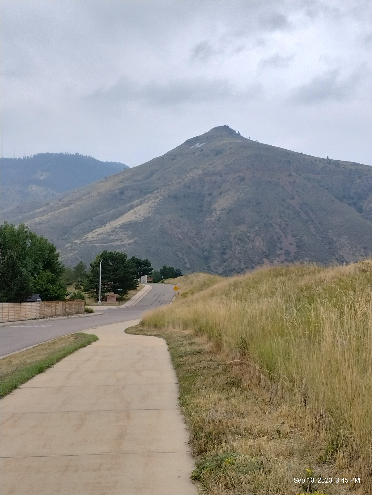
The last time, I hiked through Golden to the Golden Cliffs trailhead and looked at the basalt columns from the base. This time, I intended to go to the top, so I hired a Lyft to take me from the train station to the west trailhead.

Some information about North Table Mountain. It's a mesa (flat top mountain..."mesa" is Spanish for "table" so it amuses me how many "table mesas" there are.) The summit is 1,998 meters (6,555 feet) above sea level. It's prominence is 177 meters (571 feet). Prominence is height from base to summit. The west trailhead is 4.8 miles from Golden Station. 

It's isolation is 2.18 miles (that's the distance from it's summit to the nearest place of equal elevation). It's not actually a Rocky Mountain. Like nearby South Table Mountain, Green Mountain, Grand Mesa, and Mount Carbon, it is an erosion feature of the High Plains. Except for the lava flows, it is all sedimentary rock.

The first recorded ascent was in the 1840s by Black Kettle, a Cheyenne chief, and his tribe. 

This hill, featured in the last Volcano blog, is not Rolston Dike... it's not even a dike. Rolston Dike is another couple of miles down the road. I'll include a picture from a distance later. This is what's left of the Dakota hogback here in Golden. A little to the south, it is just a hilly terrain in town. It's also where a lot of dinosaur tracks have been found. The origin of Dakota sandstone is beachfront sand from 100 to 113 million years ago.

I took some instrument readings at the trailhead.

The average magnetic field strength for the Earth's magnetic field is around 25 to 65 microteslas. This reading is pretty high but there are houses and power lines nearby.

The Physics Pro app barometric pressure agrees with the dial reading of the Trail Sense app. The digital readout on the Trail Sense app differs because I didn't give it a chance to "catch up" to the current reading. I'll go with the 1014 hectopascals.

Temperature, wind speed, visibility, and humidity are taken from a local weather station, and there might be more than one. The barometer and altimeter readings are taken from the phone's sensors and are more reliable. 

I took these primarily to compare to the readings at the top of the mesa 

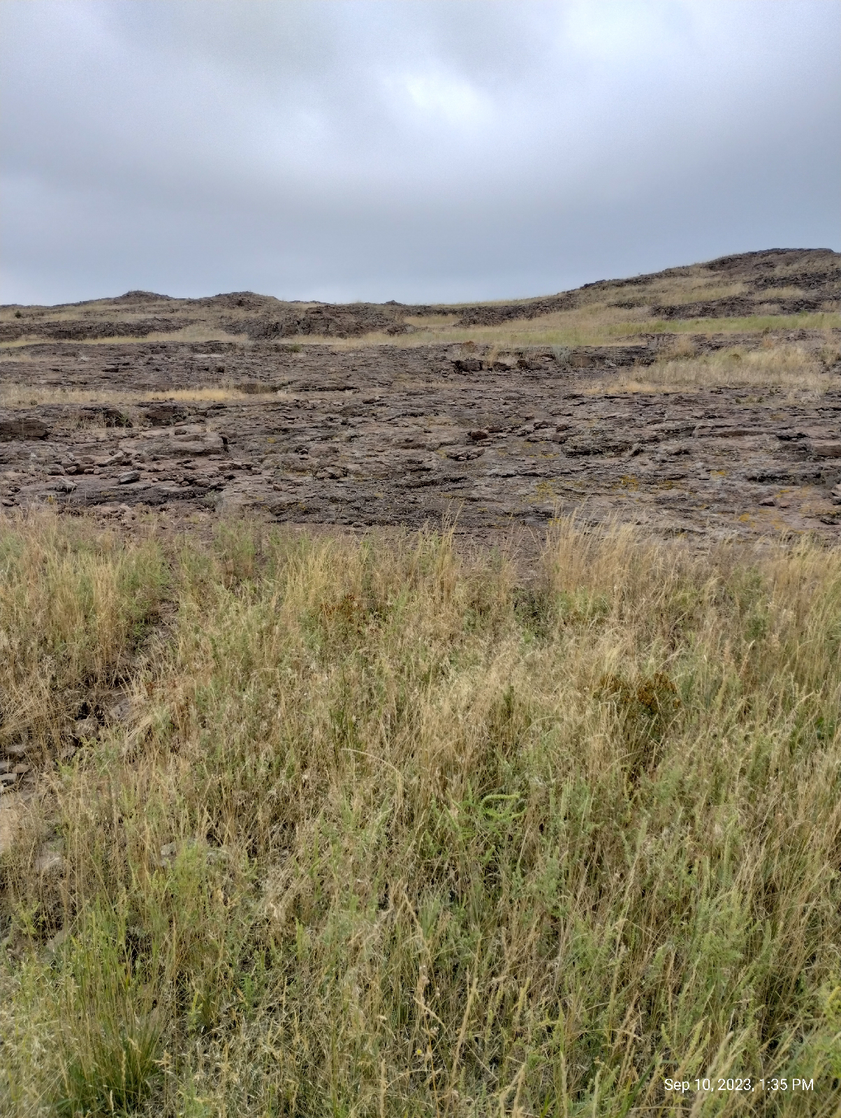
The trail from the west trailhead is a service road leading to an old basalt quarry. This is a view back down the mountain. There are neighborhoods up the flanks of both Table Mountains.


As for the instrument readings at the top...

The barometer readings were spiky, which was to be expected from the way the winds were gusting on top. Overall, barometric pressure had dropped. That would be expected for an elevation increase, but not this much. There was a front moving through.

Magnetic field strength was also much less and much more comparable to Earth's magnetic field strength. There were power lines on the mesa but they where some distance away.

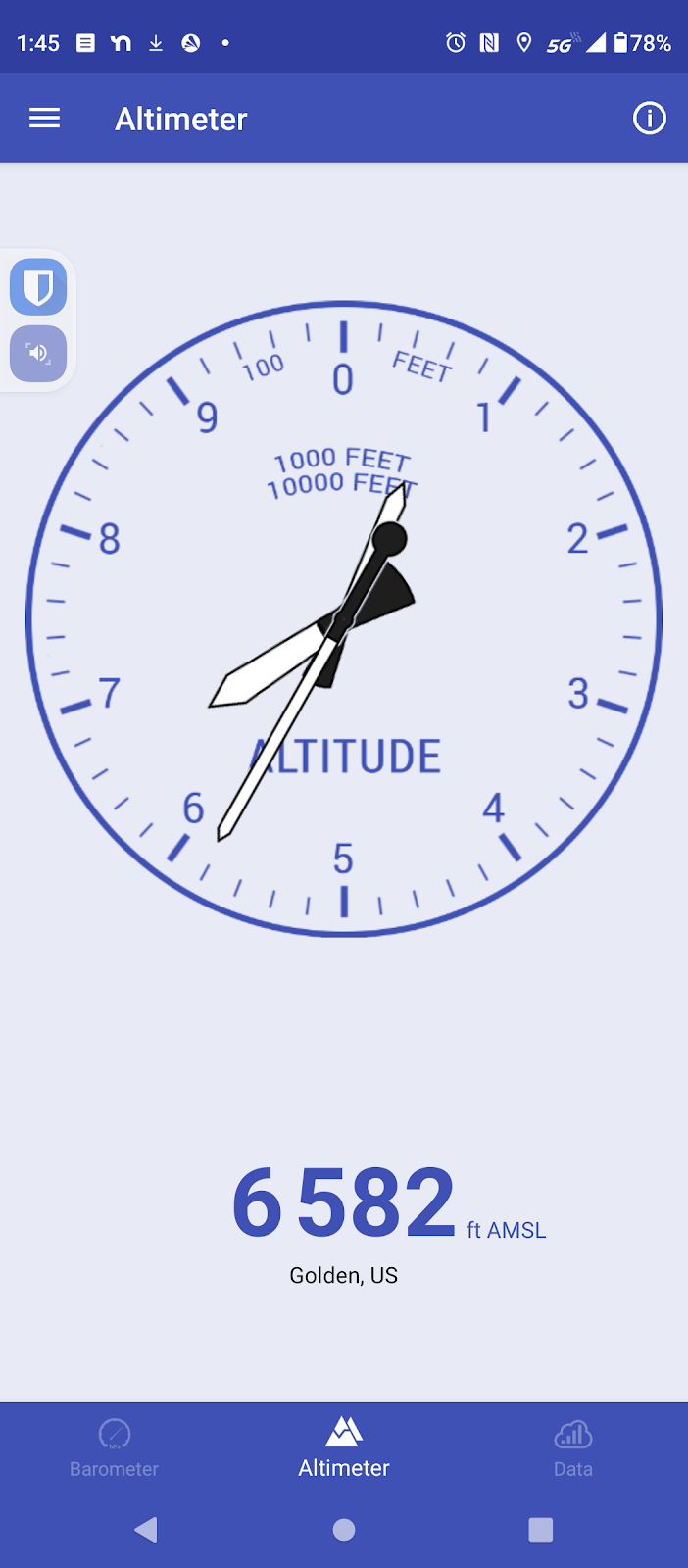
This indicates that the distance from the trail head to the top of the mesa was 471 feet. That's not the prominence since the trail head starts at a distance (it looks like about 100 feet) above the base of the mountain.

The altimeter reading is based on the barometric pressure which decreased with altitude. Of course, barometric pressure also changes with the weather so altimeters must include compensations for that. The compensations aren't perfect so there is a little variance in the altitude readings.

Humidity was increasing so, with decreasing pressure, I could expect some rain, and I got it later but it wasn't bad...just a mist to cool things off. I was thankful for that 

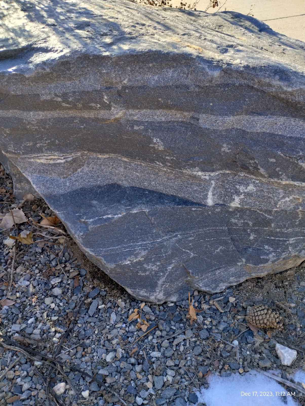
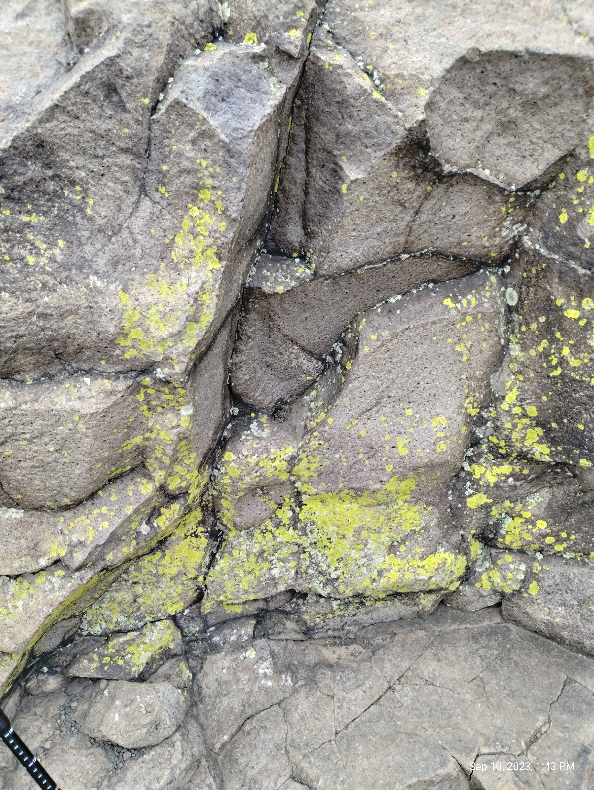
The quarry at the top displays the typical jointing of basalt seen also at more well known locations like the Giant's Causeway in Scotland and the Devil's Tower (Bear Butte) in Wyoming. The stockade-like appearance is caused by shrinkage that occured as the lava solidified. It has been intensified by weathering. The basalt contains feldspar which weather to clay and olivine which breaks down to serpentine. Here are some boulders of basalt along the trail. Notice the absence of coarse detail. The rock is almost homogeneous.

Basalt is used as a decorative building stone and has been carved into works of art.

Both Table Mountains are popular climbing areas. On North Table Mountain, Golden Cliffs and four quarries have been extensively mapped and bolted for climbing trails.

There is a lot of vegetation on North Table Mountain but very little of it grows above waist height. The soil isn't deep. A surprising amount of wildlife, and not just birds and insects, call the place home. I didn't see any large mammals but the Golden Parks and Recreation brochure says that prairie dogs, deer, bear, coyotes, and other animals live there. It also says that bighorn sheep pass through but don't live there. There are also rattlesnakes so, be vigilant.
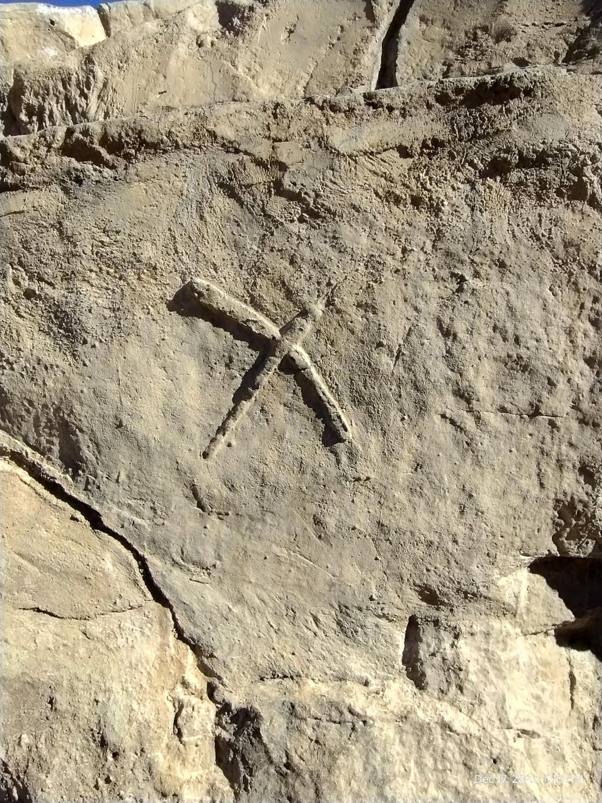
The mountain is home, also, to conservation studies and other researchers. There was currently a rattlesnake study going on but I didn't notice researchers present at the time.


It looks like a big rock pile (and it is, but it's all natural). Lichen Peak is the summit of North Table Mountain at 1998 meters (6555 feet) (actually, the highest point is at a surveyor's marker at the other end of the mesa which reads 1999 meters (6558 feet) ). Given my altimeter reading, that would make Lichen Peak 30 feet high from it's base on the mesa.

Note, if you ever visit, I couldn't get a satellite reading to check my barometer against GPS. There are a lot of dead zones in and near the Rockies.
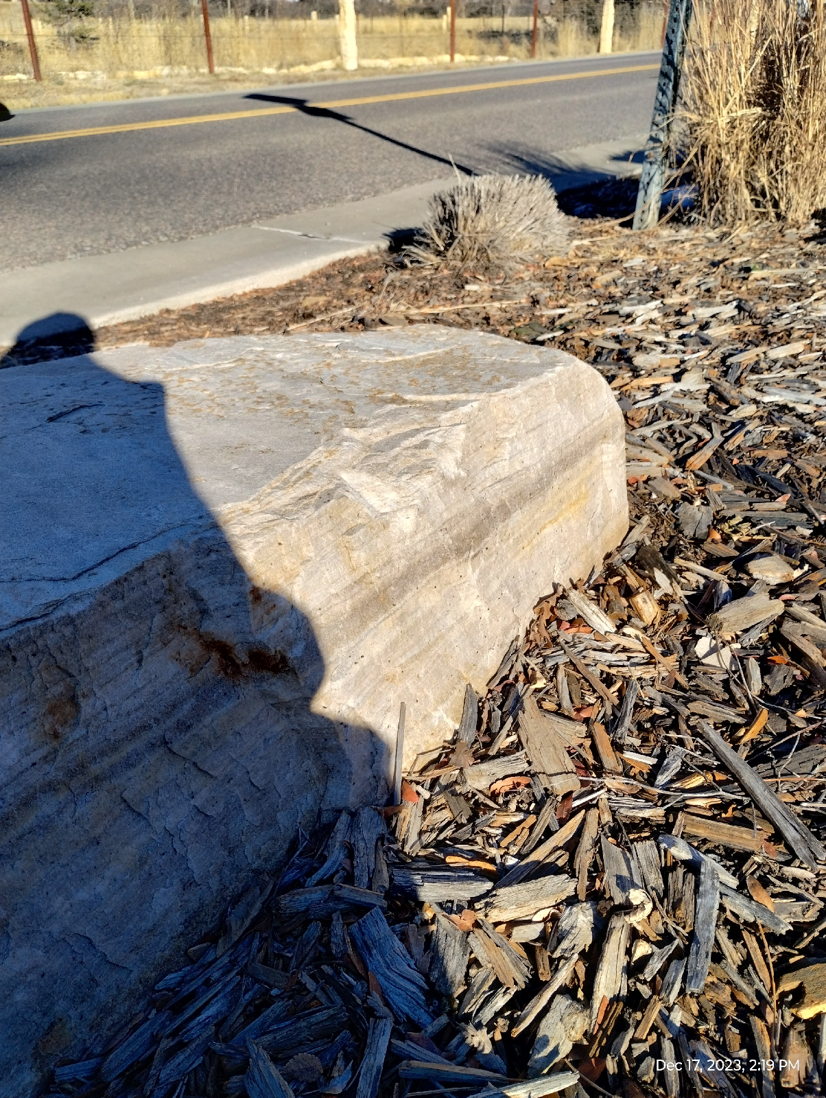
This is what the top of those basalt columns look like.

There are four lava flows discernable on North Table Mountain (two on South Table Mountain). The lowest one, and, thus oldest, is around 6250' elevation. I didn't see outcroppings of that on my hike. The oldest flow is about 64 million years old and it can be seen about halfway up North Table Mountain. I keep reading that the oldest flow is monzontite and the younger two are latite, but I don't get it.

In the first place, I checked back with the original reference (Van Horn, R. 1957. Bedrock geology of the Golden Quadrangle, Colorado. U.S. Geological Survey, Map GQ-103.) and it calls all the flows latite. The big problem is that lava doesn't produce monzontite since monzontite is a crystalline, intrusive rock and lava cools too quickly to form crystalline rocks. The error may be caused by the fact that there is a monzontite intrusion on North Table Mountain.

There are different kinds of rock formed by solidifying lava. Latite is a feldspar rich, quartz poor apheritic to porphyritic rock. That describes the lava flows on North Table Mountain pretty well.

The latest flows are both on top and are about 62 million years old. They are sometimes described (as in the Rockd app) as shoshonite. You can see the two flows in the photograph above. The material capped by the flows (and, thus, protected from erosion) is the same Dawson formation that underlies most of the Denver area.

The oldest flows are channel flows. The vents, between Rolston Dike and North Table Mountain, were small and didn't produce as much lava as the later flows, so the lava ran along depressions in the landscape. The later flows from the Rolston Dike plug blanketed the area.

A fairly recent and informative study was published in 2008 by the United States Geological Survey as Scientific Investigation Report 2006-5242 (Table Mountain Shoshonite Porphyry Lava Flows and their Vents, Golden, Colorado by Harald Drewes).
Lichens are one of the focuses of conservation efforts on North Table Mountain.
A lichen isn't a lifeform. It's a symbiosis of two, an algae and a fungus. The algae produces nourishment for the fungus and the fungus provides a protective environment for the algae (algae is usually, well, pond scum, and doesn't generally thrive in dry environments.) The arrangement is effective and lichens can thrive is very harsh surroundings, like the Arctic. They are popular food among reindeer. What they don't deal with very well is trampling. They can't do "urban" very well.
There are several springs on the Table Mountains. As the Rockies eroded while the plateau was rising and afterwards, they literally buried themselves. The uplift has occurred in three phases and the early Rockies were little more than hills so it isn't that surprising that they were completely buried in sediments. Eventually, rain, snow and wind carried the debris eastwards to fill in the depression called the Denver Basin. After the Golden volcano erupted, it were also buried. There were at least four eruptions, the first two were small and the lava was just enough to follow stream valleys and harden into basalt fingers pointing eastwards. The two later eruptions were much bigger and covered a broad area and they were also buried by sediments.  These eruptions were more like Hawaiian eruptions and not like Mount St. Helens....they were not explosive.

Lookout Mountain, the tall mountain that looms over Golden was completely buried, as was the lava flows and the volcano, but the streams in the area were working, carving away at the fairly soft sandstones and mudstones, until they reached the hard basalt, then they changed course to flow around it, forming the broad valley in which Golden is situated today. But only Clear Creek was big enough and carried enough energy out of it's canyon to cut into the basalt, so it split the flow in two forming the two mesas.

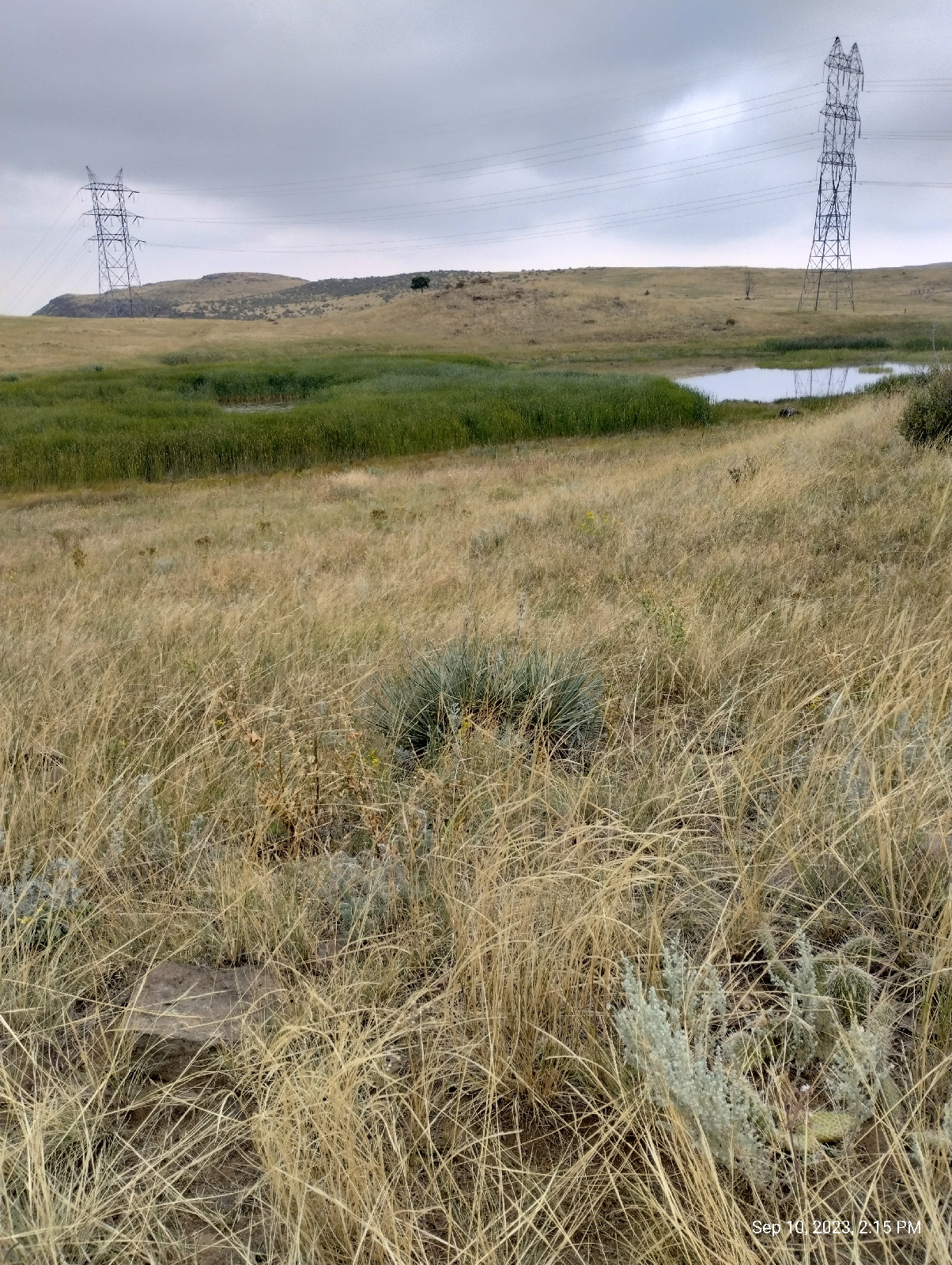
The sediments in the basin and sandwiched between the lava flows are active aquifers. Rain and snow melt soaks down into the permeable rocks and expand in the deeper heats of the Earth's crust, creating a pressure that pushes them back to the surface along faults. The result is springs, and there are several on the mesa creating swampy areas and small ponds. If you look at a topographical map of the mountains, you see gulleys running down the sides. They're usually dry but rain swells the springs and the water runs off the sides in these gulleys.

The vegetation on top is short with a few shrub sized plants dotting the landscape. They're bonsais. They get plenty of water but the topsoil isn't very deep so plants have little room to grow, so they stay small.
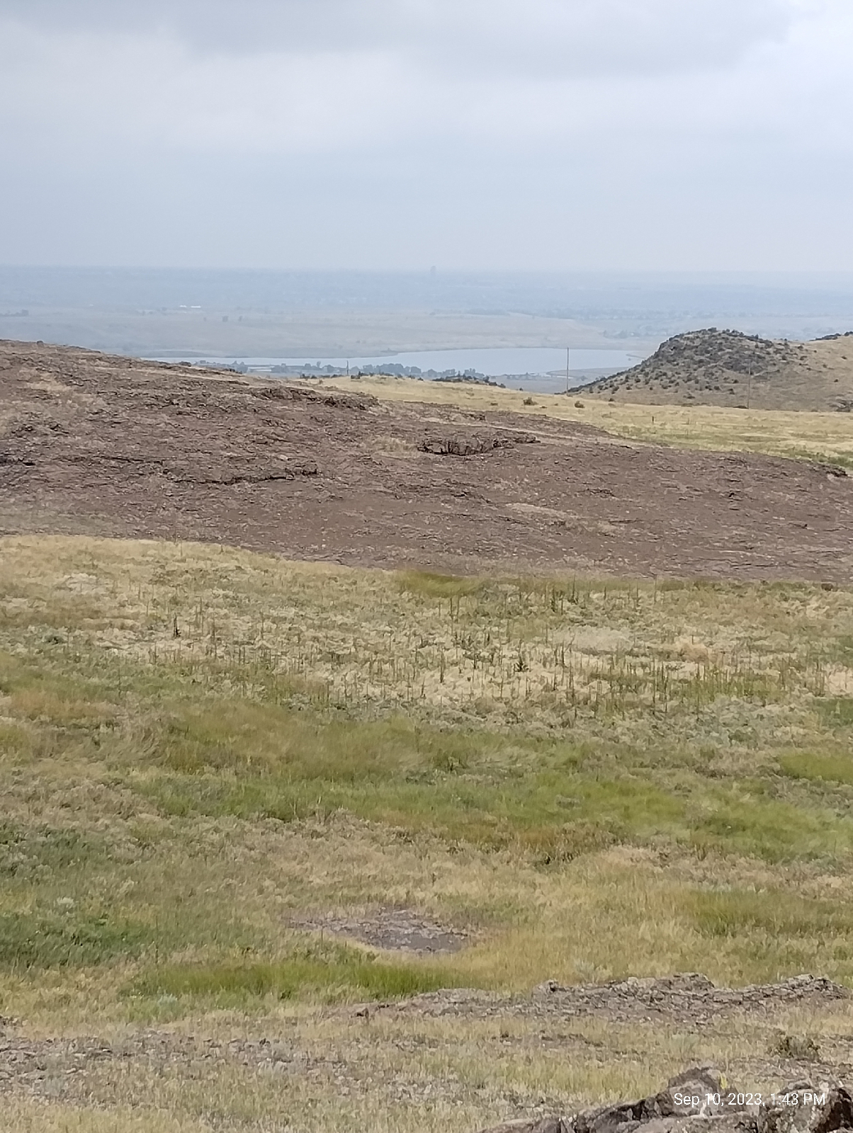
That's probably what's left of the volcano...not much. The long lake, called unimaginatively "Long Lake" is backed by a low ridge. On the other side is another long lake, that one man-made, called Rolston Reservoir. The ridge is a plug of monzontite called Rolston Dike. It's considerably deeper than it is wide. Monzontite is an intrusive rock that was deep enough to have cooled slowly. Crystals formed as the molten rock solidified. Monzontite is fairly quartz poor, unlike granite and granodiorite, having less than 5% quartz. It is very similar in chemical composition to the basalt on the Table Mountains.

It is very likely the source of the top two lava flows. There are a few smaller monzontite plugs between Rolston Dike and North Table Mountain that were probably the source of the two lower flows. Time, erosion, and quarrying have brought the volcano down to it's current humble level. I may visit the dike later if the trip doesn't involve trespassing.
The trip down North Table Mountain follows another service road, this one leading to the radio tower on top. There's the Dakota hogback again backed by the Front Range. The trail winds it's way back to the North trailhead where I began my ascent.
This inhabitant of the mountain died there. I don't know what it was. The skull was absent, probably taken as a trophy. It was too small to be a full grown deer.
I took a Lyft from the train station to North Table Mountain trailhead but decided to walk back. The day was cool and I was in pretty good shape. Nonetheless Avenue Trail follows Colorado Highway 9 from the trailhead directly to Golden Station. A lot of the way is down hill but, once it crosses Clear Creek, it's uphill all the way. It's an interesting urban trail with side trails into fossil quarries and trackways. I didn't dawdle.
It's always uplifting to see the rotunda of the Jefferson County Government Center in the distance. The train station is right next door. I felt as eroded and worn as Golden Volcano as I boarded the train back home.

I looked forward to the two train rides to my home station...not so much the mile and a half trek from Arapahoe Station home 

Not many of us live near active volcanoes like the denizens of the Ring of Fire around the Pacific Ocean, Hawaii, or Iceland, but mountain building involves volcanoes and if your live near a mountain range, there are probably the remnants of these "fossil volcanoes" within a day's drive. They make for fascinating hikes.