Tuesday, April 26, 2022

Another GPS check

I was missing one activity for the first excursion I'm working on for the Geology LabBook so I decided to knock it out on a recent visit to Littleton, Colorado. It was actually in the opposite direction but was near the bus terminal for the route 66 to Littleton so I figured I would take the full tour and see where the bus went, so I hiked up to the Arapahoe at Village Center light rail station to cross I-25 for a short walk to the nearby NGS survey marker.

If you want to know where you are, a survey marker is your best reference. That's, in fact, what it's there for (for more details on survey markers, see the blog for February 8, 2021, Survey Quest). All I needed was to lay my smartphone on the plaque and use the GPS tool of my Physics Toolbox Suite to get my bearings. Here's a copy of my results.

Going to the National Geodetic Survey website, I collected the data for this survey marker.

https://geodesy.noaa.gov/NGSDataExplorer/

39° 36' 25.29718"(N) 104° 53' 29.26822"(W) 
Ellip Ht. 1730.432 (meters) 6/27/12 adjusted
Epoch 2010.00
Ortho Ht. 1747.6 (meters) 5634 (feet) GPS OBS

In the US the National Geodetic Survey uses the best data available from multiple precision survey methods to determine geographic measures for sites across the country (many other countries have similar services). If you want to see how they came up with data at a particular site, the url listed above will tell you.

On April 18th, 2022 at 12:34 PM (according to the time stamp on the screenshot shown above) my smartphone accessed the transmissions from 22 satellites to triangulate (I guess with 22 satellites that would be eikosiduolate) my global coordinates and elevation. It was off by 0.14398 seconds of latitude to the south, 0.01582 seconds of longitude to the east, 5.432 meters too low in elevation. According to the program I wrote that calculates the distance between two global coordinates, my GPS was  off by 0.08 meters. 

I know...at one place I say the error is 8 centimeters and at another, 3.22 meters. Which is it?

Remember, I hiked up to the survey marker for a standard reference for local measures of position and altitude. My assumption that the survey data is exact is faulty. All measurements have error, but I feel justified in thinking that the error in the survey data is negligible. And my app being only 8 cm off makes me really happy. Of course, on another day, it might be 3 meters too high or 2 meters too low. How do I know?

The app said so. When it says the error is ±3.22 meters, it means that the true value might be anywhere within 3.22 meters to either side of the reported value.  The reported global coordinates may be as far as 3.22 meters away from the survey marker. 8 cm is well inside that area. Actually, 3.22 meters is pretty good for satellites 20,000 kilometers away.

3.22 meters is the result of the app taking several.measures and calculating the spread.

It was a nice day. I strolled back to the bus terminal and boarded 66 for Littleton. It's a pretty little town with interesting little shops like the Savory Spice Shop, which had a spectacular smoked black pepper mix, and Penzey's Spices, where I found a  Bird's Eye pepper I had been looking for. And Zoey's Place pet market had a cow ear for Vincent.

Then I caught bus 66 back up the hill (Littleton is on the river) to home.

Thursday, April 21, 2022

The W Line: Golden to Red Rocks College

It would have been... aesthetic, to start a new line in January. There are twelve stations on the W Line and that would have given me a hike each month, but reality doesn't lend itself to that kind of conformity, so I guess I'll just have to take things as they come.

In this series of statIon-to-station hikes, I plan to work my way from Golden, Colorado back to the Auraria West Station in downtown Denver. It's all urban and the last link is industrial.

April 12, I walked from the terminus of the W Line, Golden Station to Red Rocks Community College Station. There is no trail so I had to do some road work, east on Mount Vernon road, then Golden Road, and south on Indiana Street to the service road to the light rail station. 

The W Line from Denver passes through some industrial areas into residential neighborhoods, giving me a preview of hikes to come. Several large government complexes also lay along the route. The western end passes through the foothills between Green Mountain and the Tables Mountains.

These foothills are the immediate deposits washed out of the rising Colorado uplift as it rose. They give the area east of the Front Range an undulating appearance.

The train veers slightly near Red Rocks Community College, passes under the Golden Government Center parking lot, and stops at Golden Station, the western terminus of the RTD light rail system.

I've been here before (http://adventuringbcc.blogspot.com/2018/12/terminus-golden-i-took-first-e-line.html) and I expect to return due to the geological richness of the area.

But this was more of a site seeing tour and my first planned destination was the beautiful, modern Jeffco Government Center just northwest of the terminal.

The complex is a sprawling collection of modernist office buildings and court rooms around a high rotunda that houses the lobby. There is a cafeteria that provides devices to the government center and visitors but I brought my own lunch. The west side looks out on gardens and some great views of the surrounding mountains.

Lookout Mountain is the one just south of Golden. The city is situated in the canyon cut by Clear Creek and is surrounded by mountains of the Front Range to the south and west and by the two Table Mountains and Green Mountain to the north and east.

I was under the (mistaken) impression that the the Table Mountains were the exposed insides of an ancient volcano (like Bear Butte - the Devil's Tower of Close Encounters fame) but this hike brought me closer and it doesn't look like the neck of a volcano. The basalt doesn't extend from the top of the mountains down to the valley below. It's just on top, underlain by what looks like sedimentary rock - maybe sandstone or conglomerate. 

"Castle Rock" at the western end of South Table Mountain.

So I looked it up. These hills are made up of rock of the Denver formation, sedimentary rocks of andesitic volcanic origen that underlies most of the Denver area, topped by at least two lava flows. The actual volcano was about four miles to the northwest. And, of course, that means that the sedimentary rocks are older than the lava flows and the canyon is younger than both. (Nicolas Steno worked out how to tell the relative ages of rocks in the 1600s. Rocks from top to bottom are youngest to oldest. Rocks are originally laid down horizontally. And rocks (and canyons) that cut across other rocks are younger than the other rocks.)

South Table Mountain

There are parks around and on top of the Table Mountains, so I'll probably be coming back for a closer look.

In the lobby of the Jeffco County Building sits a statue of the man the county is named after.

Statue of Thomas Jefferson.

Down the hill from the government center is the Golden Cemetery. I like cemeteries and a plaque at the office of this one explains why.

I saw graves dated into the 1800s which is about the era that the Denver area was settled.

I didn't have that much time to wander around amongst the graves and was soon on Mount Vernon road headed to the Northeast.

Mount Vernon is mostly residential but I got some good views of South Table Mountain. Golden Road and Indiana Street are mostly commercial with a few restaurants and bars. There is a military base and prison on Golden Road.

The frontage road from Indiana Street to Red Rocks Community College is hilly and affords some nice views to the north. I saw this fellow in a small park in one of the residential neighborhoods.

The whole hike was about three and a half miles (five and a half kilometers) and the weather was nice. There's a lot in the Golden area and I plan to return, especially since I'm focusing on geology now. Golden has the School of Mines with it's natural history museum and several geological parks.

Friday, April 8, 2022

Still, for you


The water cycle in action.

Warm air will carry lots more water than cold air. Counterintuitively, warm, wet air, as heavy as it might feel, is lighter than cold, dry air and will rise like a hot air balloon.

As you rise through the stratosphere, you get colder and the atmosphere bears down on you less and less. The same thing happens to air. And as wet, warm air gets colder, it gets drier...by letting go of the water it carries. The water usually forms clouds, but if there's enough, it will condense into larger and larger drops and fall as precipitation.

The rain in the above photograph is falling on the Front Range of the Rocky Mountains. Much of it will run into the South Platte River. Some will sink into the ground, but granite and gneiss doesn't soak up water very well. Some of the water will immediately evaporate back into the air, but the air is obviously pretty loaded already. The South Platte dumps into the Platte River, which dumps into the Missouri, which dumps into the Mississippi, on to the Gulf of Mexico and the Atlantic Ocean. If it hasn't gone underground or evaporated by then, the water has a good chance to be airborne. It could even be part of a cold front or hurricane and rain out over where I used to live in Alabama.

Do you want to capture your own little rain shower? In your kitchen? That's where the still comes in. Actually, it's a steel still.

If you're following my adventures in chemistry, a source of distilled water is useful. In chemistry, you want to know what compounds you're including in a mixture and tap water isn't pure. Actually, no natural water is pure and you have to go to some extreme measures to have any pure water at all because the gases in the air are water soluble and as soon as water meets air, the water is no longer pure.

But distilled water is usually "good enough". You can actually buy distilled water in grocery stores around here, but you can also distill it yourself almost as easily as driving to the store and the tiny amount of plastic that leaches from the jug into the water won't bother you.

You need a stew pot with a steamer rack in the bottom.

Place a cross of tongue depressors across the steamer rack and set a heat resistant container (pyrex bowl or measuring cup, Mason jar...) on those. The tongue depressors protect the glass from direct contact with the hot metal. Most kitchen glassware (or ceramic) can take the heat of boiling water if it's consistently heated, but direct contact with hot metal can cause hot spots that can shatter the glass.

A stainless steel (or glass, or ceramic) mixing bowl (something with a rounded bottom) over the mouth of the stew pot will complete your still.

Pour tap water down the inner wall of the pot (don't splash it into the smaller container.)  Turn on the heat and let the water begin to boil before placing the mixing bowl on the pot. Dump ice in the mixing bowl and check to see how much water you've collected when the ice has melted. If you want more, replace the melted ice with more solid ice and continue.


When you have all the distilled water you want, use kitchen mitts to pour it off into a clean container. The pot is full of steam at 100° centigrade and it will burn you, and the container of distilled water will also be hot.

This method works if the impurities in the water have boiling points less than that of water. Fortunately, most of the impurities in tap water are salts and will not boil with water.

You might try tasting your distilled water. You'd notice that it's very bland. Water is actually tasteless. The flavor of water comes from dissolved gases and salts.

If you don't have the parts I used for my still, you can substitute other parts for them. The design is flexible. And that's why I wanted to tell you about this still. It might even save your life.

Remember the 4-4-4 rule? You can live 4 minutes without air, 4 days without water, and 4 weeks without food. Water's pretty important.

To make a still in a survival situation, all you need is something to dig with (shovel, trowel, flat rock), a sheet of clear plastic (2 x 2 feet should be big enough), and something to catch water in (cup, bowl, scooped out piece of wood). Just dig a hole deep enough to sit your collection vessel in and set the vessel in the center. Stretch the plastic over the hole and anchor it in place with some pebbles. Place a pebble in the center so the plastic is cone shaped with the point of the cone over the collection vessel. Wait for water to collect. 

This solar still will even suck moisture out of seemingly dry desert soil. Look around for a place near vegetation. The plants are getting water from the soil. You might even throw some of the plant material into the hole. You can even urinate into the hole but don't drink your own urine! After it's distilled, urine might not taste good, but it's drinkable. Most of the impurities will distill out with the water but most of the toxins will not.

What about collecting rain water? Well, you might be able to get away with it in some areas, but near big cities with a lot of pollution, acid rain will be a thing and you don't want to drink it if you can help. Distilling is still a better idea. (did you see what I did, there?)

Saturday, April 2, 2022

What causes the color? Chemical change!

High Falls, Alabama
Red Rocks, Colorado
Red Rocks, Colorado
Flooded creek in Alabama
Noccalula Falls, Alabama

Red Rocks in Colorado and red dirt in Georgia are red for the same reason...iron.

Iron is one of the most common elements on Earth. Nobody's been to the Earth's core but everything we know about it tells us that it's a little less than 90% iron (about 10% is nickel with about 3% lighter elements like silicon, sulfur, and oxygen.) We figure that because our calculations for the density of the Earth from how it orbits the sun, it's magnetism, and the way shock waves pass through the core, and everything else points to iron.

And the crust is full of iron oxides...rust. you won't find much pure iron. If you do, it's probably a meteorite. Metallic iron rusts in short order in the oxygen atmosphere of Earth.

Why is iron so common on Earth? The planet is composed of the dust that came together to make up the whole solar system. The dust came from stars that had lived, grown old, and died before our Sun. Stars create energy by combining light atoms, under incredible pressures to form heavier atoms (It's called "fusion".) Once you get the reaction going (gravity packs the materials together under great pressures and temperatures), it will just keep going. The products are heavier atoms and energy. Chemists call such reactions that give off energy, "exothermic reactions".

First, hydrogen atoms are packed together to form helium, then carbon is formed, then silicon, and finally, iron. Why "finally"? Well, it turns out that iron is the heaviest element that can form in an exothermic fusion reaction. All the heavier elements have to have energy put into the reactions to keep them going. Elements like gold and uranium are created in exploding stars...novas and supernovas... there's plenty of extra energy there!

So, the commonest elements on Earth are also the commonest elements in stars. Hydrogen is common in our water, and there's plenty of oxygen, carbon, and silicon along with the iron.

But what about the helium? The only reason hydrogen is so common is that it's bound up in the heavier compound water, otherwise, gravity wouldn't be able to hold such a light substance to the Earth. It would have all leaked out into space long ago. Helium, though, doesn't bond very easily with other elements so...away it goes.

Iron, though, is a very reactive element and it does like to bind with other elements and one of the most available elements for it to bind with is oxygen. We know iron oxide by it's common name...rust.

Want to see rust in action?

Get two iron or steel nails (not chrome plated or stainless steel. If you buy nails for this demonstration, find a package that warns not to use them if surface rust will be a problem.) And place them in test tubes. Mark one test tube "Dry" and stopper it. Mark the other "Wet", push a wad of damp cotton ball in after the nail and stopper it. Let them sit for a couple of weeks or longer.

Nails before demonstration
Nails after exposure to air. The right one was in the wet test tube.

The nail from the dry tube magnified
The nail from the wet tube magnified

Iron oxide is iron and oxygen, and both nails were exposed to oxygen, so why did the damp nail rust and the dry one didn't?

Actually, the dry nail did rust, but it rusted so slowly that I couldn't tell. Over years, I would have been able to see the rust. In a humid environment, water takes part in the reaction to speed the rusting up. If there is salt in the water, it really speeds things up. That's why things rust much faster in Florida than in Alabama, and things rust faster in Alabama than in Arizona.

Rusting is a chemical reaction because the product of the reaction, iron oxide, is a different substance than the reactants, iron and oxygen.

Iron is a transition element. It can have several charged states and that means that it can combine with oxygen in different proportions to form different oxides. Most of the colors in rocks are from these different oxides of iron. Here are two of them.

The white plates above the rocks are called "streak plates". They're made of unglazed porcelain. You can rub a mineral across them to see what their powder looks like. Powder color is more reliable for identification than the color of a chunk of a mineral. The mineral to the right, hematite, can be red, black or brown, but it's streak is always red. In it, two atoms of iron combine with three atoms of oxygen. Hematite is what makes Red Rocks red.

The other mineral in the photograph is magnetite. It has three atoms of iron to four atoms of oxygen and it's streak is always black. It's also attracted to magnets and might even be magnetic. The ancients knew magnetite as "lodestone" and they magnetized other iron items, like compass needles by rubbing them against these natural magnets.

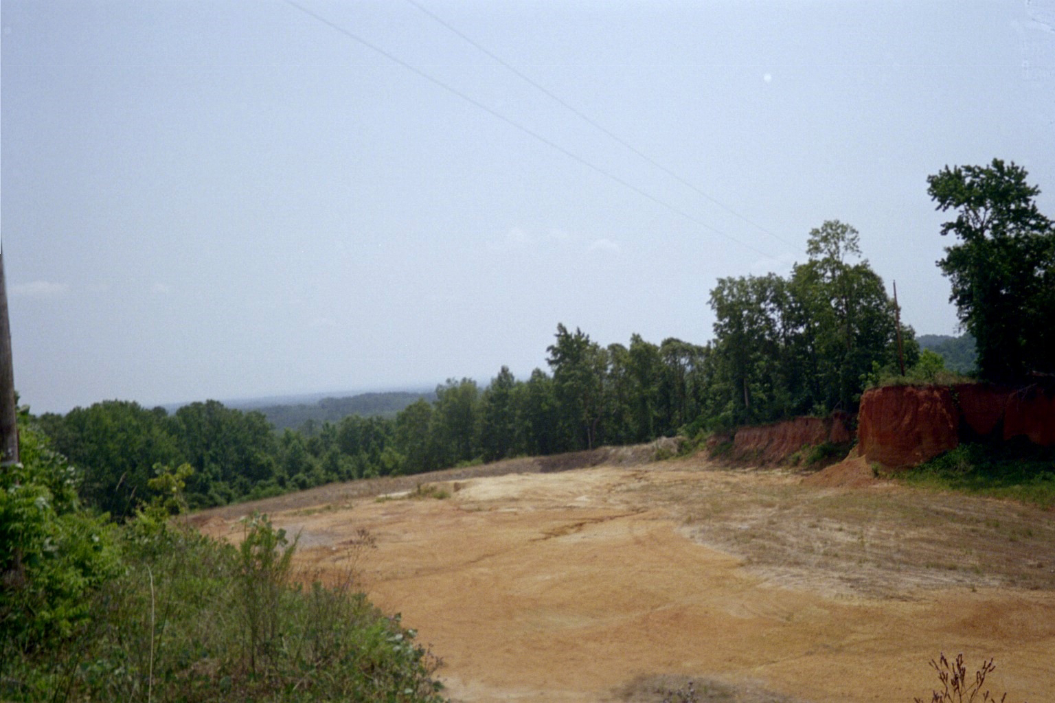
Another common iron oxide includes water in various amounts in its makeup. Because it has a yellow streak, it's called "limonite". It's what colors the ground at Englewood Reservoir.

These iron oxides are pretty but they're also important for another reason. They're the primary iron ores.

Iron has another charged stated that is green and most of the green stones in nature are also colored by iron. A few common green iron bearing minerals are olivine, amphibole, epidote, and serpentine.

In physical changes, no new substance is created. Here is some magnified sea salt.

It's a pretty, clear, blocky crystalline substance. When I dissolved it in water and let the water evaporate, I got this...

This physical reaction is arguably as important as the chemical reaction that produces rust. Rain dissolves salts from rocks and washes them into streams. The streams run into oceans and landlocked lakes like the Dead Sea between Israel and Jordan, the Salt Lake in Utah, and the Salton Sea in California. The water evaporates and the water gets salty. That's why the ocean is salty and that's how salt deposits form that can be mined for table salt.

It's not always easy to tell if a change is chemical or physical but if you pay attention, you can develop a feeling for it. The biggest difference is that chemical changes give you different substances than what you started with; physical changes don't. Ice and liquid water may look different but they're both water. When ice melts, you get your water back.

The next time you go on a hike, appreciate iron for most of the colorful rocks around you.