--- Observing ---
2016
It's good to see so many schools locally sending their students out into the field for projects. I've seen several groups wading around in Bear Creek taking samples of water and, I would guess, water life. I've also seen groups at Dinosaur Ridge and the paleontology museum in Morrison.
A necessary skill for survival and, in my opinion, a good life, is the ability to observe and evaluate what's going on around you. As I was growing up, schools didn't teach that. It seems to me that a life spent in front of a computer only teaches you to perceive the world in a 34x19 centimeter window; and where video games may present an element of chaos into ones life, frustration can always be turned off if it's computer generated. Real life isn't like that.
Every speck of nature in every direction is relevant. You can always look closer or farther out and see something new and surprising. It's like a good novel. A good novel is hard to read, not because it's written in esoteric language or because the style doesn't flow well, but because its dense. If you miss one sentence, you have missed something important. Nature is like that.
You can learn to be observant simply by being in nature with the intention of soaking up all you can. The best way to improve your senses and powers of observation is to use them.
I'm (slowly) producing a tutorial on observation skills. If you want to look at it, you'll need either LibreOffice or OpenOffice (which are free downloads) and the spreadsheet at http://www.theriantimeline.com/excursions/labbooks called "Observing and Recording".
Currently, I'm writing up explorations dealing with vision, but it's a growing project and I'll get around to the other senses if I live long enough.

Stories and ideas for adventurers and lifelong learners.
Showing posts with label Bear Creek. Show all posts
Showing posts with label Bear Creek. Show all posts
Wednesday, February 15, 2017
Wednesday, January 25, 2017
--- My range ---
2016
When I was working, my dream weekend vacation was to take a trip to a random county within a 300 mile radius of Selma, Alabama, hike a trail, stay in a camp ground, take recommendations of where and what to eat - just soak up the local flavor.
I got to do that three times.
Now I'm a pedestrian - I sold the van I moved here in and, now, I either walk or take a bus. That's pretty good. I can take a bus just about anywhere in the Denver area including Golden, Aurora, Boulder, Idaho Springs, Evergreen, and Morrison (well, I walk to Morrison). I can also take the casino bus to Black Hawk or Central City. I can cover the high desert around Denver or the front range west of Denver. Occasionally, I take trips further afield with friends and family.
My walking range is the intricate trail system along the South Platte River and into the mountains via Bear Creek. One way, I can walk to Warrior Mountain.
My regular range is Bear Creek Trail. It follows Bear Creek from its confluence with the South Platte to Morrison, Colorado. The trail ends there but Bear Creek continues through The Lair O' the Bear Park up through Evergreen to Mount Evans Wilderness. Most of my explorations will be between the South Platte and Morrison.
The South Platte pours out of the Rockies at Waterton Canyon south west of Denver and gouges a path through the high plains through Denver. The marshy confluence with Bear Creek is behind the River Point shopping area in Englewood. Bear Creek runs through a shallow gorge through the foothills of the Rockies, running out of the mountains through Bear Creek Canyon. The small mountain town of Morrison is located in Bear Creek Canyon. Just east of Morrison, the creek runs through Bear Creek Lake Park where it joins with several other mountain streams before flowing through Mount Carbon Dam.
Bear Creek Trail descends from the mountains through canyons, grasslands, hills, and plains, giving me a wide variety of scenery.
My local playground is Bear Creek Park, behind Bear Creek Shopping Center which is at the junction of Hampden Road and Sheridan Boulevard. It's a popular park with nice facilities. Here, the creek runs a couple of good rapids. Bikers, joggers, strollers, folks with their dogs, and people just wanting to get from A to B use this area.
I live on the shoulder of Bear Creek Valley. I used an altimeter app on my phone to measure the hill I live on. From the bottom of the hill to my house is 74 feet (22.5 meters); from there to the top of the hill is 105 feet (32 meters). So from the creek up to the top is about 180 feet (about 55 meters). That means that the last leg of any hike on Bear Creek, whether it is a stroll to the shopping center or a day hike to Morrison, is a steep, 74 foot upgrade. If I leave going toward Denver, the first thing I see is a 100 foot rise.
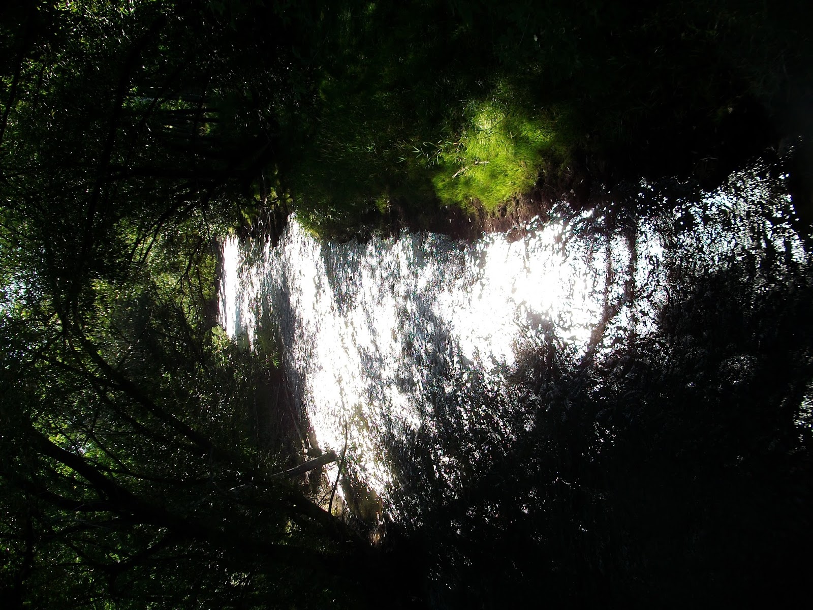
But the view from the top is gorgeous. That's where I took the panorama I use above.
I left on a hike to measure the eastern leg of Bear Creek Trail. I had an altimeter and an app called GPS Compass Explorer (Evgeni Ganchev). The altimeter was a bit of a disappointment since, although it did give me an altitude profile, I could find no way to save it and it dropped the display when I tried to use a screenshot program to capture the image. I have since replaced the app. The GPS Compass Explorer, on the other hand, worked flawlessly.
I also carried my camera. I use my regular camera for normal shots to save phone battery power. I reserve my phone for closeups, telephoto and microphoto shots. I also have a professional setup but I only use it for professional type work.
The trip back from the start of Bear Creek Trail was 2.95 kilometers (1.83 miles) and the change in altitude was 105 feet. Here, the creek cuts a shallow gorge into the plains south of Denver to meet the South Platte River. There is an abundance of water fowl and wildflowers at both ends of this section (at the confluence and at Bear Creek Park). If you want an elevation profile for the whole trail, check the Walk Ride Colorado website (http://www.walkridecolorado.com/denver-metro-single-trails/bear-creek-trail-englewood-to-lakewood). Here are a few landmarks.

(South Platte River Trail connects Bear Creek Trail)
0 kilometers (0 miles): Bear Creek Trail branches off the South Platte River Trail at River Point shopping park where the South Platte River Trail crosses the river by foot bridge. There are an assortment of food sources here including Panera Bread, Steak and Shake, and HuHot Mongolian Grill. There is also a Target up the hill from the footbridge and a large movie theater in sight of the trail head. The area provides a nice view of the Rockies.

(Plaza at River Bend)


(Confluence of Bear Creek and South Platte River)
0.38 kilometers (0.24 miles): The River Point area is marshy and is a favorite hangout for waterfowl and other wildlife. There's a broad walkway and plaza where people can sit and rest and dispose of trash. This section gets a lot of bike and pedestrian traffic but I find the people there to be courteous and friendly.

(Weir across Bear Creek)
0.57 kilometers (0.35 miles): Just a little way down, Bear Creek flows over a weir and splits into several streams before emptying into the river. Up the hill at 0.64 kilometers is a golf course.

(Federal Boulevard)
At 1.42 kilometers (0.88 miles), the creek and trail passes under Federal Boulevard. Along side the trail is Carroll's Pub Corner and, within sight is a McDonald's.

(Park at McBroom homestead)
At 1.61 kilometers (1 mile) is a flowery park that commemorates one of the early settlers in the area. This stretch of Bear Creek was the site of the McBroom homestead. The park has a water fountain.

(Lowell Street bridge)
The Lowell Street bridge at 2.16 kilometer (1.34 mile) is the only place where a pedestrian using Bear Creek Trail has to deal with automobile traffic on the eastern leg of the trail. Just north of there, across Hampden Avenue (there are cross walks and lights), there is a 7-11 convenience store, and just south is a playground.

(Colorado Heights University)
Colorado Heights University is just up the hill from my home and can be seen from most of my range. It's a comforting landmark when I've been walking for several hours.

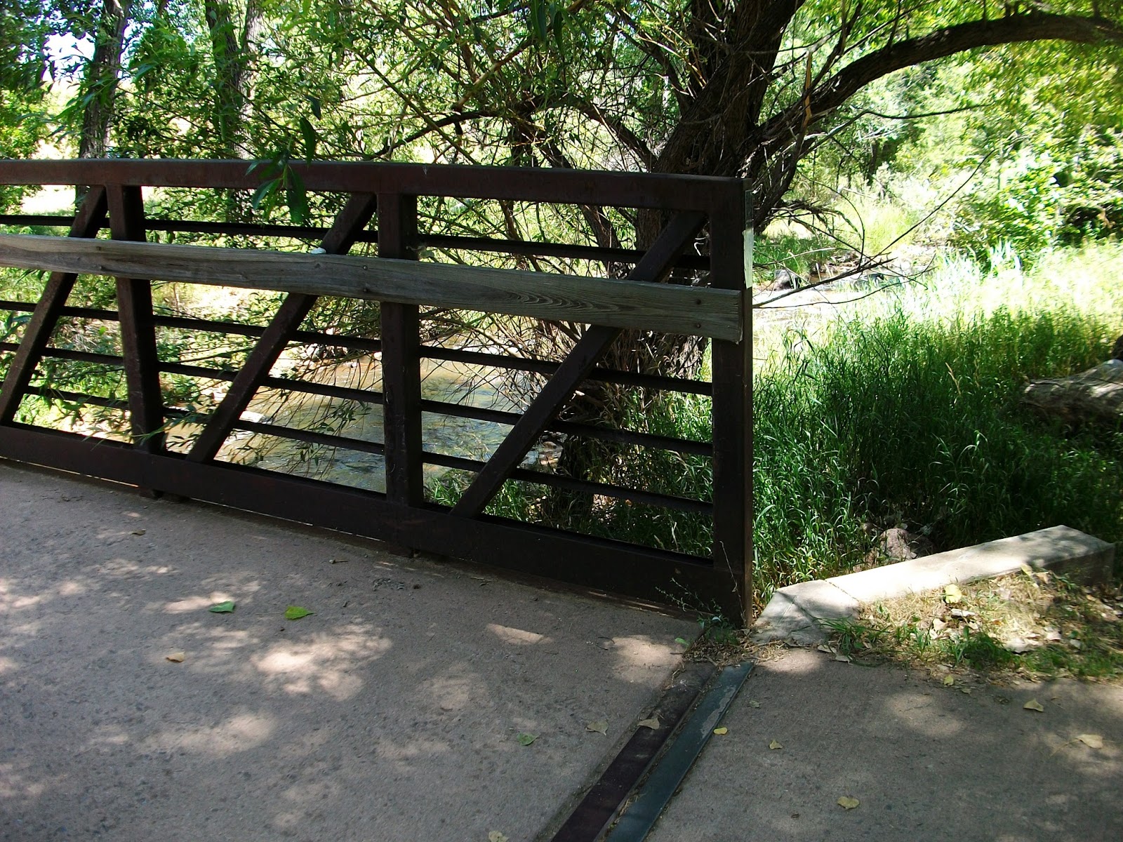
(Bridge at Bear Creek Park)
Bear Creek Trail crosses the creek at Bear Creek Park at 2.95 kilometers (1.83 miles) at the end of Raleigh Street. This marks the end of what I have been calling the eastern leg of the Bear Creek Trail. The park is popular. It has a large playground and spacious picnic facilities. The creek passes over a scenic cascade at the bridge and has several rapids within the park. The park is within easy walking distance to Bear Creek Shopping Center, WalMart, McDonald's, and Dartmouth Place Shopping Center (which has my favorite coffee and ice cream shop, Bear Valley Coffee Company).
On the seventh of August, I set out to survey the west end of Bear Creek Trail. At 6:00 it was 56 degrees and clear. I started where I left off on the last hike: at the footbridge at Bear Creek Park. The creek was low and my altimeter read 5320 feet.

(Bear Creek at 285 underpass)
The trail runs through Bear Creek Park and, at 0.52 kilometers (0.32 mile) passes under highway 285, Hampden Avenue. On the other side of the underpass is Bear Creek Shopping Center which has several shops including a King Soopers grocery, Subway Deli, Home Depot, and Dollar Tree. The creek has several rapids in the park. Trails to the east lead to Fort Logan National Cemetery. It's not quite as large as Arlington but it's pretty impressive. There's also a YMCA up there on Sheridan.

(Spillway at Sheridan)
At 0.89 kilometers (0.55 mile), the trail passes under Sheridan Boulevard and there is a pretty spillway - about the closest thing we have in my neighborhood to a waterfall. On the other side, there is a WalMart, McDonald's, and Dartmouth Place Shopping Center which has several restaurants including a Chinese and Italian restaurant and my favorite coffee shop, Bear Valley Coffee Company. I stopped there for a chocolate muffin, a large cup of mocha, and a friendly barista. Coffee bars have all the good part of a booze bar without any of the negatives.
I took note that my left knee was being a little clunky and I would have to watch it on the hike.

(Bear Valley Park)
The creek flows into the narrower confines of Bear Creek Park from a broader valley where it has more room to meander. On the other side of Dartmouth Shopping Center is Bear Valley Park beginning at 1.77 kilometers (1.1 miles). There was a deer foraging there (but my photo didn't come out very well).

(Bridge across Bear Creek)

(Mount Morrison at the end of Dartmouth)
Both Dartmouth Avenue and Bear Creek Valley Park dead end at 3.42 kilometers (2.1 miles) before reaching Wadsworth Boulevard. The trail continues over the creek and behind the Alta convenience store, before it passes under Wadsworth.
Here the trail is at 5353 feet elevation.

(Prairie dogs)

(Bear Creek Open Space)
On the other side of Wadsworth, the trail opens out into a broad open space where a lot of prairie dogs have decided to lay down stakes. I've also seen coyotes in this area. The trail has risen to 5378 feet elevation at 3.7 kilometers (2.3 miles).

(Other end of open space)
This plot of prairie is broad and the trail travels along the creek and then shoots straight across to the other side of the open space before reentering forest at 4.2 kilometers (2.6 miles). Here the elevation is 5384 feet (according to my phone app.)

(Underpass at South Estes Street)
South Estes Street is at 4.66 kilometers (2.9 miles) and the trail is at 5400 feet elevation. The many rapids along this stretch of creek indicates a consistent slope.

(Rapids near East Kipling street)
Just before the underpass at South Kipling Street is one of the more picturesque rapids on the creek at 5.32 kilometers (3.3 miles) and 5406 feet elevation.
(Light on the water under South Kipling underpass)
The trail passes under South Kipling at 5.83 kilometers (3.6 miles)

(Connection to Kipling Trail)
At 6.11 kilometers (3.8 miles), Bear Creek Trail connects to the Kipling Trail and continues under South Kipling Parkway. Kipling Trail is little more than a sidewalk along the parkway but it leads up to Jewell Avenue which leads west to Green Mountain and Dinosaur Ridge. At the underpass, Bear Creek trail has risen to 5429 feet elevation.

(Mount Carbon at Fox Hollow Lane and Morrison Road.)
At 6.97 kilometers (4.3 miles), Bear Creek Trail meets Fox Hollow Lane and Morrison Road. There is a bench and trail map here and you can see Mount Carbon, which you will have to pass over to get to Morrison. The alternative is to road walk over the southern shoulder of Green Mountain. I don't know which is better. The trail will now run through two golf courses, over Mount Carbon, and through Bear Creek Lakes Park, following beside Hampden Avenue for much of it's course. At Fox Hollow, it is at 5437 feet elevation. Things are about to get steep.

(Mount Carbon)

(Mount Carbon Dam)
In 1896 and 1938, Bear Creek flooded catastrophically. Several other streams coming from he mountains also flooded. That motivated the Corps of Engineers in the late 1970s to build several dams for flood control, including Mount Carbon Dam, to protect the Denver Metropolitan Area from further flooding. The base of the dam at 7.9 kilometers (4.9 miles) is at 5499 feet elevation (again, according to my phone app). There is a lot of wildflower photo ops here including mullein.

(Mullein)

(Mountain View)

(Green Mountain)

(Mt. Morrison and Red Rocks)

(Mt. Falcon)
The plaque says that the top of Mount Carbon, Mountain View, is at 5774 feet. From Bear Creek Park, the trail is at 8.23 kilometers (5.1 miles), so the last 0.33 kilometer (0.2 mile), the trail has risen 275 feet. Bikers love this trail (whew!). The views from the top are spectacular. The ridgeback, Red Rocks formation, and Front Range are visible from Lookout Mountain to the north to Pike's Peak to the south. Mount Evans, third highest peak in the Front Range is often visible, snow covered for much of the year. On a clear day, the Denver skyline is visible. Due to a weird fog, it is totally eclipsed today. Green Mountain is just to the north and Bear Creek Lake is just below.
There is also a shelter and spacious restrooms here. It's a nice place to get your breath after the switchbacks. You can also contemplate the switchbacks down the other side.

(Down the west side)
There is a branch of Bear Creek Trail that splits off to a trailhead on Hampden Avenue at 8 kilometers (5 miles).

(Mount Carbon from the west)
There is also a rest area partway down the mountain at 8.22 kilometers (5.1 miles) and 5637 feet elevation.

(Clouds moving in)

(Bear Creek Lake)
Several landscapes meet here. The trail, itself, passes through prairie, and finally into some forests. Bear Creek Lake is to the north. At 11:30, clouds were building up behind the mountains threatening rain.

(Turkey Creek)
There's a shelter just before Turkey Creek at 9.9 kilometers (6 miles) and altitude 5637 feet. The temperature was at 68 degrees with 77% humidity. There was no precipitation in the forecast for at least two hours, but showers and a thunderstorm in the evening.
A littl further on, at 10 kilometers (6.2 miles) is a campground with restrooms and a water faucet, a road crossing and an archery field.

(Bear Creek Lakes Park Visitor Center)

(Ridgeback from visitor center)
At 11 kilometers (6.8 miles) is the Bear Creek Lakes Park Visitor Center. Across the road are two lake, the Big and Little Soda Lakes, that have swimming beaches. Here the elevation is 5657 feet.
(Bear Creek crossing at Morrison Road.)
In a little band of forest, the trail crosses Bear Creek and comes out at a picnic area by Morrison Road. At 11.7 kilometers (7.3 miles) the trail is at 5701 feet elevation. Highway 470, the main four lane that follows the foothills up to Golden, is in sight. On the other side is Morrison.

(Bear Creek Canyon)

(Red Rocks)
There is a Conoco convenience store and gas station just as you come into Morrison. The town is nestled in Bear Creek Canyon and is packed with shops and restaurants. I generally stop in at the Mill Street Deli for a hamburger and milkshake. People complain about the wait but they're good so they're busy. As far as I'm concerned, they're worth the wait and, after I've walked over Mount Carbon, I want some excuse to just sit and vegetate for a while.
Red Rocks amphitheater is spectacular and visible from town. Bear Creek Trail ends at the Memory Plaza at 12.9 kilometers (8 miles). The elevation is 5742 feet.

(Elevation profile)
The whole trail is 15.85 kilometers (9.8 miles) and the elevation rise from the South Platte River to Morrison is 516 feet (but, then, there's that two hundred foot rise at Mount Carbon to get over.)
In the future, I'll be looking at this trail from many different angles.
Saturday, January 21, 2017
---
This blog ---
2016
I
am using Google's Blogger to create this blog. It's a first time
thing for me. I have a website but I've never "blogged".
I
compose using KeyNote NF 1.7.8, a tabbed notebook program for Windows
created by Marek Jedlinski and developed further by Daniel Prado
Velasco.
This
is one of my favorite programs. It works pretty much like a digital
notebook with tabbed pages, so I can use it to organize my thoughts
and my composition. In addition, it has lots of commands that make it
a fairly powerful word processor.
Files
can easily be exported in a rich text format that transfers really
well to websites.
KeyNote
is available on SourceForge if you want a copy.
When
composing on my smartphone, I generally use the notepad app that came
with it.
Bear
Creek Commentaries is a companion project to my website, The Therian
Timeline, which has sections on scientific excursions and cooking;
and a YouTube channel, Open the World, a series of science tutorials
and demonstrations (I haven't posted this one yet and won't for some
time, but I will before I approach physics on the trail since it will
be a prelude to that section.) [2023 correction. Open The World never happened. I even had some videos ready but my computer crashed and ate them, so I gave it up.]
I
will be telling stories. I enjoy hearing other people's stories and I
enjoy telling them. I find that stories are a good way to teach. I
like to "open up the hood" on the world and show people how
things work inside. I like to play around with the engine and let
people watch, or even help. Stories draw people in. People become
part of stories when they listen. I have some very old stories, some
told by friends like Wolf, Coyote, and Bear, and some related by
people who know streams that have gone underground for centuries
before reemerging to the surface of the earth, or stories told by
rocks that still show the footprints of massive lizards (did I say,
"lizards"? Perhaps I should have said "chickens".) Some of my stories are relatively new - stories about the Wild West
or the struggles for equality in the South. And some of the stories
are going on right now.
These
are my adventures, stories, meditations, contemplations, and
daydreams.
Let's
take a walk.....
Thursday, January 19, 2017

---
The adventurer ---
2016
I
don't want this blog to be about me, but I will be making
recommendations and giving opinions along and, you probably need to
know a little about me.
My
name is Wolf VanZandt. I'm a 63 year old (at this posting - it keeps
changing) retired vocational evaluator that lives in the Denver,
Colorado area. Until I moved here, I had never lived outside the
southeastern United States and had only traveled outside that region
four times - three times to Denver. I was born in south Florida and
grew up in Georgia and Alabama. My jobs have included ornamental
plant shipper, library assistant, textile mill worker, security
guard, retail salesperson, self-service gas station clerk, laboratory
assistant, media department manager, animal handler for a dairy unit
(that would be a cow poke to some of you), offshore pipeline lay
barge welder helper, camp counselor at a camp for disabled persons,
and, for twenty years, a professional vocational rehabilitation
specialist.
When
people ask me what I like doing, I generally report, truthfully, that
I don't like bookkeeping. My actual hobby is life long learning.
One
reason for this website is that I suspect that my other website, the
Therian Timeline, makes other people think that it's only for
Therians. It is specifically for Therians but it also has a lot of
general interest stuff (I'll be providing links here.)
Most
people, it turns out, are hybrid homo sapiens x homo
Neanderthalensis, but where most of them show as pure human, I and
folks like me show all the Neanderthal traits. I consider us
Neanderthal. As such, I'm one of a subset that shows shamanic
tendencies and (in my opinion) that makes me a Werewolf. Other have
different ideas about what constitutes a Were or a Therian but that's
my take on the subject. Regardless, I'm not in the first or second
standard deviation of humanity, but neither am I alone.
I
like diversity. I enjoy hearing others takes on things - I like
hearing stories. I like other cultures.
I'm
a devout and orthodox Christian (orthodox in that I accept the Bible
as fundamental to the Christian faith and I adhere to the Apostles'
Creed). As I also adhere to sola scriptura, I'm pretty sure the
Apostles would not recognize today's Christianity as a legitimate
embodiment of Christ's teachings. That and my outlier life
experiences undoubtedly color my beliefs.
People
ask how my therianthropy changes my world view and I have no idea how
to answer because I have nothing to compare it with and it pervades
my life, so, even if I could give an answer, it would be too long,
complex, and involved to be tolerated by a being with finite
attention span. And I've probably stretched this introduction beyond
that tolerance limit, so I will move on to other things.
Subscribe to:
Posts (Atom)