Showing posts with label aquifer. Show all posts

Wednesday, March 25, 2026

Berrendo Creek

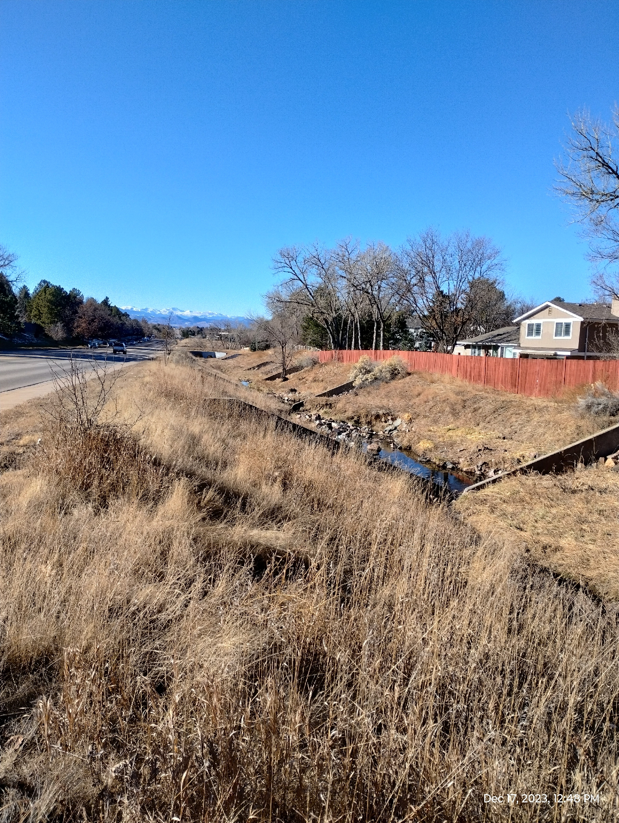
 My first long hike in my new home followed Berrendo Creek through East Roswell, New Mexico. It begins South of my home. A mile south, it looks like a dry drainage ditch....a small, dry drainage ditch. Last year it flooded and took out a lot of property in Roswell 


You can tell where these desert streams sometimes are by the line of trees on a satellite image. 

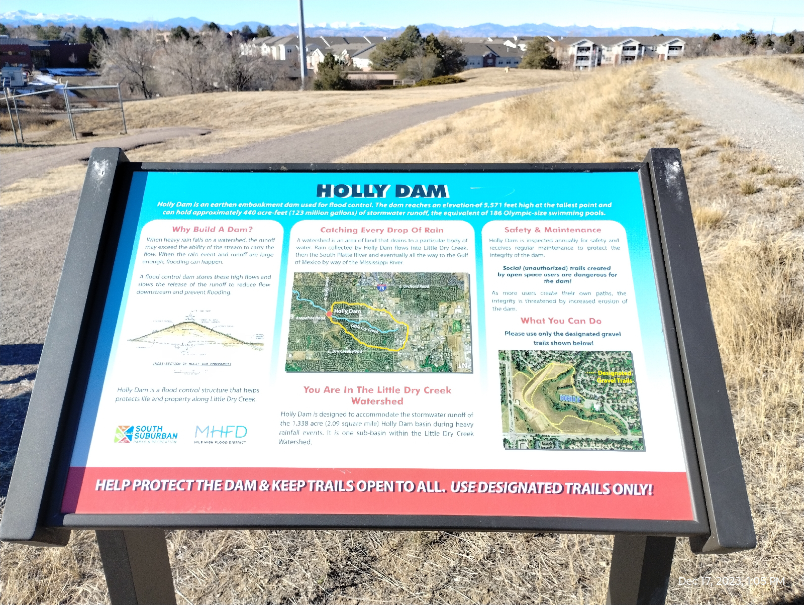
These signs are no joke.


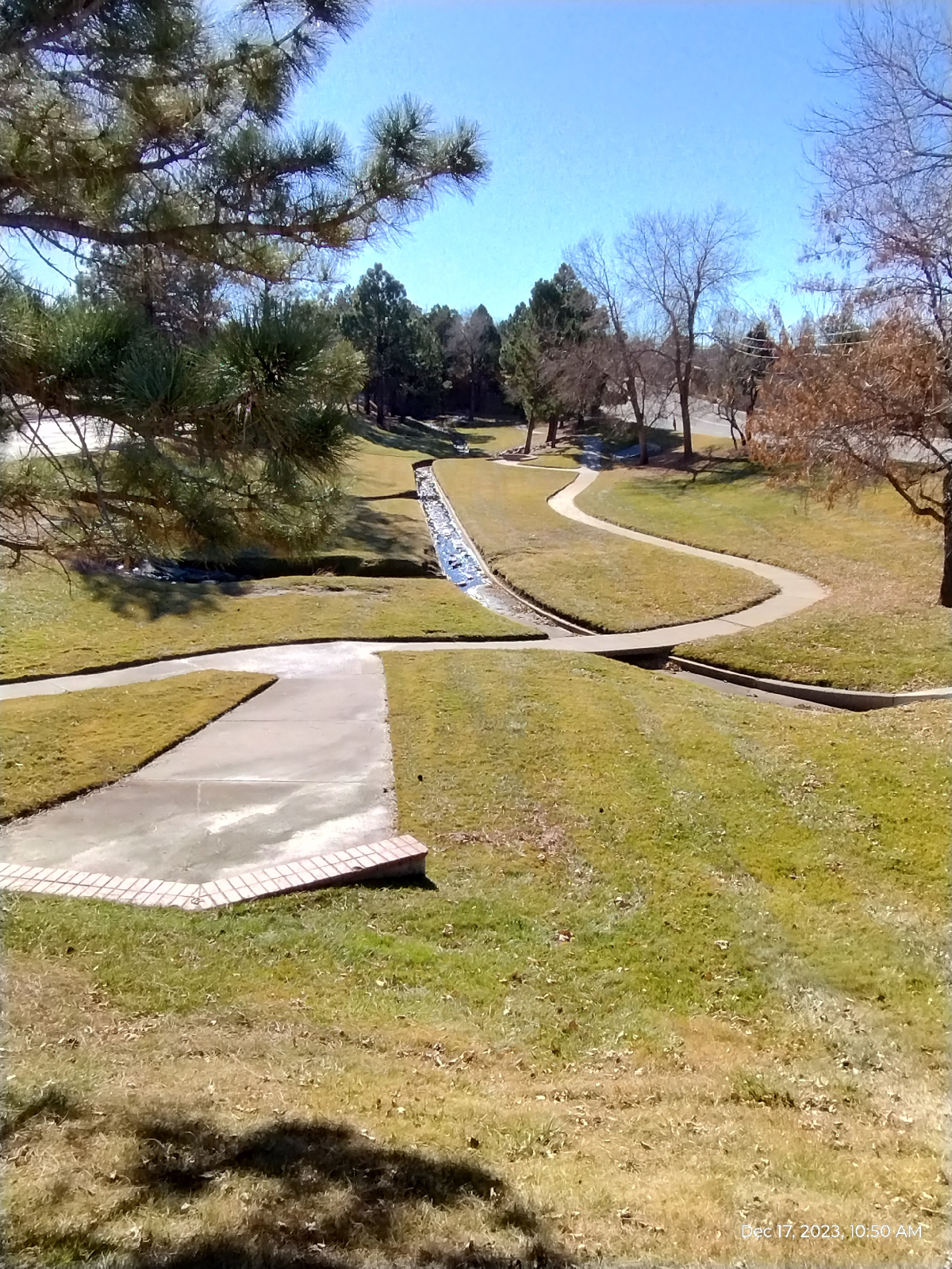
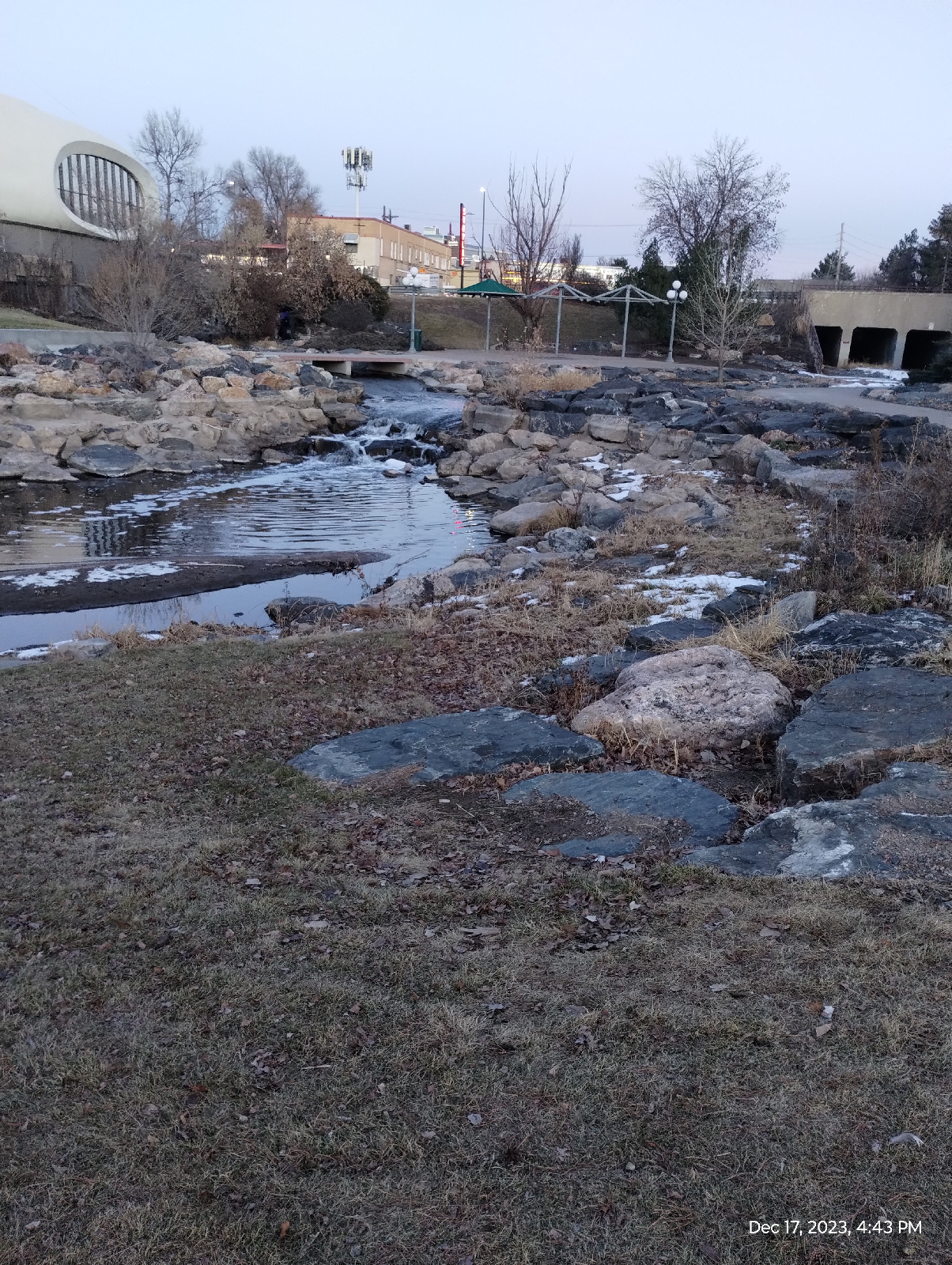
Here is Berrendo about a mile away as the meander runs.


Here, it has widened out into a broad flood plain. The same signs are on the road.

Less than a mile away.....


These 20-30 foot deep ravines, meanders, and oxbows were created by a powerful river, so where is it?

UFOs didn't put Roswell on the map.

Remember the Rule of Five. An average human can live five minutes without oxygen, five days without water, and five weeks without food  Communities are the same, five days without water, and the few little creeks in Roswell wouldn't bring nearly enough water to support a community. There were several settlers that tried.

Then, in 1899, Nathan Jaffa, a resident of Richardson Avenue drilled a well in his yard and hit the deep aquifer. Roswell had plenty of water from then on. The Pecos Valley Railroad came in 1892.

The Roswell basin actually has two aquifers  One is close to the surface but it's not very productive and has to be pumped. Then there's a deep layer of jointed limestone that's fed by the Pecos River and occasional rain runoff. This deep aquifer is capped by nonpermeable shale so it's under pressure and, when holes are punched through the shale, shoots water to the surface as artesian springs and wells. In other words, it pumps itself.

Normally, Berrendo Creek is fed by these artesian springs but all the farms and ranches in the area have these:


It's an artesian well. So much water is drawn from the deep aquifer for agricultural and industrial purposes (and to a lesser extent, household water) that it doesn't get to the creek 

On January 11, I set out to follow Berrendo Creek from North Roswell to the public fishing spot near 19th Avenue and Red Bridge Road.

I couldn't actually follow the creek without tromping through private properties, which I don't do without permission  I followed Pine Lodge Road through town, stopped at the Walmart for supplies and McDonalds for coffee, and continued east across the rural desert to Atkinson Avenue, where I turned South.


The desert along Pine Lodge Road 

Berrendo runs through a deep valley to the west of Atkinson. There's still no water.

A little further, Atkinson joins and becomes Berrendo Road. The bridge across the creek bed is interesting 


I don't see this conglomerate in the geological papers of the area. But it's outstanding. The cobbles are around tennis ball sized and seem to be solid, waterworn quartz.

The creek bed looks like it would form a nice waterfall here (about six feet) when there is water.

I stopped here for lunch.

A little further down Berrendo Road was an interesting ranch with a construction called "The Henge" that is mentioned as a significant example of modern architecture on the Internet 


The Henge was created by Roswell resident Herb Goldman and includes a gallery with mural painted by Willard Midgette. It is recognized on the State and National Register of Historic Places.

My hike from Berrendo to Red Bridge Road was through ranch lands. The sky is open, the land is flat, and it's a great place to spot raptors. It's not that great for taking photos of them with a phone.


Heh. You have to expand the photo to see it.

I joined Red Bridge Road at Bitter Lakes Farm which advertised Pistachios. This area has several tree nut farms including the pecan farm next to my home 


The house is an Adobe style ranch home.

New Mexico is famous for its nut crops.....piñon, pecan, pistachios, and peanuts.....and the piñon pine is the state tree. 

The hot, arid climate and long growing season that allows the nuts to mature are good for nut trees. Despite being in the desert, the Pecos River and it's tributaries have laid down some nicely fertile souls in some areas around Roswell.

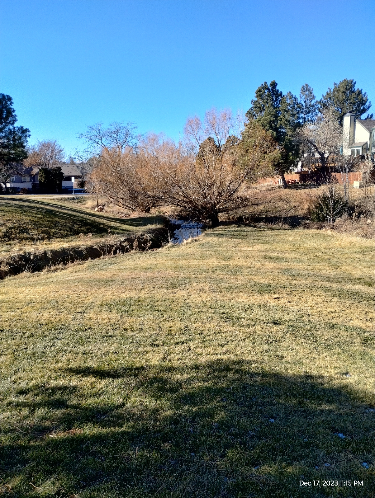
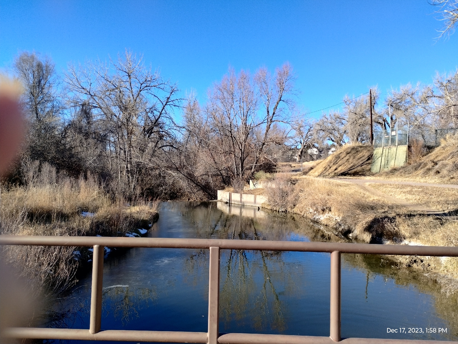
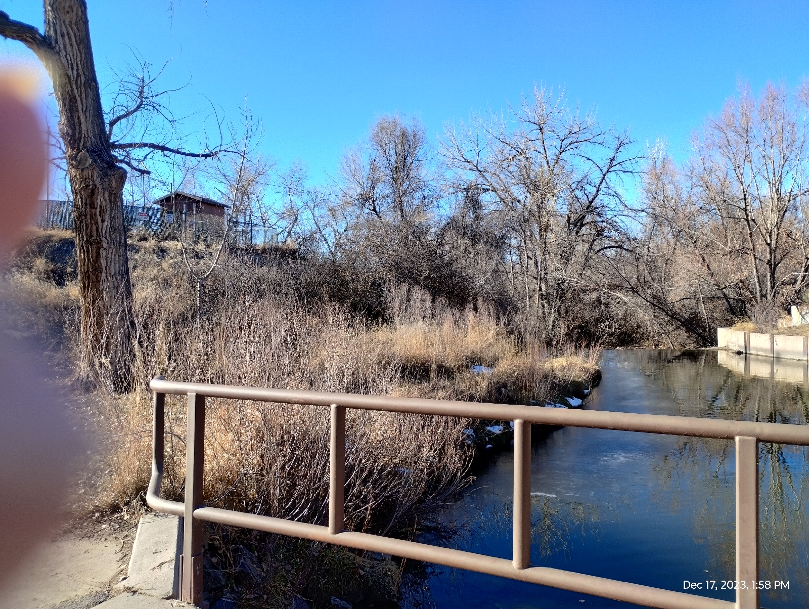
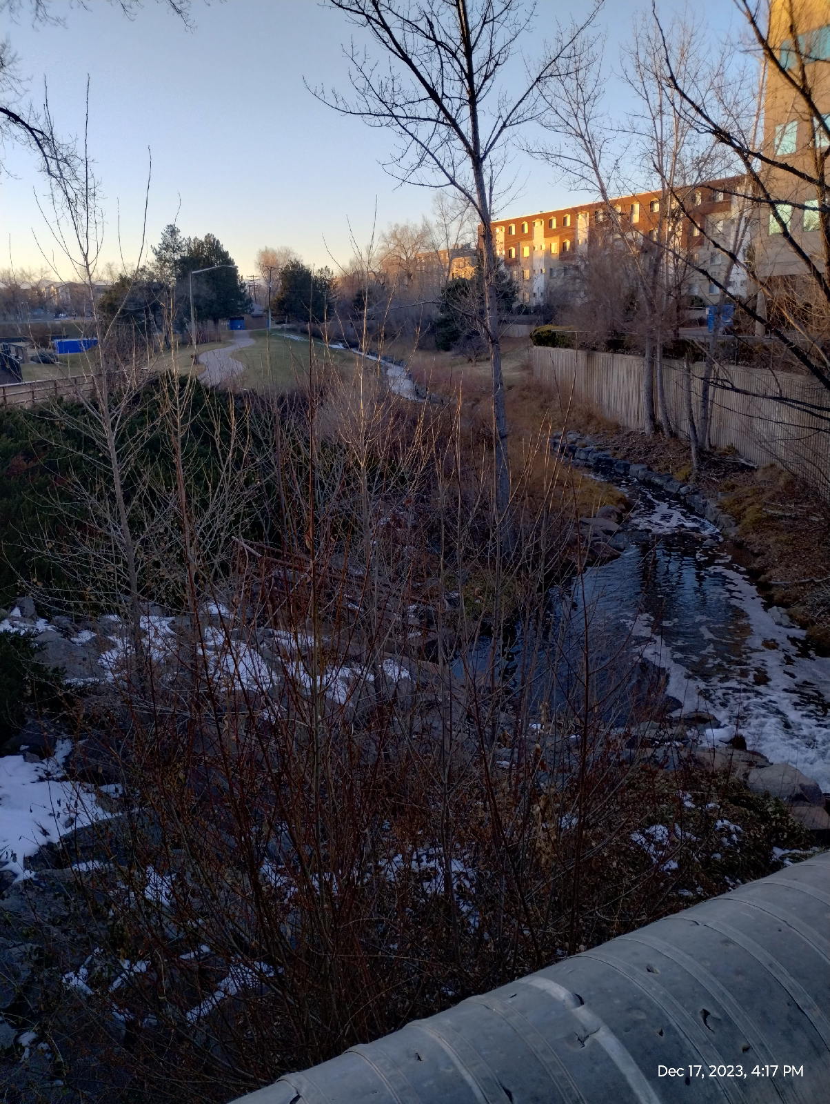
Somewhere out among the ranches, an artesian spring feeds Berrendo Creek.


Just in time to fill the public fishing spot, which was well attended on the day of my hike. I was able to talk to some of the fishers who reported good catches. Catfish and bass are resident there and the creek is stocked with trout.

The water isn't green from pollution. It's calcium. I saw the same green water back East in the karst regions of Alabama, Tennessee, and Kentucky. This water certainly comes from that deep, limestone aquifer.

The ducks seem to like it, too 

But I was hiking and, with miles to go yet, I started out toward town.


The "Red Bridge" of Red Bridge Road

The first two miles into town is along ranchlands. Soon after entering town proper, there was an old cemetery that has plans to renovate (it currently looks a lot like pictures I've seen of boot hills from the 1800s.)

About a mile further brought me to Goddard High School. As memorial to the inventor of the liquid fuel rocket which developed to carry people to the moon, there are rockets out front (I will have to revisit this place some time in future explorations of Roswell )


Finally, reaching Main Street about five miles from home, I was ready to find supper. By the time I reached the home stretch, the 1.7 mile rural desert road to home, it was very dark and surprisingly cold (out came my headband flashlight, flannel shirt, and leather jacket.)

Some people talk bad about Roswell. I suppose it isn't a major party place but for people like me who values adventure and diversity, it offers plenty. 

And so does your home. Go find the hidden treasures around you.

Where does your city water come from and how is it treated? Is your home range famous for any particular crops? If so, why are they grown there and not somewhere else?


Monday, December 18, 2023

Little Dry Creek: The Grand Tour

I've mentioned that I like following waterways from beginning to end. I've finally gotten around to following the neighborhood stream, Little Dry Creek, from it's head near Yosemite and Arapahoe, to it's mouth near Dartmouth. I almost finished early enough to photograph the river end but, alas, it was quite dark when I got there.

I started at the spring behind the Safeway offices. Everything above that is runoff.
My elevation was 5720 feet according to my topographical map. Air temperature was 74.7° F so I was shedding clothes. The stream water was at 3.5° C. It was coming directly from the Dawson formation so it was cold. I'm flip flopping between Fahrenheit and Centigrade because most weather is reported in Fahrenheit but I like to know how far above freezing things are. Water freezes at 0° C.

I tried to get an idea of the flow rate when I took samples for later analysis. I measured approximately average depth and width and tried to clock a piece of balsa wood floating downstream. But the wood wouldn't move. The flow rate at all three sites was "a trickle". I know that the water was moving because it was flowing over the weirs 

The stream here was two inches deep and 12 inches wide.

The Dawson aquifer isn't very productive and having watched the flow rate recorder by the gauge near Arapahoe (It has been nonfunctioning for a couple of months now) and keeping an eye on the spring, it looks like the flow rate responds to rain fall and snow melt almost entirely. 
A network of runoff channels between Yosemite and Alton Way carry Stormwater into Little Dry Creek for and initial boost. The creek shows a good start at valley building.
This view is just west of Yosemite from the spring at the beginning of the Little Dry Creek Greenway. From here on, rocks and weirs (overflow dams) have been added to the bed and shoulders to manage erosion.

Any large rocks in the area are primarily brought in for landscaping and erosion control, so this is not a good area for studying the indigenous bedrock. The top soil is shallow and the underlying material is clayey, weathered bedrock. The bedrock is colluvium, the pulverized material washed out of the Rockies that filled the Denver Basin in recent geologic times 
My second sampling site was between Little Dry Creek Park and Uinta Street. The banks of the stream are steep and there are several slumps where gravity is pulling chunks of the bank into the creek. Closer inspection show these slumps to be saturated with water. They look like seeps, slow moving springs from the underlying Dawson aquifer.

There was a small slump that was just big enough for a foot and a knee. I knelt on that to take a temperature reading and water sample. The temperature was 6.6° C. Trying to stand, I overbalanced and went in head first.

I came out really quickly 

Little Dry Creek is polluted and smells bad. I hoped that the rest of the ten mile hike would give me a chance to dry and air out. On the train back home, no one looked particularly offended so it must have worked.

The water here was 3 degrees warmer than at the spring. I would be tempted to credit that to kinetic energy of flow but it probably had much more to do with the amount of surface area exposed to the sun. The creek was 50 inches wide there. The depth was 14 inches (just enough to totally submerge me and make me actually swim to get out.) Air temperature was down from the spring....68° F., about 7 degrees colder.

This was where I gave up trying to measure the flow rate by throwing chips of balsa into the water. There was flow. Water was trickling over the weir downstream, but the surface was dead calm. There was an active storm sewer dumping into the creek upstream and the aquifer was adding volume at the seeps.

The creek is geologically young but the material under it is clayey debris and crumbly arkose sandstone so it has no problem cutting into it. The whole length has vertical banks from 2 to over 20 feet high, moderate meanders, and a broad valley.
Here's a topographic view of the first quarter of the course of Little Dry Creek from "Highlands Ranch Quadrangle, Colorado, 7.5 minute series." If you're not familiar with topographic maps, the brown lines are elevation contours. The closer they are, the steeper the incline. The v-shaped contours around the creek point upstream.

One advantage of this hike is that it follows a creek that's flowing downhill. There's not a lot of "up".
The third (and last) sampling site is a pretty little cascade just before Spruce Street. It's not "natural". Those granite and gneiss boulders were artistically placed there by Parks and Recreation workers. They did a nice job. A culvert empties an intermittent tributary into Little Dry Creek below where I sampled. (See the blog "Walnut Hills: The Big Hill")

Little Dry Creek was colder here (3.4° C), almost as cold as at the spring. That's interesting since the air was warmer (68.2° F) than at the second site. And I would have expected those rocks to have been soaking up sunlight and transferring the heat to the water.

The stream was 112 inches wide here and 16 inches deep. Of course, the stream dimensions can change but there was no reason for big fluctuations Little Dry Creek is historically pretty consistent, so it's reasonable to compare them from site to site. Within about half a mile, the stream has more than doubled. Runoff isn't large so I'll assume that it's being fed by that aquifer.
Past Quebec, Little Dry Creek flows through an HOA, requiring a detour up to Arapahoe and down to where the stream emerges from under Arapahoe to continue it's journey into Holly Reservoir. The approach is over a series of weirs (the area is always flood conscious) that parallel the road.
There used to be a pedestrian tunnel that passed under Arapahoe beside the creek, but they closed it off before I moved to the area over three years ago. People must have still tried to use it, because the county then covered the approach ramp with crushed granite.
Holly Reservoir (by Holly Road) is home to a recreational center with tennis courts, a swimming pool, and water slide. The creek meanders it's way through the basin and under the dam. In the case of a massive(!) storm, there could be a lake here. I can't find any record of there ever having been such an event but better safe that sorry.

Holly Dam
Little Dry Creek at the outflow of Holly Dam

Just below Holly Dam, Little Dry Creek and Willow Creek merge. Usually the resulting Creek takes the name of the larger stream, but not in this case. Willow Creek is usually larger, has traveled further, and occasionally will create a lake behind Englewood Dam but the creek that flows from this confluence is called Little Dry Creek.
That's Willow coming in from the left.
In this stretch, Little Dry Creek widens out and cuts a fairly deep gorge. There's also a steepening incline.
The Highline Canal leaves the mountains in Watertown Canyon and flows under the influence of gravity for 66 miles (in the past as much as 71 miles) to the Rocky Mountains Arsenal in northeastern Denver. Along the way, it crosses several natural streams, including Little Dry Creek. It does so by following lines of elevation contour. Natural streams generally cross contours at right angles. The crossings present engineering problems.

There are several places where the canal crosses over streams on water bridges called "aqueducts". The photos above show the syphon where the canal crosses under Little Dry Creek. I would have taken a picture from the top except the canal usually doesn't flow during the winter months.

The canal flows into the tunnel from the left (south) and exits a little lower from the right (north). It works pretty much like syphoning gasoline (or any other fluid) from a tank. The starting level is above the outflow level, so the syphon doesn't have to be primed, which is good since the canal is dry for most of the year.
Little Dry Creek is temporary home to many water fowl. Ducks are common but I've seen many others including egrets and herons. They don't usually make themselves at home but they visit often.
After a brief run down between a meander in the Highland canal, the creek takes off through backyards in Cherry Village, so I had to start some road work down Orchard and Long to University Boulevard where I picked it up again near Quincy. From there, it's an urban aqueduct, flowing between concrete walls.
It feeds some private lakes...

and water features in a golf course.
but most of it looks like this for the rest of it's course.

This is South Denver and Englewood with many shopping areas and apartments so flood control is pretty tight. As many tributaries that have joined the creek, I would not be surprised to see it clear its banks (I've never seen it but I wouldn't be surprised.) It doesn't get water directly from the mountains so the main thing that leads to flooding, melting snow pack, isn't that much of an issue.

Concrete culverts don't really draw me, but there are some points of interest here 
This was a surprise to me. I have seen many of the early sites of gold finds...Clear Creek, Montana City, Bear Creek confluence with the South Platte. These are all streams from the mountains. They erode mineralized, crystalline rock. This first significant gold find was from Little Dry Creek, a creek that runs it's entire course through the debris that has been washed from the Rocky Mountains. That means that a pocket of gold must have collected somewhere by an ancient stream, waiting until Little Dry Creek found it and washed it down to present day Englewood where it waited for William Green Russell to come along from Georgia to pan it out. Why was he even looking here?

Nearby, the creek runs below ground to travel under the Englewood shopping district.
By the time I got to the other side, it was too dark to finish photographing the last section of Little Dry Creek, but a couple of weeks later I made a supply run to the area and finished the tour.
The tunnel in the background is where Little Dry Creek emerges from underground in Cushing Park. Here at the confluence with a drainage stream from the park, it looks like a rushing mountain stream. It's landscapes....the rocks were placed.... there's no telling where they're from. They're there to prevent erosion of the bank.
A little further down the rocks give way to a concrete channel as the creek passes under the railroads and the CanAm Highway (Santa Fe) on its last approach to the river 
The underpass is decorated by a mural by Boulder muralist and graphic artist Amanda Wolf (2021).
An overlook over the South Platte River gives a good view of the confluence.
You have to cross the river by the nearby footbridge to see the mouth of the creek 
There's a low overflow dam just upstream.

At the river, I checked the elevation again and found it to be 5256 feet. That's an elevation loss of 464 feet. I'm glad it was mostly downhill.

So that's the Little Dry Creek from beginning to end. I'll be saying more about its contents. And I'll show you some rocks I encountered along the tour.

Have you ever followed a creek from beginning to end? Do your homework first and stay safe.