

One thing has drawn me since moving to Walnut Hills. Why is the big hill there?
At Uinta Street, just behind Walnut Hills Elementary School, Little Dry Creek suddenly takes a dive of about 20 feet in the length of a football field. The ridge that the creek cuts persists north to south throughout the neighborhood. It begs the question, "Why are you here."
It has a double peak. If you're walking from the west along Arapahoe road, you hit a steep incline at Spruce Street that peaks and then slopes down a little to the intersection with Uinta, and then it continues up to the top of the ridge between the South Platte and Cherry Creek valleys. It makes me think that Greenwood Plaza Street and Uinta follow an old stream bed. I've speculated that a branch might have cut down from present day Fiddler's Green and the confluence with Little Dry Creek might have increased the erosion down Walnut Hills.
So, I've been looking for an old branch that might have run along current Uinta Street. Then, I remembered that steep declines will usually migrate upstream and I started looking downstream from Uinta. An old topographical map showed me what I wanted.
The map above was cropped from the United States Geological Survey topographical map "Highlands Ranch Quadrangle, Colorado, 7.5 minute series." These maps are put together from data from different sources. The hydrologic data from this map is from a 2011 data set. The tributary that flows down from Fiddler's Green is no longer on the surface. I've never seen water there.
On the last station-to-station hike, I made it a point to trace the path of the intermittent stream on the map that is shown crossing Arapahoe near Uinta.


This is a view from Fiddler's Green Circle just east of where Greenwood Plaza crosses it. The building on the left is the Kaiser Permanente IT building and to the right is the new Junior Achievement building. Between is a depression that features a pond and a preserved wetland.
There are a lot of water features characteristic of Denver urban landscapes around Fiddler's Green. According to the map, there is a spring. That and storm runoff has to go somewhere and the storm sewer surfaces behind the Junior Achievement Building.

Water features usually have purposes in addition to beautification. Water runs into this pond from a storm sewer outlet and is then cycled through the fountains, then it runs under the driveway into the depression beyond where some returns into the sewer system but much of it soaks into the ground.
It's a miniature water treatment plant.
Many of the microbes that get into ground water to cause problems are enteric, anaerobic species like escherichia coli and strains of pseudomonas....bacteria that normally inhabit the guts of mammals but get transferred from toilets and washed out of farms. Being anaerobic (which literally means they live away from air), they don't like oxygen. The fountains oxygenate the water and kill many of the trouble makers.
Also, ground is an effective water purifier. People who camp have heard a lot that running water is safe to drink. Don't believe it. Deep well water is generally safe to drink and spring water directly out of the ground miiiiiight be safe. The idea is that many contaminants are filtered out of water by soil. There's even some ion exchange that goes on when water percolates through certain kinds of rock (some of the more expensive water filters are packed with ion-exchange resins), but some contaminants won't come out regardless of how or how much you filter it. With all the mines upstream from where I live in Colorado, heavy metal contaminants should always be suspected.
But, that said, water filtration is an important part of water purification, and swampy depressions like this, as long as the water doesn't stagnate, are intentionally designed to help purify storm runoff. Even the plants are chosen to help purify the water.

Greenwood Plaza follows the old stream bed closely, so where is the stream now?

Many streams in urban areas are diverted underground into the storm water system.
I see that in the mid-1880s, the pioneer Rufus Clark developed this area for occupation and there was actually a reservoir here where Arapahoe Plaza now stands. It wasn't a sufficient water source until Castlewood dam was built near Franktown and more water was piped in. So this spring has never been particularly productive (it's the same aquifers that feed Little Dry Creek.)
John and Marjorie Madden, the art patrons associated with the Denver Outdoor Arts Museum developed the Greenwood Plaza area east of Interstate 25 in the 1970s.
According to the 2008 annual report published by Southeast Metro Stormwater Authority, the Arapahoe Plaza storm sewer was put in the summer of 2007. That would have diverted the intermittent stream underground.

The stream resurfaces for a short distance at the intersection of Greenwood Plaza Boulevard and Arapahoe road. Then it passes under Arapahoe.
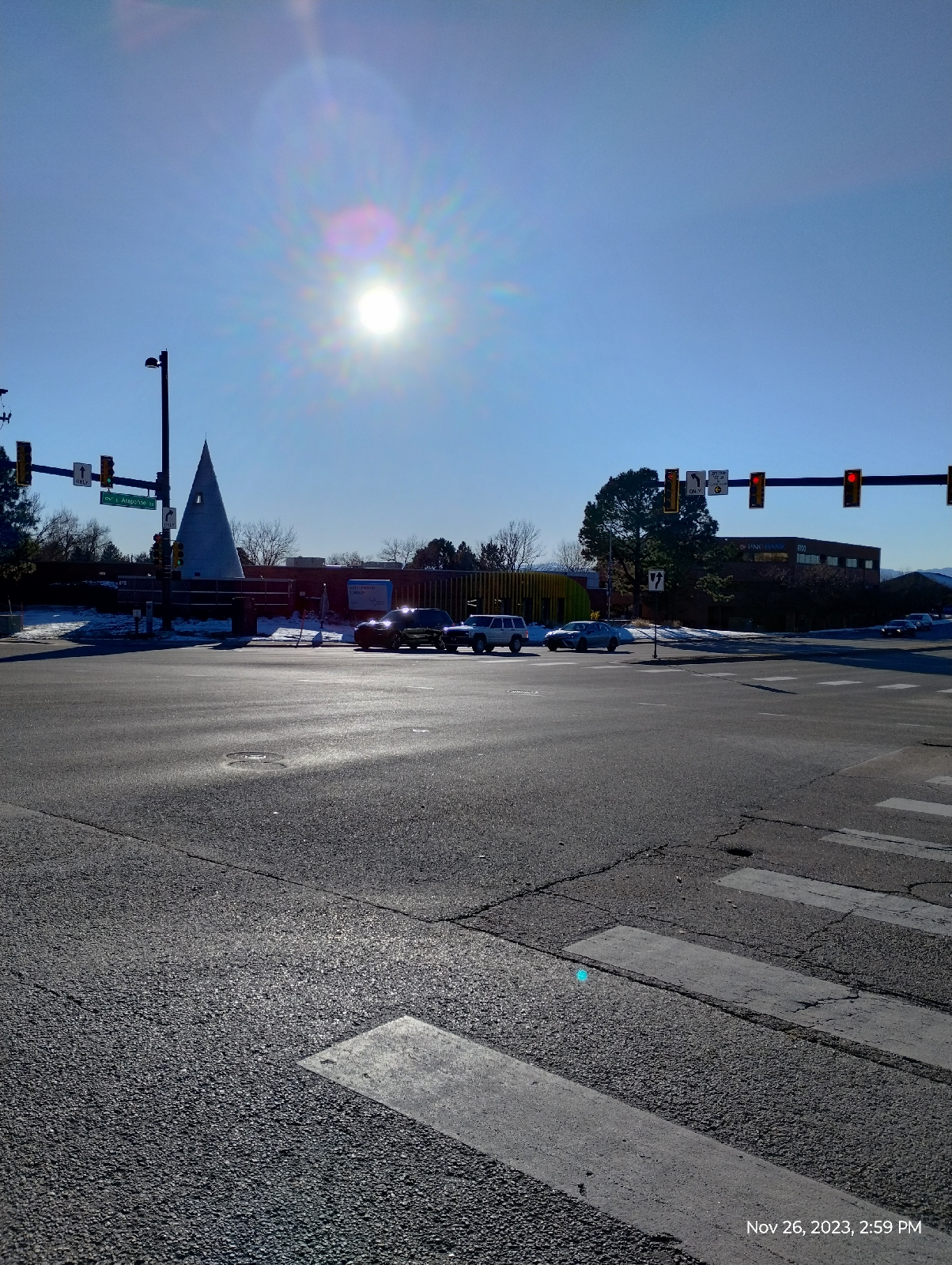
Across from the shopping center, there's a library (the Castlewood beach of the Arapahoe public library system) and a bank. The old stream bed is still visible between although the stream itself is now underground.

There it is.

There's even a footbridge over the dry stream bed.
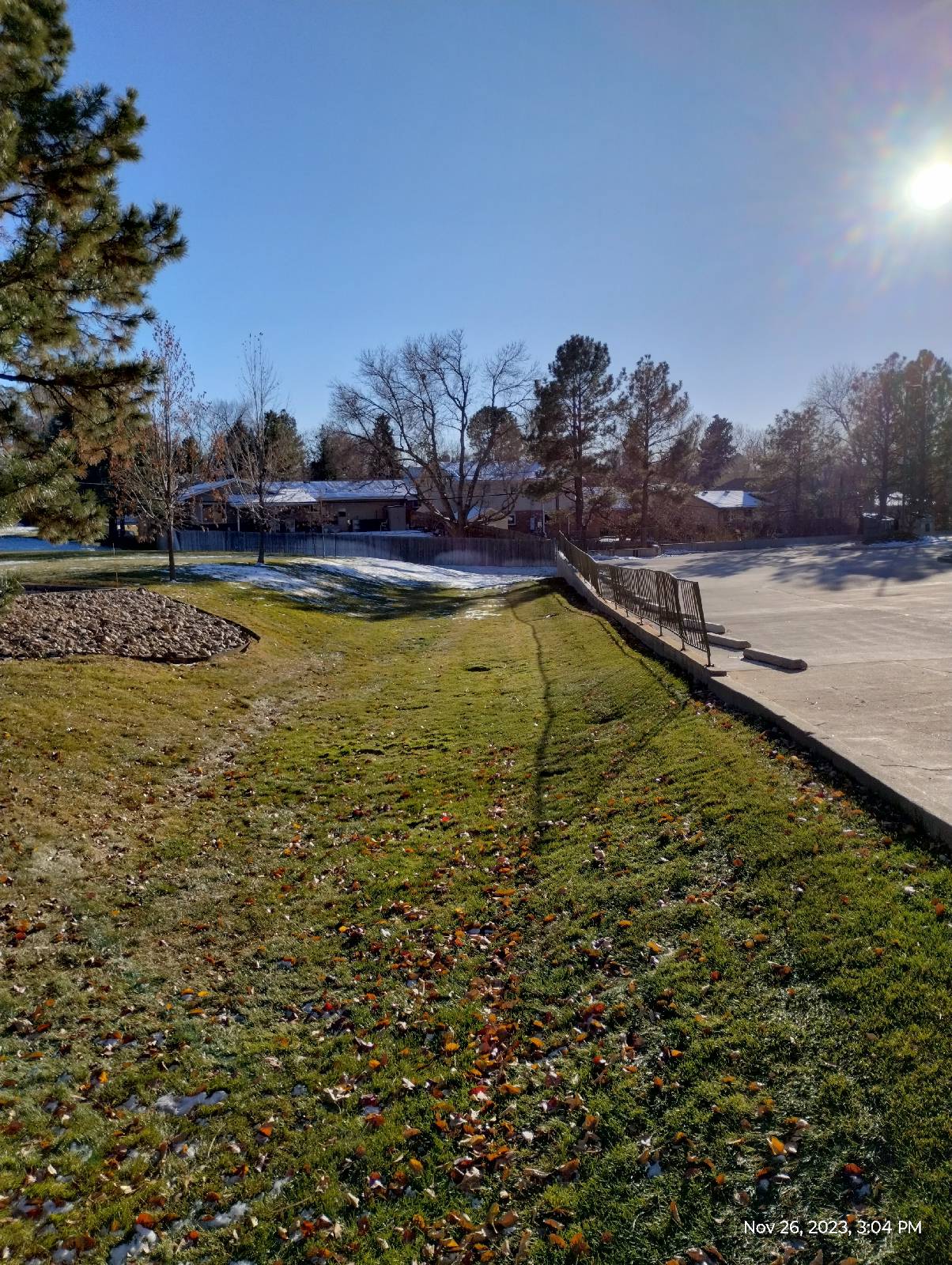
The old stream bed curves around the bank parking lot and runs between that and the Briarwood residential area.


I'm sure some water gets into this area after a heavy rain, but I've never seen any running water here. It looks like this whole channel was carved out by the old intermittent stream before the sewer lines were laid.

From the opposite side of Little Dry Creek, you can see the depression and line of vegetation between two residences between which the old stream ran. The sewer line dumps into Little Dry Creek right here.

There is a small cascade here. It's been reinforced to reduce erosion around Spruce Street.
I can imagine the South Platte River notching out a hanging valley where the Little Dry Creek entered it....maybe ever an impressive waterfall....as the Rockies rose and erosion began to fashion the broad South Platte Valley where Denver would later be built. The tributary would wallow out it's own valley in which the cataract would travel upstream. Present day gulches (actual gulches) exist along the stream's course in several places, such as along Hampden and below the confluence of little Dry Creek and Willow Creek.
But it's above Spruce Street where the little stream has sawn through the big hill at Uinta Street. I would imagine that the little stream from Fiddler's Green helped.
Water plays a major part in crustal geology. It carves the land we see around us and under us, even in very dry regions. As crust is subducted at the edge of continents, water is pulled down with it and alters the recycling of rocks. It's intimately meshed with life and economy. I'm fascinated by the course that water runs on the Earth.
You can learn a lot about geology by following the water. I plan to follow Cherry Creek, one of two major streams in the Denver area, from beginning to end. Do you have any favorite streams close by?
No comments:
Post a Comment