Showing posts with label water fowl. Show all posts

Wednesday, January 31, 2024

Cherry Creek: From Union Station to Alameda


The Millennium Bridge again, but it bears revisiting. The world's first cable stay bridge using post-tensioned construction, I've seen it in engineering texts and lecture videos and at least one movie. It was designed to nestle in amongst the tall buildings of downtown Denver and provide safe passage across a railroad yard. It's the southernmost of three innovative pedestrian bridges to cross the railway, the South Platte River, and an Interstate and connect downtown Denver with the Highlands community.

The span is 130 feet but the deck is only 6 inches thick. It's suspended by cables to a 200 foot mast that acts as a lever anchored to the foundation by cables on the opposite side of the bridge. The deck is 80 feet wide at the average and is supported by I-beams.
The South Platte River bridge and the Highlands pedestrian bridge over Interstate 25 are visible from the Millennium Bridge.
While on the bridge, I checked the weather.
Pressure was dropping but with 30% humidity (from my pocket weather meter, I didn't expect any precipitation or sharp drops in temperature soon.
Here's a closer look at the South Platte River bridge. It's springy enough to feel it as you walk across.

The two major rivers in Denver are the South Platte River and Cherry Creek (I've heard Cherry Creek called "Cherry Creek River" several times and, if South Platte's a River, I guess Cherry Creek might as well be considered a river, too.). This confluence is of historical importance because it's set where Auraria and Denver would be located. The rivers were never large enough to provide economic river traffic (though check out "Venice on the Creek" below!) But it did provide a waterway and convenient sewer for the early settlers.

Cherry Creek is named "Cherry Creek" for the multitudinous choke cherries that grew along it's banks.

There was some hope that this area would yield gold early on, but that dream quickly dissipated. It's there but not in anything like economic quantities.
This guy is about as much responsible for Denver's existence as just about anybody. Little Raven was an Arapahoe chief who welcomed the gold-hunting settlers from (mostly) Georgia to the area and helped them develop a stable community.

You'll notice a lot of things in the Denver area named "Little Raven" and "Arapahoe" (including the Arapahoe County where I live.)

Little Raven tried to establish peace first among the tribes of the Great Plains, with considerable success, and then with the settlers with mixed success. He lived from around 1810 to 1899 so he lived to see conflicts such as the Sand Creek Massacre, and died in a military hospital in Cantonment, Oklahoma. He is buried at Fort Sill, Oklahoma.

I was in familiar territory for the first half mile or so. Here's the row of iron truss foot bridges that connect Speer Avenue with downtown Denver.
These things confused me. There are five and I could see no obvious purpose for them. Best I could figure was that they were a channel for kayakers.

Turns out, that wasn't too far off the mark.

In 1996, the Denver Greenway Foundation launched (heh) an attraction called "Venice on the Creek". They bought five punts (23 foot long wooden boats), hired punters to steer the boats, and installed five dams and locks. It lasted until 2009 when maintenance costs overran the revenue.
Denver's love of murals extend up and down Cherry Creek.
This plaque, embedded in the stone wall lining the creek, explains the origin of the name "Cherry Creek" and some of its history. Although it isn't a mountain stream, it was given to flooding. 

August 3, 1933, a dam near the headwaters of Cherry Creek in Cottonwood Canyon burst and sent a devastating flood into Denver.
The downtown segment of the Cherry Creek trail is usually fairly trafficked by hikers, joggers, bikers and people just trying to get from one place to another. In response, Denver keeps it well maintained and ornamented. 
The trail runs close to many popular downtown sites including the Bellco Theater/Center for the Performing Arts/Denver Convention Center, with their RTD station, and the Auraria Campus.
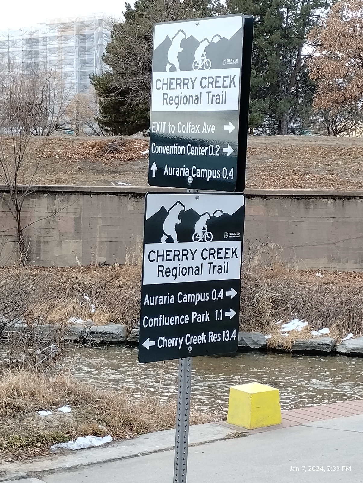
There's plenty of signage on the trail telling you where you are and how to get to where you're going.
If you're injured on the trail, it runs by the central installation of Denver Health (Denver Health and Hospital Authority) a sprawling, integrated health care facility. It was originally a private hospital but it "bought into" the city government, which caused some problems with procurement so it switched more toward the state and is now a sorta confusing conglomeration of private and public, state and city governed politics. It is governed by an eleven member Board of Directors who are appointed by the Mayor of Denver.

They are a teaching hospital that includes a full range of crisis intervention units. It even has its own Wikipedia page!

https://en.wikipedia.org/wiki/Denver_Health_Medical_Center?wprov=sfla1https://en.wikipedia.org/wiki/Denver_Health_Medical_Center?wprov=sfla1


Ducks abound.....actually waterfowl of many kind including egrets, geese, dippers, and gulls frequent the Denver area. We're on major migration routes and many species have decided that they like the area so much that going further south is just plain silly.


Like many of the streams in the area, Cherry Creek frequently runs through private areas like this Denver Country Club golf course. Then, I have to find my way around. This circumlocution brought me to my final destination, Alameda Avenue.


This little cascade where the creek passes under University Boulevard and into the golf course is man-made but rather picturesque.

A little down the street, the streams runs alongside Cherry Valley shopping center....


And a little further on I rested at a bus stop as I waited for a ride to the Alameda train station. 

The sand bars in the photo indicate that Cherry Creek still carries a considerable load of sediment down to the South Platte River. It travels up to the Missouri that empties into the Mississippi, and then to the Gulf of Mexico and, thus, to the Atlantic Ocean.

This is one of the two big streams in the Denver area and it's fortunate that we have a trail that follows almost it's entire length. There are many natural and historical sites along it.

Streams are fascinating to me. Are there any to explore in your area?

Tuesday, August 9, 2022

Decatur-Federal Station to Auraria West Station

Lakewood Gulch at the Decatur-Federal Station has grown to quite a respectable stream.
The sound of water rushing over rocks is nice. Those rocks, of course, were placed there to break the force of the water and reduce erosion. I see many places here along the gulch where the mud is wet and slippery. It's evident that the stream has been out of its banks recently. Flash floods have occurred in this section, but the valley here is deep.

The light rail station here can be busy since it offers access to both the Department of Human Services offices and recreation like Empower football stadium and the Meow Wolf Art Exhibit.
Lakewood Gulch Trail is right on the edge of downtown Denver here.

Despite the urban setting, the South Platte
River draws water fowl. Here at the confluence of Lakewood Gulch and the South Platte River, things happen. The river has grown to a respectable size (see other photos of the South Platte in these blogs) and mixing of shallower waters carry pollutants but they also pour nutrients into the river and oxygenate it's waters. This egret seems to be looking for minnows.
After I reached the river, I had a tangle of highways to deal with, Interstates 25 and 70, Colfax Avenue and Old West Colfax Avenue, Walnut Street, First Street, Auraria Parkway, Fifth Street, the light rail and train yards, and the river. They all come together and try not to collide right here. Plus, the football stadium and Meow Wolf is tucked in amongst it all.

Meow Wolf is an interactive art exhibit in Denver run by a company in Santa Fe, New Mexico. They have other exhibits there and in Las Vegas. For the curious, the name was drawn at random from a container of slips of paper with words on them.
Denver, or the settlements that were to become Denver, was built around the promise of gold, a promise that soon played out with little result. What saved the town was a branch of the railroad that dropped down from Wyoming. Denver became associated with culture, cattle, and the railroad.

The railroad is still prominent here. It runs between Meow Wolf and much of it's parking area, so I waited awhile with several customers trying to get back to their vehicles while a long, slow train moved through.

The last stop on my itinerary was the Auraria campus, shared by Community College of Denver, Metropolitan State University of Denver, and the University of Colorado in Denver. I've been here before (Auraria West to Osage, November 10, 2018 blog) but there were parts of the campus I didn't see until I visited it with a friend a couple of weeks ago.

The campus is a mix of old (some of the oldest parts of Denver) and very new (the campus was built in 1973) architecture, and the old and still operating, Tivoli brewery serves as the student union.

The lynx is the official mascot of the University of Colorado in Denver.
For a major hub of the light rail system (the W Line branches off the rails to Union Station here), there is surprisingly little art here. As the train pulls into the station from points to the south and west, a mural appears on the side of one of the campus' administrative buildings. I say "appears" because the building is blocky and the mural is split between several walls that can only be seen as an unbroken whole from one direction.

This completes my exploration of the RTD W Line and the land (physical and cultural) surrounding it. I didn't include a lot. I passed through a major art district that offered much more than I had space to describe. The geology is complex and fascinating and I will have to revisit it. The cultures range from wealthy to the tent cities of Denver's homeless population (which is distressingly large and trapped in their circumstances.) The history spans the earliest native inhabitants to contemporary Denver.

Paths offer unique opportunities to learn from your surrounding. Following a railway, or a highway, or a stream can provide adventure and many learning opportunities.

What's in your world?

Wednesday, June 6, 2018

Oxford to Englewood


                                                  [Englewood station from the bus gates]

Englewood Station is a good place for a "home station". It is quite interesting in it's own right and it has all the amenities. The Englewood Community Center is part of the complex, with it's city offices, the Englewood Library, and the headquarters and museum of the Open Air Arts Museum, which is scattered all over Denver. A short walk brings a hiker to three shopping centers and several banks, and the shopping area along Broadway. There is a WalMart and my favorite restaurant in Denver, the Beirut Grill.

It was a hot day when I took a bus down Yale Avenue to Englewood Station. The big spire in the picture above is not only a piece of art, it houses the elevator from the plaza at the Civic Center to the bridge across to the light rail station.

                                                         [Englewood Civic Center]


                                                         [Art plaza with fountain]

The fountain is constructed to allow a lot of personal wetness. Geysers of cool water erupt from the lawn around it and a hot summer day, of course, draws crowds of children in swimming attire. I was tempted, but was dressed completely inappropriately for fountain activities. Instead, I stopped into the Civic Center for a restroom and some water. There, I looked at some of the exhibits including Cherrelyn, the horse trolley (and the horse), and Museum of Outdoor Arts (and it's bear). If you ever visit Denver, you will notice that Bear is a major motif around town.

                                                                         [Trolley]


                                                                          [Bear]

The starting point for my hike was just one station down from Englewood. Here are more of the tiles decorated by children at Oxford Station.

                                                                  [Oxford Station art]

I am told that the art across town and the ornate rail stations and highways are fairly recent.

                                                                    [Oxford Station]


            [Santa Fe highway overpass]

                                              [Mountains from bridge over the South Platte]

We've been here before. It's the bridge over the South Platte River where the Mary Carter Greenway/Platte River Trail and Bear Creek Trail meet. You can see from the mountains frames in the bridge's railing that, regardless of the heat on the high plains, Mount Evans still has a lot of snow. At 14,271 feet, it's still pretty cool up there.

I wandered over to the Steak and Shake to buy a much needed milkshake and then I came back to the Greenway to begin my hike. I found these two waders, perhaps little blue herons, on a sandbar in the river. This area is a good place for spotting water fowl.


A little ways on I noticed this patch of sturdy grass, which I have been unable to identify (anybody out there have an idea?).


                                                                           [grass]

At the point where Dartmouth crosses the South Platte, it has absorbed Big and Little Dry Creeks (Little Dry Creek merges right here at Dartmouth in Englewood.), Bear Creek, and several smaller tributaries and is becoming a respectable river.

                                                                [Platte at Dartmouth]

Several of the old train depots have been preserved in the area. Englewood takes the arch shaped facade design of its depot as an emblem. It reminds me of the Spanish architecture of the Catholic missions. Some of the depots, like the Littleton depot are still at the tracks, but for others like this one, the tracks have moved away. Now, it is the front for a community garden.


Since the columbine is the Colorado state flower, I had to take a picture of these nice specimens.


Back at Englewood station, I walked up to my favorite Denver restaurant, the Beirut Grill, for lunch. On the way back to catch the bus for home, I spotted the Englewood Trolley that ferries passengers at no charge between 19 stops among the businesses near the Englewood City Center.

                                                               [Englewood Trolley]

The area around the city center is an open air art museum with an entrance to the east guarded by these two durpy looking dogs. (Actually, they're sculptures of Greek Temple dogs. evidently, if you made trouble in a Greek temple, you would be licked to death.)


                                                             [Greek temple dogs]

This stalwart gentleman rests down Galapagos street.


                                                                            [Boar]

At the other end of the street, these two sage and weary looking lions keep watch.


                                                                         [Lions]

And my last stop on the hike was the bus stop beneath the obelisk and arch bridge.

Not every town has such an extensive open air art exhibit as Denver, but just about every town has statues. There's a bole weevil statue in Enterprise, Alabama, and a chicken statue in Gainesville, Georgia. Selma, Alabama had a lot of statuary including some that caused constant controversy like the statue of Nathan Bedford Forrest (namesake of Forrest Gump and the first leader of the Ku Klux Klan) and the less infamous gargoyles on the First Baptist Church at Lauderdale and Dallas. What statues does your town have and what's their back stories?

Folks rarely give grasses, even the ornamental grasses in gardens, a second glance but, if you look closely, you will find intricate patterns in their blooms and seed heads.

If you have streams in your area, check out the areas where streams merge - the confluences. They are often favorite areas for water fowl and other wildlife - why do you think that would be? What's different about stream confluences?