Showing posts with label Great Plains. Show all posts

Thursday, June 29, 2023

Lone Tree City Center Station to Lincoln Station. Urbanity

The southeastern lines of the RTD light rail are all about cities and plains. There's nightlife, great restaurants, attractions, and hiking on the plains and foothills. I live very near the Valley Highway, the stretch of I-25 that passes through the Denver area on the narrow ridge between the South Platte River and Cherry Creek valleys. The southeastern light rail lines parallel the highway.

For the next few hikes after Lincoln Station, I'm going to diverge from the huge shopping areas near the highway and explore Willow Creek (which we saw seeping from the Denver Formation aquifer at the base of The Bluffs.) At Arapahoe Station I'll pull back to the areas around the highway to explore some more urban settings like the Denver Tech Center, Denver University, Washington Park, and Broadway.

On the way to Arapahoe Station, I met this guy. They're a garter  snake. It's about the fifth snake I've seen since I moved to Colorado. I'm a little disappointed. Watching the movies, I expected to see snakes under every boulder.

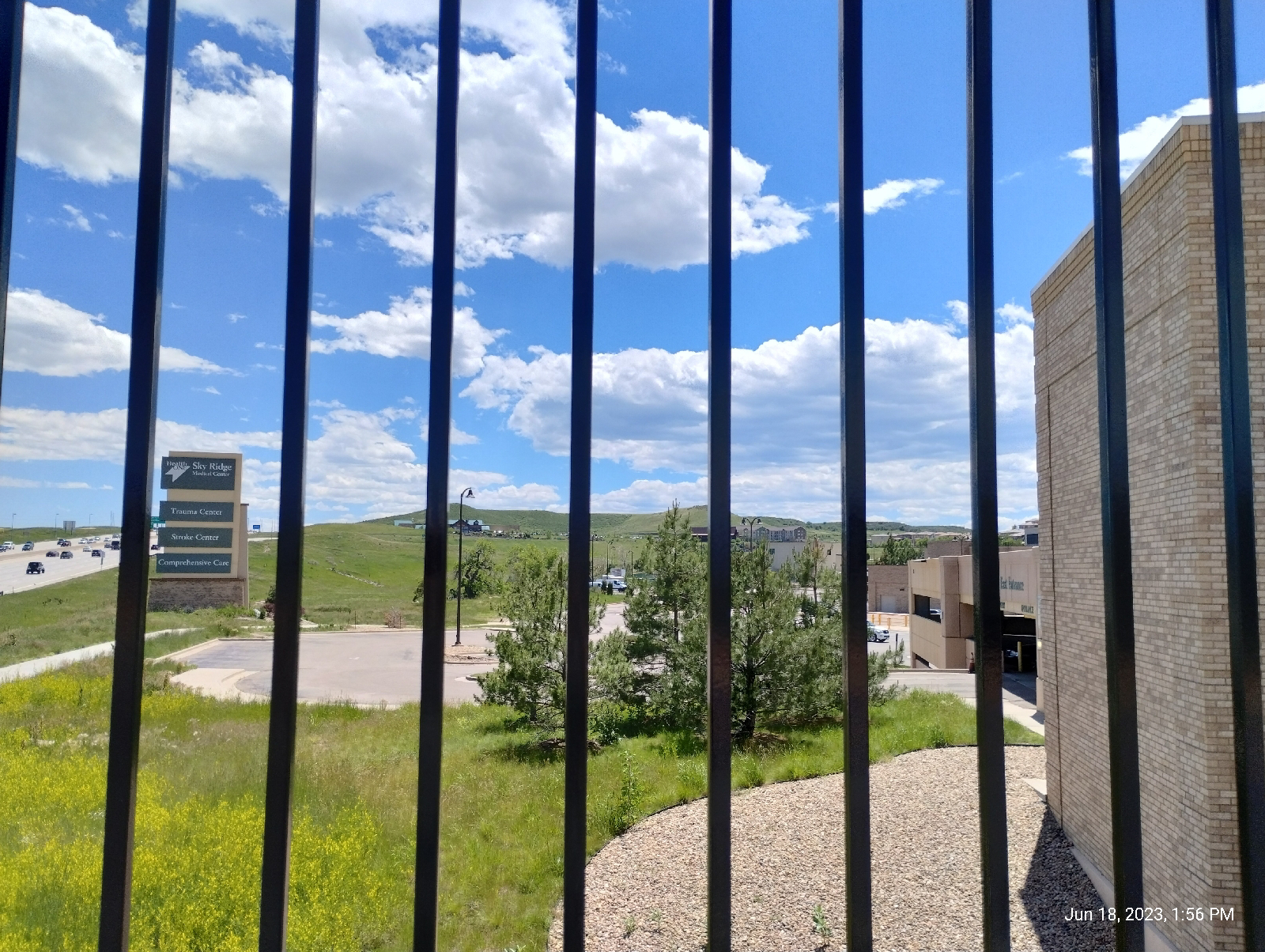
Back at Sky Ridge Station, I surveyed my surroundings.
It's actually a pretty nice vantage point to view the Bluffs and the Rockies. If you want to take in the Bluffs from light rail, it's a good choice. Leaving the station, just take Sky Ridge Avenue straight to Belvedere Park and follow Willow Creek up to the top.

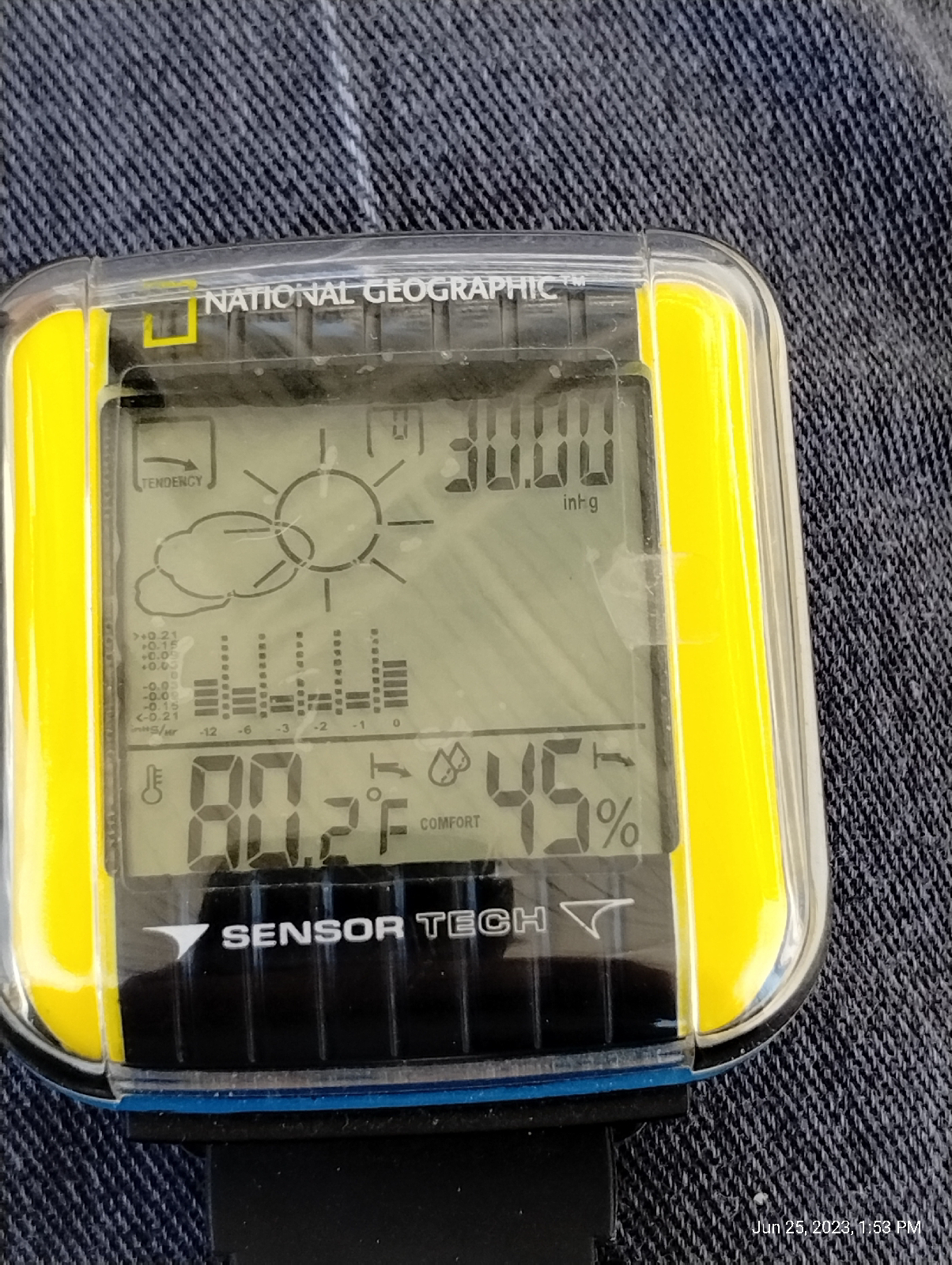
But that wasn't my destination this time. I took a minute to check with my "weather station" (my bones told me that if there was rain on the way, it would hold off for the duration of the hike. My bones are pretty reliable. But I wanted to play with my stuff.)

Lemme see. 30 inches of Mercury and rising. That's about one bar (a little high for this elevation...right at normal sea level pressure, though.), 101,000 pascals (looks heavy but weather is generally measured in hectopascals- a hectopascal is 100 pascals pressure), 762 torr. The weather looks pretty stable. No reason to expect thunderstorms. 80.2 degrees hot. 45 percent humidity...probably not enough moisture in the air to fuel any storms 

That's a screenshot from my Trail Sense app. It's a pretty nice utility for active people. It has a display for local weather that uses the phone's on board sensors and local and historical weather data. The barometric pressure is less than a tenth percent off from my Dekota pocket weather meter, so I'll forgive that. Again, high pressure rising looks like stable weather.

My barometer readout hasn't been calibrated and 819 hectopascals is pretty low. What's the altimeter say?

Eh, we're outside of the Denver Basin so, over a mile in elevation. I'll accept that. The official Wikipedia elevation of Lone Tree is 5948 feet and the train Station is up on the ridge with the Interstate and the light rail. All instruments seem to be in good working order.

Actually, none of that is a surprise to me. As a pedestrian, my weather sense is pretty fine tuned, but if I were in the mountains with no connectivity, these instruments would prove their value. It's nice to see that they work well, occasionally.

I could have walked a short distance through that little park near the station (see the last station-to-station blog) and I would have ended up at Lincoln Avenue, but it wouldn't have been much of a hike. Instead, I did a little road work and landed at the same place. There were fairly unremarkable high-rises.

Looking down Lincoln, I saw the leaf sculpture I had been seeing in the distance from Lone Tree...

so I decided to take a closer look.
It displays Denver's appreciation for cable-stay bridges. Instead of a mast, there's a nice looking leaf sculpture. I used it too get to the other side (sorta like the chicken). Then I walked up to the Interstate and the approach sidewalk to Lincoln Station.

The approach path is the longest one I have seen at any light rail station in the Denver area.
The pedestrian bridge, a typical cable-arch structure, provides a nice view of the countryside.

Again, it's the high plains but, specifically, Cherry Creek valley. Cherry Creek is over there, somewhere.

Lincoln Station is surrounded by several buildings-looks like apartments, businesses, and at least one cafe. It looks popular. The above fountain was at the other side of one. Denver likes it's water features.

And, speaking of water features, I'll be exploring Willow Creek next time.

Sky Ridge Station to Lone Tree City Center Station: Wha!?

I'm taking these first few hikes a little out of order. After Lincoln Station, the train stops at Sky Ridge, then Lone Tree City Center, and then the terminus - Ridgegate Parkway. Lone Tree is right next door to Ridgegate and it would be a quarter mile hike (if that much) if the short stretch between were not fenced and posted. To walk around through Lone Tree, you have to pass by Sky Ridge Station to get to Lone Tree City Center. And I'm not obsessive about it...

To recap, Sky Ridge Station is a gateway to Sky Ridge Medical Center, a sprawling hospital featured in passing in the last station-to-station blog. It's really big, I've visited friends and family there, and it has nice views of the Bluffs. 'nuff said about that 

The photo above shows the direction I started walking from the Sky Ridge Station. The stations might be a half mile apart. I walked under a couple of overpasses and I was there. (shrug)

The bridge over Interstate 25 provides some nice views of the surrounding countryside. It's the plains so there's not much to obstruct the view. It was warm. The sky was a crystal clear blue with scattered clouds. My Neanderthalish blood was pretty close to it's boiling point, but...eh, a pretty day with lots of blues and greens.

The only road to Lone Tree City Center (posted private property surrounding it almost the whole way) was rather in disrepair. Prairie soil is spongey (grasses decay into a tough spongey mass. Try not to get roped into digging a hole in prairie soul.) and not a good base for structures like roads and buildings. For buildings, you get a lot of heavy equipment and dig down to some kind of solid bedrock and build from there. For roads, you need to lay down a bed that can stand up to a lot of abuse, and then build the road on top of that. I'm not sure if they intended this road to be permanent or not.

The light rail makes a graceful sweep over the Interstate and the approach road, and lightly touches down at the station.

And here's Lone Tree City Center and, if you don't believe me, here's the sign.

and here's Lone Tree City Center.
Okay, you're right. There's nothing there...well, the plains and that will be our next topic, but first let me flesh out why I'm standing in a wide expanse called "City Center". It's a huge development project, approved in 2018 that is intended to take up 400 acres and include thousands of homes, businesses and shopping areas.

Ummm...okay, that's it. They're still planning. Just wait for it.

Now, the plains...

As soon as the Colorado Plateau began to rise, erosion began to tear it down. In fact, eventually, the Rocky Mountains buried themselves. The plains used to ramp right up to the tops of the Front Range. They were 7,000 feet higher than they are today. There was no sudden wall of rock that there is today.

How do I know? Well, I read the books 

Also, I've been on top of Lookout Mountain and seen remnants of the old plains up there, what the geologists call the Rocky Mountains Erosion Surface. Somewhere under all that debris are basement rock like the Pierre Shale and chunks of mountain like the Pikes Peak batholith. Eventually, enough of the debris got washed on down to the Gulf of Mexico (or what passed for the ocean back then) so that we have the gradual slopes we have today extending from the Mississippi River up to the mile high, high plains, and then the rock wall.

It's not really as flat as I make out. That's my kenophobia talking. The more accurate description for the plains is "rolling hills". There are even some pretty spectacular canyons out there. Erosion is still going on. There's just very little to break the line of sight. It just goes...on...so...far...

If I have to drive across the Great Plains, I much prefer to do so by night. Unbroken horizons make me crazy.

I sat around and admired the Bluffs and was thankful that the plains were back there where I wasn't, then I got back on a train and went home.

Some people actually like flat land! The plains actually offer much...lakes and winding rivers, history, grass lands (grasses are actually very cool if you get to know them), farms and tourist attractions related to them (how many corn mazes are there in the Midwest?) and a few big cities. If you like flat and sunny with an occasional wind that will pick up your car or truck and move it over...there, then don't mind me. Check out the Great Plains.