Showing posts with label Golden. Show all posts

Monday, October 23, 2023

Anatomy of a Mountain Range 4: The final stretch.


South Rooney Road runs from the intersection of West Street and Colfax in Golden to the east entrance of Dinosaur Ridge on Alameda Parkway. It passes between the Dakota hogback and Green Mountain and has trailheads that go both ways. On my hike, I was ready to get home so I was ignoring the trailheads. I wasn't ignoring Rooney Road, though. The traffic was continuous if not outright heavy with people going to and from Dinosaur Ridge and Red Rocks Park, and the narrow shoulder was knee deep in places with grasses, thistles, and nettles.

So, if you visit, be careful. 

Green Mountain, shown above, is popular with bird watchers and mountain bikers. It's not particularly spectacular in its own right (frankly, I think it's sorta barren and ugly) but the views from the summit of the Front Range, the Denver skyline, and the plains are stunning. And it has interesting wildlife and wildflowers. The summit is at 6854 feet and a hike from the base gives you an elevation gain of 677 feet.

It's a foothill, a three layer mud pie composed of Denver, Dawson, and Arapahoe conglomerates washed out of the Rockies as they rose from the plains. There are some patches of Shoshonite, like the volcanic stuff that caps the Table Mountains. All this stuff....well, from the mountains to the Mississippi River, the Great Plains, in fact, was once buried in sediments from the Rockies as erosion excavated them. Green Mountain is a patch of real estate that withstood erosion a little better than the land around it.

It's now a park, by name the William F. Hayden Green Mountain Park and there is a network of trails that run from one end to the other. Who was William F. Hayden? Well, he was rich. He and his family owned coal mines, cattle, and land in the Colorado. After he died in 1937, his family left the mountain to Lakewood, Colorado.

Interstate 70 crosses Rooney Road at the outskirts of Golden. The road cut through the Dakota hogback appears in a surprising number of books including geology texts. It includes a very clear unconformity between the Dakota and Morrison formations. 

Thunder Valley is a large all-terrain vehicle park. It looks like it would be fun to explore the hogback there.

This was a sight I earnestly desired. Coming over a bridge I saw the Jeffco (Jefferson County) Government Center right there in front of me with its backdrop of the Rocky Mountains and the two Table Mountains. If you've been following my blog, you've seen a lot of Golden, Colorado.

This hike was somewhere between twelve and fifteen miles, which would not have been so tiring except I began in Morrison at an elevation of about 5723 feet. At the top of the Geological Overlook Trail I made it to 6680 feet. That was an elevation gain of around 957 feet.

I was tired.

Rooney Road turned into West Street which leads to a convenience store where I could recover some electrolytes. A foot trail to the government center rather conveniently started there and I was very soon at the train station. Tired and sore, I enjoyed sitting throughout the return trip to Centennial. It was night when I arrived. The trip was one to remember.

This was a hike that effectively encapsulated the history of the Front Range of the Rocky Mountains. Is there a place like that that provides insights into the big history of your area?

Monday, September 11, 2023

Volcano 2

Back at Golden.

The view from the Jefferson County Government Center gives me a preview of what I'm in for. There was a misty rain which I was afraid the sun would burn off as the day progressed (thankfully, it didn't ). That's North Table Mountain in the distance 

The last time, I hiked through Golden to the Golden Cliffs trailhead and looked at the basalt columns from the base. This time, I intended to go to the top, so I hired a Lyft to take me from the train station to the west trailhead.

Some information about North Table Mountain. It's a mesa (flat top mountain..."mesa" is Spanish for "table" so it amuses me how many "table mesas" there are.) The summit is 1,998 meters (6,555 feet) above sea level. It's prominence is 177 meters (571 feet). Prominence is height from base to summit. The west trailhead is 4.8 miles from Golden Station. 

It's isolation is 2.18 miles (that's the distance from it's summit to the nearest place of equal elevation). It's not actually a Rocky Mountain. Like nearby South Table Mountain, Green Mountain, Grand Mesa, and Mount Carbon, it is an erosion feature of the High Plains. Except for the lava flows, it is all sedimentary rock.

The first recorded ascent was in the 1840s by Black Kettle, a Cheyenne chief, and his tribe. 

This hill, featured in the last Volcano blog, is not Rolston Dike... it's not even a dike. Rolston Dike is another couple of miles down the road. I'll include a picture from a distance later. This is what's left of the Dakota hogback here in Golden. A little to the south, it is just a hilly terrain in town. It's also where a lot of dinosaur tracks have been found. The origin of Dakota sandstone is beachfront sand from 100 to 113 million years ago.

I took some instrument readings at the trailhead.

The average magnetic field strength for the Earth's magnetic field is around 25 to 65 microteslas. This reading is pretty high but there are houses and power lines nearby.

The Physics Pro app barometric pressure agrees with the dial reading of the Trail Sense app. The digital readout on the Trail Sense app differs because I didn't give it a chance to "catch up" to the current reading. I'll go with the 1014 hectopascals.

Temperature, wind speed, visibility, and humidity are taken from a local weather station, and there might be more than one. The barometer and altimeter readings are taken from the phone's sensors and are more reliable. 

I took these primarily to compare to the readings at the top of the mesa 

The trail from the west trailhead is a service road leading to an old basalt quarry. This is a view back down the mountain. There are neighborhoods up the flanks of both Table Mountains.


As for the instrument readings at the top...

The barometer readings were spiky, which was to be expected from the way the winds were gusting on top. Overall, barometric pressure had dropped. That would be expected for an elevation increase, but not this much. There was a front moving through.

Magnetic field strength was also much less and much more comparable to Earth's magnetic field strength. There were power lines on the mesa but they where some distance away.

This indicates that the distance from the trail head to the top of the mesa was 471 feet. That's not the prominence since the trail head starts at a distance (it looks like about 100 feet) above the base of the mountain.

The altimeter reading is based on the barometric pressure which decreased with altitude. Of course, barometric pressure also changes with the weather so altimeters must include compensations for that. The compensations aren't perfect so there is a little variance in the altitude readings.

Humidity was increasing so, with decreasing pressure, I could expect some rain, and I got it later but it wasn't bad...just a mist to cool things off. I was thankful for that 

The quarry at the top displays the typical jointing of basalt seen also at more well known locations like the Giant's Causeway in Scotland and the Devil's Tower (Bear Butte) in Wyoming. The stockade-like appearance is caused by shrinkage that occured as the lava solidified. It has been intensified by weathering. The basalt contains feldspar which weather to clay and olivine which breaks down to serpentine. Here are some boulders of basalt along the trail. Notice the absence of coarse detail. The rock is almost homogeneous.

Basalt is used as a decorative building stone and has been carved into works of art.

Both Table Mountains are popular climbing areas. On North Table Mountain, Golden Cliffs and four quarries have been extensively mapped and bolted for climbing trails.

There is a lot of vegetation on North Table Mountain but very little of it grows above waist height. The soil isn't deep. A surprising amount of wildlife, and not just birds and insects, call the place home. I didn't see any large mammals but the Golden Parks and Recreation brochure says that prairie dogs, deer, bear, coyotes, and other animals live there. It also says that bighorn sheep pass through but don't live there. There are also rattlesnakes so, be vigilant.
The mountain is home, also, to conservation studies and other researchers. There was currently a rattlesnake study going on but I didn't notice researchers present at the time.


It looks like a big rock pile (and it is, but it's all natural). Lichen Peak is the summit of North Table Mountain at 1998 meters (6555 feet) (actually, the highest point is at a surveyor's marker at the other end of the mesa which reads 1999 meters (6558 feet) ). Given my altimeter reading, that would make Lichen Peak 30 feet high from it's base on the mesa.

Note, if you ever visit, I couldn't get a satellite reading to check my barometer against GPS. There are a lot of dead zones in and near the Rockies.
This is what the top of those basalt columns look like.

There are four lava flows discernable on North Table Mountain (two on South Table Mountain). The lowest one, and, thus oldest, is around 6250' elevation. I didn't see outcroppings of that on my hike. The oldest flow is about 64 million years old and it can be seen about halfway up North Table Mountain. I keep reading that the oldest flow is monzontite and the younger two are latite, but I don't get it.

In the first place, I checked back with the original reference (Van Horn, R. 1957. Bedrock geology of the Golden Quadrangle, Colorado. U.S. Geological Survey, Map GQ-103.) and it calls all the flows latite. The big problem is that lava doesn't produce monzontite since monzontite is a crystalline, intrusive rock and lava cools too quickly to form crystalline rocks. The error may be caused by the fact that there is a monzontite intrusion on North Table Mountain.

There are different kinds of rock formed by solidifying lava. Latite is a feldspar rich, quartz poor apheritic to porphyritic rock. That describes the lava flows on North Table Mountain pretty well.

The latest flows are both on top and are about 62 million years old. They are sometimes described (as in the Rockd app) as shoshonite. You can see the two flows in the photograph above. The material capped by the flows (and, thus, protected from erosion) is the same Dawson formation that underlies most of the Denver area.

The oldest flows are channel flows. The vents, between Rolston Dike and North Table Mountain, were small and didn't produce as much lava as the later flows, so the lava ran along depressions in the landscape. The later flows from the Rolston Dike plug blanketed the area.

A fairly recent and informative study was published in 2008 by the United States Geological Survey as Scientific Investigation Report 2006-5242 (Table Mountain Shoshonite Porphyry Lava Flows and their Vents, Golden, Colorado by Harald Drewes).
Lichens are one of the focuses of conservation efforts on North Table Mountain.
A lichen isn't a lifeform. It's a symbiosis of two, an algae and a fungus. The algae produces nourishment for the fungus and the fungus provides a protective environment for the algae (algae is usually, well, pond scum, and doesn't generally thrive in dry environments.) The arrangement is effective and lichens can thrive is very harsh surroundings, like the Arctic. They are popular food among reindeer. What they don't deal with very well is trampling. They can't do "urban" very well.
There are several springs on the Table Mountains. As the Rockies eroded while the plateau was rising and afterwards, they literally buried themselves. The uplift has occurred in three phases and the early Rockies were little more than hills so it isn't that surprising that they were completely buried in sediments. Eventually, rain, snow and wind carried the debris eastwards to fill in the depression called the Denver Basin. After the Golden volcano erupted, it were also buried. There were at least four eruptions, the first two were small and the lava was just enough to follow stream valleys and harden into basalt fingers pointing eastwards. The two later eruptions were much bigger and covered a broad area and they were also buried by sediments.  These eruptions were more like Hawaiian eruptions and not like Mount St. Helens....they were not explosive.

Lookout Mountain, the tall mountain that looms over Golden was completely buried, as was the lava flows and the volcano, but the streams in the area were working, carving away at the fairly soft sandstones and mudstones, until they reached the hard basalt, then they changed course to flow around it, forming the broad valley in which Golden is situated today. But only Clear Creek was big enough and carried enough energy out of it's canyon to cut into the basalt, so it split the flow in two forming the two mesas.

The sediments in the basin and sandwiched between the lava flows are active aquifers. Rain and snow melt soaks down into the permeable rocks and expand in the deeper heats of the Earth's crust, creating a pressure that pushes them back to the surface along faults. The result is springs, and there are several on the mesa creating swampy areas and small ponds. If you look at a topographical map of the mountains, you see gulleys running down the sides. They're usually dry but rain swells the springs and the water runs off the sides in these gulleys.

The vegetation on top is short with a few shrub sized plants dotting the landscape. They're bonsais. They get plenty of water but the topsoil isn't very deep so plants have little room to grow, so they stay small.
That's probably what's left of the volcano...not much. The long lake, called unimaginatively "Long Lake" is backed by a low ridge. On the other side is another long lake, that one man-made, called Rolston Reservoir. The ridge is a plug of monzontite called Rolston Dike. It's considerably deeper than it is wide. Monzontite is an intrusive rock that was deep enough to have cooled slowly. Crystals formed as the molten rock solidified. Monzontite is fairly quartz poor, unlike granite and granodiorite, having less than 5% quartz. It is very similar in chemical composition to the basalt on the Table Mountains.

It is very likely the source of the top two lava flows. There are a few smaller monzontite plugs between Rolston Dike and North Table Mountain that were probably the source of the two lower flows. Time, erosion, and quarrying have brought the volcano down to it's current humble level. I may visit the dike later if the trip doesn't involve trespassing.
The trip down North Table Mountain follows another service road, this one leading to the radio tower on top. There's the Dakota hogback again backed by the Front Range. The trail winds it's way back to the North trailhead where I began my ascent.
This inhabitant of the mountain died there. I don't know what it was. The skull was absent, probably taken as a trophy. It was too small to be a full grown deer.
I took a Lyft from the train station to North Table Mountain trailhead but decided to walk back. The day was cool and I was in pretty good shape. Nonetheless Avenue Trail follows Colorado Highway 9 from the trailhead directly to Golden Station. A lot of the way is down hill but, once it crosses Clear Creek, it's uphill all the way. It's an interesting urban trail with side trails into fossil quarries and trackways. I didn't dawdle.
It's always uplifting to see the rotunda of the Jefferson County Government Center in the distance. The train station is right next door. I felt as eroded and worn as Golden Volcano as I boarded the train back home.

I looked forward to the two train rides to my home station...not so much the mile and a half trek from Arapahoe Station home 

Not many of us live near active volcanoes like the denizens of the Ring of Fire around the Pacific Ocean, Hawaii, or Iceland, but mountain building involves volcanoes and if your live near a mountain range, there are probably the remnants of these "fossil volcanoes" within a day's drive. They make for fascinating hikes.

Monday, May 8, 2023

Volcano 1: Golden

"I don't know.
I don't know.
I don't know where I'm a gonna go
When the volcano blows."

Charles Thompson, Violet Clarke. Volcano. Sung by Jimmy Buffett, 1979.

Well this volcano won't be blowing it's top. It's been dead for 60 something million years, but it's still interesting so I went to check it out and found more questions.

Golden is more than a day's outing. There's a lot(!) to see and do there. My goal was to visit the geology museum, then take a look at the lava flows on North Table Mountain, and finally to hike out to the actual volcano, but questions intruded so this blog will be continued at a later date. First, an introduction to the area...

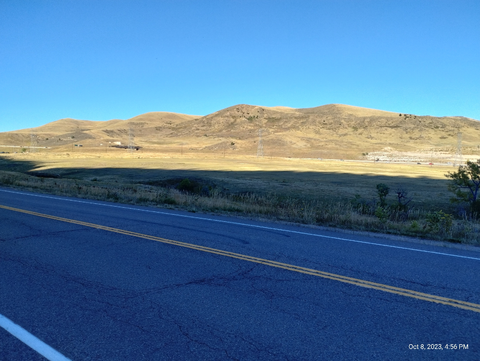
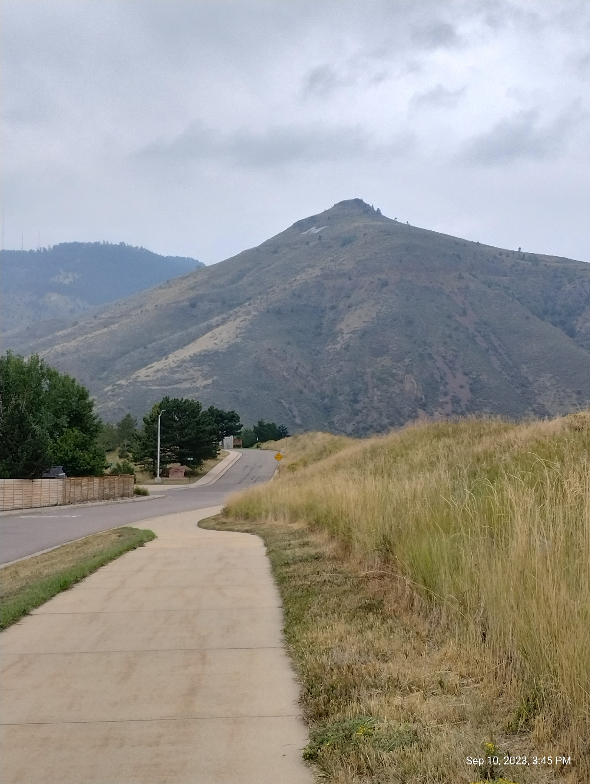
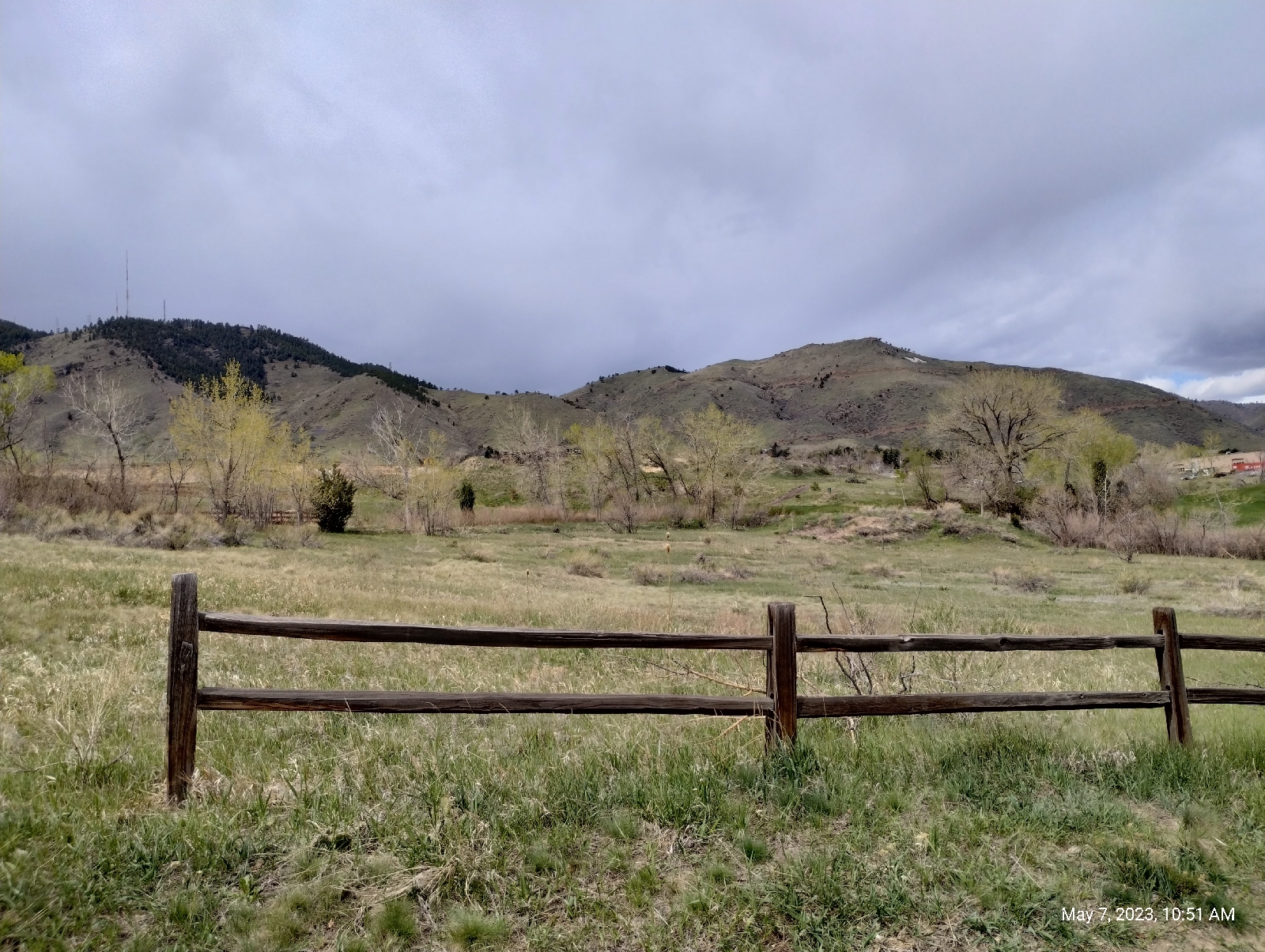
A good place for an overview is the Jefferson County Government Center. It's the first thing you see when you get off the train on the W Line and it sits on a hill overlooking the town (remember that if you're on foot. You'll have to come back here if you take the train back home.) You see all the mountains surrounding Golden, Golden itself, and Clear Creek Canyon in which the town is nestled. The university, the golf course, the tourist attractions... they're all down there. And the lava flows, North and South Table Mountain are to the right in the photograph above. The actual volcano is some where to the northwest. It turns out, I don't know where. It might be that hill in the left background with a white streak going up and around it. On Google Maps and Rockd, it's called Rolston Dike. There is also a spot on North Table Mountain that has been proposed as the vent. Then there's another dike between Golden and Boulder that might be the actual volcano. I'll be checking out Rolston Dike on a later hike.

Sandstone


The Denver area was once beachfront property (Actually, it's been beachfront property several times in the past.) When the sand that formed this rock was deposited by an inland sea, it was near the equator. You probably would have loved it. You could sit on your patio and watch the triceratops graze in you back forty.

The first triceratops skull in Colorado was found here. It now resides in the Denver Museum of Science and Natural History. Almost all the fossils found in the area (and there have been many!) have been found in this stuff.

I would imagine this is Dakota sandstone, the same stuff you see on Dinosaur Ridge. You won't see a hogback here in Golden, though. Clear Creek has pretty much obliterated it. You might wonder how such a little bitty creek could do so much damage. Of course, if you lived here long enough to have seen some of the past flash floods, you might not, but that's not the answer.

Did I mention that Colorado used to be near the equator? Climate has changed and when Clear Creek started carving out this part of the Rockies, there was a lot more water and it was a roaring river.

A cairn

It's a tradition around here. Hikers leave their marks by adding to these little stacks of stone. If you hike in Colorado, you will see them at the side of trails or in the middle of streams. Of course, cairns have been around for as long as humans have been around, for instance, as boundary markers or memorials, but they're not a constant part of the human landscape. I didn't see them much in the southeastern United States. I suspect that, once one person starts a stack, others join in.

Lookout Mountain (left) and Mount Galbraith (right)

Over there, there are those huge masses of crystalline igneous and metamorphic rock, over here it's a lot of sedimentary stuff. That usually means that there's a fault somewhere around. You can't see the one that runs along the mountain front. It's covered up by a lot of debris, but it's there and it's big. When the Rocky Mountains rose, it pushed the rock from the west up and over the rocks to the east. How do we know? 

Well, we can drill down to the different layers of rock and see which layers match. We not only know that it happened...we even now how much it happened!

The Golden fault parallels highway 6 in Golden about a city block west. It pushed the very old rocks to the west about 14,000 feet up and about a mile and a half east up and over the younger rocks of the plains. Mind you, it didn't happen overnight, but with all that slippage, something had to break and that would explain the volcanic activity here, and near Colorado Springs, and in the San Juan mountains of southern Colorado (which are almost all volcanic), and other places in Colorado.

School of Mines visitor center.

It doesn't sound like much, "School of Mines", but I realized when I was a tutor, that the Golden School of Mines is a prestigious university with tough entrance requirements. They are leading edge, for instance, beginning the first graduate program in space resources in 2018. Although they do offer minors in arts degrees, all the majors are STEM subjects and economics.

I always enjoy college campuses. They are usually sprawling museums and offer programs for the surrounding communities. Mines isn't different. The grounds is peppered with numerous statues.

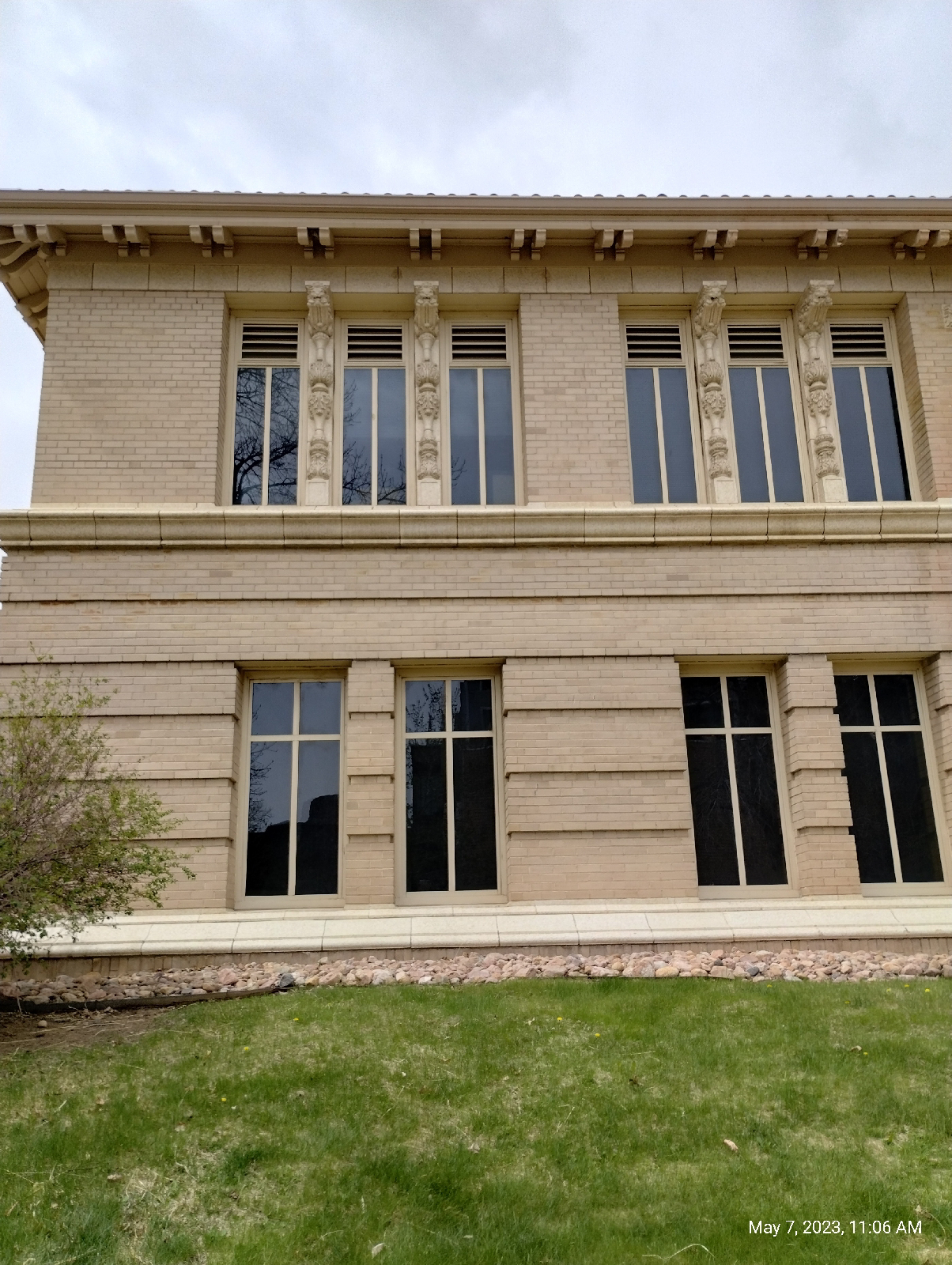
The architecture is always fun to look at. Check out the pilasters on this building.

The building across from the geology museum, the Steinhauer Field House, is especially ornamented.

It was a Sunday, so the museum was only open from 1:00 to 4:00 pm. I had plenty of time to wonder around Golden before then.

Just down the street from the museum, Clear Creek is already a respectable stream. Of course, Clear Creek, the same Clear Creek I visited on the G Line, is many of the reasons for Golden. Geographically, the stream provided the canyon that Golden resides in. It is also what drew prospectors to this part of the country (the name "Rolston" is as prominent here as in Arvada) and Golden in particular. I made it a point to collect some material from the stream bed to look at. And when big industries came to Golden, they crowded around to creek for water and the train lines that developed nearby. Clear Creek also provides for tourists by offering trails and water sports like fishing and kayaking.

The Golden History Museum, on both banks of Clear Creek in downtown Golden, provides glimpses into the early life of Golden including this preserved slice of Golden from the latter part of the 1800s.

Notice the sign on the fence warning visitors that the bee hives are real and stingy.

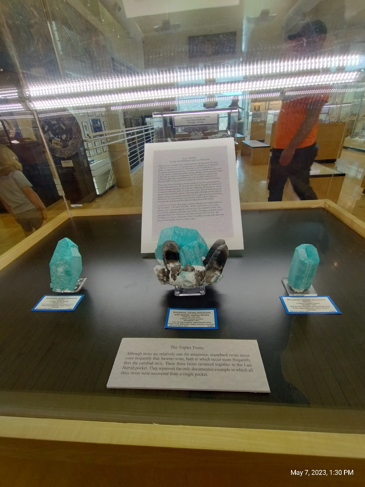
The museum is housed in a large building with many thousands of items, but the public display is in a single room. It's mostly a big (but breathtaking) mineral collection, but it does show a collection of antique instruments.

The minerals are from around the world (organized by region)...
Native gold

 Colorado...
Rhodochrosite

Amazonite

and, more to the point of this blog, Golden.
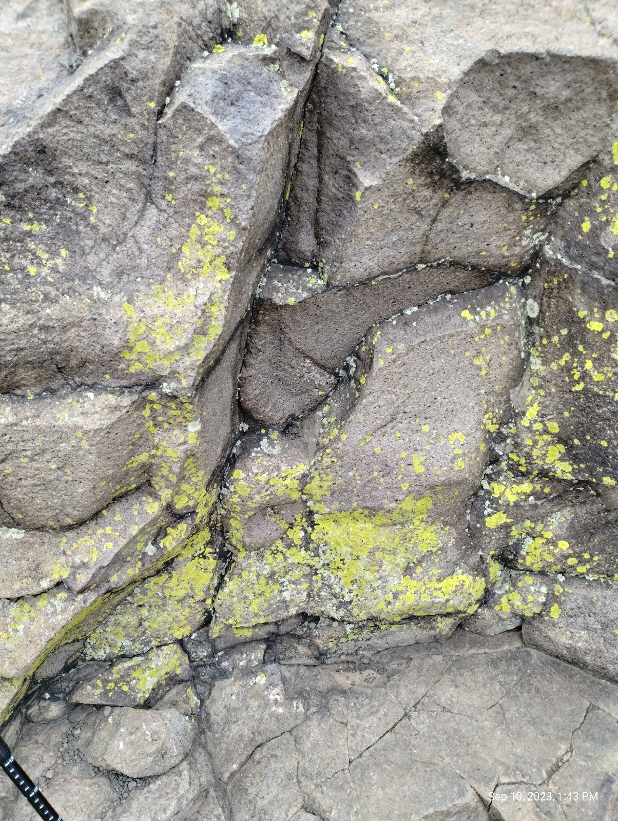
Zeolites from North Table Mountain.

Zeolites are moderately rare in nature but are so useful that they have been manufactured in a great variety. They're useful because the aluminum silicate molecules have an open ring structure that's called "microscopically porous." By adding other elements and changing the conditions under which the crystals form, the size of the spaces between atoms and the charges on the molecules can be custom made for different purposes. Microfilters and ion-exchange materials are often made of zeolites, but there are many other uses.

In nature, there are a handful of different zeolites. The above specimens were collected on the Table Mountain lava flows above Golden. These are huge compared to the typical specimen, such as the one below that I photographed on North Table Mountain.


There are three lava flows on North Table mountain and two on South Table Mountain. The zeolites occur in the second flow as a white filling in bubbles (called "vesicles") in the basalt. They form as alkaline ground water percolates through the basalt and precipitates dissolved materials into the bubbles.

 After drooling over the gorgeous specimens in the museum, I headed back to Clear Creek, and made my way to the flank of North Table Mountain, a grueling hike up steep residential streets.

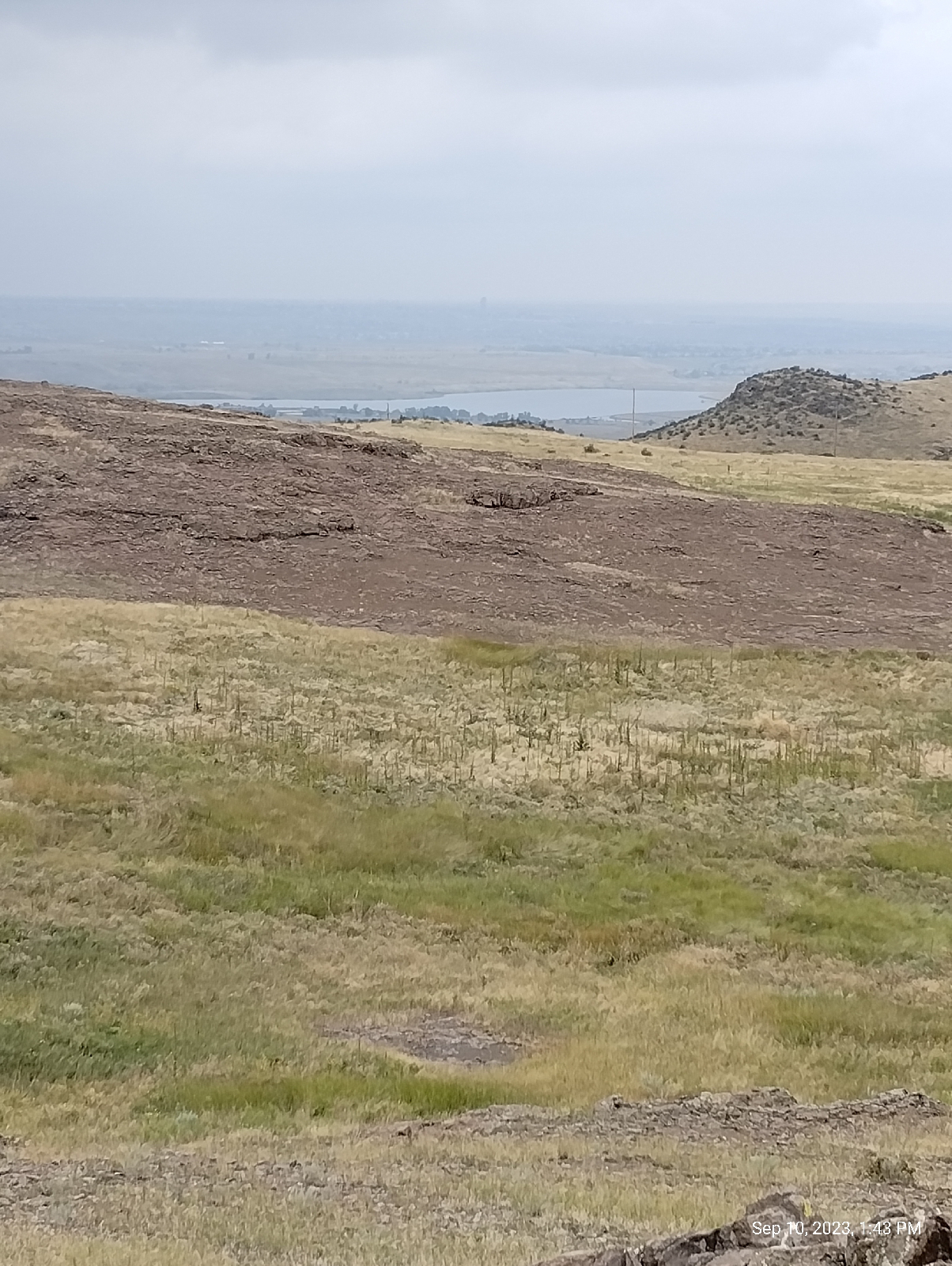
View from North Table Mountain
Lookout Mountain to the right
South Table Mountain to the left
To the Rockies side
South Table Mountain (that's Castle Rock at right center)

My destination this time was the Golden Cliffs trailhead. The trail from there runs up from a parking area to and along the base of the top lava flow.

Golden Cliffs

Detail

The Golden Cliffs trailhead is a good choice for exploring the basalt cliffs of North Table Mountain. The West trailhead, on the other hand, provides a more gentle ramp up to the top. 

The photos from Boulder Canyon show a course, crystalline rich, granite. Basalt is not that. The difference is that granite and related rocks solidify from magma deep underground. They solidify slowly, allowing recognizable crystals to form from the melt. Basalt, on the other hand, solidifies from lava on the Earth's surface. It solidified quickly so that the molecules don't have time to organize into crystals. The microscopic particles tend to be amorphous like glass. But the chemical constitution of basalt is similar to the larger grained igneous rocks.

Basalt is an example of what's called an aphanitic rock, an igneous rock with a texture in which individual particles are not visible to unaided vision and are often not crystalline. Phanitic rocks, like granite, have easily distinguishable grains.

A few basalt outcrops get most of the attention. The famous ones are the Giant's Causeway in Scotland and the Devil's Tower (also known as Bear Butte) in Wyoming. But basalt outcrops are widely distributed. And, in North America, they're not exclusive to the west. The Palisades along the Hudson River are a good example.

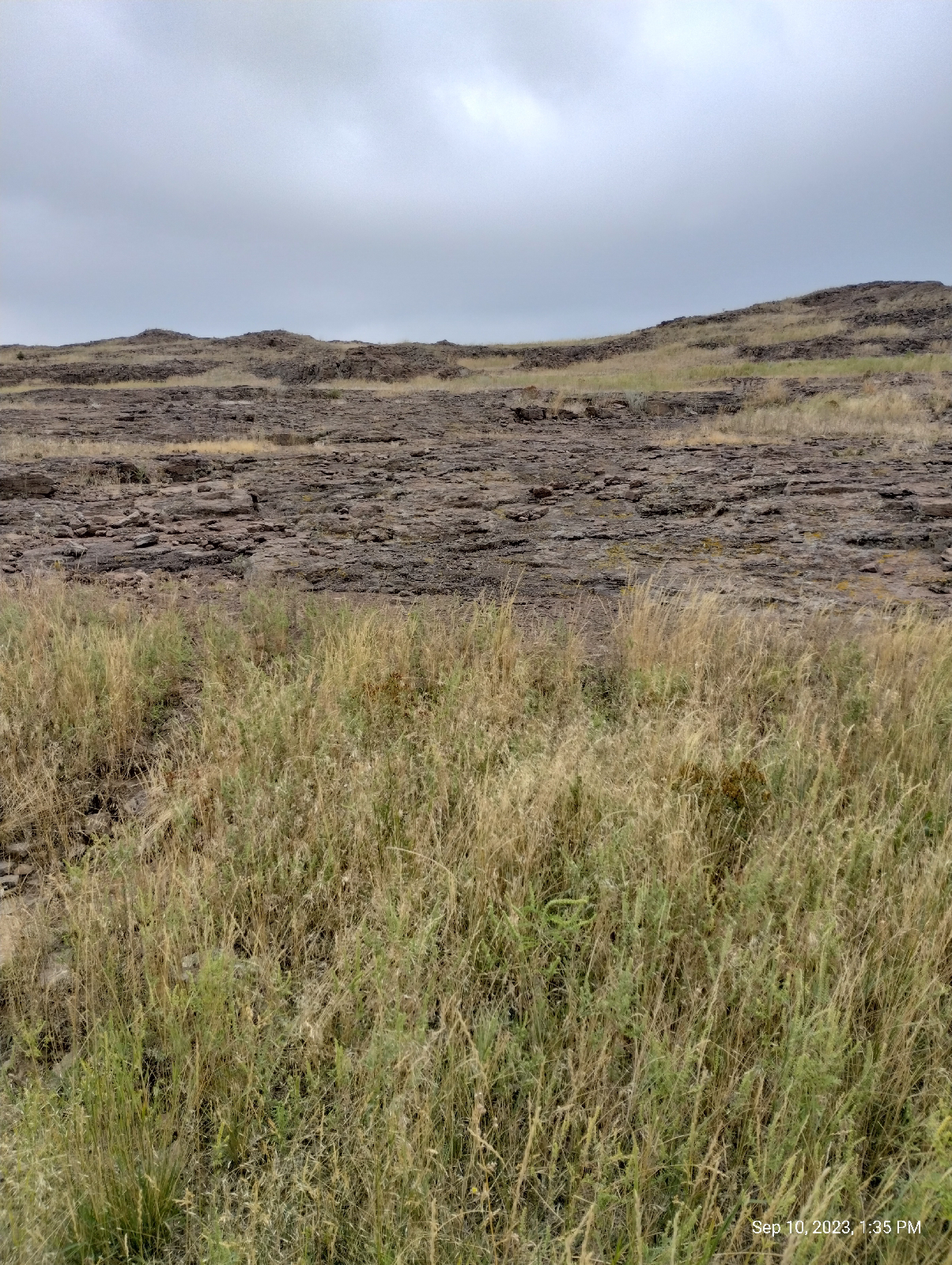
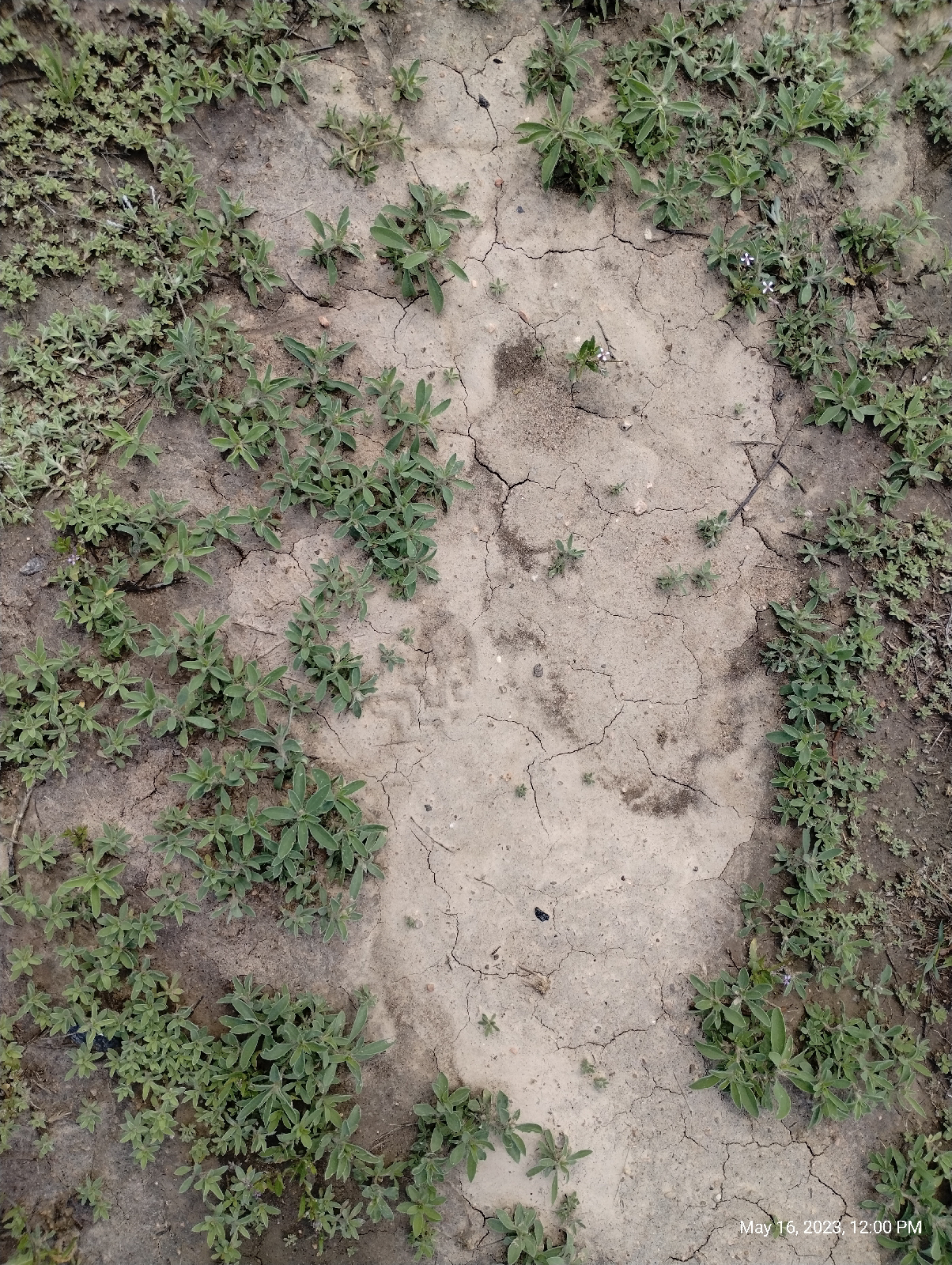
The Table Mountain basalts have the same columnar appearance as the other major outcroppings (it makes them popular with rock climbers). Called "columnar jointing", it's just the way they break as they cool and shrink. You may have noticed that, when an expanse of mud dries out, the material tends to shrink and break up into polygonal shapes. The same thing happens to basalt as it solidifies.

Mud on Little Dry Creek Trail

Lichen on basalt

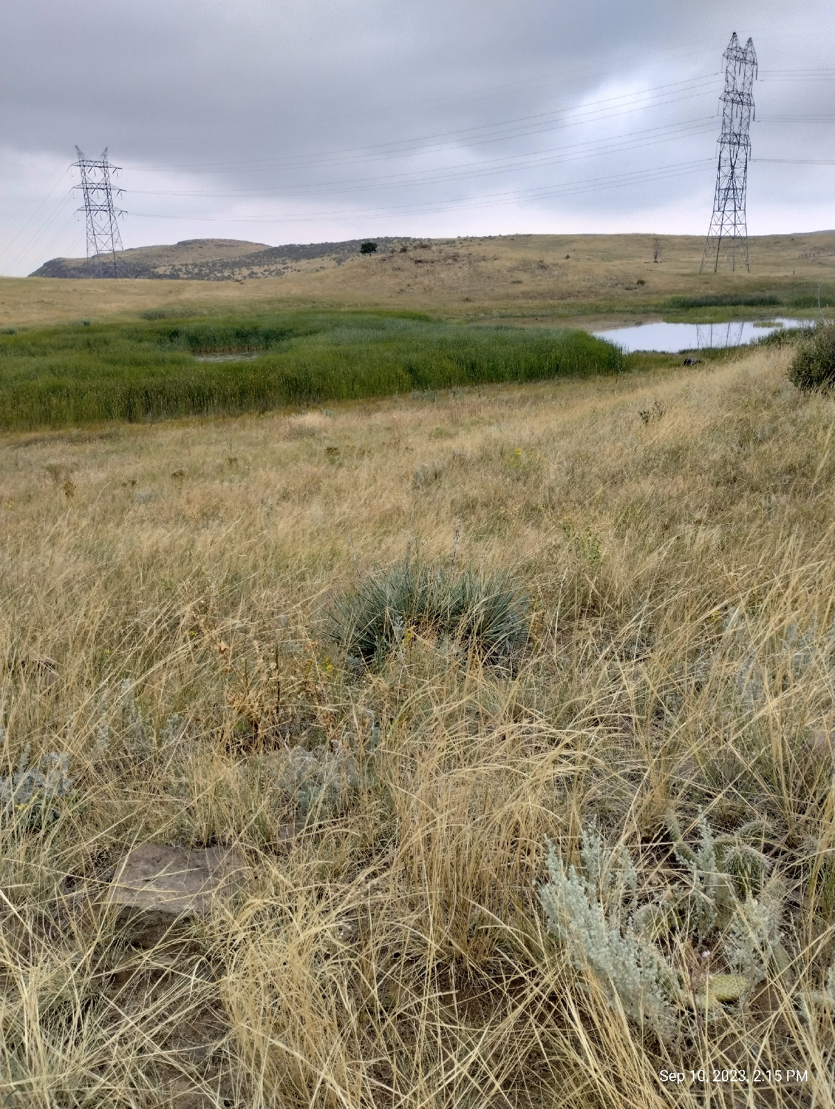
The Table Mountains are also known as a conservation site for lichens. Golden Parks and Recreation ask that visitors stay to the trails to protect these delicate symbiotic organisms, but, of course, some hikers won't, so there are areas of the mesa that are off limits.

Normally, algae and cyanobacteria can't survive in dry climates. They prefer hanging out on rocks in ponds, but in lichen, they have solved the problem. Lichen is actually two organisms in one. The fungus protects its companion organisms from the arid environment while it obtains nutrients from them. And they have an important place in their environment by being food for both large (for example, reindeer) and small (springtails).

There is a lot packed into the narrow valley between the Table Mountains. A lot of it is the Coors brewery and associated industries but there's also Rocky Mountain Metal Containers, the Colorado Railroad Museum, Colorado highway 58 and West 44th Avenue, and, of course, Clear Creek. Clear Creek, after all, is the reason the gap is there.

The volcano and lava flows are 62 to 64 million years old. Geologically, that's not very old, but they've been around long enough to have been deeply buried by sediments from the Rocky Mountains. Clear Creek, then a powerful river, flowed straight across those sediments and, when it got down to the lava, it kept right on cutting until it cut through all three flows. It's not nearly as big now, but it's still flowing out of the Mountains, through Golden, between the Table Mountains and through Arvada, to join the South Platte River North of Denver.

By the way, Clear Creek is weird in that one of it's tributaries is a river, Fall River. And, of course, Clear Creek was the site of the first gold strike in Colorado and the reason that people started flocking to the future Denver.

After exploring the flank of North Table Mountain, I returned home, thankfully by train with most of the walking downhill.

Now, the sample of sand I collected from the bed of Clear Creek in Golden...

I wasn't really looking for gold, although people do pan for gold on Clear Creek. They might even find some!

My father and I panned for gold in North Georgia for fun. One of our main pieces of equipment was an eye dropper, which we used to suck up the tiny specks of gold we found in creek sand. Those are called, by the initiated, "color" or, more often, "dust".

The Bible is often quoted to say, "gold is where they find it." That's a mistranslation for two reasons. The passage is Job 28:1, "Surely, there is a vein for the silver, and a place for gold where they fine it."(King James version) The second error is that the word is "fine", not "find".

In other words, don't expect to find gold where you're looking for it. You'll find it where it's fined (that is, refined).

Gold is found here...
(in the museum), or here...
(on your electroplated flatware.)

No, I was just sifting through the sand to see what Clear Creek was washing out of the mountains, and I was not disappointed with that, either. It was exactly what I expected.

First, I spread out the sand on a Petri dish and eyeballed it. The grains graded from course chunks of rock around a couple of millimeters to very fine dust. There were some sparkly bits but they turned out to be mica.

Next, I shined and ultraviolet light on the sample and was surprised to see that it actually fluoresced pink! I didn't expect that and I don't know if it was caused by some pollutant or it there is something in the rocks west of town.
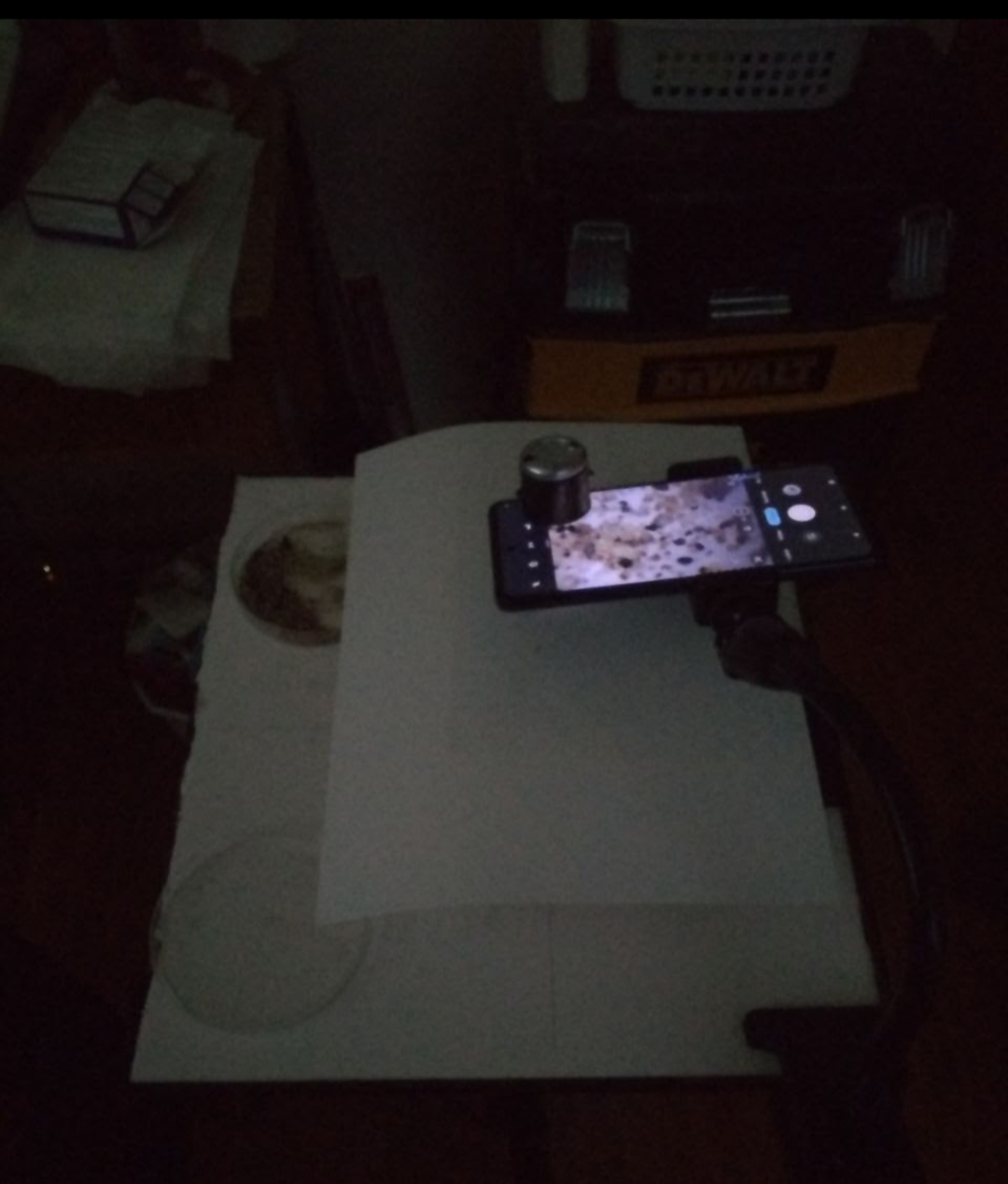
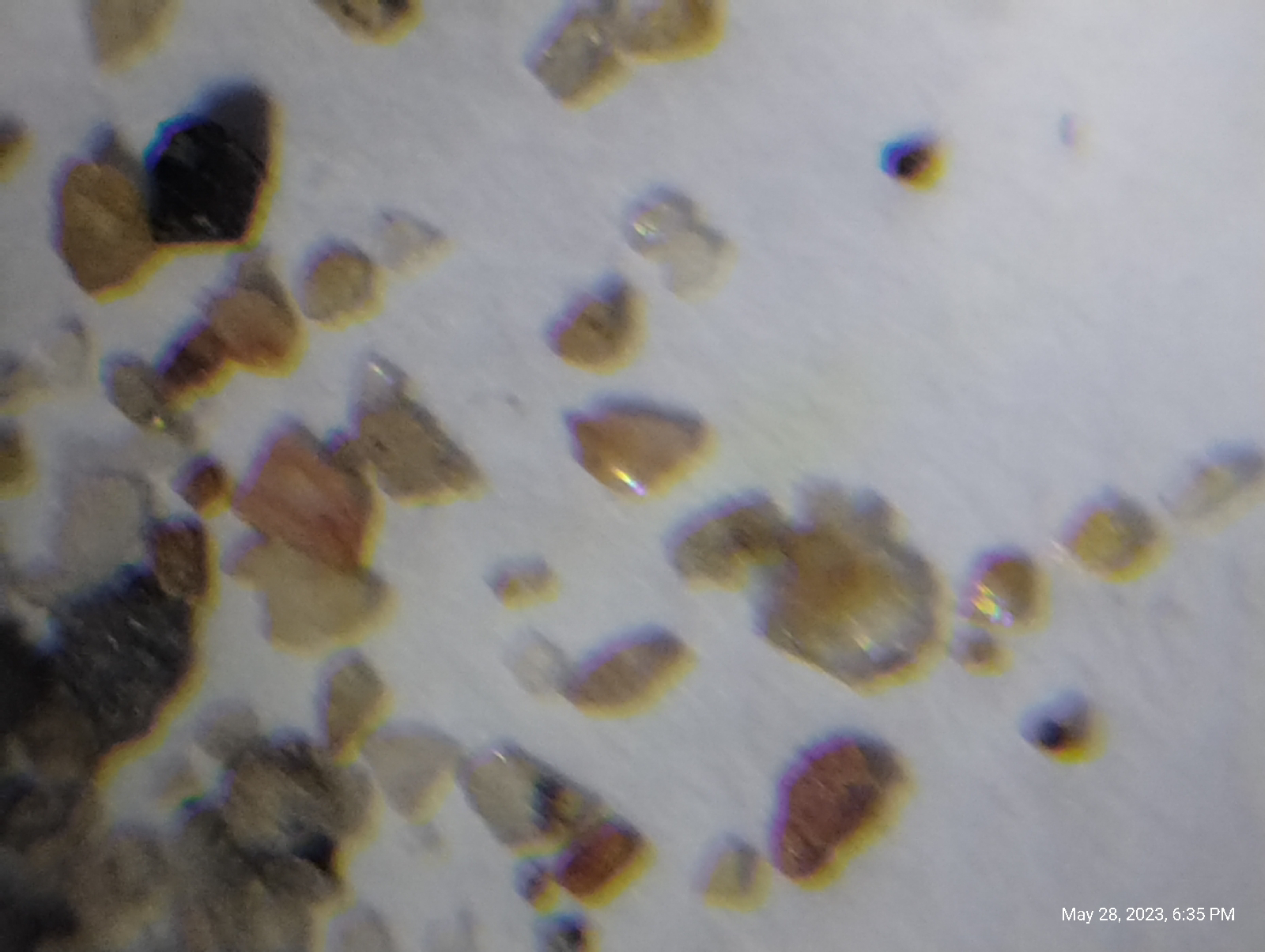
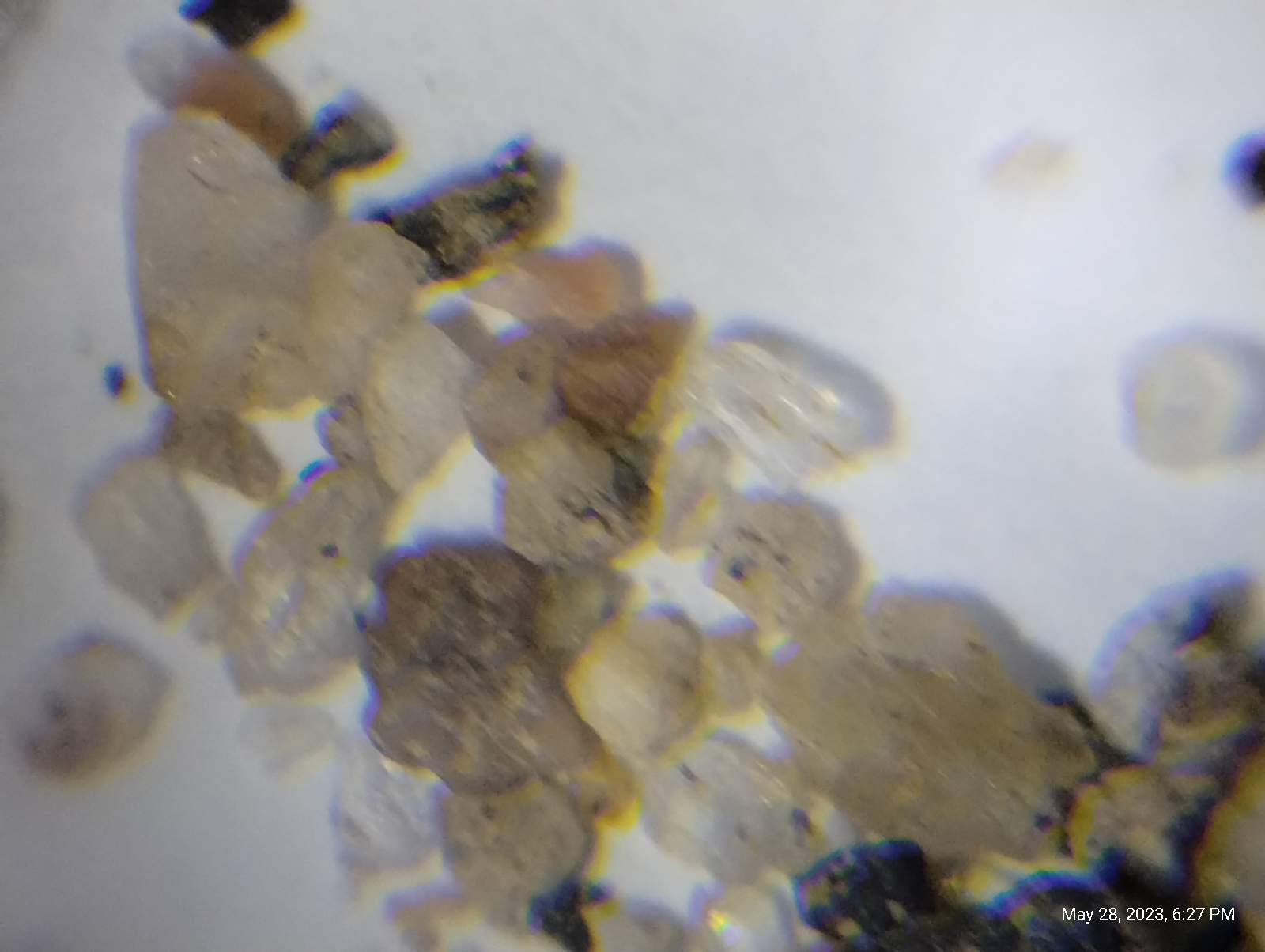
Finally, I used my smartphone microscope...
to look at the sample. 

Most of the sand was obviously washed out of the igneous and metamorphic rocks west of the Golden fault.

The chunkier stuff is granite. 
Of the individual particles, the clear grains are quartz, the cloudy white or red grains are feldspar (when I caught the light just right, they would shine like moonstone), the flat clear flakes are mica, and the black crystals are mostly hornblende. These are the fundamental rock building minerals of igneous rock. Two others are amphiboles, also dark minerals related to the hornblende, and olivine, which is a constituent in many basaltic rocks.

Here are some more photomicrographs.

Mind you, don't pass up the pleasure of looking at sand under a microscope. As a teenager, I walked down to the creek at the bottom of the hill below my house and collected some sand. When I shined an ultraviolet light on it, some of the grains glowed a brilliant orange. Under the microscope, those grains were tiny octagons of thorite. I also saw zircons and tourmaline crystals.

I'll be revisiting North Table Mountain soon. Stay tuned.

Are there any ancient lava flows near you? Check out the Wikipedia article "List of places with columnar jointed volcanics" for hints.

Pull out a microscope and look at some samples of stream sand from streams near you. What kind of materials do you see? If you have a black light, do they fluoresce? Where did the sand come from - what kind of rock produced it?