Wednesday, February 19, 2025

Cherry Creek: Dayton Station to Arapahoe Road


My last hike up Cherry Creek ended at Nine Mile Station. This one began at Dayton Street Station. There is a trail that connects the two but it runs along the trough between Cherry Creek Reservoir Dam and Interstate 225. Since they try to keep things from growing on the embankment of the dam, there's not much there to see so I skipped the nicely maintained dam, knowing I had a considerable distance to travel anyway. Also, I was breaking in some new boots and expected them to give me trouble before the hole was over.


The train platform has two elevators and a pedestrian bridge that leads back to the parking area and bus stops north of the interstate. Further down is another pedestrian bridge that recrosses both the highway and the tracks to the dam.


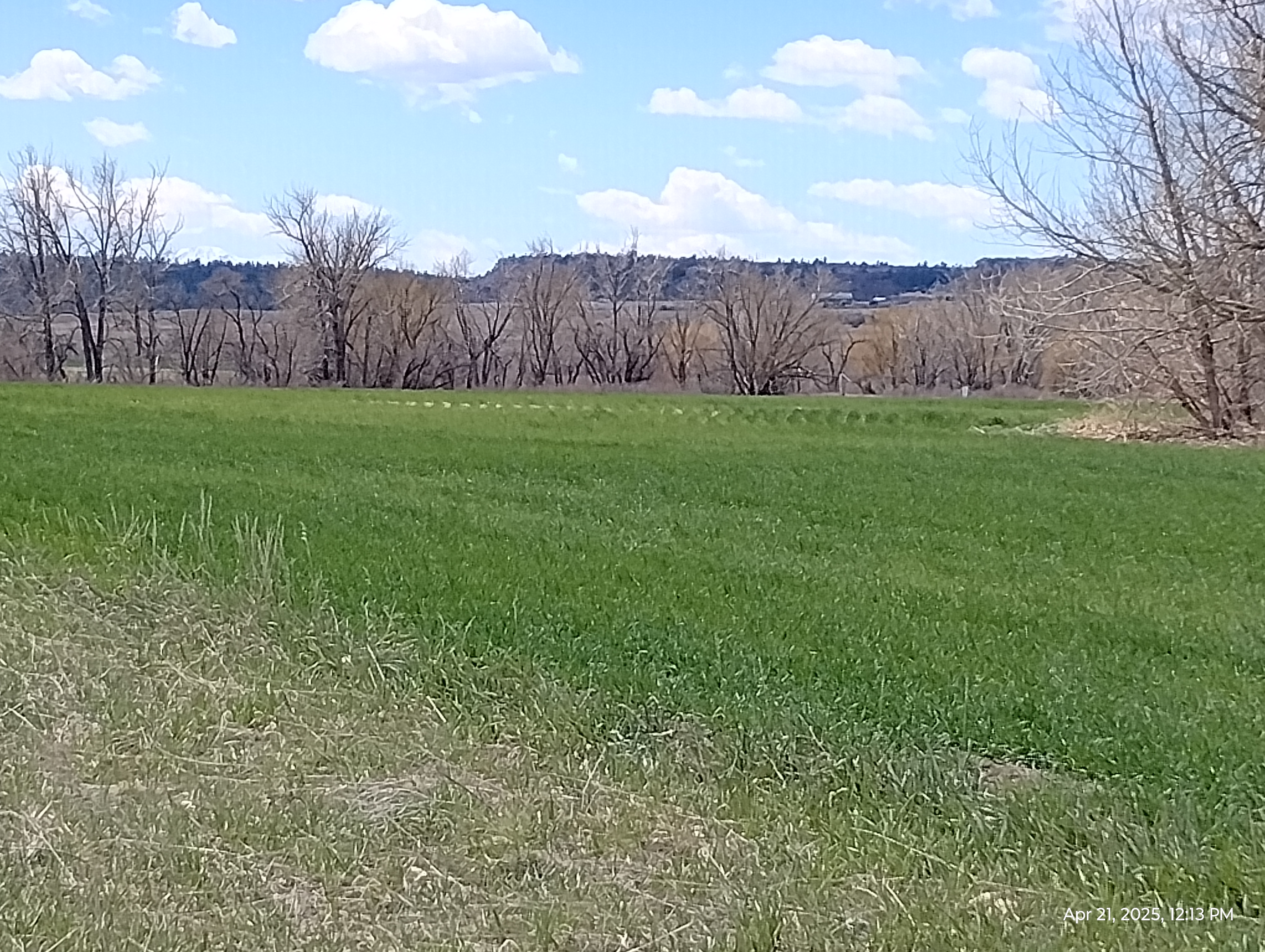
These are wetlands and, as such, they're favored areas for birds (and, of course, bird watchers.)


Here's a bridge-eye view of the train station which, like several stations on the R line are in the median of a highway.


Here's a warning I haven't seen on my hikes in the Denver area. Most of my explorations have been West of the Valley Highway that divides the South Platte Valley and the Cherry Creek Valley. Nearer the mountains, we have few tornadic storms full of lightning but Cherry Creek is well out on the plains and Interstate 25 is the beginning of tornado country. There's little shelter from storms out here.


Cherry Creek Reservoir Dam is one of the larger earthen dams in the area. It's 4400 meters (a little over 2.7 miles) long and rises to a height of 43 meters (about 141 feet). It looks over two railway stations and the interstate. Like all the local dams (Strontia, Chatfield, Englewood, Holly, etc.), the purpose of Cherry Creek Dam is flood control. It was constructed by the Corps of Engineers between 1948 and 1950.


On the average, the reservoir fed by Cherry Creek and several smaller tributaries only covers 3.6 square kilometers and is 5.23 kilometers in length. It's average depth is about 14 meters and it's stocked for sport fishermen. There are several docks for boating. The reservoir has a capacity of 170 million cubic meters.

Most of the reservoir parks (Cherry Creek Park is a Colorado state park.) in the Denver Metro area conserve important wetlands.

The water was low at the time. The extra capacity will be needed in the spring when snows melt. Cherry Creek has a history of some devastating floods. Currently, I can't see the lake from the Interstate but I have seen it from the eastern end of the dam. The creek fluctuates wildly over a year.


Cherry Creek Gage heights from the United States Geological Survey website

Keep in mind that this isn't a mountain stream. It arises from Palmer Divide south of Denver so it's fed by the same aquifers as Little Dry and Willow Creeks. The drainage area is broader but it doesn't get runoff from mountain snowpacks directly (although those do feed the aquifers in the Denver Basin.)


The park is bordered on the west by the affluent neighborhood of Greenwood Village and the Denver Tech Center.


It is a refuge for a variety of wildlife. I saw a herd of deer but I wasn't quick enough with my camera.


At one point, a flock of geese flew low overhead, so low that I could clearly hear the sound the wings make. They don't flap that often. They mostly glide.

That geese fly in V-formation is common knowledge. Some other birds do it also. Canadian geese used to migrate through Colorado on the way to warmer lands to the south, but with global warming, they have decided that Colorado is a nice place to put down stakes and we have a pretty year round stable goose population here.


Geese fly close to each other and they swap out the front position. A goose further back flies a little above the goose in front of it. Each goose provides and uplifting force for the next goose back. The "point goose" works the hardest..... that's why they change positions.

Once while driving through Kansas at night (the flat makes me nuts during the day) I noticed a lot of weird red lights ahead....a broad area of red lights. As I got closer, I heard, "whoop.......whoop.......whoop...." What was this?! I was in the middle of the field of electric generating windmills before I realized what the were.

The downstroke of a goose's wing gives off the same "whoop" sound but, over that, there's a "burrr". It sounds a little like a card inserted into the spokes of a bicycle wheel. My son-in-law explained that it comes from the second and third lead feathers of the wing.

A goose's wing produces a horizontal tube of turbulence that creates an upward push off the top of the wing. That's the secret of the V-formation.

If you want to know more, Robert M. May wrote an article on bird flight for Nature magazine.


Geese aren't the only wildlife along Cherry Creek. It's actually a very active corridor for wildlife into the Denver Metro area (Denver likes it's wildlife).

I don't imagine that many animals come directly from the mountains across Interstate 25. But Cherry Creek provides a clear path up from the more rural Palmer Divide which separates the South Platte and Arkansas River watersheds and is a spur of the Rocky Mountains to the West. 

I saw deer and bald eagles too but they were quicker than my camera 


Beaver are a keystone species along Cherry Creek. A keystone species may have a small population but they have a huge effect on their environment. They are nature's terraformers and wildlife managers 

One outstanding keystone animal is the wolf. When all the wolves were removed from the Yellowstone River watersheds, the prey species overpopulated and ate the vegetation that kept erosion in check. Sediment plugged up the river and changed it's course. The reparian plants and spawning salmon suffered, too. When wildlife managers brought wolves back to the area, everything returned to normal.

That can backfire.

When I was in college, a friend and I decided to canoe down Chewacle Creek from Auburn to Tuskegee. We didn't make it. The wildlife managers had stocked the area with beavers to build dams and help with erosion. What they did was undermine the trees along the banks and the next hurricane that came through dumped all the trees into the creek. We spent most of the time porting the canoe around obstacles.

As we neared the first road we saw on the map, we kept hearing cars...a welcome sound, until we came around a bend and saw it on the far side of a thirty foot high pile of trees and bramble. It took us an hour to saw through that.

Cherry Creek has several beaver dams along its length. Their presence overall is beneficial to the ecosystem providing small lakes for erosion and flood control and a place for aquatic and amphibian wildlife and water fowl.


A nice thing about Cherry Creek trail is that there are bathrooms in many of the parks that dot the creek. You can actually ask Google if there's a bathroom near you and it will usually direct you to one.


Winter isn't a very picturesque time on the plains. If you have time to stay in one place (these Cherry Creek hikes are through hikes so I don't have a lot of time to just sit) you might be surprised at how much wildlife you can spot in an area like this. But the spring is a better time for that.


Wetlands are inconvenient for some folks. They might want to build on them. Or they might not like the view from their picture window. But wetlands are vital to the environment. They not only provide habitat for wildlife but they're buffer zones. Things happen more slowly in wetlands. They provide larger areas for storm water to collect and reduce flooding and erosion. They also cleanse water that feeds aquifers.

When I was young, outdoorsy people used to say that, if you want to drink out of a stream, follow it downstream for 100 feet (a third of a football field) and if you don't encounter a source of pollution (dead animal, sewer outlet, etc.) the water is clean.......not so much anymore. Everywhere is suspicious. But streams and wetlands still clean the water flowing through them to some extent.


Some cities conserve their wetlands. There are greenways and wetland parks all over the Denver Metro area. There are even constructed street margins, "berms", designed as micro-wetlands to control flood waters and cleanse water seeping into the ground.


How does your area handle wetlands? It's a consideration of activists in many areas 


Monday, January 27, 2025

Cherry Creek: From Arapahoe Road to Lincoln Road


The Rockies from Greenwood Plaza

My weather meter

First order of business: check the weather. I can't do much better here than a spot check, the weather is so unpredictable. There's nothing going on to the west. That's a nice snow pack on Blue Sky. That's where a lot of our water comes from in the Denver area. Some of the snow melt will pour into the South Platte River.

62.8° F.... comfortable 
30% humidity....fairly dry
Barometric pressure steady at 30.25 inches mercury

I can expect a good day weather-wise.


The Cherry Creek Trail runs through a string of parks that parallels the creek .


We've had a lot of snow lately but the creek is stable. No flash floods expected.


This stretch of trail features a string of parks including an ecological park which provides educational materials and activities relating to high plains ecology and another reconstructed way station on the Smoky Hills trail.


That's not wildlife. It's a metal dog in a big dog park just south of Arapahoe Road. There was only one living dog in the park that day.


A sign with a map welcomes visitors to the Cherry Creek Valley Ecological Park. There wasn't much going on the day I hiked by. This is the entrance from the trail. There are also street entrances.

The Cherry Creek Stewardship Partners provides ecological events in the areas. Here's their website.


This area is high plains. The flat landscape belies the fact that it's still a mile above sea level with generally dry climate and often brutal, windy winters. Trees are generally short and scraggly without a lot of variation......cottonwoods and willows around small streams.

Creeks are often conserved in this area providing urban corridors for birds, prairie dogs, beavers, coyotes, deer, bobcats, cougar, fox, occasional bears, and other wildlife.


If I were not on a through hike, I could have brought a camp chair and staked out this area.


Plaques along the trail provide information about the ecology and history of the area.


The 17 mile House is the third way station that has been conserved on the Smokey Hill Trail, a historical frontier approach to Denver from the South. (A fourth is under water behind Cherry Creek Reservoir Dam.)


Construction is under way on the High Plains Trail which is intended to connect the Cherry Creek Trail in Parker to the Highline Canal Trail in northern Aurora. This footbridge is part of phase one of the project.


Conservation efforts along the trail include grassland habitats, deer, beaver, and these little bitty jumping mice. They have a big yard laid out just for them North of Lincoln Avenue at the Lincoln Recreation center.

It's February here in Colorado and some of the weather here is brutal. The Werehouse ecology has featured a cocktail of viruses including SARS and a new Flu A to go along with the new avian strain. It triggered off a round of bronchitis and gastroenteritis to delay my return to Cherry Creek, but first chance I get......


Tuesday, December 10, 2024

Exploring the eyes (the adventurous way)

You will never see me suggesting a dissection.

It's not that I don't see the importance of cutting into animals to see how they work, but there are a lot of very explicit dissections and medical procedures on the Internet. We can let things live now.

There are some really good alternatives to getting your hands into some cadaver's abdominal cavity: Two are Internet videos, and yourself. I'm not suggesting that you take a scalpel to your torso. But everyone (sooner or later) has medical procedures and we finally have free access to our medical records. In my case, my doctors use a tool called "My Chart". I'm having a blast with it.

After I had the cataracts removed from my eyes (both of them in two sessions), I watched the procedure on YouTube. The surgery itself was painless and fascinating. I enjoyed it thoroughly. The videos were great, too.

I'm glad I waited to watch them until after my surgery!

And now, after knocking the retina loose in my left eye and having it fixed, I have learned a lot about eyes.

Actually, you can see inside your own eyes. Much of my Observing and Recording LabBook (on this page

https://theriantime.wordpress.com/labbooks)

Is about vision and there are explorations of the inside of your eyes. Check it out.

There is that other thing.....

If you hunt for food, you'll be killing and "dressing out" animals. If you're going to be disassembling animals for food, you might as well be learning anatomy while you do it. Just stay safe.

There are at least two famous cases of biologists that were killed by their own curiosity.

In 2007, Eric York, a research biologist in the Grand Canyon National Park, found a collared female cougar dead of unknown causes. Taking her back to his lab, he opened her up to try to determine what killed her. He soon became sick and succumbed to pneumonic plague (closely related to bubonic plague).

In 1626, Sir Francis Bacon, father of modern experimental science, bought a bird from a woman, had her clean it, and stuffed it with snow to study how well it preserved the meat. There was a lot of trudging around in the winter weather. Soon after, Sir Bacon died of pneumonia.

So learning is fun.....just don't kill yourself doing it 

Do you have access to your medical information? If not, you're doctor's staff may be able to tell you how to get access. When you get the results of a visit, look them up online to see what they mean.

For instance, using My Chart, I can see that my last visit to my surgeon included an ocular coherence tomography and that some "drusen" were found. There are links that explain these terms. In addition, there is an article about ocular coherence tomography on the Wikipedia site.

Sunday, December 8, 2024

Cherry Creek: Monaco to Nine Mile Station

For anyone following this blog, you've noticed that I've slowed down considerably. That's partially a result of the two months stagnation after my eye surgery this year and the accumulated effects of aging. 

When I first moved to the Denver area eleven years ago, an endurance hike was thirty miles. Now it's ten. This leg of the trip up Cherry Creek was around five miles according to Google Maps but I noticed about a mile into it that I had left my wallet at home and walked another mile to retrieve it. With a one and a half mile hike to and from the train station, that adds up to about ten miles. I was pretty whipped at the end but I still had enough energy to wash the supper dishes, so I'm not completely debilitated yet.


This section of Cherry Creek is not the most scenic, as it flows mainly through residential and industrial areas, carving its way through deep sandy sediment. Being an active flood plane, this soil is geologically very recent.


It's a popular stretch of trail near Greenwood Village so the traffic is heavy with bicyclists, walkers, and hikers. The plants are a mix of indigenous and introduced species. I didn't see any big predator or prey animals but I've seen reports of both deer, Coyote, and bear in the area. The creek and Greenway provides a natural corridor for wildlife coming up from the less inhabited canyons and Palmer Divide to the South.


The deep layers of sediment laid down by past flooding shows a typical soil profile. The layer of humus at the top is thin. Past vegetation on the plains (this is the beginning of the Great plains) is sparse and gets washed off regularly. Beneath is a thin layer of leached soil. The clayey layer below tends to hold darker ionic materials that are drained into it from above and that darker layer is thick and goes down to the bedrock that fills the Denver basin....eroded materials washed out of the Rocky Mountains. You can faintly see layering where different floods deposited various materials and hollowed out softer sediments. 

Cherry Creek has been around long enough to have developed some decent meanders.


Sage (Artemisia tridentata) is so common out here that it's become indelibly a part of the spirit of the West. How many western bands have had "Sage" in their name. It's a typically scrubby plant. A lot of the plants on the plains are low and tough. They have to be to withstand the winds and sharp, and often brutal, shifts in weather. Despite the fact that this plant lives next to a watercourse, unless it's actually in the creek, it's in a very dry environment. It rains a good bit, but the air is so dry that anything wet will soon be dry again and the soil is loose and sandy and drains rapidly.

Big plants (trees) that are indigenous to this area have to be able to manage their water well. They usually live right next to a stream and there aren't many - mostly cottonwood and willow. Most of the trees you see in these photos were introduced and cultivated to become part of our urban forest.


This pretty little ground cover always catches my eye. I can never remember the name so I use Google Lens to look it up.

Oh, yeah. "Silver mound". It's another Artemisia.  It's pretty common out here.


Looking north, back the way I came, that cloud sorta bothered me. It was talking. Weather closer to the mountains, about twenty miles west where I live, doesn't worry me.....even the occasional hurricane force winds and hail. But even here I'm on the plains. They get tornados and the lightning is considerably more dangerous.

I have rain gear in my pack (always) but, even so, a downpour would be inconvenient. Luckily, it passed by to the north.


The Rockies, to the West, are an ever present sight here. 


Gaillardia Pulchella is a common wildflower here. Also called Fire wheel Daisy or Indian Blanket, it really stands out in the landscape.


Ants are less common here than they are in the Southern United States but they are here.


It's still autumn here and we've had a nice display of fall colors this year thanks to more rain than usual.


This squirrel was curious, but not enough to come completely out of hiding.


The Highline canal crosses Cherry Creek here through a syphon. 


The diversity of cactuses increases in the mountains (the state cactus is the Claret cup) but the plains still see the wide spread prickly pear. Best I can tell, those are all over the coterminous United States. We had them growing both wild and in gardens in Alabama. Although the modified stems (the "mouse ears") and leaves (the spines) aren't very showy, the big yellows blooms are gorgeous and the "pears" are edible. My housemates were waxing nostalgic about eating prickly pears the other day.


We have a lot of corvids in the Denver area, crows, ravens, a variety of jays, but magpies are most common in the South Denver Metro Area. In other places in the US, they can be a rather obnoxious bird but around here they are, across the board, a friendly creature unless you get too near a nest. A friend calls them "tuxedo crows".


About two-thirds of the way from Monaco and the end of my hike, I begin to see my destination, the large dam that impounds Cherry Creek Reservoir.

This massive earth embankment plays a major part in the next section of my journey up Cherry Creek, so I will hold off discussing it for now.


Keeping with tradition for the Denver area, Aurora (the largest eastern area of the Denver Metro Region) has plenty of public art scattered around. John King's 16 foot high kinetic structure was awaiting me where I exited Cherry Creek trail at South Havana Street. Here, I had to do a little road work to get to the light rail station.


Nine Mile Station is a little daunting with its labyrinth of tunnels leading to train and bus terminals, parking garages, and passing under heavily trafficked highways and rails to the area under the dam. In the center courtyard is this minimalistic, abstract clock tower. It's a train station.....people need to know what time it is. (Of course, in the band, Chicago's opinion, "Does anybody really care?")


Nine Mile Station, like the Four Mile House Historic Park is situated near a pioneer way station. It was at the nine mile mark outside Denver on the Smoky Hill Trail.

Unlike Four Mile Station (best I can tell) there's nothing left of the historic site of Nine Mile house.

The Smoky Hill Trail was named for the Smoky Hill River that paralleled most of its way. It developed from a Native American trail through prime huntng range. It started in Atchison, Kansas and continued to the Kansas River, along the Smoky Hills River and Cherry Creek, to Denver.

The site of the Nine Mile House is today on the other side of the dam, under water.

The Nine Mile Station platform provides some great views of Cherry Creek Reservoir and the Rocky Mountains as a backdrop to the Denver Tech Center and the surrounding area. To the south is the familiar profile of Pike's Peak.


And Pike's Peak.....


From here, it's a short train ride back to Arapahoe Station and the mile and a half hike back home.

These hikes are scratching my itch to follow a way (in this case, Cherry Creek) from one end to the other. On the next link of my journey I'm going to skip the unremarkable trail along the base of Cherry Creek Reservoir dam to the next light rail station to the west and take it up at Dayton Station. See you there.