Showing posts with label station-to-station hike. Show all posts

Monday, November 27, 2023

Louisiana-Pearl Station to Broadway Station: A brief coda.


Back at Louisiana-Pearl Station, I wasn't waiting for a train this time so I had time to play with the Strange Machine. The plaque explains that it is a homage to the guru of tubology and tube bending technology. The afore mentioned guru is the sculptor, Ira Sherman's mentor, Ron Strange.

The Strange Machine is a 3,500 pound kinetic structure that can be set in motion by turning a steel orb. The orb doesn't go 'round and 'round, but back and forth. It takes a little umph but it does work.
After convincing myself that the mass of tubes and neon actually does move, I headed to street level to follow the E and F lines to my final destination (for the time being) in the station-to-station hikes. I've hiked from Watertown Canyon to Union Station and beyond, through downtown Denver and Five Points, Golden to Auraria West, Wheat Ridge and Westminster to Union Station, and around all the light rail terminals, plus Boulder. After this hike, I will give the light rail a rest and change channel....the next channel being Cherry Creek. There's something that likes (to paraphrase Robert Frost) following a large stream from beginning to end 
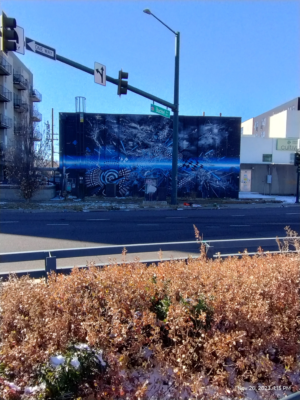
There are very few places in Denver that is far from murals. This one is across the street from the light rail station. It's called "Furtherrr" and is by the trio, Mars-1, Damon Soule, and Oliver Vernon. It's an interesting piece in that it's hard to focus on any particular part of it.

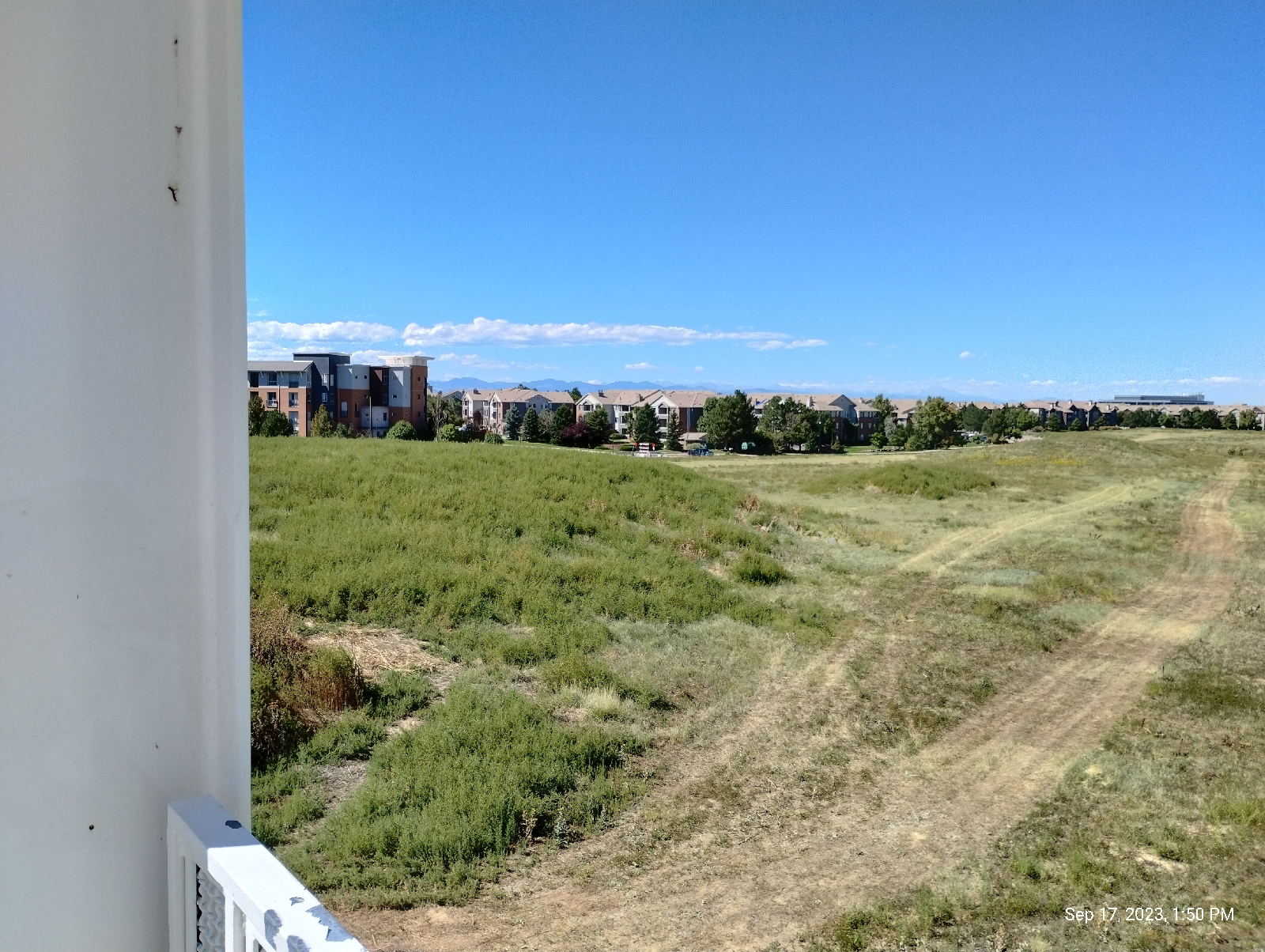
This is the requisite shot of the Rockies for this hike. Just a little further, Interstate 25 converges on Broadway and the light rail at Broadway Station. That's Long's Peak in the distance.
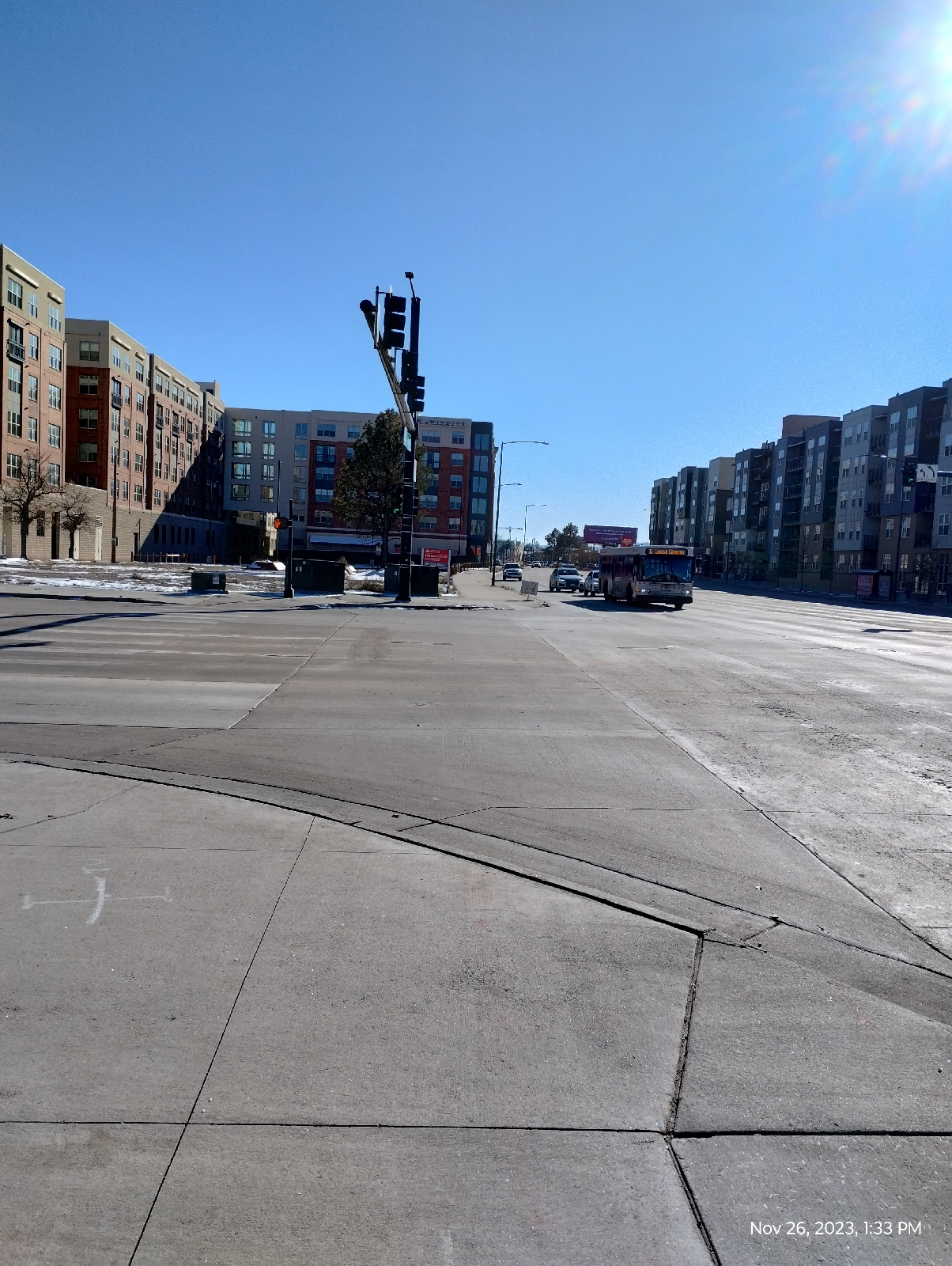
Near Broadway Station, Broadway is mostly high rise apartments but it's a major north-south thoroughfare through Denver with a lot of interesting spots such as the Gothic Theater, the Brutal Poodle restaurant, Denver Biscuit Company, the Wizard's Chest, a lot of museums, Civic Park, and Natural Paws (the pet store where I usually shop for Vincent's treats and food.)
I-25 and Broadway Station is a major hub in Denver's light rail system. Lines from the southeast and southwest Denver Metropolitan area converge there with lines to downtown Denver. In addition, it's only a block away from Santa Fe Boulevard and Broadway and the parking lot has four bus gates. 

Also, it has one of the best panoramic views of the Rockies and the foothills in Denver.
The Pedestrian Bridge to Nowhere...one end is on a fenced in construction area and the other just hangs in mid air. It's been there for a few months. I guess it might one day join the lot next to Broadway Station to Santa Fe. That would be nice, but, for now, we can make jokes about The Pedestrian Bridge to Nowhere.

So ends my tour of the western lines of Denver's Regional Transportation District light rail. I've seen cool things that I would not have seen had I not been on foot...met cool people.

I'm not sure what I'm going to do with the eastern lines. Many of the stations are too far apart and embedded in industrial areas to provide very satisfying hikes. I'm thinking that I might want to tour the individual stations and hike between selected pairs of stations. The lines in question connect Thornton to Denver and form a loop with the E and F lines out into the plains and to the Denver International Airport.

But my next adventure will be to follow Cherry Creek (in sections) from it's confluence with the South Platte River in downtown Denver to it's origin near Castle Rock. It's a large geologically and historically interesting valley.

There's something that likes following a large stream from beginning to end. Join me.

Sunday, September 17, 2023

Bellevue Station to Southmoor Station


I'm back on the high plains for this hike. I've spent so much time west of the Valley Highway (Interstate 25) that I've decided to focus more on the Cherry Creek Valley, east of the highway, for a while.

The above shot was taken on my outward journey, at the Arapahoe at Village Center Station. The premier plant on the plains, either wild or cultivated, is grass but the variety is so outstanding, it shouldn't be overlooked. These plants are almost certainly cultivated pampas grass planted in the margin of the station plaza right next to the tracks but the whole scene grabbed my attention so I took the photo for a lead-in to the blog. (East of the interstate, the valley highway blocks clear views of the mountains so don't expect any breathtaking vistas this time.)
I don't know what causes the bumpy land on the north side of Union Avenue from Bellevue Station, whether the bumps are natural or manmade. The area is used as a park for the residential area nearby and one of the mini-mesas has a picnic table on top. I wonder if the mysterious mound at Arapahoe Station is just one of these hills that has been landscaped.

A mesa is generally a flat topped hill formed by weathering and erosion. The Table Mountains in Golden area are sedimentary rock topped by an erosion resistant cap of an ancient lava flow. Green Mountain, between there and Denver is just an erosion feature carved out of the layered sandstones and mudstones of the bedrocks underlying the Denver area. Mesas are a typical feature of desert areas, carved away by wind and water, less by streams than by the direct action of falling rain, dew, and water that seeps up out of the ground.

The Denver, Dawson, and Arapahoe formations are mainly sand and mud stones but there is certainly variation in density of the rock and, so, the ground can be expected to erode at variable rates. I can imagine these hills being the result of that process.

This view from the Union Street bridge next to Bellevue Station is the best I could do for a requisite shot of the Rockies on this hike. From here, I'm headed east.

I catch up to Goldsmith Gulch at George M. Wallace Park, which borders the DTC Parkway. Not to be confused with the Alabama governor, George M. Wallace is a developer considered to be one of the founders of the Denver Tech Center. The park is a big lawn with picnic tables and benches that provides an outdoor recreational area for the surrounding developments.

Goldsmith Gulch goes underground at Interstate 225, a Denver perimeter bypass, and the RTD H/R light rails. It reemerges on the other side near Rosamond Park.

These are very urban parks, manicured and all that, but they do have some small draws for the naturalist. I'm pleased to see my (and the Monarch butterfly's) favorite wildflower growing in abundance. I usually show the blossoms but, to the plant, the seeds are all important, so ..
I'm sure one of the milkweed 's secret to success (I have never been to a place where it isn't) is the fact that so many seeds are spread by the wind.

These guys are there, too. You may have noticed from my past blogs that we like our prairie dogs.
By 2:00 I had to see just how badly I was overheating and was surprised to see that the air temperature was only 88° F. The humidity was sorta high for a desert town, 41%, but the real culprit was that blazing Colorado sun. If you aren't from Colorado and decide to visit, don't underestimate it. Heat, dryness, and altitude can be a deadly trifecta.
By Rosamond Park, the gulch has grown considerably. 

The surface of the park is mostly loess and the colluvium that is so common in the area. "Loess", by the way is pronounced "less". It's a soft rock formed by sand, clay, and/or silt deposited by the wind. Geology students are reminded of that by the phrase, "more and more of loess and loess." 

Most of the material around the stream was deposited by it...and the folks that constructed it, of course. Those rocks weren't born there.
This mudstone is a rare outcropping of something that actually belongs there...real bedrock! Muds often dry and compact into layers like this. The platey molecules, which are generally complex, tend to want to bind more strongly to those next to them to form sheets. The sheets are held together by weaker forces that become even weaker when dry. The polar attraction between water molecules go away. This stuff ends up being sedimentary mudstones and, if subjected to stronger forces and heat becomes shale, and then metamorphic slate.

This, believe it or not, is Goldsmith Gulch. It goes underground beneath that shopping center and then emerges across the street to continue it's journey to Cherry Creek. I left it here to follow Hampden Avenue west to my destination.
A car wash shaped like a river boat in the high desert. That's.....novel.

Like many of the light rail stations, Southmoor's parking lot is across the interstate from the train platform. The two are connected by a tunnel under the interstate. There used to be light columns along the walk that lit up and made an audible tone as you walked by. As Stephen King says, "the world has moved on."

There are residences behind these walls. From Southmoor to Broadway Station, there are noise barrier walls around long stretches of the light rail and Interstate. They're decorated with Colorado scenes. The bison is, of course, an iconic animal of the plains. It's not an official symbol of Colorado. The bighorn sheep is the official Colorado State mammal. But they're impressive, historic, and there are still a few around in ranches and national parks, and, uh, zoos. They're conserved and maintained.

Ones skullcap popped off. It shut down one of the rails for awhile until they repaired it. There are also mountains featured....and squiggly lines...not sure what they represent.

Anyway!
I had a supply run to make in Englewood. The light rail station there has nice vistas of the Front Range.
My hikes often turn into multipurpose treks. Once I loaded my backpack with supplies, I headed back home.

Next time, I'll take a final look at Goldsmith Gulch (for the time being), the Highline Canal, and Yale Station.